Walls of Ferrara: The City’s Historic Defensive Circuit
Site at a Glance
- Country
- Italy
- Primary era
- Early Modern
- Eras represented
- Medieval, Early Modern
- Civilizations
- Byzantine, Duchy of Ferrara, Papal States
- Site type
- Military
- Remains
- Wall
On this page12 sections
History
The Walls of Ferrara are a defensive circuit in Ferrara, Italy, whose earliest fortifications were built around the sixth century by the Byzantine Empire, the eastern continuation of the Roman imperial state, to guard a river crossing. Over the centuries, the defenses followed the city’s growth and were adapted to changing military needs, including artillery and siege warfare.
Early defenses and the city’s expansion
In the tenth century, the nobleman Tedaldo di Canossa ordered further defenses at a second river crossing. Ferrara began to shift northward in the early twelfth century, when a new cathedral was built north of the earlier basilica. As the settlement expanded, its defenses grew around it. By 1314 they enclosed Borgo Vado, a district where the first brick sections of the walls appeared. A gate there stood at the site of today’s Via Ripagrande.
Este rule and the Renaissance expansion
In 1385, Ferrara’s ruler Niccolò II d’Este commissioned Bartolino Ploti, an architect and fortification specialist, to build Castello di San Michele north of the city. Its foundation was laid on September 29. As the defenses extended north along the routes of today’s Viale Cavour and Corso della Giovecca, the castle came within the walls and lost much of its military importance. Under Borso d’Este, the protected area extended southeast to the San Giorgio bridge, leaving the old cathedral outside the perimeter.
The city’s gates served different approaches and purposes. Porta Paola controlled the southern entrance; it dated to the thirteenth century and was rebuilt around 1426. Porta San Giovanni guarded entry from the east. In the late fifteenth century, Porta degli Angeli was Ferrara’s most prestigious gate, used to welcome distinguished visitors and the dukes. In 1598, Cesare d’Este left through it to move the duchy’s capital to Modena, after Ferrara had returned to papal rule.
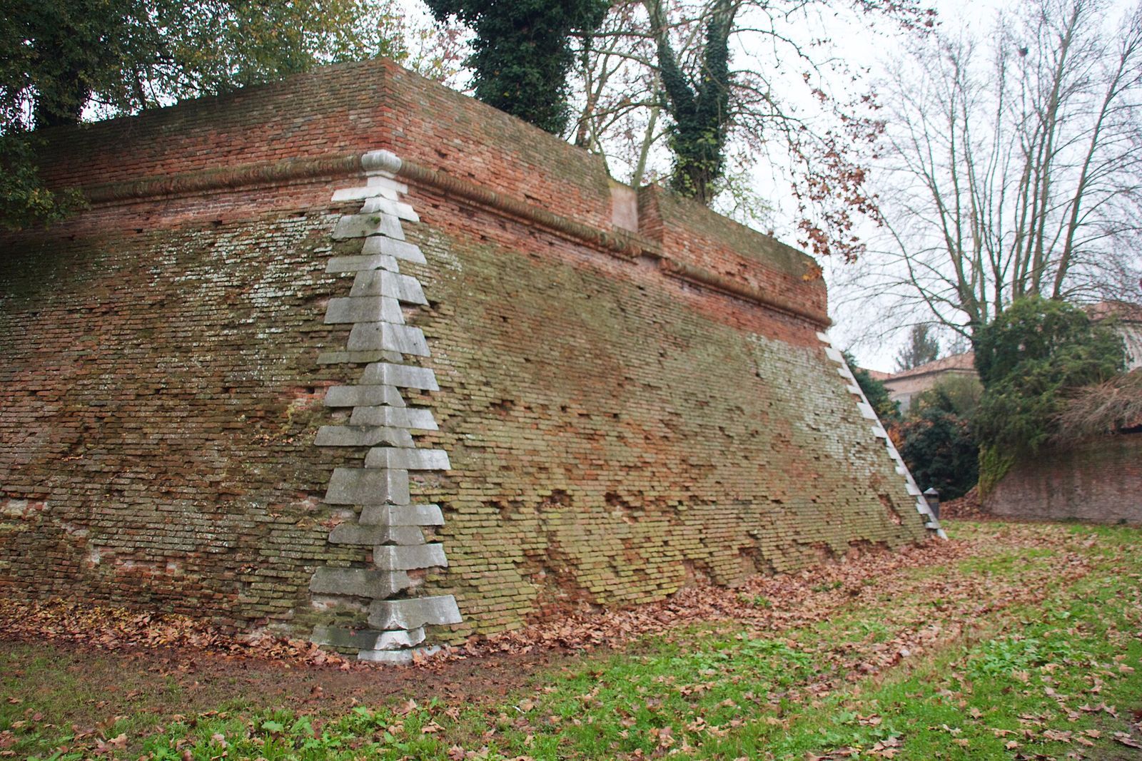
Ferrara’s northern walls were built mainly between 1493 and 1505 as part of the Addizione Erculea, a major urban expansion associated with Ercole I d’Este and designed by Biagio Rossetti. Across the fifteenth and sixteenth centuries, the fortifications were reshaped to withstand artillery and sieges. The triangular bastions of San Tommaso and Montagnone, projecting sections of wall built to defend its approaches, date from the late fifteenth or early sixteenth century. Their earth embankments used soil dug from the outer ditch. Both areas soon became places for gardens and recreation; Montagnone also served as an observation point. Its name refers to Mount San Giorgio, from which an aqueduct ran toward the city.
After the monastery of Sant’Antonio and its lands were brought within Ferrara in 1451, the Baluardo dell’Amore was built along the southern walls. Its tower collapsed in the earthquake of 1570. Around 1541, Ercole II ordered ducal baths and a garden beside Montagnone.
Papal rule and later changes
When Alfonso II d’Este died without an heir in 1597, Ferrara passed to the Papal States, territories in central Italy governed by the pope. Pope Clement VIII visited in 1598 and considered a fortress to deter the Venetians and control the local population. Construction began in 1608 under Pope Paul V and continued for about a decade. The project made papal rule unpopular: whole city blocks were demolished, and the Este family’s Belvedere pleasure estate was lost.
French forces partly destroyed the fortress in 1805. Around 1860, as papal rule ended, Ferrara’s provisional government dismantled it. The area around Montagnone was abandoned in the late nineteenth century, and Ferrara’s first drinking-water reservoir was built nearby in 1890. Restoration of the Baluardo dell’Amore, accompanied by archaeological work in its surroundings, was completed in 2020. Ferrara’s walls were included in the UNESCO World Heritage listing for the city in 1995; the protected area was extended in 1999 as “Ferrara, City of the Renaissance and its Po Delta,” with the walls and fortifications recognized in the listing criteria.
Remains
The defensive circuit
Extent and bastions
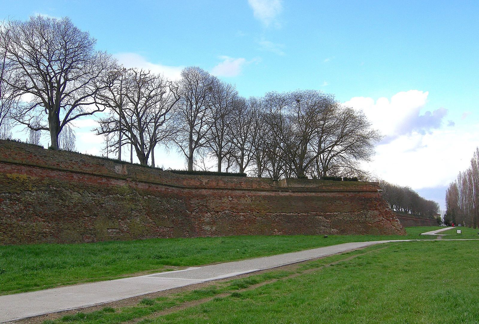
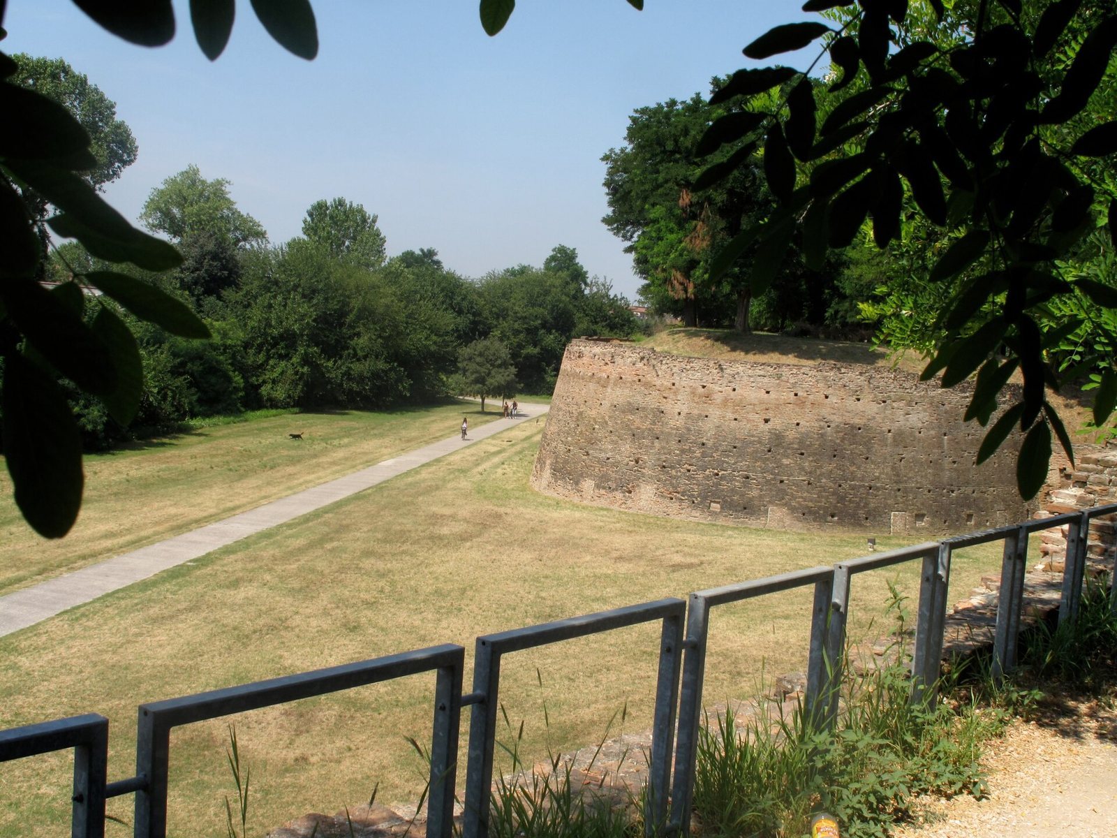
The original circuit completely enclosed the city and extended for about 13 kilometers; roughly 9 kilometers survive. Bastions are concentrated mainly along the southern walls, although some are incomplete. Their outlines resemble a spur or pike. Ditches once surrounded them, and openings in the fortifications allowed artillery to fire. The San Tommaso and Montagnone bastions retain their triangular plan, with embankments formed from earth excavated from the outer ditch.
Northern and eastern structures
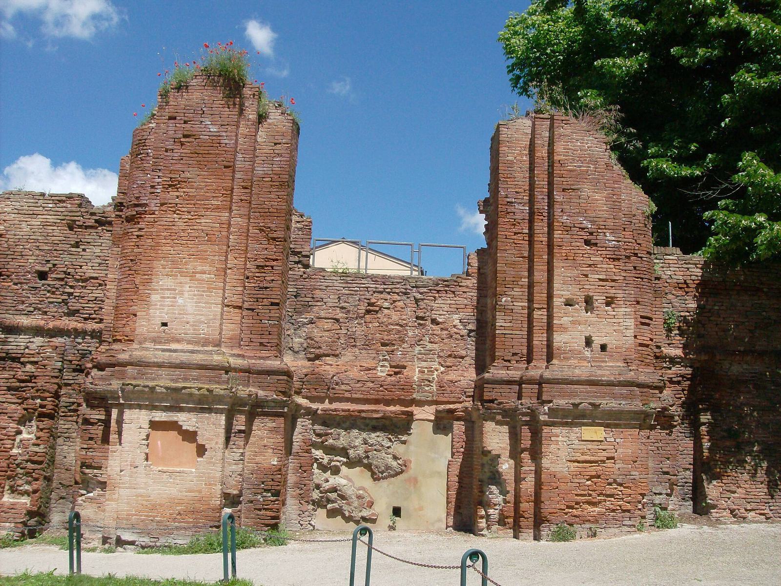
The northern defenses include semicircular towers and a long walkway for sentries. At the northwest end stands the Torrione del Barco, a military structure characteristic of the transition between fifteenth- and sixteenth-century architecture. Porta degli Angeli is in the north, while the circular Torrione di San Giovanni stands to the east and has a form characteristic of Renaissance architecture. A copy of a statue by the modern Italian artist Giorgio de Chirico stands on a nearby square.
Fortress remnant
A surviving section of the later Ferrara Fortress lies near Viale 4 Novembre, among the parkland associated with the former defensive circuit.
Parkland and associated features
Former defensive grounds
Parkland now occupies parts of the former circuit around Ferrara’s Renaissance center. It includes level grassy areas, long paths between rows of trees, and densely vegetated stretches with a woodland character. The grounds include the Montagnone and San Tommaso bastions, the Montagnola in the Rampari di Belfiore, and much of the southern stretch along Via dei Baluardi.
Montagnone
The ducal baths and garden built beside Montagnone around 1541 formed part of this area. Ferrara’s first drinking-water reservoir, constructed near the bastion in 1890, is another feature of its later history.