The First Medieval City Wall of Maastricht: A Thirteenth-Century Fortification
Site at a Glance
- Popularity
- Medium
- Country
- Netherlands
- Primary era
- Medieval
- Eras represented
- Medieval, Early Modern
- Civilizations
- Duchy of Brabant, Dutch, Holy Roman Empire
- Site type
- Military
- Remains
- Wall
On this page22 sections
History
The First Medieval City Wall of Maastricht enclosed the town’s left-bank area beside the Meuse in the Netherlands, forming a stone fortification built in the second quarter of the thirteenth century. Maastricht was then a two-lord city, jointly governed by the prince-bishop of Liège and the duke of Brabant. The enclosure covered about 36 hectares, including an area roughly corresponding to the present inner city and part of the Jeker Quarter, and extended for approximately 2.4 kilometres.
Earthwork defenses and the stone wall
Before the stone wall, an earth bank topped with a wooden fence stood around the town by 1204. Archaeological evidence dates a section near the Old Friars Minor Monastery to about 1175–1180. A chronicle from Saint-Jacques Abbey in Liège credited the Duke of Brabant with building the bank shortly before 1204, although proposals for an earlier enclosure remain uncertain. During the siege of 1204, Hugh of Pierrepont, prince-bishop of Liège, and his vassal Louis II, Count of Loon, destroyed the earthwork. After reconciling with the duke, they agreed to repair Maastricht’s bridge; whether they also restored the bank is unclear. Liège forces destroyed the bridge again in 1214.
On 25 April 1229, Henry I, Duke of Brabant, authorized the town to build a wall. A few months later, Henry VII, King of the Romans, confirmed the right to construct walls, ditches and other defenses. The title King of the Romans was held by the elected ruler of the Holy Roman Empire before imperial coronation. Work probably began in 1229, possibly with earthworks and ditches before or alongside the gates and towers. Archaeological investigation found the stone wall on the line of the bank destroyed in 1204. Gates are mentioned in 1245 and the stone wall in 1251, while the sequence of construction remains unresolved.
Sieges and the second enclosure
The first major recorded attack came in 1267, amid the Liège-Brabant conflicts, a prolonged series of struggles over political control and Maastricht’s Meuse crossing. Liège and Guelders forces led by Henry III of Guelders, prince-bishop of Liège, and supported by his brother Otto II, first attacked Wyck on the opposite bank. Dirk II of Valkenburg and 300 men defended a fortified tower near the bridge, but the attackers took the town and held it for two years, demolishing the tower. They crossed the Meuse by the Roman bridge and entered the walled left-bank town through the Our Lady Gate, possibly after townspeople opened it. The wall’s part in the outcome is uncertain.
Further attacks followed. In 1284, Walram the Red of Valkenburg targeted Wyck, whose provisional defenses, built after 1267, apparently discouraged him. Hugh of Chalon, prince-bishop of Liège, besieged Maastricht in 1296 or 1297. In 1303, the forces of John and Peter of Bar abandoned their siege after Wyck’s defenses held, while Adolf of the Mark, another Liège prince-bishop, ended his 1334 siege after the townspeople paid a sum of money. The left-bank wall’s precise role in these episodes is unknown, though its defenses may have resisted or deterred attackers.
Work on a second city wall began in 1294 to enclose a larger urban area. Its gates were built between 1297 and 1300, and the new enclosure was in use by 1380, although construction continued afterward. The first wall then remained a reserve defensive line for at least two centuries. During the 1579 siege, commander Sebastiaan Tapijn planned to retreat behind it if the newer wall fell, but the plan was not carried out.
Maintenance and changing uses
The older enclosure continued to be maintained, especially beside the Meuse, where it remained part of the main defenses. A riverside section was rebuilt in the fifteenth century. Small openings through the wall were alternately blocked and reopened, and a bastion between the bridge and the Our Lady Gate was built in 1477. It was replaced in the sixteenth century by a triangular earthwork. Town officials and residents also disputed a ditch apparently situated in front of the southern riverside wall.
As defensive needs changed, parts of the wall were adapted to other purposes. From the fifteenth century, niches were rented for storage or commerce. Small dwellings were added to some during the first half of the sixteenth century, often for poor residents without rent, but they could be removed in wartime. From the second half of the seventeenth century, houses and other buildings increasingly stood against the outer face. The moat along Grote Gracht and Kleine Gracht had probably been filled by the sixteenth century, and houses occupied the reclaimed ground. Gatehouses also served as homes or guild meeting rooms. The Gevangenpoort became a prison in 1306 and an arms and gunpowder storehouse in 1465; the Leugenpoort and Veerlinxpoort also held prisoners, and the latter was used as a school in 1549.
The dry ditch outside the western wall, called Boichgraeve, was used for bow practice from 1420 and crossbow practice from 1423. Disputes over ownership arose between the town government and the canons of the Saint Servatius chapter. In 1505, Philip the Handsome, a Habsburg ruler of the Burgundian Netherlands, assigned the wall to the canons and allowed them to build on it to improve their gardens. A house is shown there on a plan from 1587.
Around 1640, the fish market’s expansion pushed the riverside wall at Vissersmaas outward toward the Meuse. The Visserspoort and Schuttenpoort were replaced by the Batpoort. An earth bank was raised on the city side of the riverside wall, supported in places by masonry; houses were later built on the bank. Construction of the Maas Mill in 1705 led to the rebuilding of the Molenpoort in Bokstraat. In 1774, the Batpoort and Our Lady Gate lost their portcullis housings, and the latter also lost its drawbridge and defensive pit.
Demolition, restoration and archaeological study
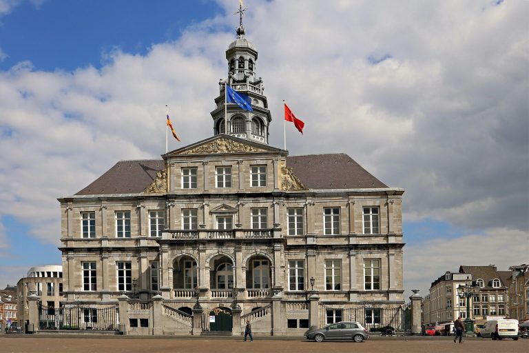
The wall’s protected role as a reserve defense was relinquished in the seventeenth century. Between 1655 and 1660, the Gevangenpoort, the Leugenpoort and their connecting wall were demolished to make way for the new town hall, ending the old enclosure’s defensive function. The riverside stretch remained part of the second wall’s defenses until 1867, when Maastricht’s fortress status was abolished. Much of that stretch was demolished between 1868 and 1905; removal elsewhere continued into the early twentieth century. The round tower of the Tweebergenpoort was demolished in 1926.
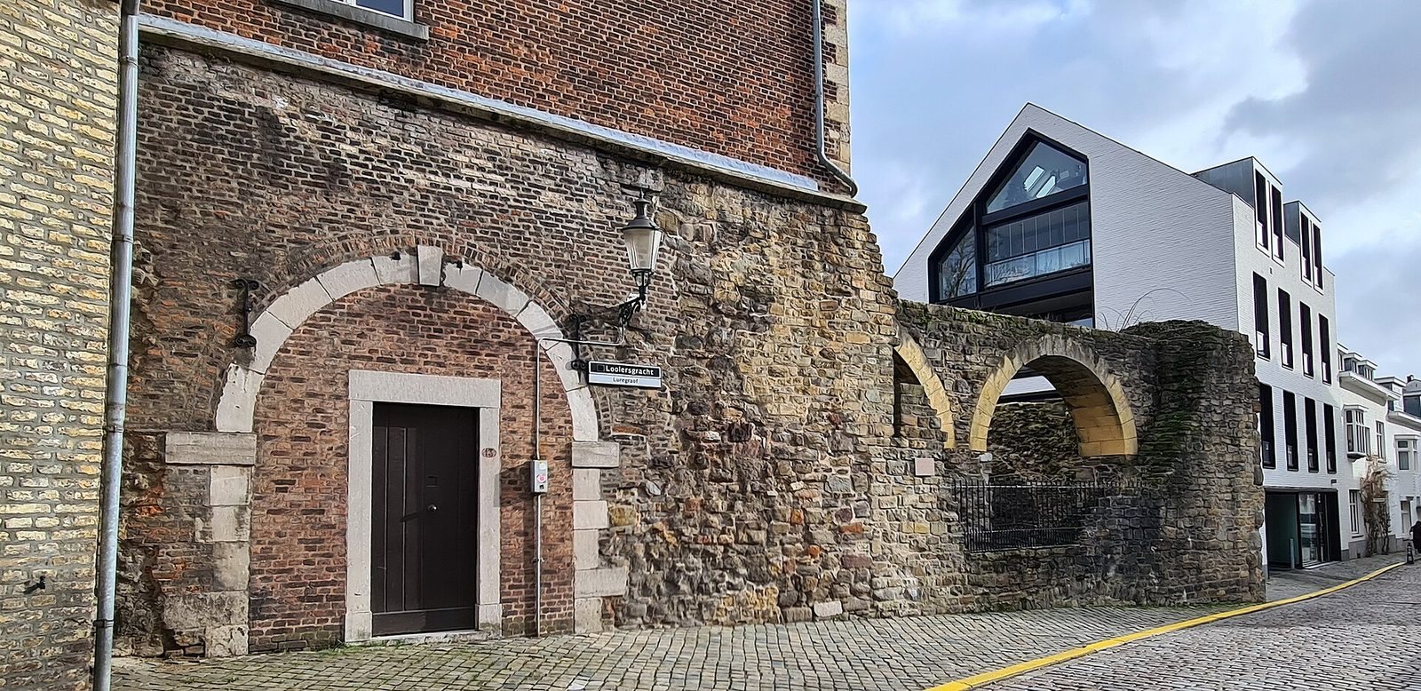
Preservation and rebuilding began in the early twentieth century. A section between the Helpoort and Jekertoren, demolished in 1894, was reconstructed in 1906, using remains excavated in 1904 on the other side of the gate. Walls at Lang Grachtje and Klein Grachtje were restored between 1908 and 1912, and houses built against them were removed. In 1910, a deteriorated section at Looiersgracht was taken down and partly rebuilt. The Jekertoren, reduced to a 2.5-metre stump by the early twentieth century, was rebuilt in 1911 in a romanticized medieval form. Preservation advocate Victor de Stuers promoted the work and protested the undocumented demolition of the Tongersepoort.
Maastricht’s municipal archaeological service, established in 1979, enabled more sustained investigation. A 1981 excavation at the Kommel monastery examined part of the ditch and bank. Excavations behind the Generaalshuis in 1988–1989 revealed the bank and established that a semicircular tower, the Wittevrouwentoren, had stood there. Work at the Old Friars Minor Monastery in 1991 uncovered substantial wall foundations, part of which was made visible during restoration and expansion of the complex. That investigation also dated the earth bank at the site to about 1175–1180.
Historical images and plans help trace the enclosure. A city panorama first published in 1575, based on sketches by Simon de Bellomonte, depicts the fortified left bank. His 1587 plan records portions of the riverside, western and northwestern walls. A detailed plan made by French military engineer Jean-Baptiste Larcher d’Aubencourt in 1748–1749 became the basis for a model showing wall sections still standing at the time. Many surviving sections and related features now have national-monument protection, and some also have municipal protection.
Remains
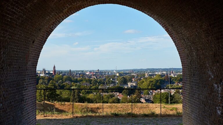
About 750 metres of the former enclosure survive in separate stretches. Their remains include sandstone walling, inner arches, earthworks, towers, a gate and smaller openings. The wall’s recorded construction and the layout of the surviving sections together preserve evidence of how the defensive line was built and altered.
Wall construction and earthworks
Masonry wall
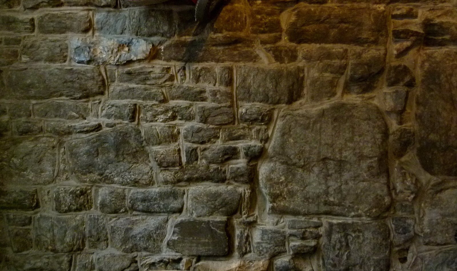
The wall was built from irregular Carboniferous sandstone masonry, stone formed during the Carboniferous geological period, with rubble and lime mortar in its core. It averaged about 5.5 metres high and 1.25 metres thick. On the outer side, a steep earth bank partly covered the masonry. On the city side, piers about 1.4 metres thick supported rounded marl-stone arches, roughly 3.5 metres high and 3.8 metres wide. These arches carried a wall-walk, a path along the top of a defensive wall. Battlements originally topped the wall and were later replaced, perhaps around 1500, by brick parapets.
Bank, ditch and foundations
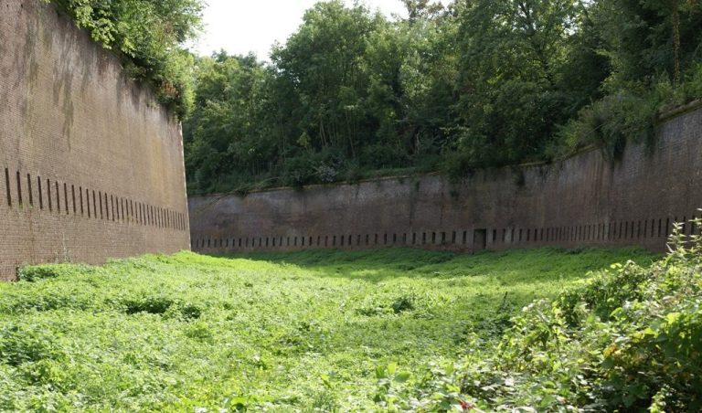
At the Kommel site, excavation exposed a cross-section of the ditch and surviving bank. The bank reached about three metres above present ground level. The ditch was at least 20 metres across and seven metres deep, measured from the bank’s top; its terraced slope may indicate that it was deepened in stages. Earth, rubble and charcoal filled it during the fifteenth or sixteenth century. A steep slope of loam soil may preserve part of a bank that predates the 1229 authorization. Layers of loam, gravel, pebbles, charcoal, phosphates and iron ore also survive in the bank. At the Generaalshuis, the wall was partly embedded in it, which had risen about two metres on the city side by the late thirteenth century.
Near the southern end, the wall began to subside toward the end of the thirteenth century, possibly through erosion by the Jeker. Around 1300, builders added short wooden piles beneath its outer side to strengthen the foundations. At the Old Friars Minor site, pottery from the bank supports a date of about 1175–1180.
Surviving wall sections
Onze-Lieve-Vrouwewal
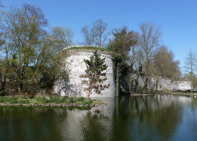
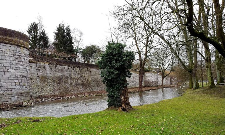
The Onze-Lieve-Vrouwewal is about 150 metres long and seven metres high. Its Carboniferous sandstone masonry carries a brick parapet about 1.75 metres high. It is the remaining riverside stretch of the first enclosure. The Jeker’s mouth and the former Bat loading quay lie between it and the river.
Helpoort wall section
About 80 metres of wall extend between the Jekertoren and the Pater Vincktoren, which belongs to the second enclosure. Much of this stretch, including the Helpoort, was reconstructed. It retains a wall-walk and battlements, features preserved together in this section.
Old Friars Minor Monastery
Within the former monastery complex, an approximately 15-metre length of foundation includes some rising masonry. Most of the exposed material is marl blockwork associated with a fourteenth-century repair. The wall continues beneath later monastery wings, and part is exposed on the south side of the cloister court. A vertical mark in the historicizing twentieth-century west facade of an originally eighteenth-century wing indicates where the city wall crosses the monastery wall.
Lang Grachtje
About 125 metres of wall and a tower remain along the south side of Lang Grachtje. The city-facing side is exposed along the street, while private gardens occupy the outer side. The wall is distinguished by its city-side relieving arches, arches that redirect weight around openings.
Klein Grachtje and Jeker–Looiershof
The Klein Grachtje and adjoining Jeker–Looiershof sections together extend for about 150 metres. Slightly less than half lies along the south side of Klein Grachtje; the wall continues across properties on the south bank of the northern branch of the Jeker. Its city face is visible from the Toneelacademie grounds, and a section of the previously concealed outer face has been exposed since 2016.
Looiersgracht–Lenculenstraat
This stretch is about 70 metres long and meets the Looiershof wall at a sharp angle. Only its southeastern end is exposed along Looiersgracht; the rest is incorporated into the late-seventeenth-century Protestant Orphanage, now the Toneelacademie. A further section is visible inside Café Tribunal.
Boichgraeve
West of Sint Servaasklooster, about 120 metres of wall survive, reaching approximately 5.5 metres in height. Sections stand beside a public road and within private or monastery gardens. Masonry supports reinforce parts of the outer face, and remnants of the wall-walk remain. A small garden pavilion stands on the wall.
Grote Gracht and Preekherengang
Behind buildings south of Grote Gracht, a sloped western fragment extends for less than 20 metres. Its varied masonry reflects repeated repairs, and two relieving arches remain recognizable. A larger arch once provided access to the Wittevrouwentoren. Farther east, the Preekherengang section extends about 75 metres behind buildings; some of its relieving arches contain niches with loopholes.
Towers, gates and openings
Helpoort
Dating from the second quarter of the thirteenth century, the Helpoort is the oldest surviving city gate in the Netherlands. Its walls are Carboniferous sandstone, its cornice is marl stone, its passage ceiling is brick, and its roofs are covered with slate. The two semicircular towers rise to nearly 24 metres, each with a spiral staircase. The passage is about four metres wide, and a slot for a portcullis, a vertically lowered barrier, remains visible on the outer side.
Jekertoren and other tower remains
The Jekertoren marks the southeastern corner of the former walled area. Rebuilt in 1911 to more than 15 metres high, it is 4.6 metres across, with Carboniferous sandstone walls about 80 centimetres thick and a conical slate roof. The tower at Lang Grachtje is hollow, U-shaped and strengthened by relieving arches. Other tower remains include the Wittevrouwentoren behind the Theater aan het Vrijthof and a tower incorporated into buildings at Kleine Gracht and Gubbelstraat.
At the corner of Looiersgracht and Looiershof, a reinforced wall section forms an angle of about 80 degrees near a branch of the Jeker. The nearby bridge retains a slot for a portcullis. Its adjoining wall has a wall-walk and two rows of loopholes.
Gates and water openings
The first enclosure had thirteen city gates and two water gates where the Jeker entered the town. The Helpoort remains as a land gate. The former Our Lady Gate, the principal Meuse gate until 1275 because it gave access to the old bridge, survives through an eighteenth-century guardhouse and a hard-stone pier from a nineteenth-century outer gate structure. Its key is held in the Centre Céramique collection.
The Water Gate Behind the Friars Minor stands near the point where the northern branch of the Jeker leaves the inner city. It has three openings: one is blocked, one belongs to the first enclosure and one to the second. Five smaller openings remain in the Onze-Lieve-Vrouwewal, two blocked; the largest retains a portcullis slot behind its masonry arch. Their use for defense or for loading and unloading boats is uncertain. Most other openings in surviving sections were made later, in the eighteenth or nineteenth centuries, for private use.