Nieuwstad: The Southern Fortifications of Maastricht
Site at a Glance
- Popularity
- Very Low
- Country
- Netherlands
- Primary era
- Early Modern
- Eras represented
- Medieval, Early Modern, Modern
- Civilizations
- Duchy of Brabant, Dutch, Holy Roman Empire
- Site type
- Military
- Remains
- Wall
On this page25 sections
History
Nieuwstad is a historic fortified district in Maastricht, the Netherlands, whose southern defences formed part of the city’s medieval enclosure. Its own fortifications began in 1486 and were rebuilt in stone in 1515–17, as Maastricht strengthened its southern approach.
Medieval walls and the southern boundary
Before Maastricht’s first stone wall, an earthen bank topped with wooden palisades was in place by 1204 and may have originated in the late twelfth century. Duke John I of Brabant authorized a stone enclosure in 1229. Construction probably began that year, and the wall was likely complete by about 1250.
Work on a second city enclosure began in the 1290s. It entered service in 1380, although some sections had not reached their planned height. The new circuit expanded the enclosed area from about 36 to 114 hectares. Around 4.4 kilometres long, it incorporated about 3,575 metres of new wall and 800 metres of existing wall.
The southern route could not follow its planned line east of Sint-Pieterspoort. The neighbouring village of Sint Pieter belonged to the prince-bishop of Liège, who would not allow the wall to cross his territory. The enclosure therefore turned northeast to meet the earlier wall, leaving Maastricht exposed to attack from the nearby village. Maastricht itself was governed jointly by Liège and Brabant, while Sint Pieter was a separate Liège lordship.
In 1407–08, rebels from Liège and Loon besieged Maastricht but failed to capture it. Prince-Bishop John of Bavaria had taken refuge in the city for a time. During renewed danger in 1465, Sint Pieter sided with the rebels. The village and a Beguine convent outside Maastricht’s southern wall were burned. Beguines were women living in religious communities without binding monastic vows. Prince-Bishop Louis of Bourbon banned the village’s reconstruction, a prohibition confirmed by Charles the Bold in 1467. Sint Pieter was partly rebuilt about twenty years later.
The creation of Nieuwstad
Around 1456, silt shifted the Jeker River several metres south, by about 25 metres in its eastern stretch. Maastricht claimed the newly formed ground and built a curved stone boundary wall between water gates near Pater Vinck Tower and Jeker Tower. This work may have brought Helpoort’s use as a city gate to an end. In 1471, the city council set aside the enclosed ground for a pesthouse, also known as a sickhouse or Paradise. The site later became the municipal slaughterhouse.
In 1486, Maastricht took control of part of Sint Pieter without agreement from its neighbour, enabling the city to strengthen its southern defences. Work began that year on an earthen rampart and moat and was complete by 1490. The rampart included at least one defensive work at the site later occupied by Haet ende Nijt. From the late fifteenth century, the enclosed area was called Nieuwstad.
Brabant’s support for Maastricht’s annexation weakened, and the city eventually had to give up its claims. Nieuwstad nevertheless remained within the Freedom of Sint Pieter, a territorial jurisdiction distinct from Maastricht’s, until French forces arrived in 1794. Sint Pieter’s new aldermen took their oaths on the Nieuwstad rampart.
In 1489, Robrecht I van der Marck, Duke of Bouillon, tried to capture Maastricht but was driven off. The defensive value of the earthworks, which were nearly complete, is uncertain.
Stone fortifications, sieges and repairs
Between 1515 and 1517, the earthen defences were reconstructed in stone. Coenraad van Neurenberg has been proposed as the person directing the work, but his involvement is uncertain. One defensive work, Haet ende Nijt, was completed while Herman van Zaraziën managed the city’s finances; his name was carved on a stone there. A second work, De Drie Duiven, was also in place. Between 1542 and 1551, workers deepened the moat, moved the Jeker’s mouth and filled formerly hollow defensive works with earth to strengthen them and create cannon platforms.
Before Alexander Farnese, Duke of Parma and a senior commander for the Spanish crown, besieged Maastricht in 1579, artillery platforms with projecting points were built at the foot of Haet ende Nijt and De Drie Duiven. Their outer faces used stone from Sichen. After nearly four months, Farnese’s army, numbering about 20,000, captured the city. Three days of killing and looting followed. The siege demonstrated that Maastricht could be taken despite decades of fortification, increased taxes and forced labour.
Frederick Henry of Orange, a Dutch stadtholder and military leader, captured Maastricht in 1632. In 1638, after local residents tried to return the city to Spanish rule, five executed men’s heads were displayed on a stake at De Drie Duiven. The work thereafter became known as De Vijf Koppen, or The Five Heads.
Maastricht’s fortifications acquired the reputation of being the “key of Brabant” and the “bulwark of the Netherlands,” but they required repeated repairs. The wall between the Jeker and De Vijf Koppen was renewed in 1643, and the section between Sint-Pieterspoort and De Vijf Koppen was refounded in 1679. The platform at Haet ende Nijt was repaired in 1739. The platform at De Vijf Koppen was probably removed in 1792 or soon afterward.
Canal works and the dismantling of the defences
The Liège–Maastricht Canal was built between 1845 and 1850, with excavation on Dutch territory beginning in 1847. In Maastricht, the canal cut through the southern defences and part of the enclosed city. At De Vijf Koppen, the moat was widened to make a turning basin. The Jeker, which flowed east between the defensive work and Jeker Tower, was carried beneath the canal through a water passage. A settling tank at the passage collected blood and waste discharged by the municipal slaughterhouse, which had occupied the former pesthouse site since 1824. The slaughterhouse moved to Fransensingel in 1902, and its Nieuwstad buildings were demolished in 1904.
King William III of the Netherlands revoked Maastricht’s fortress status on 29 May 1867. The city’s fortifications were then dismantled, and their land was made available for possible demolition, sale or reuse. Nieuwstad’s defences remained largely intact until 1884, when the wall between the former Sint-Pieterspoort and Haet ende Nijt was removed, together with part of a water gate and a wall tower. The five-sided platform at Haet ende Nijt was probably removed at that time. A road and Poort Waerachtig cut through the wall joining the two defensive works in 1886–88.
Further alterations removed sections of the earlier city defences. Most of the first wall between Helpoort and Jeker Tower was demolished in 1894 and rebuilt in 1906–07. In 1906, about half the wall between Jeker Tower and De Vijf Koppen was taken down for a tramway and connecting road. Jeker Tower was rebuilt in 1911, when some earth was also removed from inside De Vijf Koppen.
Conservation and recent changes
The wall beside the operating canal was restored in 1951–52, and the outer wall of De Vijf Koppen was repaired in 1956. After the canal was filled in 1962–63, its former turning basin became a park pond and the surrounding park was redesigned. In 1967, further earth was removed from the top of De Vijf Koppen, which was paved with Meuse cobbles. Benches and a cannon brought from elsewhere were placed there.
In 2018, repairs to the wall joining the two defensive works revealed outward bulging, thought to result from poor drainage. Drainage was improved and the wall monitored. Part of the wall near De Vijf Koppen collapsed on 24 March 2019, leaving a breach about six metres wide; another collapse on 4 April widened it to about ten metres. Investigation linked the failure to trapped moisture, erosion and wear, pressure from the earth behind the wall, and inadequate anchoring between its inner and outer masonry. No link to the earlier repair work could be established. The breach also exposed a sunken wall-walk, a passage along the wall for defenders.
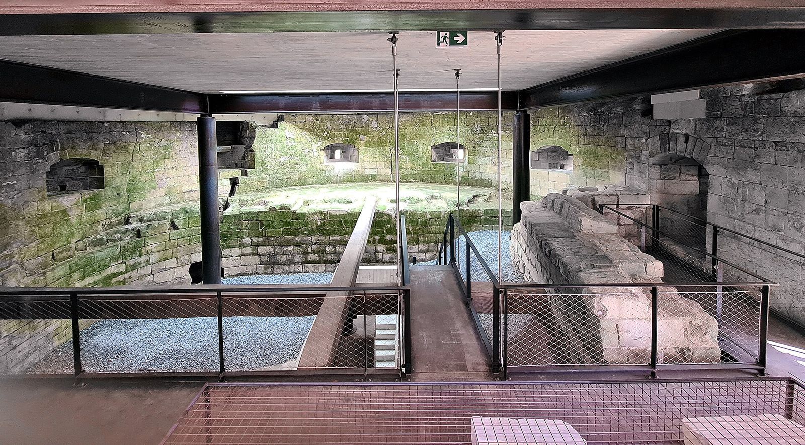
Deformation at De Vijf Koppen worsened in 2020. Emergency work supported the exterior, removed earth from inside the structure to reduce pressure and anchored its outer wall from within. Excavation revealed vaulted remains that may belong to a protected chamber, or casemate, within the fortification. In 2021, it was decided to take down and rebuild the outer stone facing of both De Vijf Koppen and the connecting wall. The rampart on the city side was to remain lower, exposing the wall-walk, and De Vijf Koppen was not to be refilled, restoring something of its early-sixteenth-century arrangement.
Restoration began in October 2023. More than 2,500 numbered stones were temporarily stored and then reset in their original positions, with 250 new stones used as replacements. About half of the fortification was returned to its former appearance. The fortifications and the two former watermills are protected as national monuments; several other features in the district have municipal monument status.
Remains
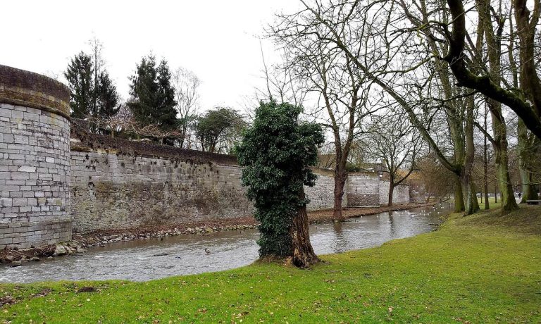
Nieuwstad’s surviving defences once extended for about 320 metres, and somewhat less than half of that length remains. The principal elements are two large projecting works, their connecting wall, part of a water gate near the former Sint-Pieterspoort and sections of older city wall along the Jeker. The defences stand among parkland and ponds. A former moat fed by the river is now difficult to distinguish from the park’s ponds.
The projecting defences
Haet ende Nijt
Haet ende Nijt, whose name means “Hate and Envy,” is the western of the two semicircular defensive works, or roundels. It is about 15 metres across and projects slightly more than halfway beyond the wall line. Large, evenly sawn blocks of Namur stone face a core of soft, pale marlstone. A projecting base supports a damaged carved band decorated with tridents. An inset stone bears a Burgundian cross between two Maastricht stars.
A small secondary gate on the eastern side leads to the lower protected chamber. A similar opening on the west may have been added during later restoration. The city-facing rear wall is made of marlstone and was partly concealed by the rampart. A recessed entrance leads to the upper chamber. Above it, a shaped stone lintel carries a city star, while a name stone bears a difficult-to-read verse; a replica replaced the original in 2018. Small windows framed in hard stone flank the entrance.
North of the structure, a forecourt paved with Meuse cobbles and a hardstone stair at its northeast corner give access to the top. The rounded upper surface has been partly cut down, leaving its edge above the parapet. A safety barrier surrounds the platform, where a wall of corten-steel plates stamped with the structure’s name replaced a wooden fence in 2018. A cast-iron cannon stands on the cobbles. Its origin is uncertain: it may have come from the 1874 demolition of Lindenkruispoort or been donated by scrap-metal dealer H. Dotremont in the 1960s. A wooden replica carriage installed in 2018 was burned by vandals in 2022.
De Vijf Koppen
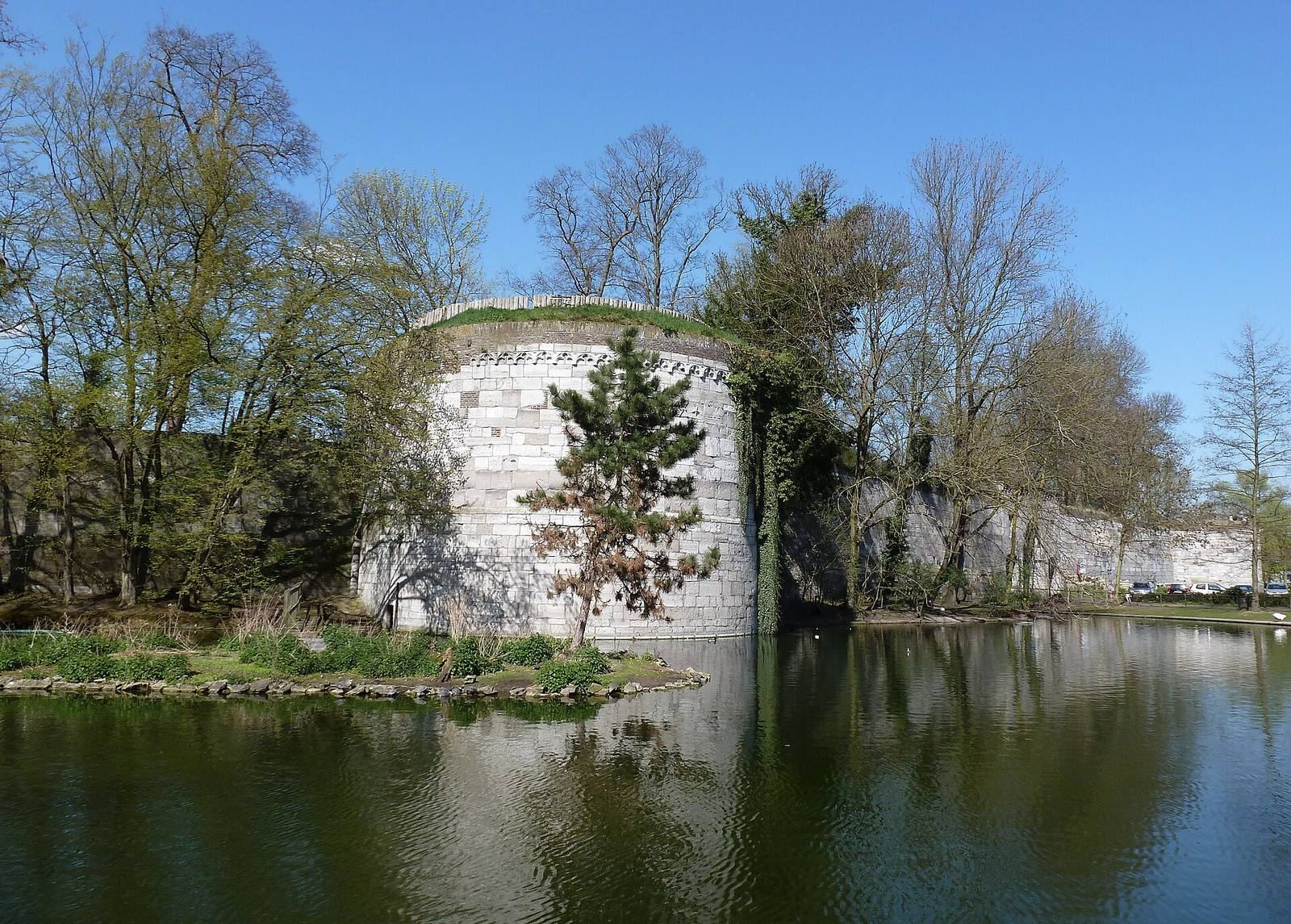
De Vijf Koppen, formerly called De Drie Duiven, or “The Three Doves,” is larger than Haet ende Nijt. It is about 18 metres in diameter and projects roughly two-thirds of a circle beyond the wall. Namur stone forms its outer face, which has a lower base but no carved band. A projecting horizontal moulding marks the foot of the brick parapet, which includes a machicolation, an opening through which defenders could drop objects on attackers below. A relief on the outer wall shows two crossed gun barrels or loading rods between two cannonballs.
The rear wall is made of marlstone. It was once partly hidden by the earth rampart but became visible again when the rampart was lowered. A cast-iron cannon and a wooden copy of the stake used to display the executed men in 1638 formerly stood on the platform. Neither was put back after the recent restoration; two stone benches now occupy the platform.
Chambers and connecting wall
Chambers at Haet ende Nijt
Both roundels probably had two levels of protected, vaulted chambers from the sixteenth century. Haet ende Nijt retains both, in broadly their original condition. They were once used to store gunpowder, which gave the work the alternative name Polvertoren, or Powder Tower. Each chamber is about 2.75 metres wide and high. The lower one is 10 metres long and can be reached through a nine-metre passage on the north or through either of two side entrances. The upper chamber is 12 metres long and opens from the forecourt.
Chambers at De Vijf Koppen
The lower chamber at De Vijf Koppen is reached by a bent, barrel-vaulted passage 32 metres long. Beneath the structure, it divides into two passages measuring 13.5 metres in total; they are about two metres wide and two metres high. A second chamber above was long assumed to exist. Vaulted remains uncovered during excavation in 2020 may belong to it and have since been restored and made accessible.
The connecting wall
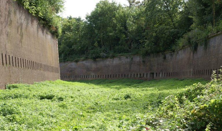
The connecting wall is about 93 metres long and consists of masonry backed by an earthen rampart. Namur stone forms much of its construction, with numerous repairs in marlstone and brick. A decorative band runs along the upper wall, lower than the one on Haet ende Nijt. The city-side rampart, once high and covered with trees, was partly lowered during recent restoration, leaving the sunken wall-walk exposed.
Gates and earlier walls
Poort Waerachtig
Poort Waerachtig is a Neo-Gothic gate built through the connecting wall in a deliberately medievalising style. It is 13 metres wide, with a broad pointed arch for road traffic between two arched pedestrian passages. Its original crenellations collapsed during the 1930s and were not rebuilt. The side facing away from the city bears Maastricht’s arms and a chronogram, an inscription whose selected letters encode a date, composed by historic-preservation advocate Victor de Stuers.
Older city walls and water gate
Remains of the first Nieuwstad wall can be seen south of Het Ancker and at other points along the Jeker. Most of the roughly 145-metre section between the former Sint-Pieterspoort and Haet ende Nijt has disappeared; about 20 metres remains west of the roundel. Less than half of the approximately 70-metre stretch between De Vijf Koppen and Jeker Tower survives, and only a small portion still reaches its full height.
Only the lower part of the former water gate beside Sint-Pieterspoort remains. Its neighbouring wall tower was almost entirely demolished in 1884. Part of the earlier curved boundary wall opposite the watermill Het Ancker survives as a quay wall between Pater Vinck Tower and the former pesthouse site. It was raised slightly around 1907 using old blocks of Namur stone.
Waterworks and mills
The Jeker moat and water controls
The former moat drew water from the Jeker and is now largely indistinguishable from the surrounding park ponds. Its water level was controlled by two stone weirs fitted with sluices and overflow channels. The surviving quay wall is another remnant of the older water system.
De Vijf Koppen mill
Despite its name, the former De Vijf Koppen watermill stood closer to Haet ende Nijt. It was mentioned by 1533 and served, among other purposes, as a fulling mill, where woollen cloth was beaten and cleaned. It was dismantled in the early twentieth century and no longer operates.
Het Ancker
Het Ancker began in the first half of the sixteenth century as a saltpetre mill. Saltpetre, or potassium nitrate, was an ingredient in gunpowder, and a powder house stood nearby. After an explosion in 1773, the mill was rebuilt as a paper mill. It was dismantled in 1876.
Parkland and associated features
Faliezusterspark and Stadspark
Faliezusterspark occupies part of Nieuwstad. Its landscaped grounds are bordered by the Faliezusters Convent, the Old Franciscan Convent, Pater Vinck Tower, sections of both city walls and Helpoort. Quay walls and bridges over the Jeker are among its built features. An iron fence at Begijnenstraat 11 was brought from Sint Servaas Bridge, which underwent extensive rebuilding in 1932–34.
Stadspark Maastricht lies south of the roundels. The park beside Haet ende Nijt, now called Mgr. Nolenspark, was laid out around 1877 in the English landscape style to plans by landscape architect Liévin Rosseels. Its pond, island and fountain are traditionally known as the Duck Pond. The park beside De Vijf Koppen dates to 1837 and follows the same landscape style, to a design by city architect Mathieu Hermans. Its pond is also called Zwanengracht, a name linked to its former use as the canal’s turning basin. A large fountain transferred from the 1972 Floriade was installed there in 1973. Both parts of the park contain old and unusual trees.
Building at De Vijf Koppen
At the foot of De Vijf Koppen is a building dating to about 1800 that formed part of a paper mill in the nineteenth century. The tall, white-painted structure has a mansard roof and a stair tower at the rear.
Sculpture on the Jeker
On the south bank of the Jeker, opposite Vijfkoppen 2, a hardstone sculpture by Frans Gast depicts three children carrying a bowl of flowers. The work is dated 1950.