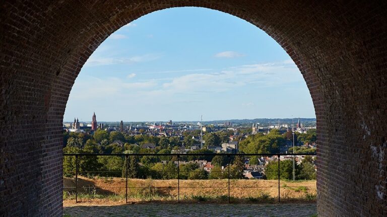
The Second Medieval City Wall of Maastricht: A Defensive Circuit
Site at a Glance
- Popularity
- Medium
- Country
- Netherlands
- Primary era
- Medieval
- Eras represented
- Medieval, Early Modern, Modern
- Civilizations
- Duchy of Brabant, Dutch, French, Holy Roman Empire
- Site type
- Military
- Remains
- Wall
On this page28 sections
History
The second medieval city wall of Maastricht was a defensive circuit around the city’s expanded area on the left bank of the Meuse, in the Netherlands. Construction began in 1294, when Maastricht was jointly ruled by the Prince-Bishop of Liège and the Duke of Brabant, and continued through successive building phases for roughly two centuries. The wall entered service in 1380 as the city’s primary defensive line, while the first medieval wall remained a reserve line for at least two centuries.
Building the expanded circuit
The first work on the new defenses took place near the Antonite monastery, a religious house associated with care for the sick. The Boschpoort, Brusselsepoort, and Tongersepoort followed between 1297 and 1300, apparently built in stone from the outset. Construction then slowed. Stone wall-building probably resumed around the middle of the fourteenth century, beginning in the south near the later Pater Vinck Tower and extending beyond the first tower west of the Nieuwenhof Gate. Around 1375, the city’s two collegiate chapters, bodies of clergy attached to churches, and Prince-Bishop Jan van Arkel contributed funds.
When the circuit began operating in 1380, it measured about 4.4 kilometres, including 3,575 metres of new wall and 850 metres of earlier wall. The area enclosed had grown from 36 to 114 hectares. By the end of the fourteenth century, the city was enclosed, but parts of the northern and western defenses remained too low, and twenty wall towers were still unfinished.
Completion and artillery changes
Work continued during the fifteenth century, and some earlier sections were dismantled as construction advanced. Between 1400 and 1450, builders raised walls and towers between the Sint-Pieterspoort and Brusselsepoort, worked on the middle section of the northern Meuse Tower behind the Biesen, and added to the Sint-Pieterspoort and Lindenkruispoort. A barbican, an outer defense protecting a gate, may also have been built at the Boschpoort.
From 1450 to 1500, the heavily indebted city completed more upper wall sections, part of the Tongersepoort’s flanking towers, and the barbican at the Brusselsepoort. Repairs were made to the Boschpoort using Namur stone, and work continued on the Meuse Tower behind the Biesen. Some towers and parts of the Tongersepoort’s flanking towers may still have been unfinished at the century’s end. The moat was substantially widened during the fifteenth century.
War threats prompted further strengthening in the first half of the sixteenth century. Flooding by the Jeker damaged southern sections, which were rebuilt; another section at Hoog Frankrijk was repaired after a collapse, and the Boschpoort was also rebuilt. Work on the Schonenvaarders artillery platform behind the Biesen began in 1525. Between 1542 and 1544, earth was banked against the inner face of the wall, except along the Meuse, where arches were first blocked with marl blocks. Raised earth platforms for artillery and defensive enclosures behind some main gates were added. Towers were gradually lowered to wall height, filled with earth, and adapted as gun platforms. By about the middle of the sixteenth century, these changes had brought the circuit close to its final form.
Defense, sieges, and changing fortifications
Before 1567, Maastricht had no permanent garrison; citizens defended the city, and parish districts were assigned sections of the city-owned wall during wartime. The sieges of 1407–08, probably the first test of the incomplete circuit, failed to capture Maastricht. Liège and Loon rebels besieged the city twice while Prince-Bishop John of Bavaria had taken refuge there. A threatened siege by Liège in 1465 came to nothing. In 1489, Robert I de la Marck, Duke of Bouillon, attempted to take the city but was driven away. The part played by the nearly completed wall in that outcome is uncertain.
In 1579, Alexander Farnese, a Habsburg commander and governor in the Netherlands, captured Maastricht after a siege of nearly four months with an army of about 20,000 men. Three days of killing and looting followed. During the siege, a tower beside the Tongersekat was destroyed and never rebuilt, leaving the southwest corner with its surviving outward angle. Defensive outworks placed in front of gates and at the northern point of the Meuse had already been added; some were later replaced by projecting gun platforms. These outer defenses increasingly took over the main defensive role from the city wall.
Breaches in the wall during the 1632 siege were repaired. The city surrendered to Dutch commander Frederick Henry in 1632, French king Louis XIV in 1673, French marshal Maurice of Saxony in 1748, and French general Kléber in 1794. Attempts by Spanish commander De Moncada in 1634, William III of Orange in 1676, and De Miranda in 1793 did not force a surrender. Maastricht’s reputation as the “key of Brabant” and “bulwark of the Netherlands” reflected its defensive importance, though it may also have attracted ambitious attackers.
A new earthen rampart was built along the Meuse wall around 1640. About thirty years later, inner earthworks elsewhere were widened, sometimes reinforced with retaining walls, and planted with trees. During the French occupation of 1673–78, the Jeker Canal was built to supply water to the northern moat and other ditches. The Lindenkruispoort was taken out of use in 1676 and was soon concealed by earthworks.
Decline of the fortress and preservation of its record
A powder explosion in 1761 killed about twenty people. The Brandenburg artillery platform was largely rebuilt, and a breach in the main rampart, 40 metres wide and 10 metres deep, was closed. Repairs and improvements continued during the nineteenth century. Construction of the Zuid-Willemsvaart and the Bassin in 1822–26 cut through the circuit in two places, including a passage nearly 17 metres wide east of the Boschpoort and an opening in the Meuse wall connecting the basin to the river. The Liège–Maastricht Canal, built between 1845 and 1850, largely ended the defensive value of the Meuse wall.
King William III of the Netherlands signed the decision to end Maastricht’s fortress status on 29 May 1867, following pressure that included lobbying by the municipality. The Ministry of War then began dismantling the fortress. City gates were among the first structures removed, mostly between 1867 and 1870; demolition of walls, ramparts, and outer works continued into the 1930s. The Tongersepoort came down in the winter of 1867–68, followed by the Brusselsepoort and much of the defenses between Tongersestraat and Hoog Frankrijk in 1868. The Onze-Lieve-Vrouwepoort was also demolished in 1868, the northern Meuse wall in 1869, the Sint-Pieterspoort in spring 1869, and the Boschpoort in the winter of 1869–70. The Lindenkruispoort was removed in 1874. Further wall and rampart sections were taken down in the 1870s and early twentieth century, and the passage between the Zuid-Willemsvaart and Bassin was widened in 1875.
As demolition began, artist and historian Alexander Schaepkens and the young Victor de Stuers secured requirements for drawings and photographs of gates scheduled for removal. Draughtsman Johannes Brabant made detailed drawings, and photographer Theodor Weijnen recorded the fortifications, particularly the second wall and its gates. De Stuers later opposed further demolition and initiated restoration and reconstruction, including work on the Pater Vinck Tower. Today, surviving sections have national or municipal monument protection.
Written descriptions and maps also preserve evidence of the circuit’s form. Maastricht humanist Matthaeus Herbenus and Dominican chronicler Thomas de Heer wrote about the city when both medieval walls still stood. A panorama based on sketches by Simon de Bellomonte was first published in 1575 and depicts the fortified left bank, including gates, towers, and artillery works. A city plan published that year shows the circuit in greater detail; a 1612 version adds gate outworks but retains older tower forms and may not accurately represent some gates. French military engineer Jean-Baptiste Larcher d’Aubencourt made a detailed plan during the French occupation of 1748–49, which later served as the basis for a French model of Maastricht.
Serious archaeological investigation began in 1979, with excavation at the former Tongersepoort. The work identified its northern half, a later-added gate tower, and part of the wall. The gate had been reduced to ground level during demolition in 1867–68, and the medieval street level lay 2.5 metres below today’s. Two building phases appeared in the exposed foundations. Archaeologist Titus Panhuysen proposed that the earlier, simple rectangular structure was the first stone Tongersepoort, which Thomas de Heer associated with 1298.
Excavations in the northern Boschstraatkwartier between 1981 and 1983 covered 4,000 square metres and revealed early medieval habitation and burials, as well as some thirteenth-century occupation. Substantial urban development appears to have begun near the end of the fourteenth century, after the second wall entered service. This evidence supports historian Louis Morreau’s conclusion that Maastrichter Grachtstraat was not the site of a temporary city moat.
Remains
The circuit enclosed about 114 hectares on the Meuse’s left bank, broadly corresponding to today’s Binnenstad, Boschstraatkwartier, Statenkwartier, Kommelkwartier, and part of Jekerkwartier. Its length was about 3.6 kilometres, or approximately 4.4 kilometres when the earlier 850 metres incorporated into the circuit are included. Construction used Carboniferous sandstone, limestone, including Namur stone, Limburg marl, and brick. About 750 metres of wall fragments survive, chiefly in the southern city centre.
Wall sections and ramparts
Pater Vinck wall fragments
Two wall fragments beside the Pater Vinck Tower measure about 40 metres together. The northern fragment joins the thirteenth-century wall, while part of the southern stretch is ruined. Their crenellations have been reconstructed. These fragments form the surviving wall section not built on an earthen rampart.
Nieuwenhofwal
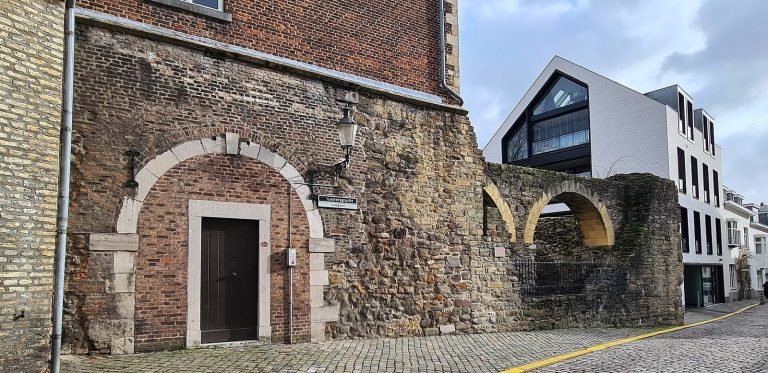
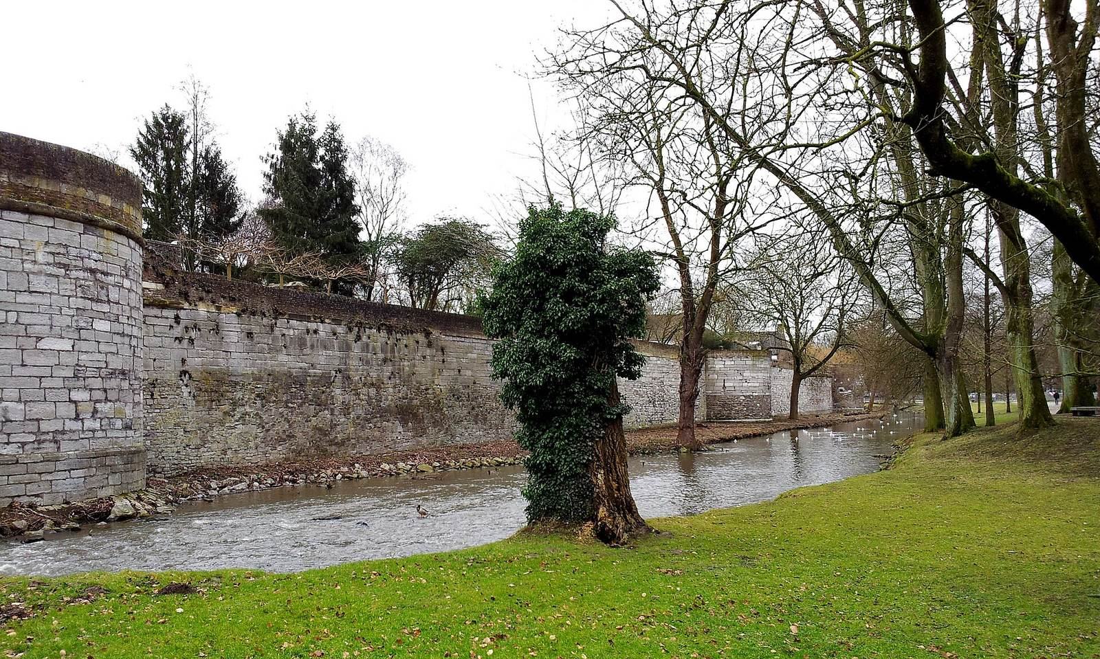
The Nieuwenhofwal, also called the Nieuwenhof wall, extends about 160 metres between Sint Pieterstraat and Zwingelput. Its outer defensive face is chiefly limestone, with Carboniferous sandstone in places from an early building phase and repairs in marl or brick. The brick parapet continues toward the Tongersekat and has marl bands in some stretches. Removing the inner earth rampart in 1911 exposed blocked arches beside today’s Nieuwenhofstraat; a branch of the Jeker runs in the moat outside the wall.
Walls from Zwingelput to Tongersestraat
From Zwingelput to Heksenhoek, about 170 metres of wall joins the Nieuwenhofwal. The Reek water gate stands at its western end, with the Jeker running along the outer face. During the Second World War, a raised walkway and garden were laid out on the wall.
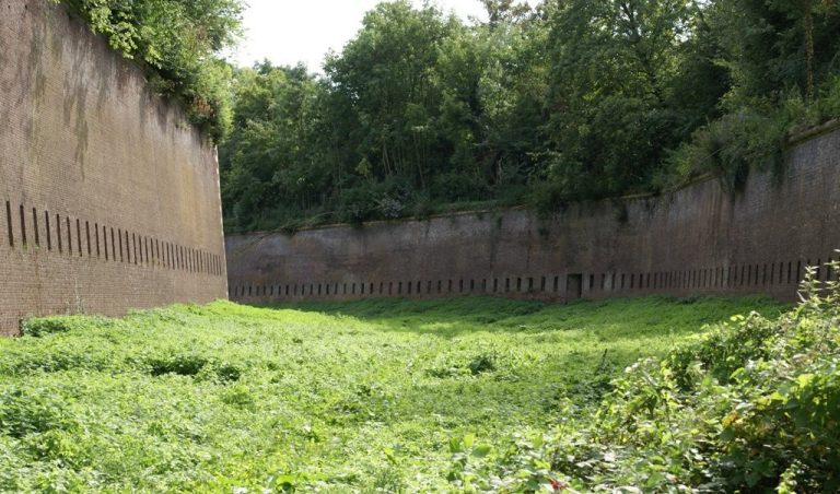
The Jezuïetenwal extends about 270 metres between De Reek and Tongersestraat. At the Tongersekat it bends by less than a right angle, with a dry moat outside. Nearby, the Polverpark buttress wall is about 100 metres long and built of brick in the late eighteenth century to keep the inner earthen rampart from collapsing.
Towers and artillery works
Pater Vinck Tower
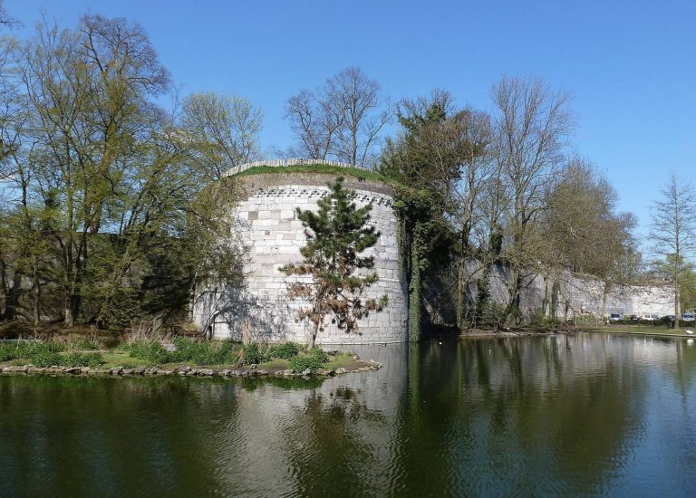
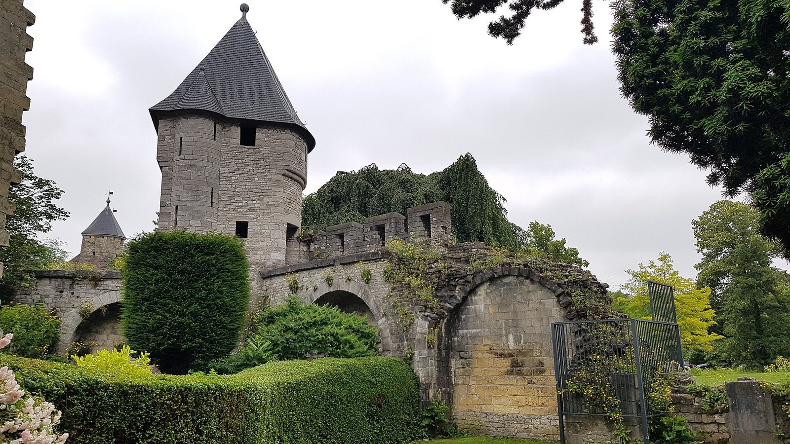
The largely reconstructed Pater Vinck Tower is a fourteenth-century wall tower in Faliezusterspark. Architect Willem Sprenger designed its reconstruction in 1906 on the foundations of an earlier tower, using the demolished Wycker Powder Tower as a model. The name Pater Vinck dates from the twentieth century.
Other surviving wall towers
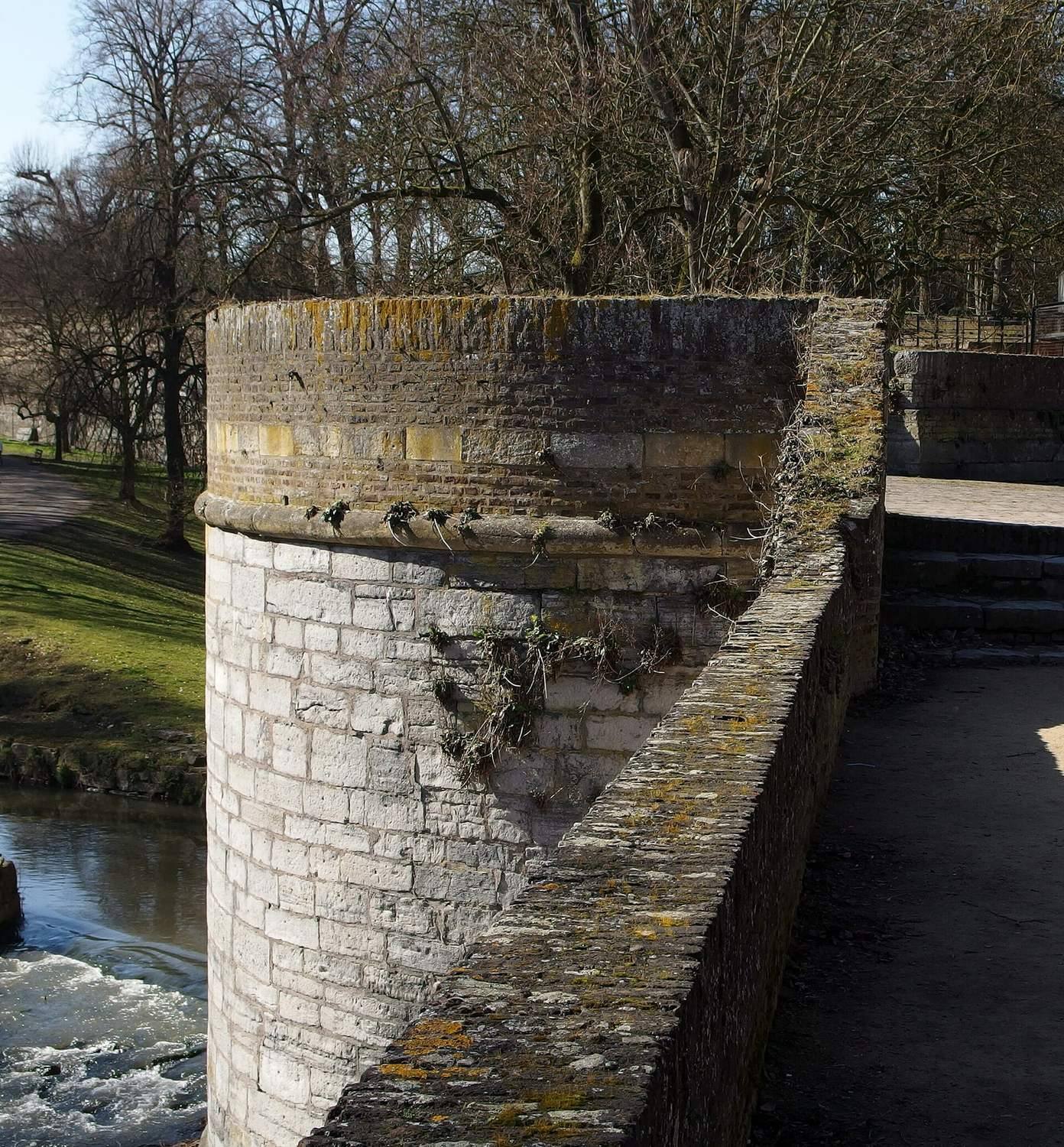
Six further towers stand along the wall between the Sint-Pieterspoort and Tongersepoort. Most are semicircular and retain a sixteenth-century form between a wall tower and a rounded gun platform. Their masonry shows different building and repair phases. The tower east of the Nieuwenhofpoortje is entirely marl; the one to its west has a lower section of Carboniferous sandstone, an upper section of limestone, possibly Namur stone, and several brick infills.
Tongersekat
The Tongersekat is an artillery earthwork, not a tower, at the southwest corner of the Jezuïetenwal. It is the surviving, reduced example of the circuit’s six raised artillery platforms. Built in the sixteenth century, it was greatly enlarged by the French between 1673 and 1678. Parts were later cut away for the Canisianum and for a partly underground University of Maastricht lecture hall, but the earthwork remains recognizable in the landscape.
Gates and protected passages
Water gates
A water gate behind the Minderbroeders lies on the Jeker and has three passages. One passage belongs to the first wall, and one of the other two is blocked. Another water gate stands on the Jeker east of the Sint-Pieterspoort. The circuit’s gates included five land gates and two, or possibly three, water gates; gates in the first circuit’s Meuse wall also continued in use.
Nieuwenhofpoortje
The Nieuwenhofpoortje, a small secondary gate, stands at the corner of Nieuwenhofstraat and Zwingelput. It was taken out of use around 1485 and concealed by the inner rampart, which was removed in 1909. A wooden bridge crosses the Jeker branch outside the passage. Above it are a rectangular niche, possibly intended for a saint’s image, four corbels, and a carved relief installed in 1947.
De Reek water gate
De Reek stands on the Jeker in Aldenhofpark, south of Heksenhoek. The gate originated in the fourteenth century, and its flanking towers were renewed in Namur stone in the sixteenth century. Its name refers to a local word for an iron portcullis. An inundation sluice, the Grote or Bonnefantensluis, is incorporated into the structure and regulated flooding in De Kommen.
Bonnefantensortie
The Bonnefantensortie is a 22-metre protected passage through the rampart to a small gate beside De Reek. It dates to 1674.
Sortie de Bres
The Sortie de Bres is a 46-metre passage beneath the garden at the Calvariestraat–Sint Servaasbolwerk corner. Built in 1762 after the powder explosion, it is largely brick-built, and part of its vaulted ceiling was repaired between 1940 and 1944.
Royale passages
The partly surviving Royale passage at the Brusselsepoort dates to 1727; eight vaulted chambers were added around 1750. Its western half survives behind Sint Nicolaasstraat. A second partly surviving Royale passage runs beneath the Hoog Frankrijk artillery platform. It is 18 metres long and has four chambers dating to around 1750.
A commemorative stone dated 1459 from the Tongersepoort survives, as do keys from several city gates.
Water supply and military buildings
Jeker Canal
The Jeker Canal is an underground aqueduct 1,165 metres long, built in 1676. Its brick-lined vaulted channel carried Jeker water to the northern moat and ditches between the outer defenses.
Guardhouses
The guardhouse at Sint Pieterstraat was built on the city side of the Sint-Pieterspoort in the eighteenth century and later substantially altered. It gained another storey around 1900, and its ground-floor plasterwork imitates masonry joints. The guardhouse on Tongersestraat, probably built in the early eighteenth century on the city side of the Tongersepoort, is largely intact. It is a low building with a gable roof and broad overhangs.
Powder stores
The underground Tongersekat powder bunker, probably dating to 1692, lies beneath the Canisianum garden and has a barrel vault made of marl stone. The Bleekhof powder magazine on Bonnefantenstraat was one of three powder houses built for the second circuit between 1784 and 1794. The powder house at Hoog Frankrijk, on Herbenusstraat, has been almost entirely altered or rebuilt on its original foundations; it later became the country house Le Téméraire and then an old people’s home.
Cannon storehouse
The cannon storehouse at Abtstraat dates to 1786, according to its date stone. Converted into a hospice in 2011, it retains its façade in roughly original condition.
Jeker riding hall
The five-sided riding hall at Jekerstraat was built in 1708 and has a tent roof. It served as a theatre from 1748 to 1789, after which it returned to use for horses.
Affuitenloods Bassin
The Affuitenloods Bassin is a carriage house built around 1825 for wheeled gun-carriage frames. It stands behind the wall near the Boschpoort and was converted into workers’ housing for the neighbouring paper factory in the early twentieth century.