Burgsalach Roman Fort: A Third-Century Military Installation
Site at a Glance
- Popularity
- Medium
- Country
- Germany
- Primary era
- Classical
- Eras represented
- Classical, Modern
- Civilizations
- German, Kingdom of Bavaria, Roman
- Site type
- Military
- Remains
- Fort
On this page17 sections
History
Burgsalach Roman Fort is a third-century Roman military installation on the Harlach plateau in Germany. It was occupied during the Severan period, the era of the dynasty founded by Septimius Severus, and remained in use until no later than AD 259/260. Its unusual design has been associated with the final expansion and strengthening of the Roman frontier system known as the Limes. In AD 213, the emperor Caracalla inspected the frontier and several forts.
The fort and its possible role
The fort may have been built for a centuria, a Roman military unit led by a centurion. Its shrine for the unit’s standard suggests that the soldiers carried their own standard and acted as an independent tactical force. Since the fort stood behind the frontier and beside a Roman road, it may also have monitored movement along the route. Its garrison could have included soldiers assigned to policing and administrative work.
Its precise purpose remains uncertain. It has been interpreted as a small fort, a post for soldiers with administrative duties, or a lodging station. Franz Anton Mayer favored the lodging-house explanation, as did archaeologist Andreas A. Schaflitzl in 2011, but the evidence does not settle the question.
No matching plan is known among the fortifications of the Upper German-Raetian Limes. The square design has instead been compared with military sites in North Africa, including early fourth-century forts associated with the term centenarium, a name for a type of Roman fortification. One unproven explanation links Burgsalach to soldiers from Legio III Augusta, a Roman legion based in North Africa. After political upheavals involving the Gordian emperors in AD 238, some of its troops may have been sent to other provinces, possibly including Raetia. The legion had been officially condemned in memory and forbidden to put its name on building inscriptions, a circumstance that forms part of this hypothesis.
The nearby Roman camps
A separate Roman timber-and-earth camp was established about 350 metres southeast of the stone fort. It had two phases: the first was small and probably brief, while a second, much larger camp also seems to have been used for a short time. These camps formed a distinct part of the Roman military presence around Burgsalach.
Early investigations
In 1790, Michael Redenbacher described the ruins, then locally called the Old Little Castle, as exceptionally well preserved. He also saw several altars dedicated to Septimius Severus, emperor from AD 193 to 211. Ignaz Pickel carried out the first recorded excavation in 1800. Although the work was superficial, Pickel produced the first plan of the fort. Redenbacher’s excavation in 1805 captured construction details that later deterioration erased; his plan contained errors, including the identification of the northern semicircular shrine room as a tower.
Treasure hunting and stone removal accelerated the damage. In 1831, local farmers found a Roman key during what was probably an illicit dig. Mayer acquired it and interpreted it as a key for a lodging house. In 1861, King Maximilian II of Bavaria had a commemorative stone monument erected at the ruins. It wrongly identified the site as a colonia, a Roman settlement formally designated as a colony.
Archaeology and conservation
After the landowners refused permission for an excavation by Limes researcher Wilhelm Kohl, the Historical Association of Weißenburg bought the site in 1915 with regional government support. Friedrich Winkelmann of the Imperial Limes Commission directed systematic excavations in 1916 and 1917. The fort and nearby timber-and-earth camps belong to the Upper German-Raetian Limes, which became a UNESCO World Heritage Site in 2005; they are also registered archaeological monuments under Bavarian heritage law.
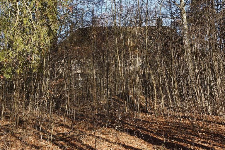
Weathering and further stone removal damaged the ruins during the first half of the twentieth century, while vegetation spread over the area. Repairs took place in 1962 and again in 1965–1966, when students and teachers from Christian-von-Bomhard Gymnasium worked under the Bavarian State Office for Monument Preservation. The school later took responsibility for ongoing care. In 2008, test trenches began the first scientific investigations since Winkelmann’s work, alongside a conservation programme that reviewed earlier records and documented surviving masonry. A restoration model of part of the entrance gate was largely complete by July 2011.
Remains
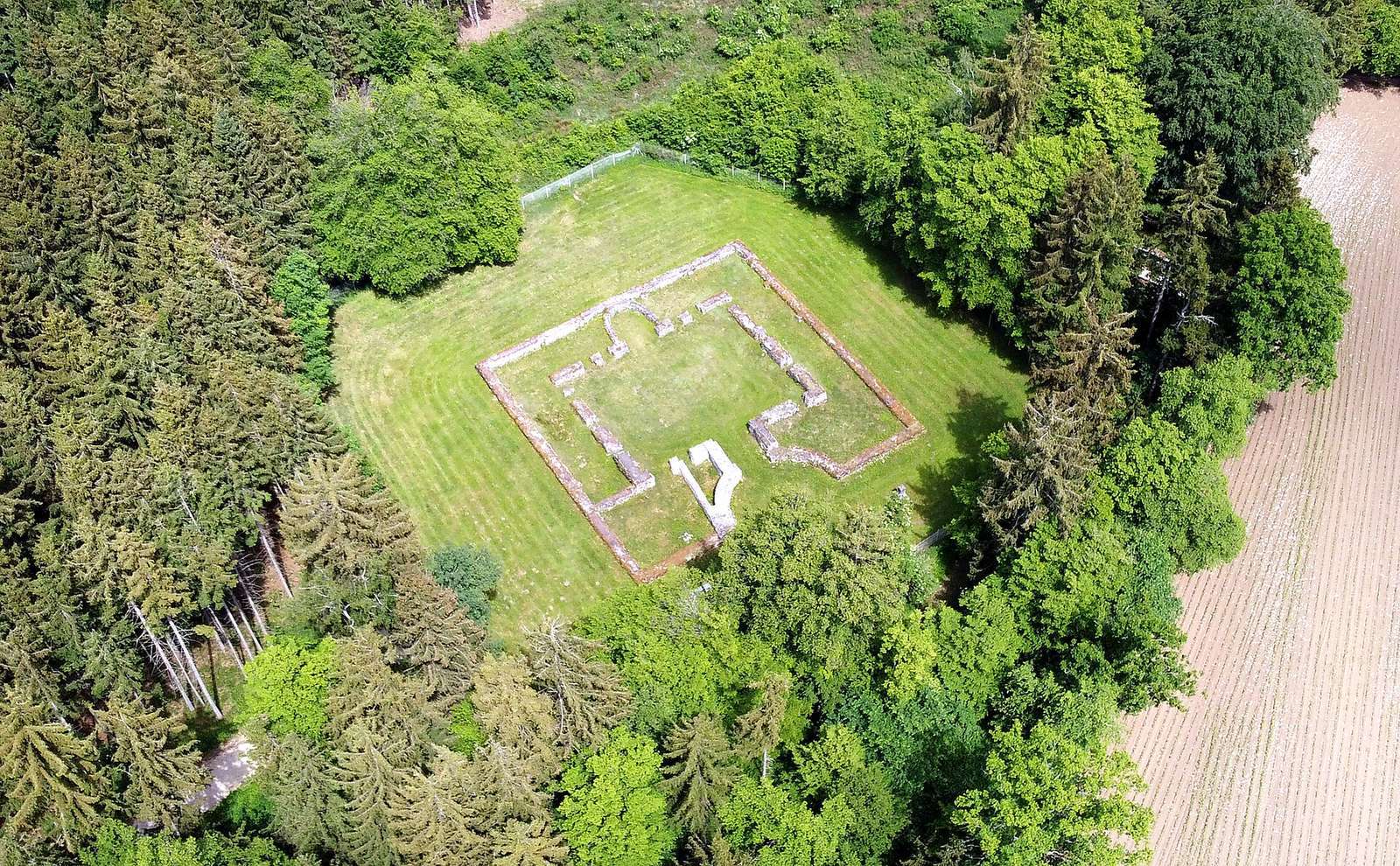
The site comprises a nearly square stone fort and a separate, larger timber-and-earth camp to its southeast. The fort occupies about 0.1 hectares beside the Roman road between Weißenburg and Pfünz, where sections of the road remain in particularly good condition. The camp lies roughly 350 metres away. Both settings place the remains in the landscape of the Roman frontier.
Stone fort
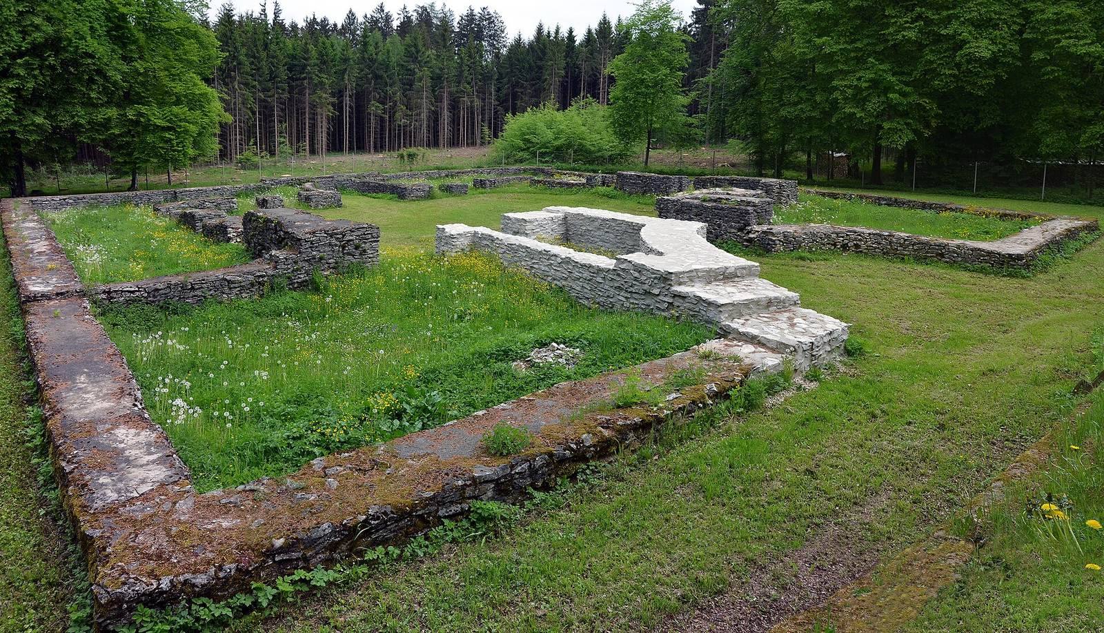
The fort’s rooms were arranged around an open, square courtyard enclosed by a substantial outer wall. Its entrance faced the southwest. The surviving archaeological evidence includes foundations, wall stumps, traces of interior arrangements, and finds recovered during excavation.
Plan and outer walls
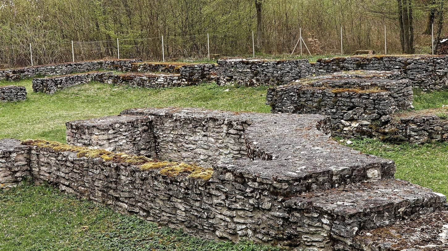
The fort measures 32.60 metres along its southwest side, 32.40 metres northwest, 31.90 metres northeast, and 32.60 metres southeast, dimensions close to 100 Roman feet per side. Its enclosing wall is 1.20 metres thick, and the foundation projects a further 0.15 metres outward. The substantial foundations have led researchers to propose that the building had a fully developed second storey, although its form is unknown. Rectangular projections were spaced along the inner face of the perimeter wall, except on the southwest side. Each had a lower ledge about a metre above ground, with the upper part continuing at half the width; some were cut back in Roman times.
Southwest entrance
A semicircular forecourt curves inward within the southwest wall. It is 11.25 metres wide at its outer opening, with a radius of 5.30 metres at its deepest point. A passage 3.5 metres wide led inward, with a double-leaf gate about a metre from the entrance and a second gate of the same construction 4.40 metres farther on. Excavation identified the thresholds and door stops. A tower above the entrance arch has been proposed, but remains uncertain. A room to the right may have served as an officer’s quarters or storeroom, while a stairway may have stood to the left. Curving masonry beneath the rooms on both sides appears to belong to an earlier, wider version of the entrance feature; its date and purpose are uncertain.
Rooms and cellar
Ten ground-floor rooms, each about 20 square metres, have been identified against the perimeter wall. Most were divided by timber-framed partitions, traces of which remain as shallow channels in the floors and impressions in exterior plaster. Several rooms had hearths that appear to have been added after construction. Their size could have accommodated around eight to ten people apiece. In the room immediately right of the entrance, a cellar extended 3.70 metres in length and between 3.20 and 4.76 metres in width. It lay 1.2 metres below the surrounding level and was reached by a two-metre ramp. An adjoining room to the east measured 4.30 by 4.60 metres and had a concrete floor surface and timber-framed walls.
Courtyard and water supply
Wooden posts set about 25 centimetres into the ground surrounded the courtyard. They probably supported a roofed walkway, with a tiled roof sloping inward, that sheltered access to most of the ground-floor rooms. Two rectangular cisterns occupied opposite uncovered corners. The southeast cistern measured 2.25 by 2.50 metres and was about 1.55 metres deep when excavated. Its basin was sealed with clay and contained fallen roof tiles. The cisterns may have provided residents with drinking water independently, at least for a time.
Shrine and interior finishes
Opposite the entrance, a semicircular shrine room adjoined the northern wall. Its floor stood about 25 centimetres above the surrounding level, and the centurion’s quarters are thought to have been on either side. Redenbacher described plaster in red and bright white, with walls and floors finished to resemble marble. He also noted a smooth, reflective white gypsum floor in the shrine. Winkelmann later recorded plaster fragments, and fragments of projecting cornice suggest that the exterior of the upper storey was architecturally articulated.
Inscriptions and recovered objects
Redenbacher noted three inscribed sandstone blocks in the shrine in 1805; parts of their texts were difficult to read. He had also seen altars dedicated to Septimius Severus in 1790. A small statuette of Priapus, a Greco-Roman deity associated with fertility and the protection of property, was among the finds from the fort. Winkelmann recovered seven fragments of the inscription once placed above the gate. One retains the letter F; the inscription’s recessed letters had been painted red over a fine mortar coating.
Other finds from Winkelmann’s excavation included a worn coin from Hadrian’s reign (AD 117–138), a spearhead, a knife, a small hammer, part of a pair of shears, and pottery. The pottery included red-gloss tableware with maker’s stamps, a plate repaired with lead strips and rivets, and a fragment of a Raetian bowl decorated with stars and stripes. The ceramic material points to second-century production.
Later physical features
Stone removal and weathering altered the remains over time. During repairs in 1965–1966, surviving wall stumps were raised and capped with a thick cement layer, and rubble from inside the fort was used to form a mound before the main gate. The commemorative monument erected in 1861 remains at the ruins. A stone slab showing the fort’s ground plan was installed in 1965, and three bronze models illustrating alternative reconstructions were added as part of an interpretation trail created between 2010 and 2013.
Timber-and-earth camps
The separate camp occupies roughly one hectare. Its rectangular outline has rounded corners, with short sides oriented approximately north to south. The Roman road passes to its southwest, and the camp’s alignment appears to take account of the road. A magnetic survey in 2008 clarified the camp’s phases and also indicated a probable Iron Age settlement of loosely arranged post-built structures in the area.
First camp
The first Roman camp measured about 45 by 50 metres. It had eastern and western entrances, facing respectively toward the Limes and the road. A simple ditch was interrupted at each entrance, while a short, offset ditch in front of each gate obstructed a direct approach. A wooden palisade stood behind the ditch. The camp followed the earlier Iron Age settlement, which had probably ceased to exist before the Roman military enclosure was established.
Second camp
In the second phase, the enclosed area grew to about four times the size of the first camp. Its western and northern sides followed and directly overlaid the earlier boundaries. The ditch measured approximately 113 metres on the west, 109 metres on the east, 97 metres on the north, and 93 metres on the south. The skewed outline, including a concave eastern side with no apparent functional reason, suggests that the layout was surveyed imprecisely. Entrances lay on the north, south, and west sides. Each had a short, offset ditch; the northern and southern gates were shifted 10 to 15 metres east of the imagined central axis.