Burg Bechthal: A Medieval Hilltop Fortress in Germany


Site at a Glance
- Rating
- 4.4
- Popularity
- Very Low
- Country
- Germany
- Primary era
- Medieval
- External website
- Open
- Eras represented
- Bronze Age, Iron Age, Medieval
- Civilizations
- Holy Roman Empire
- Site type
- Military
- Remains
- Castle
On this page10 sections
History
Burg Bechthal is a high- and late-medieval hilltop fortress in Germany, near Raitenbuch, built by the Lords of Pechthal, later called Bechthal. Probably constructed in the 13th century, it became the ancestral seat of a family whose name first appears in written records during the mid-12th century. The name may preserve a connection with earlier pitch production in the surrounding area.
The Lords of Pechthal
The lords of the castle were ministeriales of the Prince-Bishopric of Eichstätt. Ministeriales were members of the medieval service nobility who commonly served a territorial ruler in administrative or military roles. The Pechthal family later appears to have escaped this dependence and established a small independent lordship around the fortress.
The castle and lordship changed hands through a series of shared holdings. In 1353, Konrad Pechthaler transferred half of his allodial fortress, meaning property held as his own rather than as a feudal grant, to the nobleman Konrad of Heideck. He then received that half back as a fief. In 1414, Hermann Pechthaler sold the lordship to Rüdiger of Erlingshofen. Sigmund and Caspar Erlingshofer were recorded as co-owners in 1473, while the brothers Christoph and Albrecht Reicharter held shares in 1503.
Acquisition and destruction
The Prince-Bishopric of Eichstätt acquired the two halves of the castle in 1544 and 1557. A Prince-Bishopric was a territory governed by a bishop who exercised both religious and secular authority. After the acquisition, Burg Bechthal apparently became unnecessary. Administration of the locality was conducted from the episcopal offices at Titting and Raitenbuch, while the exact reasons for abandoning the fortress remain unknown.
Nuremberg chroniclers reported that Swedish artillery destroyed the fortress in 1633 during the Thirty Years’ War, a major European conflict that involved political, religious, and military struggles across the German lands. In the 19th century, the ruins acquired the name “Burg Waldeck.” This later name was probably inspired by the romantic setting on a wooded corner rather than by the medieval history of the site. A restoration campaign in 1983–1984 secured the surviving remains. The castle is protected as a Bavarian architectural heritage monument, together with buried archaeological remains and evidence of earlier settlement from the Urnfield, Hallstatt, La Tène, and Migration periods.
Remains
Ridge and outer defenses
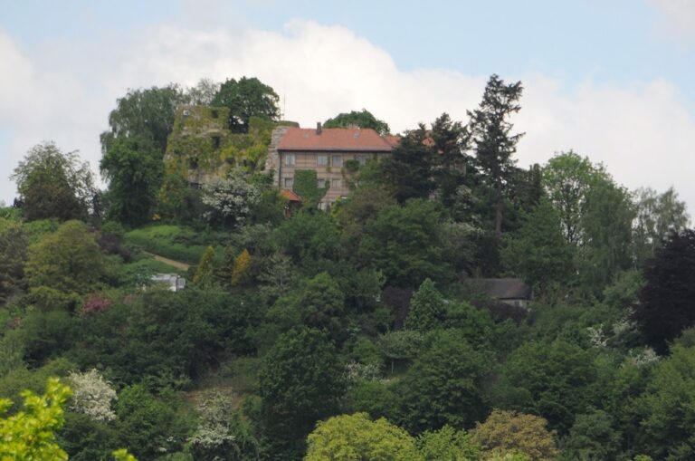
Burg Bechthal stands about 500 metres southeast of Bechthal on a spur-like ridge above the Anlauter valley, at an elevation of 513 metres. A spur castle is a fortress positioned on a projecting ridge, using steep slopes and artificial cuts for defense. The elongated ridge contains an older sectional fortification and is crossed by five transverse ditches whose dates are uncertain. The wider settlement area had already been partly fortified during the Urnfield, Hallstatt, La Tène, and Migration periods, successive archaeological periods spanning prehistory and late antiquity in Central Europe.
Outer baileys
Two broad outer-bailey plateaus extend east of the partially preserved main castle. A rubble-stone wall, now surviving mainly as a foundation, enclosed the end of the spur. Around 55 metres before the deep eastern ditch of the core castle stands a recognizable wall-and-ditch feature approximately three metres high. Its raised bank formed from a largely collapsed limestone wall, and further wall remains continue across the outer plateau. These defenses and earthworks are built into the ridge rather than arranged on level ground.
Eastern ditch and terraces
The eastern neck ditch was cut largely into the rock and reaches depths of up to 10 metres. Behind it, the main-castle mound forms an approximately square area measuring about 30 by 35 metres. A shallow, angular inner ditch runs around its southern and western sides before continuing north as a terrace. Material removed from the ditch was heaped onto the slope, creating two substantial hillside terraces.
Core castle
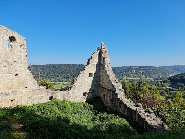
The core castle is built in ashlar masonry and preserves the compact arrangement of a small medieval fortress. A narrow rocky ridge projects west from the main castle and is separated from it by another sectional ditch. About 40 metres farther west, a shallow cross ditch cuts through the rugged foreland. The masonry of the core castle was extensively dismantled and reused, while foundation traces and rubble banks preserve the positions of its internal buildings. The residential building probably stood northwest of the keep.
Square keep
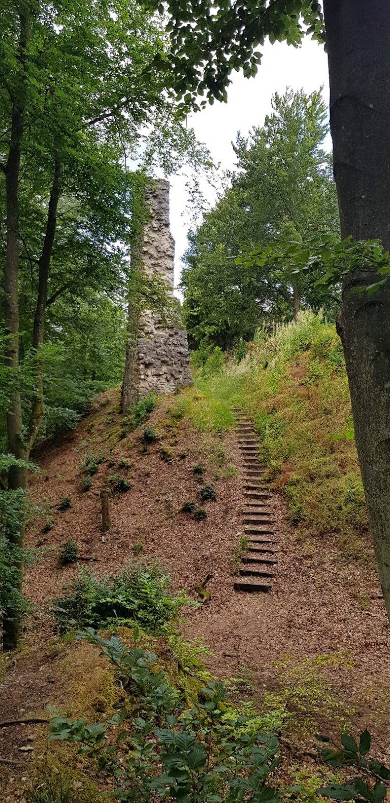
The most complete surviving structure is the square keep, the principal defensive tower of a medieval German castle. It rises approximately 30 metres and has sides measuring 5.5 metres, with walls about 1.5 metres thick. Small, roughly cuboid blocks of local limestone rubble form its walls. An elevated entrance on the western side leads into the tower, whose second storey retains a vaulted interior.
Southwestern tower and outer wall
A narrow rectangular tower rises above the southwestern corner of the castle. Several light openings remain visible in its walls. Large sections of the former outer wall’s rubble core survive along the southern side, and parts of its outer rubble-stone facing are preserved in places. Together with the tower, these remains define the edge of the castle plateau and show how the masonry defenses enclosed the core.
Nearby sites