Teotihuacan: An Ancient Mesoamerican City
Site at a Glance
- Popularity
- Very High
- Country
- Mexico
- Primary era
- Classical
- Eras represented
- Iron Age, Classical
- Civilizations
- Teotihuacan
- Site type
- City
On this page30 sections
History
Teotihuacan was an ancient city in Mexico’s Teotihuacan Valley, in the northeastern Basin of Mexico. It became a major political, religious, economic, and cultural center of Mesoamerica, the ancient region extending across Mexico and Central America whose societies shared religious ideas, calendars, and architectural traditions.
Origins and urban growth
Small agricultural settlements occupied the valley before Teotihuacan developed into a city. Its earliest major buildings date to about 200 BCE, and a substantial urban center began to form around 100 BCE. The city’s growth coincided with the decline of Cuicuilco, although the timing and effects of volcanic eruptions and population movements in the Basin of Mexico remain uncertain.
Archaeologists commonly arrange Teotihuacan’s history into pottery-based phases. These run from Patlachique, about 100–1 BCE, through Tzacualli, about 1–100 CE, Miccaotli, about 100–170, early and late Tlamimilolpa, about 170–250 and 250–350, early and late Xolalpan, about 350–450 and 450–550, and Metepec, about 550–650. The dates are approximate and describe a relative sequence rather than exact boundaries between periods.
During its early expansion, Teotihuacan became the largest urban center in central Mexico. Its population is estimated at roughly 60,000–80,000 during the Tzacualli phase. Estimates for its height vary: some place the population around 85,000–100,000, while others suggest 150,000–250,000. The city’s maximum developed area is generally estimated at about 20–22.5 square kilometers.
A regional center and a diverse population
Teotihuacan’s connections reached communities across Mesoamerica, including Veracruz and the Maya region. Goods and ideas moved through relationships that may have involved trade, political alliances, military action, and cultural exchange. The city’s influence is clear, but whether it controlled a territorial empire remains disputed.
The population included people from different regions. Archaeological evidence points to communities associated with the Zapotecs, an Indigenous people especially connected with Oaxaca, the Maya, and the Gulf Coast. Tlailotlacan, a Zapotec-associated neighborhood, lay in the west of the city, while a separate quarter associated with Gulf Coast merchants lay to the east. A structure in the Zapotec-associated area was occupied by people from Michoacán. The identities of Teotihuacan’s founders and the languages spoken in the city remain uncertain.
Agriculture, craft production, and long-distance exchange supported the city. Artisans made obsidian tools and ritual objects, and Teotihuacan exchanged or exported pottery and obsidian products. Its commercial, political, and cultural ties extended to the Maya region and other parts of Mesoamerica.
Political change and Maya connections
The form of Teotihuacan’s government is unresolved. Interpretations include rule by a single sovereign, collective government, and a model that divided the city into four political sectors. One speculative proposal links a shift from centralized rule toward more collective or egalitarian institutions to the desecration of the Temple of the Feathered Serpent around 300–350.
The city’s main civic and ceremonial focus moved south, from the area of the Pyramid of the Sun to the Ciudadela, probably between about 250 and 350. The reason is unknown, though political change has been suggested as one possible explanation.
Maya inscriptions describe the arrival of Sihyaj K’ahk’ at Tikal in 378 and the replacement of its ruler. The intervention is associated with Teotihuacan imagery and influence, but the evidence does not establish whether it was directed by the Teotihuacan state. Maya records also connect a ruler known to scholars as Spearthrower Owl with Teotihuacan and with the installation of his son, Yax Nuun Ayiin I, as king of Tikal.
Decline and later occupation
Teotihuacan’s decline involved population loss, political and social disruption, and the burning and deliberate destruction of important civic and elite buildings. This destruction is generally placed between about 550 and 650. Damage was concentrated in civic-ceremonial and ruling-class areas rather than spread across the entire city. Internal unrest is one proposed explanation. Prolonged drought associated with the climate disruption of 535–536, possibly compounded by volcanic effects and famine, has also been suggested; these causes need not have been exclusive.
Damage to buildings has been used to identify five earthquakes dating from the Tzacualli through the Xolalpan–Metepec phases. One may have contributed to the city’s collapse, perhaps by worsening conflict and unrest. After the main collapse, the population dispersed, but occupation continued in reduced form. Communities associated with Coyotlatelco pottery lived in parts of the city into about 750–850.
The city’s original name is unknown. Maya inscriptions may refer to it as puh, or Place of Reeds, but this identification is uncertain. Teotihuacan is a later Nahuatl name, adopted centuries after the city’s decline. Nahua tradition connected the site with the creation of the Fifth Sun, the present world-age in that tradition. The Mexica, who founded and ruled the Aztec capital of Tenochtitlan, later made pilgrimages to the ruins and sought valuable objects for offerings.
Exploration, archaeology, and protection
Pre-Hispanic visitors explored the ruins. In 1675, the Mexican scholar Carlos de Sigüenza y Góngora carried out excavations. Archaeological work continued from the nineteenth century, and major excavation and restoration began under Leopoldo Batres in 1905. The Pyramid of the Sun was restored for the 1910 centennial of Mexican independence; the project was later criticized for its speed and for the assumptions behind its reconstruction.
Manuel Gamio supervised work at the Ciudadela in the 1920s, and Sigvald Linné led excavations in 1932. Other areas were investigated in the 1940s and 1950s. From 1960 to 1965, Mexico’s National Institute of Anthropology and History, known as INAH, undertook a site-wide excavation and restoration project. It cleared and consolidated buildings along the Avenue of the Dead and excavated the Palace of Quetzalpapalotl. René Millon began a city-mapping project in 1962, using aerial photographs and topographic surveys; the map published in 1973 remains a major reference. In 2015, only about 5 percent of the archaeological site had been systematically excavated.
Work connected with a sound-and-light project led to the discovery of a tunnel beneath the Pyramid of the Sun in 1971. Excavations and restoration at the Pyramid of the Feathered Serpent and the Avenue of the Dead followed in 1980–1982. Work at the Pyramid of the Moon from 1998 to 2004 revealed successive building phases and offering deposits. A tunnel beneath the Temple of the Feathered Serpent was discovered accidentally in 2003, prompting further investigation. Conservation at the Plaza of the Moon began in 2014; later investigations exposed pre-Hispanic pits and upright greenstone monoliths, while geophysical survey in 2017 confirmed a chamber beneath the pyramid and a tunnel extending south beneath the plaza.
Teotihuacan entered the UNESCO World Heritage List in 1987, and a federal decree established the protected archaeological zone in 1988. Modern interventions have also raised concerns about damage. In 2004, pottery fragments found in soil dumped from a construction site prompted concern over an authorized retail store in an archaeological zone. A proposed sound-and-light installation in 2008–2009 involved drilling into stone; experts identified damage to original stone, and the project was criticized for its effect on the site’s authenticity. In 2021, construction and land clearing on the northern outskirts threatened archaeological structures and prompted government enforcement action.
Remains
The surviving city is organized around the north–south Avenue of the Dead and a crossing east–west axis, with large ceremonial complexes set among extensive residential compounds. Stepped pyramids, plazas, platforms, and enclosed courtyards form the main architectural groups. The city grid extends across varied terrain and incorporates the redirected course of the San Juan River.
Landscape and urban plan
Valley setting and axes
The archaeological zone occupies the Teotihuacan Valley in the northeastern Basin of Mexico, at roughly 2,240–2,400 metres above sea level. Volcanic highlands border the valley, and Cerro Gordo rises north of the city in line with the Avenue of the Dead. The San Juan and San Lorenzo rivers cross the valley. Permanent springs, fertile alluvial soils, obsidian deposits, and clay suitable for pottery formed part of the local landscape.
Grid and survey markers
The city follows an ordered grid centered on the Avenue of the Dead and an east–west avenue that crosses it at the Ciudadela. Most streets and buildings deviate about 15°30′ east of astronomical north, while the east–west alignment lies about 16°30′ south of east. Builders maintained the grid across uneven ground and redirected the San Juan River to fit it. The plan divides the city into four quadrants and has been interpreted as a representation of the cosmos, with the Ciudadela at the intersection of the main axes. The central area follows the Pyramid of the Sun’s orientation, while the southern area follows that of the Ciudadela. Connections between these alignments, solar observation, and calendrical practices remain interpretations rather than settled explanations.
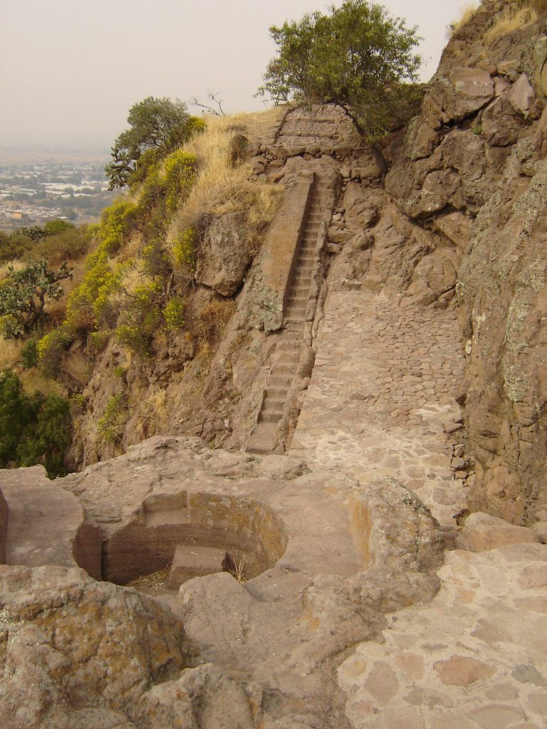
Pecked-cross circles, markings formed by a cross inside two concentric circles, occur in the city and on nearby mountains. Some contain about 260 small depressions. They may have helped establish the city grid, and their relationship to the 260-day ritual calendar and solar observations has been proposed, though neither interpretation is certain.
The Avenue of the Dead and its pyramids
Avenue of the Dead
The Avenue of the Dead runs north–south from the Plaza of the Moon toward the Ciudadela and the southern part of the city. It extends for about 4 kilometres and varies from roughly 40 to 95 metres in width. Steps, landings, ceremonial platforms, temples, and smaller buildings line its length. Many platforms once supported temples. The Mexica later interpreted them as tombs, giving the avenue its name.
Pyramid of the Moon
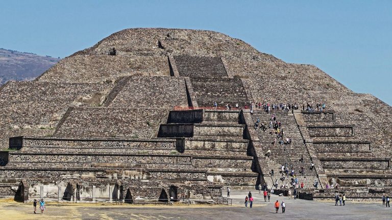
At the avenue’s northern end, the Pyramid of the Moon stands in front of a plaza bordered by symmetrically arranged platforms, with Cerro Gordo behind it. The pyramid is about 45–46 metres high and approximately 45 metres across at its base. It was built in at least seven successive phases; the earliest had a different orientation from the later city grid.
Excavations beneath the pyramid identified five tombs and five offering deposits. Tomb 2 contained a person probably sacrificed, jade, obsidian and pyrite objects, and animal remains that included pumas and a wolf. Other deposits held human and animal remains with carefully arranged offerings. One separate deposit contained 18 notable obsidian pieces arranged in radial pairs.
Pyramid of the Sun
The Pyramid of the Sun is about 65 metres high, with a nearly square base measuring approximately 225 metres on each side. Its five tiers have inward-sloping faces and were built largely in one major construction episode, completed around 100 CE. A front platform was added later. The pyramid’s orientation aligns it with Cerro Gordo to the north.
A human-made tunnel beneath the pyramid extends about 97–100 metres and ends near the building’s center in a chamber with four lobes. An access shaft descends about 6.5 metres to it. The tunnel’s proposed use as a royal tomb remains a hypothesis.
Ciudadela and earlier ceremonial buildings
Ciudadela
The Ciudadela is a large, non-defensive enclosure measuring about 400 metres on each side. Its sunken central plaza is approximately 250 by 200 metres and could hold large gatherings. Two residential complexes lie behind the temple precinct, and a central shrine has four stairways leading to its platform.
Temple of the Feathered Serpent
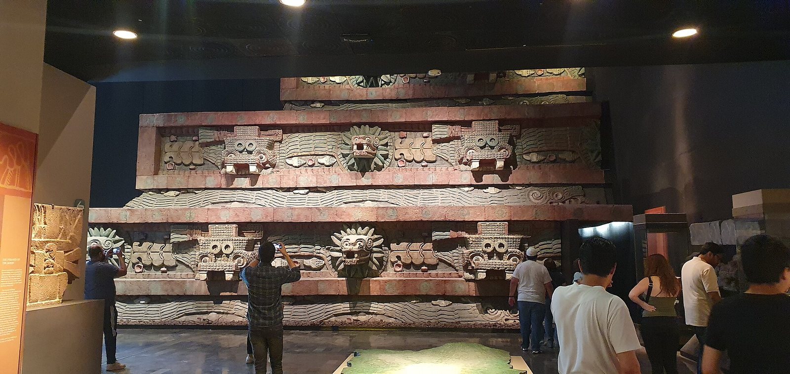
At the far end of the Ciudadela plaza, the Temple of the Feathered Serpent rises on a platform surrounded by thirteen secondary temples. The seven-tiered pyramid was built around 150 CE. Its talud-tablero design, in which a sloping exterior section supports a projecting upright panel, carries reliefs of undulating feathered serpents along the sloping faces and alternating reptile heads and geometric forms on the panels. The sculptures were once painted, and individual serpent heads were fixed to the building with projecting stone fittings. Each head weighs about four tonnes. A later platform attached to the western facade partly concealed that face of the temple.
Offerings associated with the temple included the remains of 137 people, many with their hands crossed behind their backs, suggesting they had been bound. Animal remains included puma, wolf, eagle, falcon, owl, and rattlesnake.
Temple tunnel and earlier complex
A tunnel about 100 metres long runs beneath the Temple of the Feathered Serpent to three chambers cut into bedrock. It was deliberately sealed, most recently around 220–230 CE. Finds include wooden masks inlaid with jade and quartz, necklaces, rings, greenstone crocodile teeth, human figurines, crystal eye forms, beetle wings, jaguar sculptures, and metal-coated spheres. The tunnel also contained a miniature landscape with pools of liquid mercury, four greenstone statues, and a bouquet of flowers about 1,800 years old. Coatings of magnetite, pyrite, and hematite on its walls and ceiling created a reflective surface.
Buildings predating the Ciudadela, known as the Pre-Citadel complex, date to the Tzacualli phase. They formed an earlier sanctuary associated with the tunnel and may have included an I-shaped ballcourt, a purpose-built space for the ritual ballgame. The structures were gradually levelled to make way for the Ciudadela plaza.
Administrative and residential districts
Great Compound
Across the Avenue of the Dead from the Ciudadela, the Great Compound covers about 20 hectares. Low platforms, roughly one metre high, border a central area approximately 254 by 214 metres. Buildings on the platforms may have served administrative purposes, while the open central space has been proposed as a market; its function remains uncertain.
Residential compounds
About 2,300 residential compounds have been identified within the city grid. Most are square or rectangular and around 60 metres across, though some measure only about 30 metres. Walls roughly one metre thick enclosed family apartments grouped around an open central courtyard. Smaller patios admitted light and air, and drainage systems and roof crestings formed part of the compounds. Apartments contained one to five rooms, and many compounds had household altars.
Named compounds include Tetitla, Zacuala, La Ventilla, Tepantitla, Atetelco, Xolalpan, Yayahuala, and Teopancazco. Their layouts and decoration differ. At Atetelco, one patio contained a central altar, while murals decorated the porticoes in its White Patio.
Palace of Quetzalpapalotl
The Palace of Quetzalpapalotl stands behind Structure 5 at the southwest corner of the Plaza of the Moon. A stairway guarded by jaguars leads to a raised platform and a central courtyard bordered by roofed walkways and interior chambers. Carved butterfly and quetzal-plume designs decorate stone columns that were once painted, while water-related motifs cover interior walls. Beneath this palace lies the Patio of the Jaguars, whose murals show jaguars wearing feathered headdresses opposite shells and human hearts.
Other named buildings
Other named structures include the Palace of the Jaguars, the Feathered Shells structure, the House of the Priest, and the Temple of the Mythological Animals. The Palace of Quetzalpapalotl covers an earlier building known as the Palace of the Feathered Snails, whose shell reliefs retain traces of paint.
Murals, signs, and carved works
Wall paintings
Murals survive at residential compounds including Tepantitla, Tetitla, Atetelco, La Ventilla, and Techinantitla. Artists used fresco, applying pigments to wet plaster, and often arranged images in stacked registers. Many surviving wall fragments come from lower portions of walls. The palette included Teotihuacan red, a hematite-based pigment, as well as lime preparation and surfaces polished with mica.
The Tepantitla mural conventionally called the Tlalocan shows a frontal female figure and smaller people engaged in varied activities. Its name refers to a paradise associated in later Nahua tradition with Tlaloc, a rain and storm deity; applying that later identification to Teotihuacan imagery remains conventional rather than certain. Painted processions also appear at Tepantitla and Atetelco.
Techinantitla yielded fragments from four large compositions featuring feathered serpents and glyphs of flowering trees. The surviving group includes 145 large fragments and about 1,500 smaller or medium-sized pieces. Most of a group removed and sold in the 1960s was returned to Mexico in 1986.
Glyphs and stone marker
A plaza at La Ventilla yielded 42 red-painted glyphs, graphic signs that can convey names, words, or other meanings. Most were painted on the floor. They add to evidence for a local sign system, though its signs remain undeciphered.
A composite stone marker from La Ventilla stands about 2.13 metres high and consists of four interlocking parts: a cylindrical shaft, a truncated-cone section, a globe, and a disk. It has been interpreted as a marker used in ball play, but that interpretation is debated.
Burials, ritual objects, and ceramics
Burial practices
Excavations identified about 2,000 burials, usually beneath house or patio floors. The dead were commonly placed in circular pits in flexed or seated positions, and cremation also occurred. Some burials included tools, weapons, ornaments, incense burners, tripod vessels, or fine orange pottery. Masonry burial chambers point to distinct mortuary practices among some people from Oaxaca.
Sculpture and masks
Teotihuacan sculptures include a stylized volcanic-stone monolith about 3.19 metres high and nearly 24 tonnes in weight, generally interpreted as a water deity. A large statue of an aged fire deity, often called the Old Fire God, was found at the summit of the Pyramid of the Sun. At least 36 andesite incense burners showing the seated, aged deity have been recorded from residential compounds.
Stone masks were made from materials including granite, alabaster, serpentine, nephrite, and onyx. Some have shell or pyrite inlays around the eyes or mouth. A funerary purpose has been proposed, though their exact use remains uncertain.
Ceramic vessels
The city’s ceramics include theatre-style incense burners with a conical base for burning copal, an aromatic resin, and an elaborately decorated lid. Artisans first made their applied ornaments by hand and also began producing them in moulds from the Tlamimilolpa phase. Many burners were found disassembled in funerary contexts. Tripod vessels carry painted, stuccoed, incised, or cut-out decoration.
Fine orange pottery was imported from southern Puebla rather than made in Teotihuacan. Vessels conventionally called Tlaloc vessels depict a Teotihuacan storm deity through facial features and often a three-mountain motif around the rim. Many were found in ritual or funerary contexts.