Hedemünden: A Proposed Roman Military Complex in Germany
Site at a Glance
- Popularity
- Medium
- Country
- Germany
- Primary era
- Classical
- Eras represented
- Classical
- Civilizations
- Roman
- Site type
- Military
- Remains
- Fort
On this page15 sections
History
The Hedemünden complex, on Burgberg above the Werra in Germany, is interpreted by some archaeologists as a Roman military base established around 11–9 BC during campaigns led by Drusus, a Roman commander who fought in Germania under Augustus, Rome’s first emperor. Its proposed role was to support Roman operations east of the Rhine, but the identification remains disputed.
The proposed Augustan base
The complex occupied a strategic position beside a crossing of the Werra and a route linking areas that are now in northern Hesse and southern Lower Saxony. The river also served as a regional transport and trading route. If the Roman-camp interpretation is correct, the site has been described as the only fortified Roman camp in Lower Saxony and the easternmost of its kind then known in Germania magna, the Roman name for lands beyond the Rhine rather than a province. Its regular garrison has been estimated at 300–500 men.
The proposed construction date may relate to either of two stages in Drusus’ campaigns: his advance to the Weser in 11 BC or his movement toward the Elbe in 9 BC. Finds indicate activity at least until 8 or 7 BC. Use after the start of the Christian era, perhaps until Rome’s defeat in the Varus disaster of AD 9, is possible, as is a later role in Germanicus’ campaigns of AD 15–16.
The coin finds support an early Roman date. Particularly relevant are bronze coins struck at Nemausus, the Roman name for present-day Nîmes, between 16 and 8 BC. Most are asses and dupondii, Roman bronze denominations that circulated widely at northern military posts and could be used to pay soldiers. Their presence places the complex within the early phase of Rome’s advance into Germania magna, often called the Oberaden horizon, a chronological label for that period.
A disputed identification
Archaeologists disagree over whether Burgberg was a Roman military installation. In 2014, Dietwulf Baatz argued that the remains and finds differed from known camps of the Augustan period. He pointed to the small amount of wheel-thrown pottery and, in his assessment, a lack of Terra Sigillata, a fine Roman pottery with a red-gloss surface. He considered the finds more consistent with a battlefield or a Germanic ritual site and proposed that a rampart might have been added to a Germanic sacrificial site during the first century AD.
Siegmar von Schnurbein also judged the excavated structures insufficient to establish that the site was a Roman camp. Excavator Klaus Grote defended that interpretation, citing amphora fragments and Terra Sigillata, evidence for timber buildings, the fortification, and the distribution of military equipment alongside other finds. He argued that the assemblage differed from finds at battlefields and did not indicate later Germanic ritual use.
Recognition and investigation
A ring rampart on Burgberg was recognized in the nineteenth century. It was first understood as a refuge fort from the later pre-Roman Iron Age, with possible reuse as a refuge in the eleventh or twelfth century. In 1894, archaeologist Carl Schuchhardt described it as the Hünenburg in the Sudholz woods. During roadwork, an axe was found where a section of the rampart had been cut. Initially considered unhelpful for dating, it was later identified as a Roman dolabra, a multipurpose soldier’s tool used for digging and construction. The object was subsequently lost at the Provincial Museum in Hanover.
In 1854, a hoard of Roman coins in a clay vessel was found east of Hedemünden, between the village and Ellerode, on an old long-distance route. Most of the coins were melted down. The two recorded types were associated with the Minucia and Mamilia Roman clans. One Mamilia coin was identified as a serratus denarius, a silver coin with a notched edge, struck at Rome in 82 BC by C. Mimilius Limetanus.
A small excavation in 1965, intended to test the refuge-fort theory, recovered Germanic and imported Roman pottery. Charcoal dating indicated an Iron Age context, but the charcoal came from an earlier local Germanic settlement on the hill, not from the rampart itself. The site drew renewed archaeological attention in 1998, after reports that looters had been removing Roman objects and coins from Burgberg since 1992. Follow-up work found looters’ holes and discarded iron objects. Metal detecting then recovered Iron Age finds and, in 2000, part of a Roman pilum, a throwing spear. Further military equipment was found between 2001 and 2003.
A trial trench across a rampart and ditch in autumn 2003 produced another dolabra and Roman wheel-thrown pottery. Further fieldwork in winter 2003 and spring 2004 strengthened the case for a Roman military complex. From 2003 to 2011, archaeologists excavated 62 trenches across areas I, II, and IV. Together they covered about 4.3 percent of the site, including roughly 1,300 square metres in Camp I. The woodland largely prevented extensive open-area excavation.
From 2006, fieldwork also examined possible outposts and troop routes around the main complex. Airborne laser scanning covered 13 square kilometres in 2010, while metal finds helped trace a possible Roman marching route through the Kaufunger Forest south of the Werra. Two possible outposts, at the Kring and near Ellerode, produced groups of Augustan-period Roman metal objects. Coin dates have been used to associate both locations with Drusus’ campaigns.
Remains
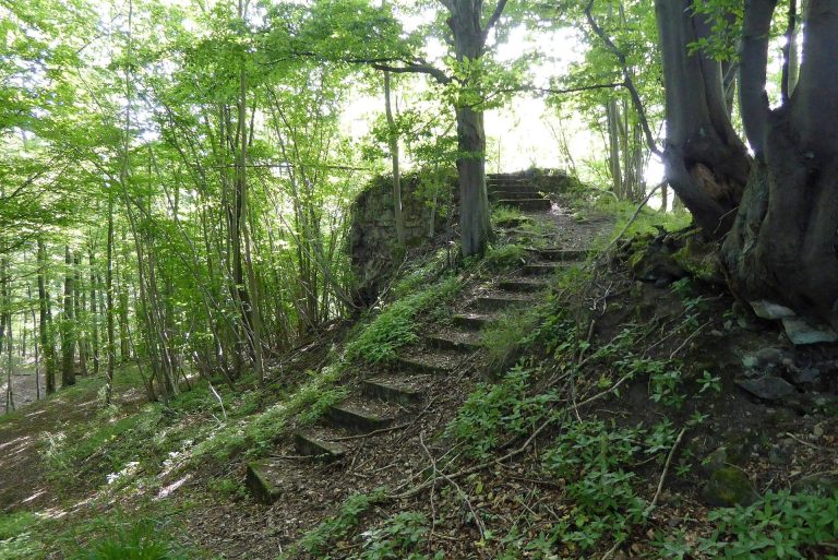
The remains occupy the wooded Burgberg, about 1.8 kilometres northwest of Hedemünden’s centre, on the Werra’s north bank. The hill rises to 215 metres and about 90 metres above a bend in the river. Camp I occupies its plateau, between approximately 180 and 215 metres above sea level. Steep slopes fall toward the Werra on the south and east, and reddish-brown sandstone is exposed near the summit. Modern quarrying has left cliffs on the slopes. Six terrain complexes have been identified, including enclosures, outer areas, and possible camp extensions.
Camp I
Enclosure and defenses
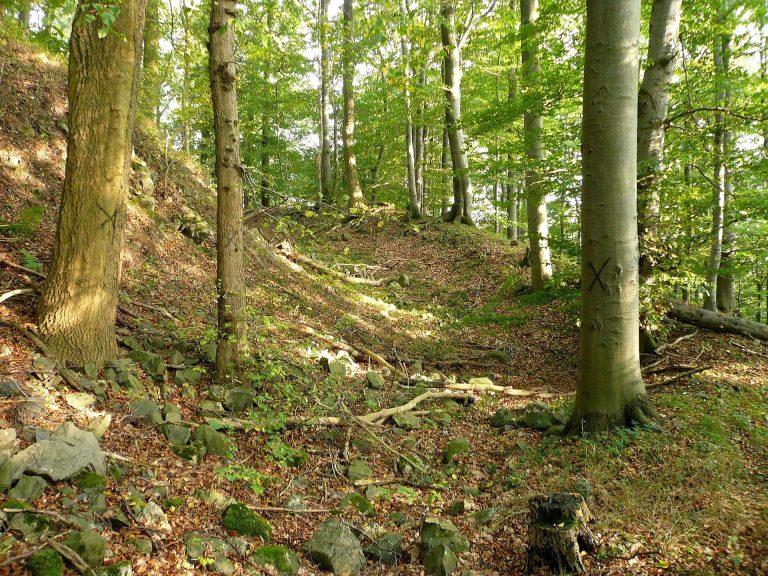
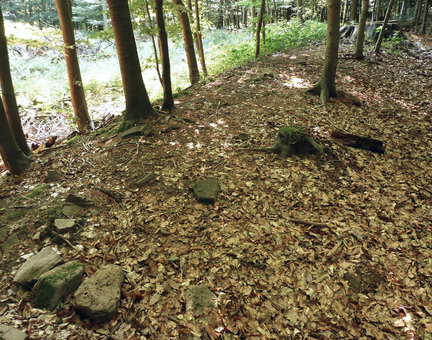
Camp I is an elongated oval enclosure measuring about 300 by 125 metres, with a gently undulating interior covering 3.2 hectares. Its rampart and ditch extend for 760 metres. Four gates, each 3–5 metres wide, were identified in the middle of the west, east, and south sides and at the southeast. The rampart now measures 5–6 metres across its base and stands 0.8–1.2 metres high. It was probably built from timber and earth, with upright posts and planks facing the outer side. The height from the ditch bottom to the rampart crest is estimated at 3.5 metres.
Six iron pioneer axes, two hammers, and a pioneer shovel lay beneath the rampart. They are interpreted as deliberate deposits made during construction, perhaps as a foundation offering. Three prominent rectangular groups of stones along the rampart may indicate the positions of wooden towers.
Buildings and internal features
Rows and rectangular arrangements of large, unworked sandstone blocks in the interior are understood as foundations for timber-and-daub buildings, probably built with timber frames or planks. Excavations found stone settings, burnt building daub, and sunken pits. Geophysical surveys, which map buried features without excavation, indicated large buildings that may have included a headquarters and a commander’s residence. Two structures measured about 40 by 10 metres and 60 by 25 metres. A nearly square central structure had outer sides of about 40 metres, with three smaller annexes visible at its corners. Excavated stone packing in this area formed a paved walkway around a building.
Several cellar pits, stone-set hearths, and a field oven were also found inside the enclosure. Coin finds place stone heaps and earth mounds there in ancient times; a connection with Roman burial-mound practice has been suggested. Their purpose remains uncertain.
Pottery, tools, and equipment
About 1,200 vessel sherds came from Camp I. Roughly a quarter is local pottery from the later Iron Age, while about three quarters is imported Roman wheel-thrown ware, including fragments of oil amphorae. Other finds include Roman coins, a small coin of the Aduatuci, an ancient people of Belgic Gaul, four unidentifiable Celtic small coins, basalt lava hand-millstones from the Mayen district in the Eifel, an Aucissa-type Roman brooch, and a bronze phallus amulet.
Military and work-related iron objects include a sword blade, pilum remains, socketed spearheads, catapult bolts, spear-shoe fittings, tent pegs, and tools for leatherworking, farming, and building. Finds also include awls, chisels, punches, plane blades, nails, and chain links. Numerous hobnails, the iron studs attached to sandal soles, came from Roman footwear. Equipment for transport includes harness fittings such as a bridle and draft yoke, along with wagon parts such as hub rings, sleeves, axle and rim nails, eyelet pins, and axle fragments. Iron slag and technical waste in bronze and lead indicate metalworking.
Camp II
Camp II adjoins Camp I on the south and appears to have been built as a contemporary extension. Its interior covers 1.3 hectares. Low stretches of rampart survive on the east and west, each about 120 metres long; railway construction and quarrying disturbed the southern side. The surviving rampart is up to 40 centimetres high and 3 metres wide, while its reconstructed total length is about 400–450 metres. Excavation confirmed a timber-and-earth rampart and a V-shaped ditch. The ditch fill contained extensive burnt material, probably from a facing made of woven wood coated with clay. Two radiocarbon analyses place the complex in the Augustan period, the reign of Augustus from 27 BC to AD 14. Finds include a fourth dolabra, hammer-adzes, spearheads, catapult bolts, sickle fragments, nails, sandal hobnails, tent pegs, and building fittings.
Other areas on and around Burgberg
Western outer area
Area III lies west of Camp I and measures about 150 by 150 metres. Roman metal objects are concentrated there, including a silver coin from the Roman Republic, the period of Roman government before the imperial era, and a copper coin possibly issued under Augustus. Other finds include a 40-centimetre pilum shaft, a pilum fitting, two catapult bolts, sandal hobnails, a bell clapper, and building fittings.
Possible Camp IV
The possible Camp IV lies east of and below Burgberg, on a usable plateau about 400 by 500 metres in size, or roughly 20 hectares. A terrace edge along its southern side runs above the steep slope toward the Werra lowland. Its western and eastern ends have rounded right-angle turns, and a gap of about 20 metres may have been a gate. Pottery scatters, features in ploughed ground, and geophysical surveys revealed building and pit structures. The area may have served as a marching camp.
Terraces and northern outer area
Area V consists of four terraces on the upper eastern slope between complexes I, II, and IV. Their edges reach 3 metres high, and they may have linked Camps I and II with Area IV. Excavation on one terrace found a small rectangular enclosure with a rampart and ditch, attached to the east of Camp II. It had a burnt palisade. Pottery, including a sherd of Terra Sigillata, came from the other terraces.
Area VI lies north of Camp I. Fired building daub, charcoal, and metal finds mark this outer zone. A marshy spring on the plateau may have provided fresh water.
Possible outposts and marching route
The Kring, about 3 kilometres southwest of the main complex and across the Werra, occupies elevated ground. Finds previously associated with a medieval rampart pointed to earlier activity and led to its interpretation as a possible outpost. About 5 kilometres northeast, near Ellerode, finds and evidence of timber framing with clay daub suggest a possible observation and signal post. The Ellerode position had a line of sight to the Kring but not to Hedemünden.
Metal finds also trace a possible marching route between the Kring and the Werra ford. They include characteristic hobnails from legionary sandals and a complete iron legionary dagger, recovered in a deposit along the route. The ford crosses a shallow stretch of the river at its bend, where the water is now about 0.3–1 metre deep. The Werra passes through a valley roughly 250 metres wide there, within a basin about 3 by 3 kilometres across. Across the river lies the Kaufunger Forest, at the meeting of the northern Hessian Fulda–Werra uplands and the southern Lower Saxon Leine–Weser uplands.
By the end of 2011, metal detecting and excavation had yielded about 2,600 objects classified as Roman metal finds. These included 640 larger objects such as tools, military equipment, and other gear; 27 Roman coins; about 1,200 sandal hobnails; around 80 waste pieces, as well as slag; and approximately 660 very small finds.