Shum-gora: An Early Medieval Mound in Novgorod Oblast
Site at a Glance
- Popularity
- High
- Country
- Russia
- Primary era
- Medieval
- Eras represented
- Medieval
- Civilizations
- Unclassified
- Site type
- Religious
- Remains
- Tomb
On this page10 sections
History
Shum-gora is an artificial mound near Zapol’e in Novgorod Oblast, Russia, dated to the eighth through tenth centuries. It belongs to a larger archaeological complex that also includes a hillfort, a settlement, and a group of burial mounds. Its purpose has been interpreted in different ways.
Local traditions and religious use
Many local residents, including members of Old Believer communities, Russian Orthodox groups that maintained older forms of worship after seventeenth-century reforms, identified the mound as the grave of Rurik. Traditionally regarded as the founder of the Rurikid dynasty that ruled early Rus, Rurik became the subject of a local burial legend. Recorded in the late nineteenth century, the tale says he was mortally wounded in battle on the Luga River’s north bank, then carried across the river in spring and buried in the mound on its south bank. It describes a golden coffin, forty barrels of silver coins, a horse with a gilded saddle, and twelve people buried with their heads arranged in a circle. This is local tradition, not an established account of Rurik’s burial.
The name Shum-gora came into use only in the late nineteenth century and was linked to stories about hearing sounds from inside the mound. People were said to drop coins and ribbons into a summit pit and listen for noises from below. Folklorist A. N. Afanasyev connected stories about noisy hills with legends of Odin’s wild host, a supernatural procession associated with the Norse god Odin.
The mound was also a focus of local Orthodox observances. Processions and prayer services took place for Trinity and All Saints, with prayers for the dead on commemorative Saturdays. In the mid-nineteenth century, pilgrims circled the mound three times before climbing it to listen for sounds and leave small offerings in the summit pit. Some people associated sand from the pit with relief from headaches and put it in their ears. The gatherings attracted people from surrounding districts. Crosses and a chapel once stood on the summit; they were removed after 1917.
Competing interpretations
Shum-gora is generally regarded as a sacred burial monument, but its function remains debated. One alternative interpretation sees it as a motte, a raised earthwork typically used as the base for a fortified tower. Proponents suggest that a mound dating to between the mid-tenth and mid-twelfth centuries may have been adapted for this purpose, perhaps serving as a princely stronghold for several decades. This proposal is unconfirmed, and critics argue that the location and reported lack of defensive provisions make a military role unlikely.
One version of the fortification theory links the mound with Mstislav Vladimirovich, prince of Novgorod and Kiev in the late eleventh and early twelfth centuries. His rule in Novgorod lasted from 1088 to 1117, with a brief interruption in the mid-1090s. The proposed stronghold has been interpreted as a possible base for princely authority in the Upper Luga region, with its use ending amid changes in Novgorod’s relations with its princes around 1136. Monogrammed stones uncovered on the summit in 2003 also revived the hypothesis that Rurik was Rorik of Dorestad, a ninth-century Viking leader of Danish origin who held territory in Frisia under Frankish authority. The proposed connection remains unproven.
Archaeological investigation and protection
P. N. Schultz and V. P. Grozdilov surveyed the complex in 1927. Six mounds in the group were recorded in 1949, S. N. Orlov examined the area in 1959, and a Novgorod archaeological team surveyed it in 1975. In 1984, N. I. Platonova identified a settlement covering about nine hectares. Excavations there began the following year and continued intermittently into the mid-2000s. Across different parts of the settlement, excavators opened 212 square metres and also excavated two other mounds, recovering evidence relevant to burial practices of the Sopki culture, an archaeological grouping associated with early medieval burial mounds in northwestern Russia.
Shum-gora itself has not been excavated. Investigations using georadar in 2002, seismic surveys from 2003 to 2005, and seismic, electrical, and magnetic methods in 2006 confirmed its artificial construction and revealed subsurface anomalies whose interpretation remains uncertain. The mound is designated a cultural heritage property of federal significance in Russia.
Remains
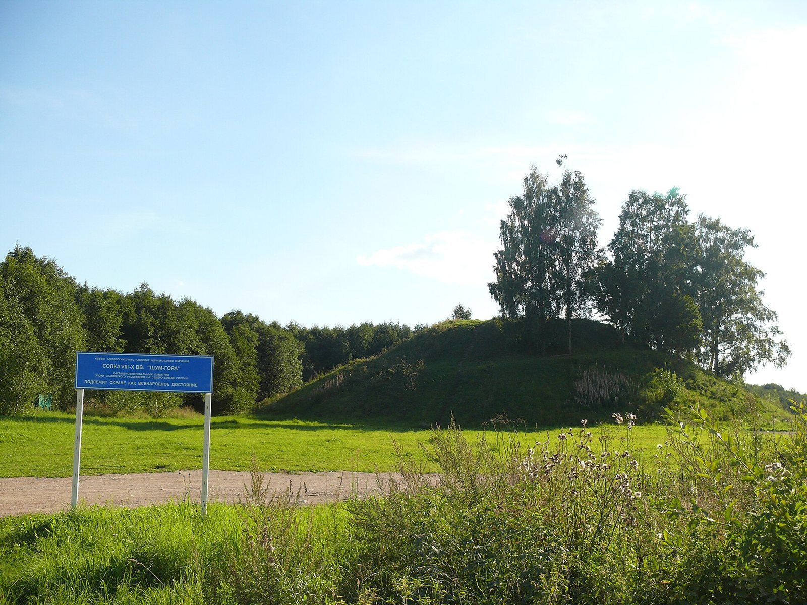
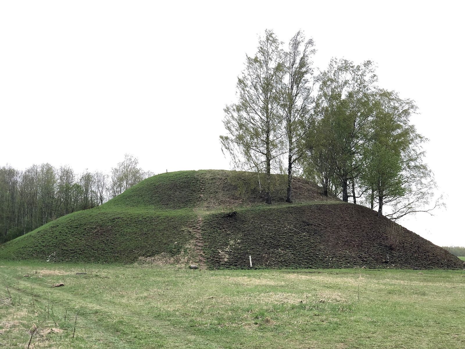
Shum-gora stands on the left bank of the Luga River, between Podgorye and Zapol’e, in a marshy field. An old cemetery begins in the forest about 50 metres to the east. The mound has two tiers and a level summit, with limestone flagstones set into its slopes in terrace-like courses.
Form and construction
The mound is about 14 metres high and measures roughly 70 metres across at its base. Its lower tier rises 6.5 to 8 metres and has a platform about 50 metres wide. Above it, the upper tier has a base diameter of 34 to 35 metres and stands about 5.5 metres high, ending in a flat summit platform up to 18 metres across. The surface is covered by 10 to 20 centimetres of turf. The pale limestone may once have made the structure appear white. Its level top has been compared with those of Scandinavian-style burial mounds at Gnezdovo, an early medieval archaeological complex near Smolensk.
Subsurface features
Geophysical surveys found concentrations of boulders around the base and anomalies within the mound. An east-west anomaly, about 9 by 3 by 3 metres and 14 to 15 metres below the summit, was interpreted in early georadar work as a possible cavity, with a broad passage apparently extending from a stone at the base. Repeated profiling registered the anomaly, but the readings do not establish a burial chamber or tunnel. Other surveys identified a low-velocity zone in the upper mound, interpreted as a possible buried chamber, as well as a ditch. A connection between the boulder concentrations and the remains of a structure remains possible.
Summit features
Monogrammed slabs
Two stone slabs found on the summit bear a monogram, a design combining letters. The signs have been compared with those on obol coins of Charlemagne, ruler of the Frankish Carolingian dynasty, struck at Melle, and denarii, a medieval coin denomination, struck for Charles the Bald at Verdun. Other proposed parallels include monograms of the Byzantine Palaiologan ruling house and two- or three-pronged signs associated with the Rurikid dynasty.
Crosses, chapel, and trees
A stone cross once stood on the summit among boulders bearing markings whose meaning is unclear; three crosses are also associated with the site’s earlier history. A chapel stood on the summit for a time. Fifteen spruces once grew on one side of the mound and were regarded as sacred or protected, and cutting trees there was forbidden.