Adro Vello: A Roman Coastal Settlement, Church, and Cemetery in Spain
Site at a Glance
- Popularity
- Low
- Country
- Spain
- Primary era
- Classical
- Eras represented
- Classical, Medieval, Early Modern
- Civilizations
- Roman, Spanish, Visigothic
- Site type
- Burial
- Remains
- Necropolis
On this page16 sections
History
Adro Vello is an archaeological site on the northern coast of the O Grove peninsula in Spain. Its history encompasses nearby Bronze Age activity, Roman coastal production and residence, and centuries of worship and burial.
Bronze Age and Roman phases
A clay mould used to cast bronze axes provides the earliest evidence of human activity in the area and points to occupation during the Bronze Age. Later, fish-salting works may have operated here from the first to the third centuries CE. The Roman coastal villa, with buildings and productive activity closely connected to the sea, dates from the third to the fifth centuries.
A fire devastated the villa around the middle of the fourth century, after which the area began to serve as a cemetery. Burials continued over a long period, from the fifth to seventh centuries through the eighteenth century.
Church, medieval complex, and relocation
A church was built at Adro Vello in the seventh century and may have been rebuilt in the twelfth. The site’s name refers to this old church. In 899, Alfonso III, king of Asturias, confirmed an earlier donation to it. Ordoño II, king of León, confirmed the donation again shortly afterward.
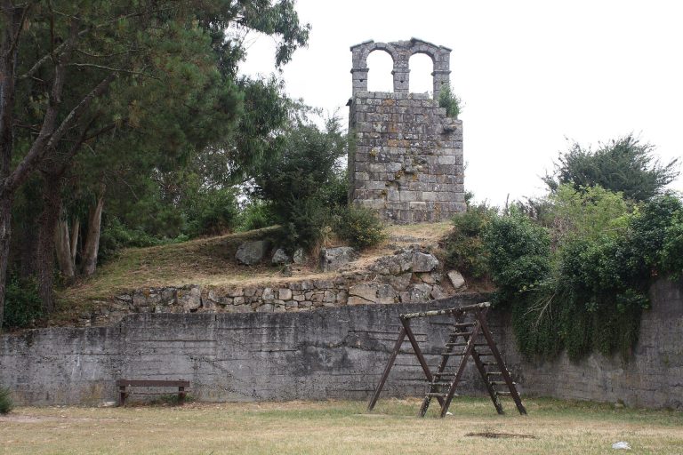
A tower and an enclosure belonged to a later medieval phase. Their purpose is uncertain: the complex may have helped defend the area against Norman and pirate attacks, but the tower could instead have been a freestanding bell tower. The nearby hill name O Sineiro has been cited in support of the bell-tower interpretation.
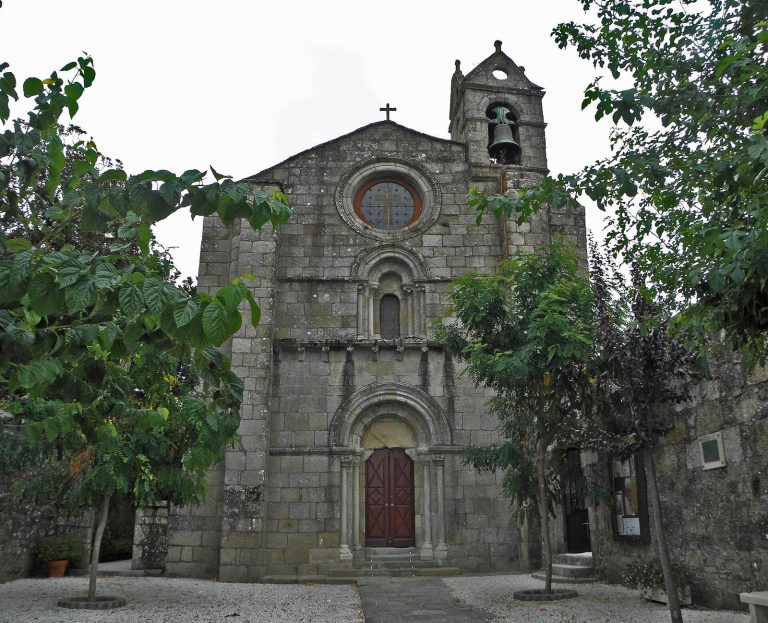
In the eighteenth century, repeated pirate attacks and the old church’s exposed coastal position led to its relocation inland. A replacement was built on higher ground about 500 metres southeast, using stone from the earlier church. The work was contracted to the stonemasons Serrapio in 1770. Foundations were laid on 3 February 1771, and the main chapel was blessed and its first mass celebrated on 1 May. Construction was completed on 20 October. The old cemetery was abandoned and covered by sand, eventually fading from popular memory.
Rediscovery, research, and protection
Storms exposed roof tiles and human bones on Carreiro beach in 1968, bringing attention to the buried remains. An access road for a housing development planned to the west, but never built, also revealed walls and bones. Surveys began in 1971, followed by excavation during the 1970s. Work became more regular from about 1985 into the 1990s, then continued sporadically. Excavation stopped where it reached a road. Anthropologist Xosé Carro Otero led most of the research.
A 2002 survey examined the site’s boundaries. In 2017, a University of Vigo team studied fish remains from the salting vats to investigate the origins of Galicia’s fishing industry, including Roman fish-processing sites.
Road construction and a house cover an estimated half of the area occupied by the ancient buildings. Storms in 2006, 2016, and 2021 damaged supports near the beach, eroded the dune, and scattered bones along the shore. Bone-bearing sand displaced during roadwork was dumped on the dune, leaving those bones without their original archaeological context. Other pressures have included inadequate upkeep of the perimeter enclosure, parking over areas with unexcavated remains, and a water-pipe trench dug immediately beside the enclosure.
Adro Vello became an Asset of Cultural Interest, Spain’s formal protected cultural-property designation, as an archaeological zone on 26 January 2023, after protection proceedings opened in February 2022. The designation includes the archaeological area and its surroundings, recognizing the site’s historical and research value as well as the potential of ground that remains unexcavated.
Remains
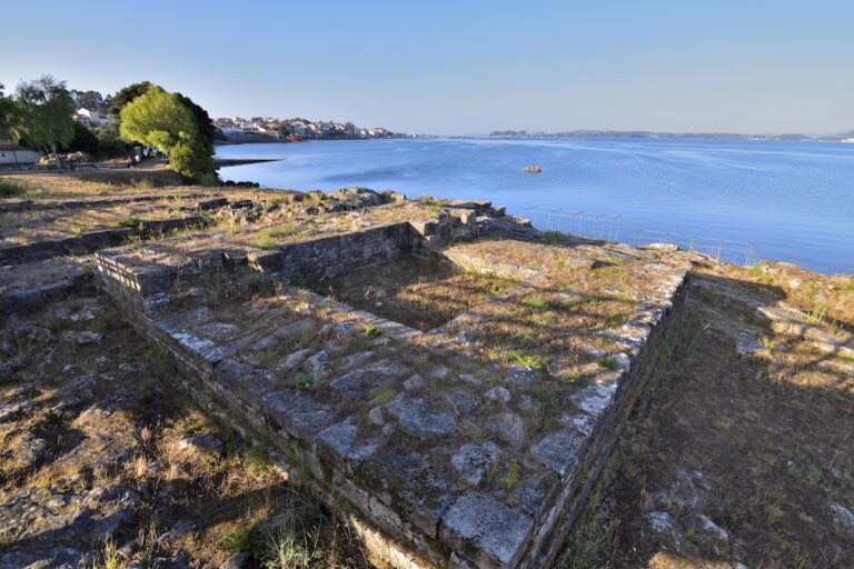
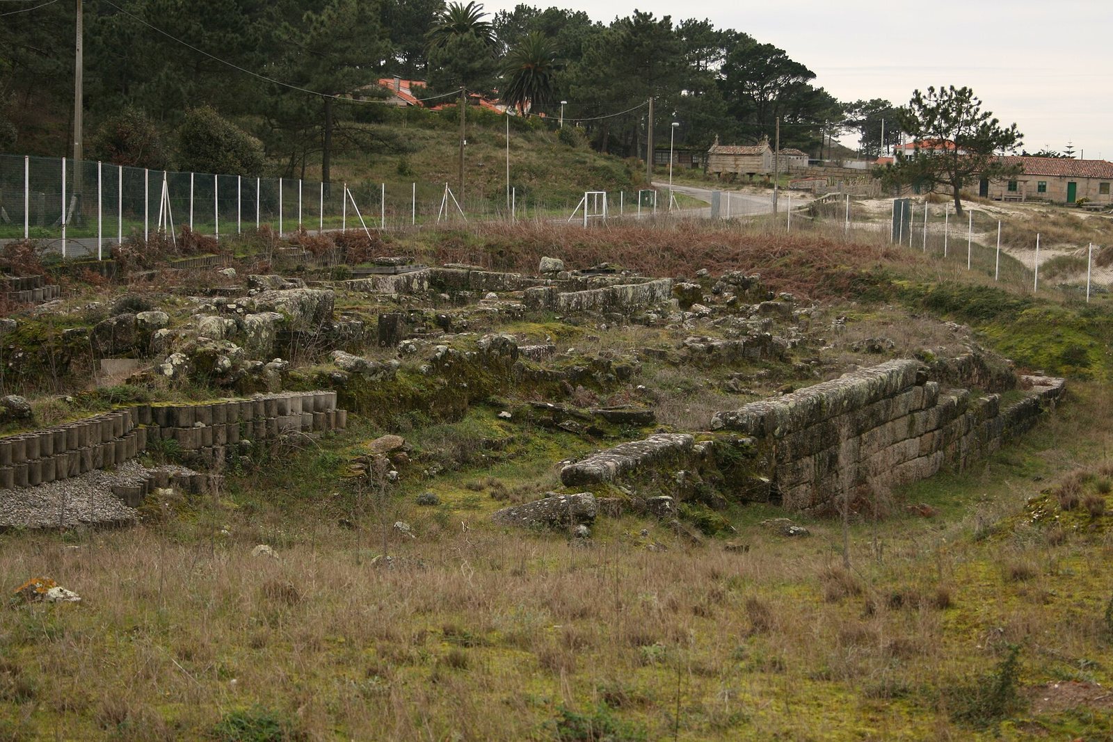
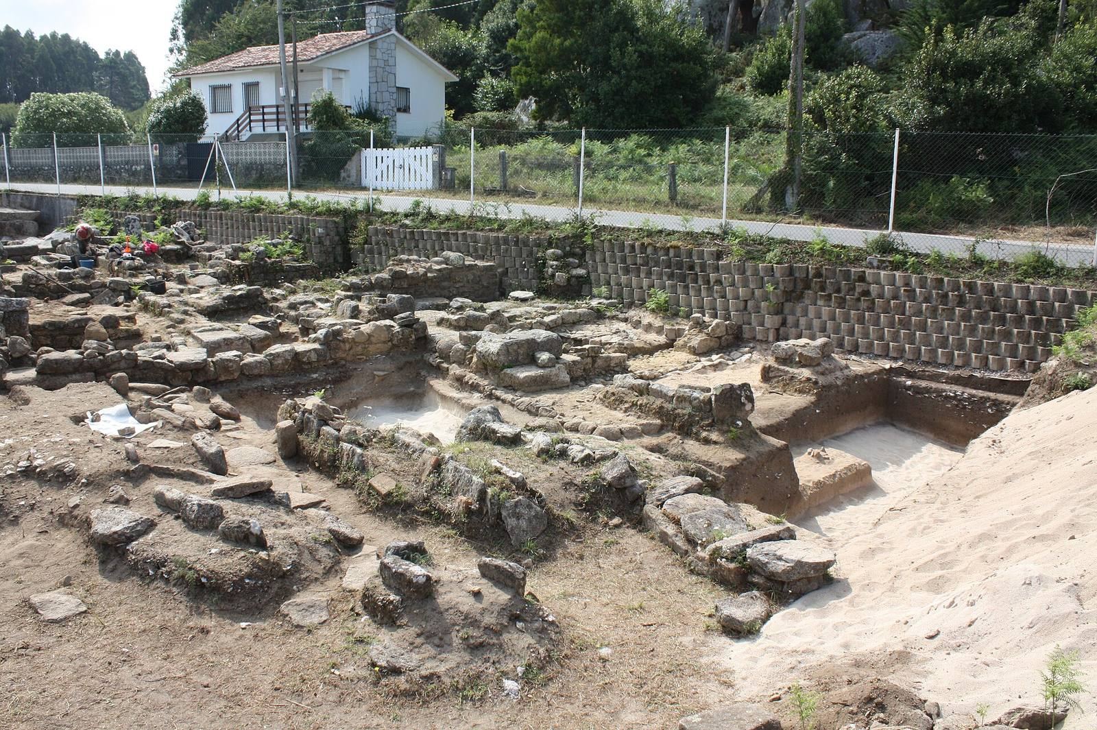
The remains occupy a sandy rise on a narrow coastal platform, about 170 metres long and 19 to 20 metres wide, facing Carreiro beach. A rocky hill bounds the site to the south; Punta do Castriño lies to the west, while Punta Barcela and the Barceliñas islets lie to the east. A small stream immediately east of the site now flows only seasonally toward the beach. It once formed an estuary where boats could moor, and salt pans may have stood nearby. A road built in the 1950s cut the stream off from the sea, contributing to silting around the structures. Rocks projecting above the sea offer some protection from waves.
Roman coastal buildings and production
Fish-salting vats
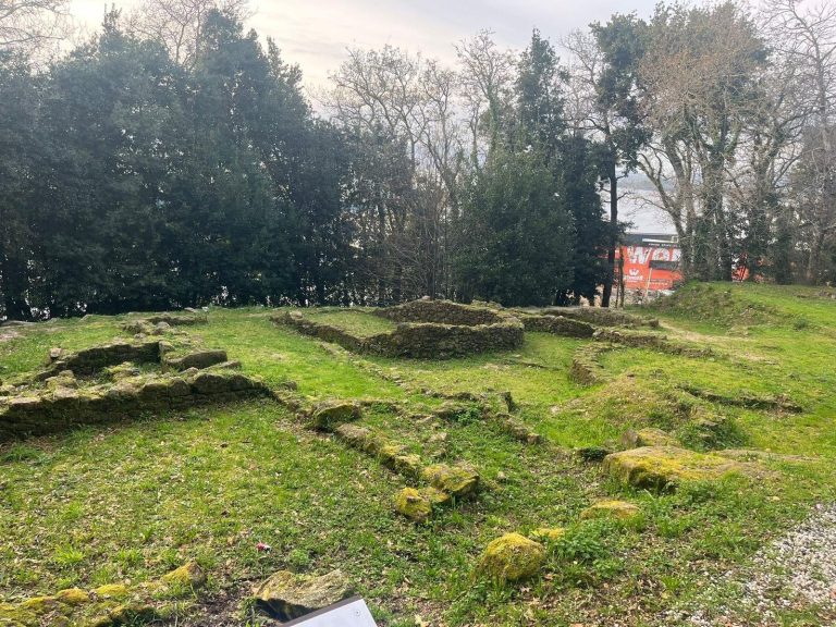
Four rectangular vats form the remains of the fish-salting works. The first was found in 1988, with a layer about 20 centimetres thick of fish scales and bones at its bottom; three more were identified later. Their combined capacity indicates production beyond household needs, consistent with production for trade, although the scale of that trade is unknown. These were the first structures of this type found in Galicia. Their walls are about 30 centimetres thick and plastered with lime and gravel, mainly quartz, to make them watertight and easier to clean. The corners are rounded.
Roman villa
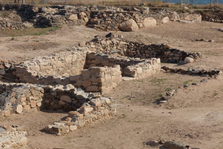
The villa is represented by walls, stone channels, heaps of shells, paved surfaces, and fragments of painted stucco. Its perimeter walls were built from large dressed stones with rough outer faces. Finds from the site include Roman pottery, pottery associated with the fortified-settlement tradition of northwestern Iberia, and an amber bead.
Cemetery
More than 3,000 skeletons have been recovered from the cemetery, and the total number of burials may reach 4,000. Graves lie in as many as ten layers from different periods. The most common are simple graves cut into the earth, alongside burials lined with stone, built with bricks or roof tiles, covered by slabs, or placed in coffins carved from single blocks of stone. One inscribed slab may refer to a stonemason.
Graves were sometimes reused, with as many as three bodies placed in one burial. In some cases, older bones were gathered into piles to make room for another burial. The layered graves and varied construction methods reflect the cemetery’s long period of use.
Church and medieval structures
Old church
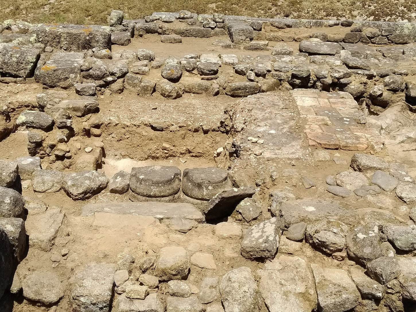
Only the foundations of the old church survive. Rows of dressed stone blocks outline the nave, with the church’s eastern end, a recessed doorway on the west, and an annex on the south. Its rectangular sanctuary end had a mortar floor that was later covered by a brick floor.
Tower and enclosure
A medieval tower, dated to a phase later than the twelfth century, and an enclosure of the same period formed another architectural group within the site.
Altar and coin
Roman altar
A Roman altar was cut down and reused as building material in the north wall of the old church. The surviving fragment is 49 centimetres high, about 25 centimetres wide, and no more than 21 centimetres thick; two or three lines may have been lost with the missing portion. Three openings ending in semicircular arches appear on its upper part. The fragmentary inscription, “DEO D / EVER,” is interpreted as an invocation to an unidentified indigenous sea deity, possibly associated with Neptune. The arched openings have been associated with the Gates of Hades, the Greek underworld.
Half-dinero coin
A small half-dinero coin made from silver and copper alloy was found in 1985 on the north face of the villa’s perimeter wall. It measures about 13 millimetres across and weighs 0.28 grams. Struck at the mint of Santiago de Compostela, it has been displayed at the Museum of Pilgrimages in Santiago since its discovery and is the only known example.
On the front, a lion walks to the right beneath the inscription “FERDINANDUS REX,” identifying the coin with Ferdinand II, king of León and Galicia from 1157 to 1188. The reverse shows a boat that nearly fills the image. It is interpreted as carrying the body of Saint James the Greater, one of the Twelve Apostles in Christian tradition, with James’s head at the bow and his disciples Theodore and Athanasius at the stern. The inscription “S(ancti) IA / COBI” is divided by a mast ending in a cross.
The reverse may be the earliest image of the Translatio, the tradition that James’s remains were transferred to Compostela, though a twelfth-century tympanum at the church of Santiago de Cereixo has also been proposed for that distinction. The boat is shown with wooden planks and figureheads at both ends, like contemporary cargo vessels.
Wider archaeological landscape
The surrounding area includes the current church of San Vicente, a rectory, a granary, two freestanding stone crosses customary in Galicia, and four modern fish-salting works. About 500 metres to the west, Castro do Castriño is a nearby fortified-settlement site with slight remains. The archaeological area also extends south beneath a road and adjoining fields, where test excavations identified remains, and north into a strip of sea and rocks near the shore.