Vetera (Castra Vetera): Roman Legionary Camps on the Lower Rhine
Site at a Glance
- Popularity
- High
- Country
- Germany
- Primary era
- Classical
- Eras represented
- Classical
- Civilizations
- Roman
- Site type
- Military
- Remains
- Fort
On this page21 sections
History
Vetera was the name of two successive Roman legionary camps near present-day Xanten, Germany. A legionary camp housed a large Roman military formation and the services needed to support it. Vetera I was occupied from around 13/12 BCE until 70 CE; Vetera II was built in 71 CE about 1.5 kilometres farther east and remained occupied at least into the second half of the third century. Both were in Germania Inferior, the Roman province of Lower Germania, and formed part of the Lower Germanic Limes, Rome’s frontier system along the Lower Rhine. They were major garrisons on the empire’s northern border.
Establishment and Augustan campaigns
After Julius Caesar’s campaigns in Gaul, Roman leaders sought to secure the Lower Rhine through resettlement, administration and roads. As governor of Gaul, Marcus Vipsanius Agrippa pursued these measures. Following the defeat of Marcus Lollius’s forces in 17 or 16 BCE, Augustus shifted toward a more offensive deployment beyond the Rhine and moved troops to the river, establishing Vetera and a camp near Noviomagus.
The precise beginning of Vetera I is uncertain, though evidence points most strongly to 13/12 BCE. The camp probably supported Drusus’s campaigns east of the Rhine, which ran from 12 to 8 BCE, and helped control the lower Rhine and Lippe. Its role as a permanent base in these earliest years is not certain. After Drusus’s death, campaigns continued under Tiberius, Lucius Domitius Ahenobarbus and Marcus Vinicius, before Tiberius resumed command. A revolt in Pannonia interrupted operations in 6 CE.
After Publius Quinctilius Varus was defeated in 9 CE, Rome withdrew its garrisons east of the Rhine and concentrated on the river frontier. Legio XVIII Augusta and Legio XVII Augusta, probably stationed at Vetera beforehand, were among the units lost. Legio V Alaudae and Legio XXI Rapax replaced them. Around 11/12 CE, Vetera became the principal base of the newly organized Lower Germanic army district.
Frontier garrison and expansion
In 14 CE, Vetera’s legions joined the mutiny that followed Augustus’s death. Germanicus suppressed the revolt and then led campaigns east of the Rhine, with Aulus Caecina Severus commanding the northern force based at Vetera. Tiberius ended the offensive in 16 CE, and the Lower Rhine became a defensive frontier. Vetera then experienced more than fifty years of relative peace.
Around 46 CE, Legio XV Primigenia replaced Legio XXI Rapax, and a new camp was constructed. Around 60 CE, another camp was built for Legio V and Legio XV. Pliny the Elder may have served at Vetera in the early or middle 50s as commander of an auxiliary cavalry unit; an inscribed military decoration associated with his authority supports this possibility.
Destruction in the Batavian revolt
Vetera I’s final years unfolded during the Roman civil war of 69 CE, when Vitellius and Vespasian competed for the imperial throne, and the Batavian revolt against Roman rule. The Lower Germanic army declared Vitellius emperor in January. His march to Italy included about 4,000 soldiers from Legio V at Vetera and eight Batavian auxiliary cohorts. When Vitellius ordered the Batavians back to the Rhine, his levies among them and the Cananefates helped provoke a revolt led by Iulius Civilis. Civilis initially presented himself as supporting Vespasian against Vitellius.
The Vetera garrison remained loyal to Vitellius. After an initial attack failed, Civilis’s forces laid siege to the camp. A relief force under Gaius Dillius Vocula advanced from the south and halted near Gelduba. It temporarily relieved Vetera, but the siege resumed in late December 69. In March 70, with supplies exhausted, the remaining defenders, including parts of Legio XV Primigenia and Legio V Alaudae and possibly Legio XVI Gallica, surrendered. Although allowed to leave, they were ambushed and killed about five miles south of Vetera. A few who returned died when the rebels set fire to the plundered camp. Roman troops won a major battle outside the destroyed fort in late July or early August 70 while suppressing the revolt.
Vetera II and later history
Vetera I was not rebuilt. After the revolt, the army in Lower Germania was reorganized, and Vetera II was established in 71 CE as a camp for one legion rather than as a restoration of the earlier double camp. Legio XXII Primigenia was stationed there first. Around the turn of the first century, Legio VI Victrix replaced it; that legion is attested at Vetera in 104/105. Legio XXX Ulpia Victrix took over around 119–122 and remained there into the later third century.
The end of Vetera II’s occupation is unclear. Its latest securely dated find is a coin of Postumus from 260, though use may have continued into the fourth century. The fourth-century settlement of Tricensimae is often placed at Colonia Ulpia Traiana, the Roman colony at modern Xanten; some scholars have instead associated it with continued occupation of Vetera II.
After the camps were abandoned, their stone was reused. Material from Vetera I went into the expansion of nearby Colonia Ulpia Traiana, while medieval builders took stone from the Fürstenberg ruins for a monastery. A belief that the amphitheatre was the site of Saint Victor’s martyrdom helped preserve it. Interest in the remains and stone extraction began long before modern archaeology. Stephanus Winandus Pighius was the first to record Roman remains systematically, and Johannes Spenrath documented the removal of more than 5,000 tonnes of stone from Vetera I between 1714 and 1716. Philipp Houben founded a museum in Xanten in 1803 and conducted and financed regional excavations from 1819 to 1844. He used the reversed name Castra Vetera in an 1839 publication; Vetera and Vetera Castra also occur in scholarly usage. Tacitus is the earliest writer to record the name Vetera. Its meaning is uncertain, though it may derive from a Romanized name for a nearby pre-Roman Cugerni settlement.
The Lower Rhine Antiquities Society, founded by Josef Steiner in 1877, excavated at the Fürstenberg with the Provincial Museum in Bonn. Systematic work there began in 1905 under Hans Lehner and continued in 1905–1914 and 1925–1933 under Lehner and Franz Oelmann. These investigations located Vetera I and examined its defenses, interior, civilian settlement, burial areas and amphitheatre. Gravel extraction on Bislicher Insel after the Second World War brought Roman material to light and prompted the search for Vetera II. Wilhelm Piepers recognized an important concentration of finds, and underwater investigations commissioned by Harald von Petrikovits in 1955, 1957 and 1958 traced the submerged camp. Vetera is protected under North Rhine-Westphalia’s monument-protection law and belongs to the Lower Germanic Limes UNESCO World Heritage Site, inscribed in 2021.
Remains
Vetera’s remains belong to two camps with different settings. Vetera I occupied the southern slope of the Fürstenberg, a glacial ridge more than two kilometres south-southeast of central Xanten. Vetera II stood about 1.5 kilometres east on a low Rhine terrace. The surviving evidence includes successive earth-and-timber defenses, a large later camp plan, buildings and associated military and civilian sites.
Vetera I’s setting and defenses
Terrain and early camps
In antiquity, marshes and moorland surrounded the Fürstenberg. Vetera I stood in an exposed position opposite the Lippe’s mouth, where the Rhine and Lippe valleys could be observed. The Roman Rhine followed a course broadly similar to its modern one, though somewhat farther south or west. The earliest defenses used timber and earth. At least seven overlapping ditch systems represent successive early plans, from the Augustan period through the decades before the stone camp. Finds from these phases include pottery kilns, another kiln dating to the early Claudian period and rubbish pits.
Later camp defenses and streets
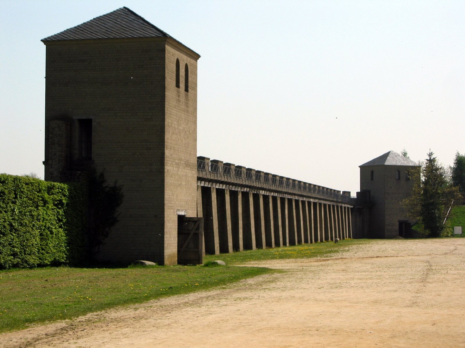
The best-understood camp, built around 60 CE for Legio V and Legio XV, covered about 60 hectares. Its perimeter wall measured 902 by 621 metres; including the outer earth bank and ditches, the dimensions were approximately 926 by 636 or 640 metres. The wall was about three metres thick, built with timber framing and infill of mud brick or clay blocks. Its framed faces incorporated compartments filled with clay-coated flanged tiles, and paving slabs covered the patrol path along the top. Four gates had passages 8.5 to 9.5 metres wide, each flanked by two towers and provided with a bridge. The main front faced south, with the principal gate at the hill’s foot and the rear gate on the ridge. Two pointed ditches and branch obstacles protected the camp. Two north–south roads and a main east–west street organized the interior. Brick stamps place Legio V in the western half and Legio XV in the eastern half. Covered colonnades and mostly two-room shops lined both sides of the main cross-street.
Headquarters and accommodation
Headquarters complex
The camp’s headquarters stood at the central road intersection. Measuring 120 by 94.8 metres, it was built from greywacke, a coarse sandstone, basalt and tuff, a volcanic rock, bonded with lime mortar. Entry from the south opened onto a courtyard about 61.8 by 64.8 metres, surrounded by covered walkways. Chambers behind them, mainly interpreted as armouries, occupied the west, south and east sides. A large hall with three aisles and rows of columns stood to the north, probably serving religious functions. Remains of wall paintings and decorated capitals indicate elaborate fittings. Separate shrines for the two legions held their standards, treasuries and divine images; nine rooms closed the northern end of the complex.
Commanders’ and officers’ residences
Two commanders’ residences stood on opposite sides of the headquarters, with entrances and covered walkways facing it. Each had three courtyards surrounded by columns. One courtyard, long in plan and ending in rounded bays, has been interpreted as an ornamental garden. The western residence measured 97 by 77 metres including its walkway, and the eastern one measured 109 by 78.5 metres. North of the headquarters, Building G measured 124.5 by 95.4 metres, with small rooms around larger courtyards and halls. Its proposed use as the camp commander’s residence and offices remains hypothetical. Four nearly square houses, each about 39 by 41 metres, have been interpreted as senior officers’ residences. Three were fully excavated, while only the western room range of the fourth was exposed. Five further buildings, four beside the main cross-street, are considered staff officers’ quarters.
Military hospitals
The western military hospital, associated with Legio V, stood near a side gate and measured about 83.5 metres on each side. On three sides, two rows of rooms separated by a corridor enclosed an inner court measuring 43 by 39 metres; the rooms served the sick and wounded. A column-supported hall on the north side has been interpreted as an operating room. A second hospital for Legio XV in the eastern front section was identified from aerial photographs.
Settlement, arena and burial grounds
Civilian settlement
A civilian settlement serving the camp lay beyond an undeveloped strip about 100 metres wide. Its streets followed a regular plan, and aerial archaeology shows dense development on the eastern side. Evidence for its earliest decades is slight, while its presence is more firmly established during the later Claudian and Neronian period, the reigns of those emperors. The settlement probably extended south toward the cemetery near modern Birten and may have formed a U-shaped area around the camp’s western, southern and eastern sides.
Amphitheatre
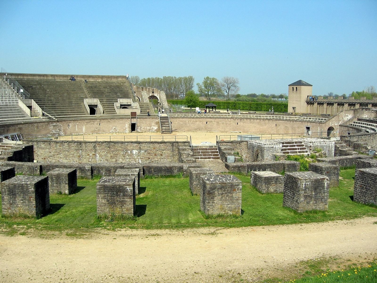
The amphitheatre, an oval arena for public spectacles, was built during the Claudian and Neronian period using timber and earth. Its outer dimensions were 98 by 84 metres, and its interior measured 47.5 by 34.5 metres. During excavations in 1908–1909, the earthwork still rose as much as eight metres and measured ten metres across; the venue could hold up to 10,000 spectators. It has since been reconstructed and is used as an open-air stage.
Burial grounds and inscribed finds
A cemetery serving the garrison and civilian settlement lay south of the settlement near Birten. More than 60 cremation burials have been identified, mostly dating from the Augustan through Neronian periods, with one from the reign of Vespasian. Some were uncovered during construction of Birten parish church in 1902–1903, and most were found during work on the forest cemetery in 1960. Another cemetery lay north of Vetera I, between the camp and Xanten’s southern medieval boundary. A tombstone discovered in the early 1620s commemorates Marcus Caelius, a senior officer of Legio XVIII. Its inscription gives his age as 53 and a half and says he died in Varus’s war; his brother Publius commissioned it. The stone may have belonged to a memorial for someone buried elsewhere, perhaps in a cemetery on the Fürstenberg summit, though its exact findspot is unknown. An inscribed military decoration identifies Pliny as commander of a cavalry unit and indicates that the award was made under his authority. It supports, but does not prove, a posting at Vetera in the 50s.
Vetera II and associated sites
Submerged camp and civilian settlement
Vetera II was built on a terrace that was above flood level at the time and probably lay directly beside the Rhine. Its remains at Bislicher Insel now lie beneath gravel and water, between five and ten metres below the visible surface. Around 1200, a loop in the Rhine shifted south, undermining and covering the site with gravel. An artificial diversion in 1788–1789 left the loop as a dead river channel. Underwater surveys traced the camp’s wall lines. Surface finds indicate that its associated civilian settlement extended west and south of the camp. Gravel extraction beginning in the early 1950s brought Roman bronzes, coins, pottery, oak beams, bricks, tuff masonry and lead plates to light. A statuette base found in 1953 bears an inscription recording Publius Aelius Severinus’s dedication of a statuette to the protective spirit of the standard-bearers of Legio XXX Ulpia Victrix.
Legionary brickworks
A legionary brickworks stood on the road between Vetera II and Colonia Ulpia Traiana. Its kiln, discovered in 1901, was built by Legio XXII; stamped bricks also indicate earlier production at the wider site by Legio XV. Legio VI later took over and repaired the kiln, and Legio XXX used it into the fourth century. This kiln operated for about 225 years. Excavations revealed production rooms and a drying shed, while later work in the 1970s and 1990s uncovered two further brick kilns, a pottery kiln, settling basins, and drying and storage sheds. Clay pipes supplied fresh water, and canals carried wastewater to the Rhine. Products included roof tiles, hollow and facing bricks, wall tiles, floor-heating slabs and pipes. Stamps identify the legions involved in production.
Military training camps
Aerial surveys have identified more than 60 Roman training camps between Xanten and Alpen, on both sides of the road linking Vetera with Asciburgium. They cover an area exceeding ten square kilometres. Many were incomplete practice works focused on the difficult construction of camp corners; two were excavated at Kaninenberg in 1961–1962. A complete temporary camp at the southern edge of the area has been interpreted as a stopping place for reinforcements travelling to Vetera, but the camps cannot be assigned to a particular phase of the legionary base. A separate group of 13 practice camps in Uedemer Hochwald was built during manoeuvres between the first and third centuries. Their earthworks survive up to 0.5 metres high.