Archaeological Park Xanten: The Roman City of Colonia Ulpia Traiana
Site at a Glance
- Rating
- 4.6
- Popularity
- Medium
- Country
- Germany
- Primary era
- Classical
- External website
- Open
- Eras represented
- Classical
- Civilizations
- Roman
- Site type
- City
On this page20 sections
History
Archaeological Park Xanten in Germany preserves much of Colonia Ulpia Traiana, a Roman city founded in the area of present-day Xanten during the imperial period. Laid out as a high-status Roman colony around the reign of Emperor Trajan, the city became one of the major urban settlements of Lower Germania and had more than 10,000 inhabitants during its second-century height.
From legionary camp to Roman city
Roman history in the Xanten area began when legions arrived during Emperor Augustus’s first offensive along the Rhine, around 13 to 12 BC. Augustus, the first Roman emperor, ruled from 27 BC to AD 14. A legionary camp was established on the Fürstenberg, and at least one legion remained in the region afterward. The camp’s military presence encouraged roads, river transport, commerce, and the growth of a civilian settlement beside the Rhine.
During the first century AD, the two-legion camp known as Vetera I became temporarily one of the Roman Empire’s most important military bases. Roads, waterways, and a harbor supplied as many as 10,000 legionaries. Their purchasing power attracted civilians, helping the settlement develop into an urban community connected to the Rhine frontier.
The Batavian revolt of AD 69 to 70, an uprising against Roman rule in the Rhine region, destroyed Vetera I and the early civilian settlement. Vetera was then rebuilt at another location as Vetera II. The civilian settlement was reconstructed as well, while only one legion was subsequently stationed in the area.
Colonia Ulpia Traiana
Around AD 98 to 99, Emperor Trajan granted the settlement colonial status and Roman citizenship, together with the legal and fiscal privileges associated with that status. A colonia was a Roman settlement with elevated civic standing and institutions modeled on Roman urban administration. The city’s name, Colonia Ulpia Traiana, combined its colonial status with Ulpia, Trajan’s family name.
The new city covered approximately 73 hectares and was organized according to a rectangular street grid. Its forum, the principal public square for political, administrative, commercial, and social activity, occupied the intersection of the two main streets. The Capitol, a temple dedicated to Rome’s principal state gods, stood directly beside it. Other sanctuaries served local religious traditions, including a temple near the harbor and a temple dedicated to the Matronae, female protective deities widely worshipped in the Roman northwest.
Colonia Ulpia Traiana prospered during the second century through trade, cultural diversity, military connections, and economic growth. Its residents came from different parts of the Roman Empire, as well as from Germanic and Gallic communities. Discharged soldiers and their families settled in the city, while active soldiers took part in urban life and helped construct public buildings. Civilian offices modeled on those of Rome administered the community.
Occupations included butchery, baking, metalworking, bronze casting, locksmithing, painting, weaving, and medicine. Merchants and service providers brought goods from across the empire. The Rhine served simultaneously as the principal transport route, a frontier, and a source of supplies. Its harbor received everyday goods, building materials, and luxury products. In the surrounding area, livestock raising was more important than arable farming because the soils of the Lower Rhine were poorly suited to productive cultivation.
The military frontier and the city’s decline
The Thirtieth Legion was stationed at nearby Vetera II from about AD 122 and remained the city’s associated legion for approximately two centuries. Its presence contributed to Colonia Ulpia Traiana’s prosperity and reinforced the close connection between the city and the Rhine frontier. Over time, however, the Rhine changed course and moved farther from both the legionary camp and the city.
During the third century, internal instability and attacks from outside the empire placed the Rhine provinces under increasing pressure. Toward the end of the century, the Franks overran and partly destroyed Vetera II and Colonia Ulpia Traiana. The urban area was then greatly reduced and enclosed by a strong late Roman fortification, conventionally called Tricensimae. Its identification with the fortress remains debated.
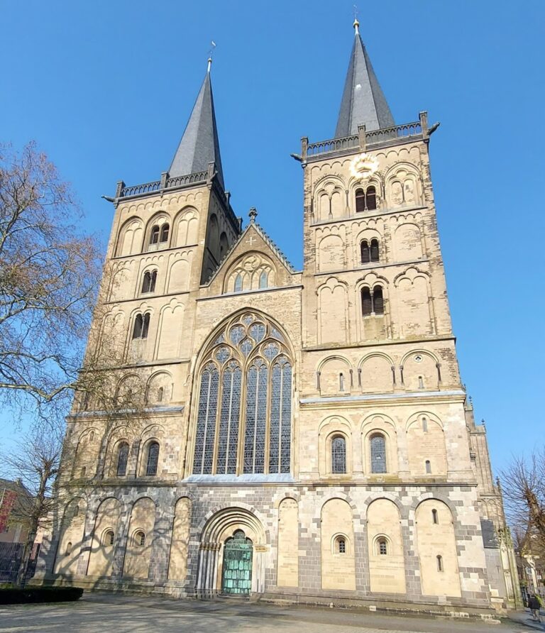
Buildings outside the reduced fortress were largely demolished. Archaeological evidence indicates that urban life eventually ceased amid continuing unrest in the fourth century. The fortress was later abandoned, and Frankish communities occupied the area in scattered farmsteads and small settlements. Roman buildings deteriorated, while their stone was reused centuries later in medieval Xanten and nearby structures, including much of Xanten Cathedral.
Christian Xanten and the rediscovery of the Roman city
The name Xanten derives from ad sanctos, meaning “to the saints.” The name refers to two early Christian martyr graves believed to have been found in a late Roman cemetery south of the city. Memorial structures were built over the cemetery from the fifth century. An ecclesiastical collegiate foundation developed there in the eighth century, and construction of Xanten Cathedral began roughly five centuries later.
Interest in the Roman remains revived by the second half of the sixteenth century. In the nineteenth century, investigations by the Lower Rhine Antiquarian Society uncovered parts of the city fortifications and Capitol, together with approximately 1,500 graves. The first traces of the amphitheater were identified in 1887.
Road construction in 1930 led to emergency excavations by the Rheinisches Landesmuseum Bonn. Larger systematic excavations began in 1934. They revealed a former Rhine channel in the eastern part of the Roman city, while the amphitheater was fully exposed and conserved. Industrial development after the Second World War prompted further excavations from 1957 onward, including work on the Great Baths, a crafts and commercial quarter, several streets, and a building complex whose function remains unknown. Some of these remains were later removed and built over.
Plans around 1970 to extract gravel from the former Rhine channel and create recreational facilities threatened the previously undisturbed eastern part of the Roman city and its harbor. The plans were abandoned, and the industrial area was not expanded. Businesses were relocated so that the land could be used for an archaeological park.
On 14 September 1973, the Landschaftsverband Rheinland decided to establish the park and became its operator the following month. Construction began near the amphitheater, and the first six-hectare southeastern section opened on 8 June 1977. The 1980 State Horticultural Show expanded the park from six to 27 hectares, covering the eastern part of the Roman city. Most temporary gardens were later removed, although the rock garden and playground remained. The park has continued to expand since its foundation.
After industry was relocated from the area of the Great Baths, the baths were excavated and covered by a glass protective building in 1999. The Regional Museum Xanten moved from the city center into a new structure above the baths’ entrance hall in 2007 and reopened as the LVR-RömerMuseum on 16 August 2008. The former B 57 had divided the Roman city and park until the road was relocated after the northwestern bypass opened on 21 December 2008. The park expanded across the formerly separated area on 15 May 2009, reaching 60 hectares, and roads were subsequently removed or rebuilt to reconnect its sections.
Archaeological research and excavation remain part of the park’s work. Since 1989, it has hosted the International Archaeological Summer Academy of Xanten, a field-training excavation in which students, mainly from European countries, participate in archaeological investigations. On 27 July 2021, Colonia Ulpia Traiana was included in the UNESCO World Heritage property “Frontiers of the Roman Empire: Lower Germanic Limes.” The Lower Germanic Limes was the fortified and militarized frontier along the Rhine in Lower Germania, where the river formed much of the boundary. Colonia Ulpia Traiana is the only Roman city among the archaeological sites in that World Heritage property between Katwijk and Remagen. After the city’s destruction around AD 275, a large fortress in its reduced center became important to frontier defense during the fourth century.
Remains
The surviving archaeological landscape combines excavated foundations, marked streets, reconstructed buildings, protective structures, and sections of the Roman defenses. Colonia Ulpia Traiana’s rectangular plan is shown by paths and avenues following the former street grid. Lawns and gravel-marked streets indicate the urban blocks, or insulae, while trees placed at the former intervals of covered sidewalk supports and hornbeam hedges outlining house plans make the organization of the city visible in the landscape.
Fortifications and gateways
City walls and the northern gate
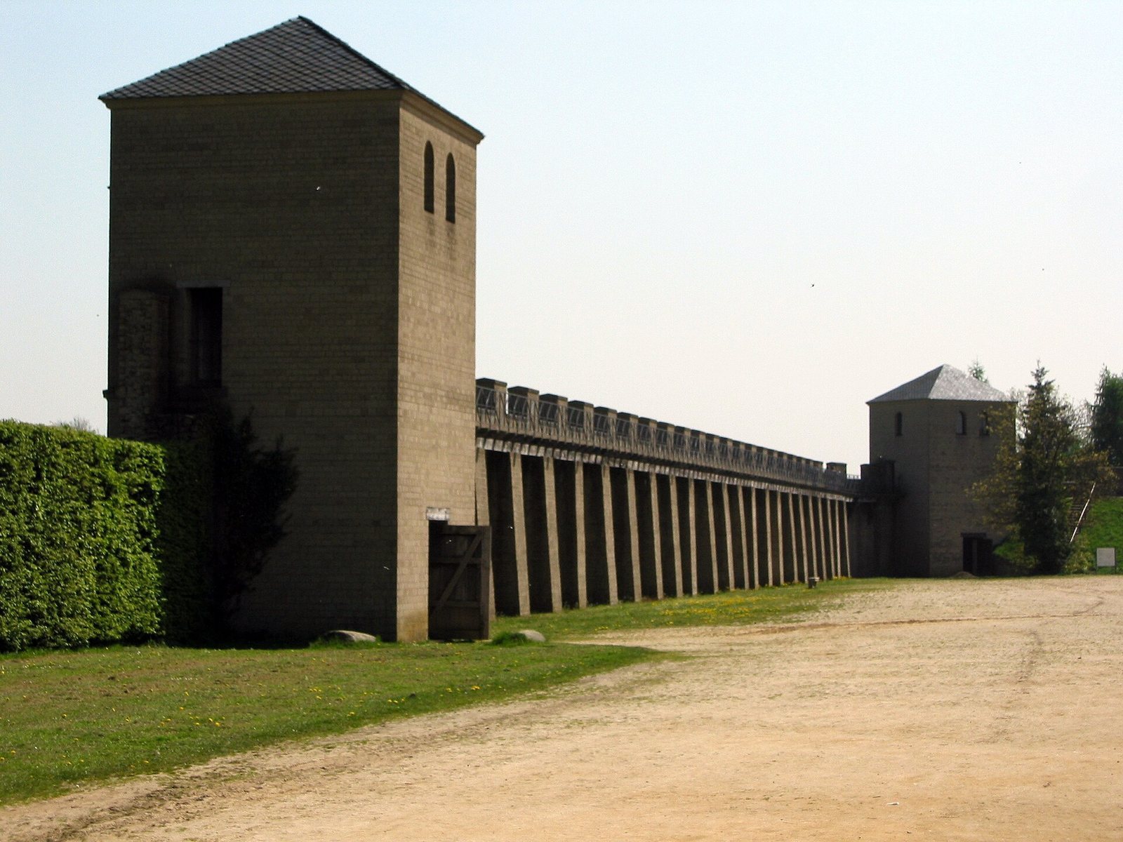
The city was enclosed by a substantial fortification consisting of walls, gates, towers, and an additional ditch system. The walls were broad enough for two soldiers to pass each other. Reconstructed sections and hedge lines indicate the former perimeter. The northern city gate, also called the Burginatium Gate, had projecting towers and three storeys joined by a platform for artillery. Heavy crossbeams and iron portcullises protected the entrance. A sewer passed beneath the gate toward the defensive ditch and then to the Rhine channel, while the road beyond it led toward the northern military camp of Burginatium.
Harbor gate
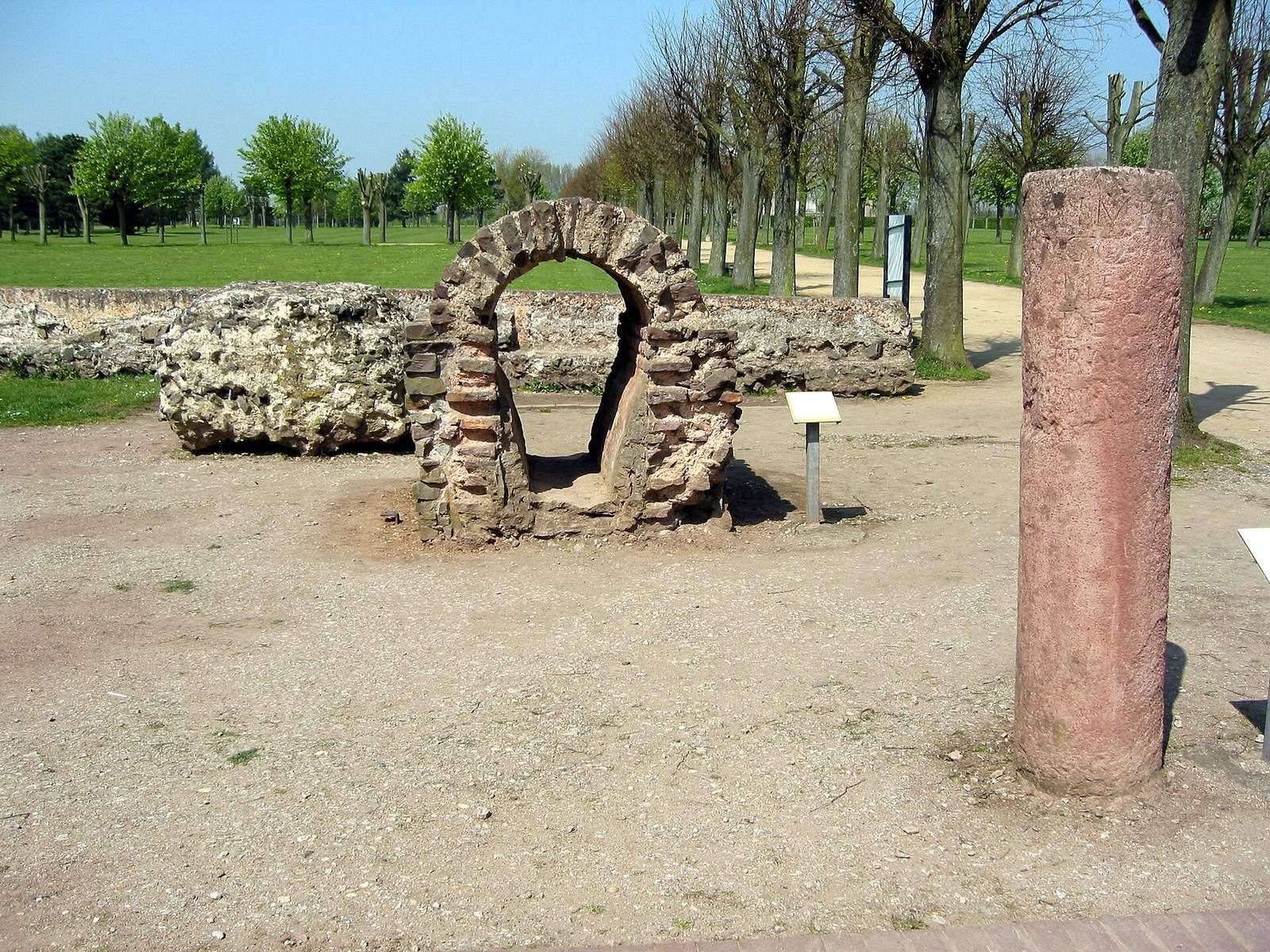
A smaller harbor gate connected the city with its river harbor. It was wide enough for carts approximately 1.5 meters across, and wheel-wear marks on a recovered stone block show that carts passed through the entrance.
Harbor and water systems
Harbor and Harbor Temple
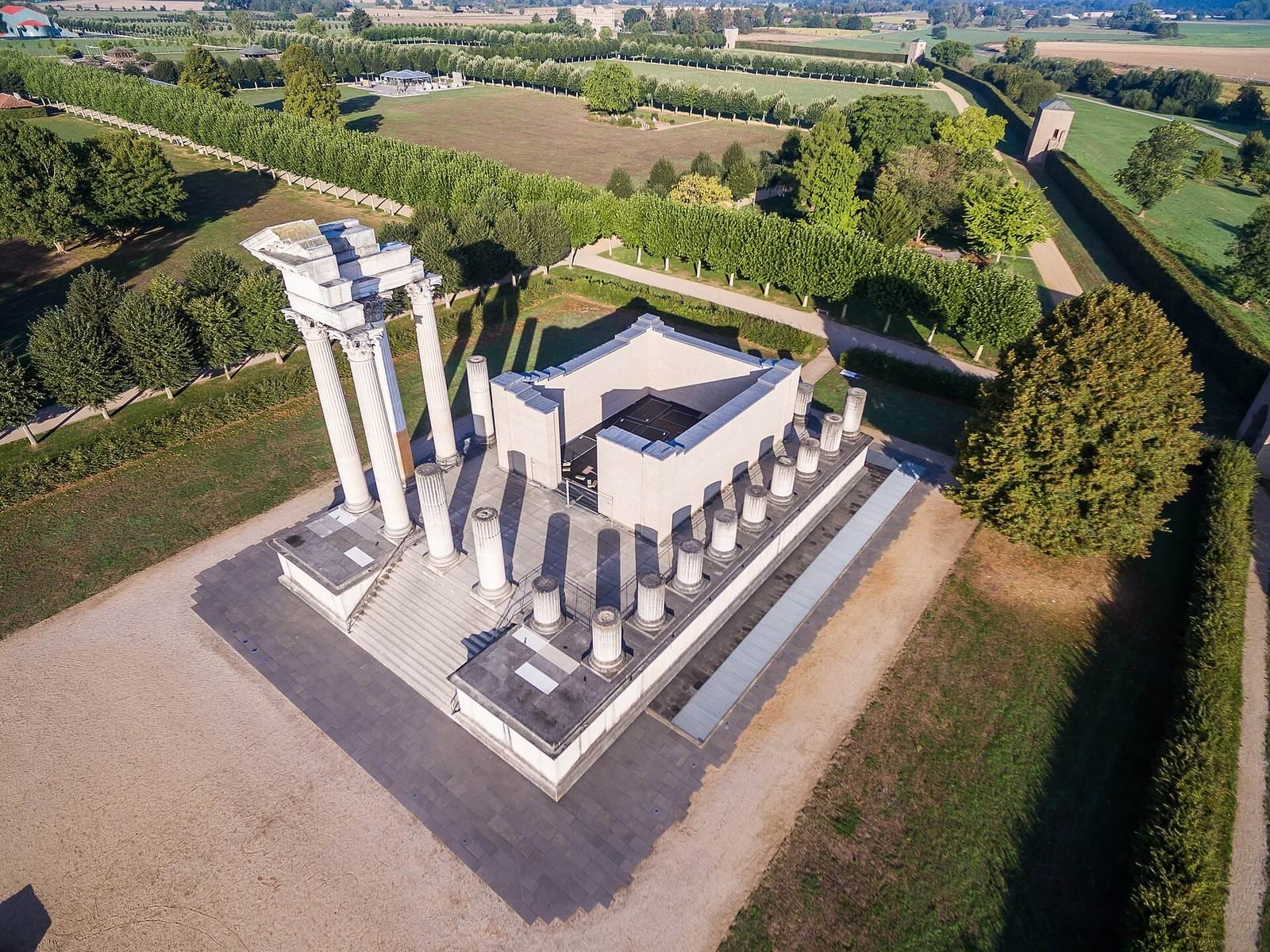
The harbor lay east of the city beside a now-silted former Rhine channel and extended toward the small harbor gate. The harbor itself remains unexcavated, and part of the channel is now occupied by a modern parking area. Near the harbor stood the Harbor Temple, a Corinthian-style building whose foundations have been excavated. Part of its superstructure has been reconstructed, creating the appearance of a rebuilt ruin, while the deity to whom it was dedicated remains unknown.
The temple colonnade had 28 white-limestone columns, each up to 18 meters high. Each column was assembled from drums weighing approximately five tonnes. Parts of the architrave and one capital retain colored decoration, including green foliage and areas of blue, red, and ochre. Excavated fragments allowed parts of the original design to be reconstructed.
Wells, cisterns, and sewers
The city obtained water from groundwater wells, rainwater-collection basins or cisterns, and an aqueduct. One conduit brought water from a spring approximately eight kilometers away. Part of it ran underground at a depth of about 70 centimeters, while the section nearer the city ran on aqueducts.
Wells were distributed throughout the city. Their cylindrical shafts were constructed from heavy oak planks and beams and averaged about seven meters in depth. Cisterns supplied another source of water and may have served communal rather than private needs. Gutters and downpipes carried water from roofs and covered sidewalks into the cisterns, which were commonly placed at street intersections. Their pink waterproof mortar included stone debris from roof fragments and lime.
Sewage from latrines, bath buildings, and workshops passed through underground channels. The earliest channels were made of wood, while later examples used stone. They generally ran beneath the centers of streets and eventually discharged into the Rhine channel.
Residential and commercial buildings
Strip houses and urban blocks
Most homes were narrow, elongated strip houses, a form common in the northwestern Roman provinces. Workshops and shops opened onto the street, while living quarters occupied the rear of the building or an upper floor. Wealthier houses could contain wall paintings, decorated floors, underfloor heating, sculptures, costly furniture, and fine tableware.
Harbor inn and small baths
The reconstructed inn near the harbor gate includes a bathhouse with cold, warm, and hot rooms. A large furnace and an underfloor heating system warmed the building. The reconstruction also represents a kitchen, dining room, residence, bedrooms, guest rooms, cafeteria, and larger quarters for servants accompanying merchants.
The Small Baths stood beside a taberna, a shop or commercial premises, and served travelers. Local residents could also bathe there for a small fee.
Craftspeople’s houses
Three reconstructed craftspeople’s houses opposite the inn were built traditionally from wood and clay. Their interiors are reconstructed to represent the homes and working environments of Roman artisans and to help convey the appearance of a Roman street.
Public buildings and bathing complex
Amphitheater
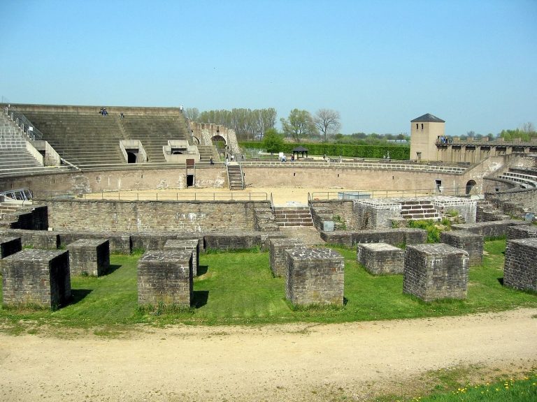
The amphitheater was probably built soon after the foundation of Colonia Ulpia Traiana and could accommodate approximately 10,000 spectators. The lowest three broad seating rows were reserved for prominent people, while other spectators sat directly on stone steps. The organizer watched from a special box. One quarter of the building has been reconstructed, with the work completed in 1981. Original foundation pillars remain behind it, although the original pillars were removed from the reconstructed structure after weathering left them too weak to support the seating.
Great Baths and museum building
The Great Baths formed one of the city’s largest building complexes. Their entrance hall, the basilica thermarum, measured approximately 70 by 22 meters. The term describes the monumental entrance hall of a Roman bath complex. The entrance hall now lies beneath the LVR-RömerMuseum, while an adjoining steel-and-glass protective building follows the dimensions of the ancient baths apart from that hall. It protects excavated bathing pools, fire installations, and heating channels from weathering.
The museum was designed above the original foundations of the entrance hall, allowing the Roman remains and excavated finds to be presented close to their archaeological location. Planned by Gatermann + Schossig in reference to the ancient structure, the building began construction in September 2005, reached its topping-out ceremony on 30 May 2006, and opened on 16 August 2008.
Collections and river transport
The LVR-RömerMuseum contains the permanent exhibition on the Roman city and displays original finds from Colonia Ulpia Traiana, its immediate surroundings, and the legionary camps Vetera I and Vetera II. Objects include a block-recovered hearth, the original remains of the Great Baths, and an original Roman ferry suspended in the museum.
Large Roman stone blocks displayed near the museum were removed from the city’s ruins and later returned to Colonia Ulpia Traiana. They illustrate both the scale of transporting stone to the Lower Rhine and the later extraction of building material from the abandoned Roman city. Six boats preserved in the park’s ship shelter and wood workshop represent vessels that used the Rhine, including cargo boats carrying goods from across the Roman Empire and military ships used to secure the frontier.