Aqueduct of Pont-de-Crau: Roman and Craponne Canal Waterworks near Arles


Site at a Glance
- Rating
- 4.9
- Popularity
- Very Low
- Country
- France
- Primary era
- Early Modern
- Eras represented
- Classical, Early Modern
- Civilizations
- French, Roman
- Site type
- Infrastructure
- Remains
- Aqueduct
On this page7 sections
History
The Aqueduct of Pont-de-Crau in Arles, France, comprises the remains of a Roman aqueduct built in the first century AD to supply Arelate, the Roman name for Arles. The system brought water from the Alpilles through northern and southern branches, which joined at Barbegal before continuing toward Pont-de-Crau. At the site, the aqueduct crossed the marshes toward the city, while its lower level also carried a route associated with the secondary Via Aurelia, an alternate road within the Roman network along the western Mediterranean coast.
The Roman water system
The northern branch approached through the area of present-day Fontvieille and measured about 50 kilometres, while the southern branch travelled about 15 kilometres through the area of Paradou. Their meeting at Barbegal, an ancient industrial site known for its Roman watermills, formed part of the water supply that reached Pont-de-Crau. The Roman structure there rose in two levels and carried water high over the surrounding hills and marshes on its way to Arelate.
Medieval destruction and early-modern reuse
After the fall of the Roman Empire, local building activity reused stone from the aqueduct. The structure was destroyed during the First Crusade in the eleventh century, leaving its foundations. In the sixteenth century, those foundations were incorporated into the Arles branch of the Craponne Canal, an early-modern waterway associated with the engineer Adam de Craponne.
After Craponne’s death, the Ravel brothers extended the canal westward from Salon-de-Provence through the Crau plain to Arles. The surviving Roman structure served the final approach from Pont-de-Crau, and the work over the ancient foundations was regarded as a major technical achievement. It cost 98,000 pounds.
The Craponne bridge-aqueduct
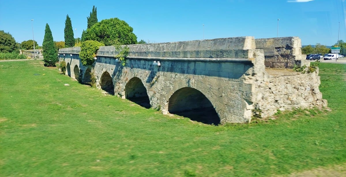
Built between 1585 and 1587, the sixteenth-century bridge-aqueduct carried the Craponne Canal across a marsh for 660 metres. This stone masonry structure used semicircular barrel arches and originally contained 93 spans. A flood of the Rhône severely damaged it. The architect Projet and the engineer Georges Vallon repaired the structure in 1757.
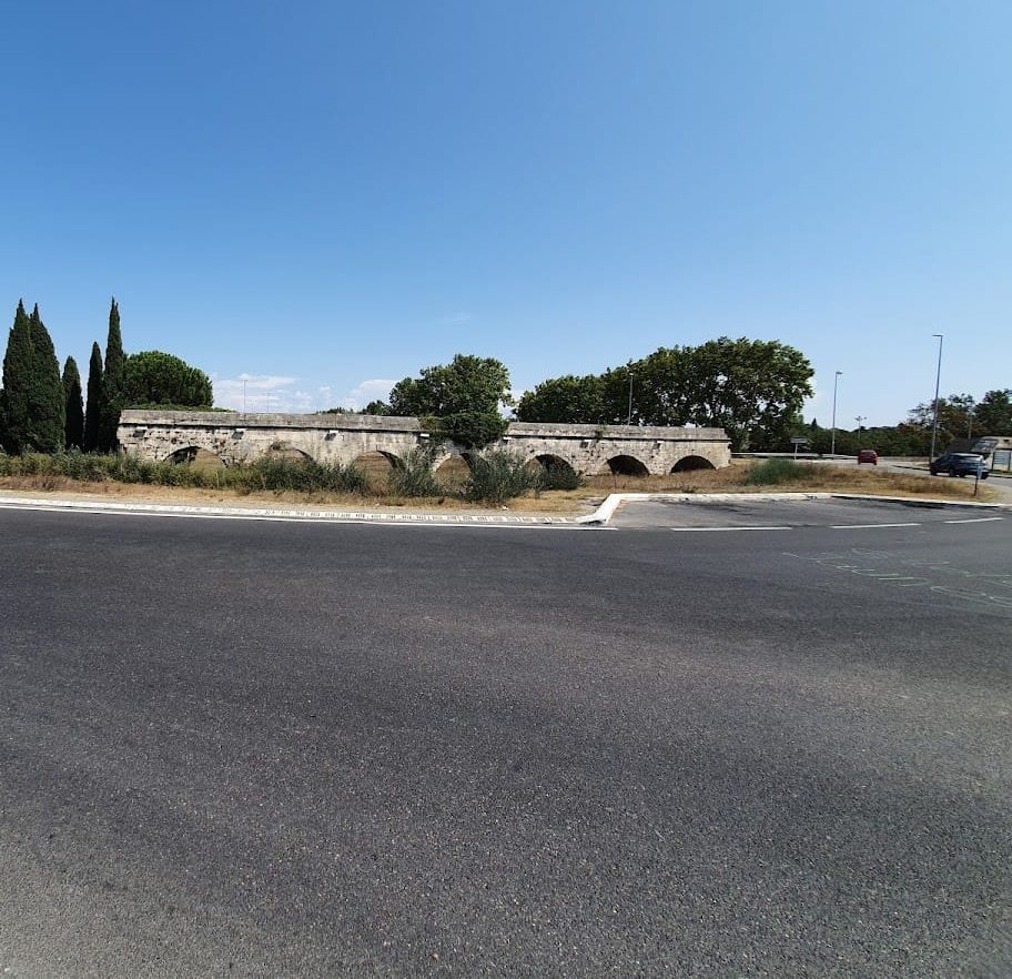
During the nineteenth century, the Craponne Canal was assigned to irrigation, while its terminal section was taken out of service. The aqueduct ruins were classified as a French historic monument in 1922. In 1990, sections of the bridge-aqueduct were demolished during construction of a roundabout. The surviving remains now extend along the roadside on either side of the roundabout at the intersection of the CD 453 and CD 570 roads.
Remains
Roman aqueduct
The Roman aqueduct was a two-level structure about 22 metres high. Its elevation allowed the water channel to pass over the hills surrounding Arles, while the first level also provided a road for travellers crossing the marshes. The Roman aqueduct was probably taller than the later bridge-aqueduct built for the Craponne Canal.
The wider Roman system reached the Pont-de-Crau area through two channels. The northern aqueduct was about 1.15 metres high and 0.90 metres wide, and the southern aqueduct was about 1 metre high and 0.80 metres wide. Both channels converged at Barbegal before the route continued toward the crossing at Pont-de-Crau.
Craponne Canal bridge-aqueduct
The later bridge-aqueduct was built of stone masonry and formed a long arcade of semicircular barrel arches. Its original length was 660 metres, with 93 spans carrying the canal across the marsh. The canal was laid over the surviving Roman foundations, reusing the earlier structure for the final approach to Arles.
Today, the surviving sixteenth-century remains are divided into three sections. A central section measuring 52 metres lies within the roundabout area, while two roadside sections extend for approximately 315 metres and 200 metres. Together, these fragments preserve the physical relationship between the Roman foundations and the later canal crossing.