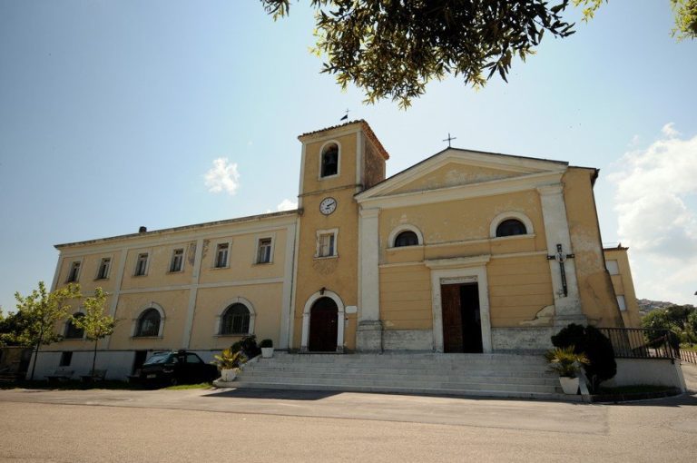
Larino: Ancient Larinum and Its Archaeological Remains in Italy

Site at a Glance
- Rating
- 4.1
- Popularity
- Low
- Country
- Italy
- Primary era
- Classical
- External website
- Open
- Eras represented
- Iron Age, Classical
- Civilizations
- Roman
- Site type
- City
On this page27 sections
History
Larino, ancient Larinum, is an archaeological settlement in Italy built by Frentanian and Roman communities, whose prosperity had reached a high point by the 3rd century BCE. Set about 400 metres above sea level in the hills of the hinterland, roughly 26 kilometres from the Adriatic coast, it overlooked the lower Biferno valley and occupied a strategic crossroads between the Adriatic, Samnium, Daunia, and Apulia.
The settlement benefited from fertile level land, a mild climate, water, clay, limestone, river stones, woodland, and seasonal livestock routes. The Frentani were an Italic population associated with the Adriatic-facing part of ancient Samnium, a central-southern Italian region linked especially with the Samnites. Their communities maintained connections with inland Samnium as well as Apulia, Campania, and the wider Adriatic world, making Larinum a frontier town where coastal and inland traditions met.
Origins and the Frentanian city
Activity in the surrounding territory began at least in the Final Bronze Age and Early Iron Age, while the first substantial evidence for settled communities at the city dates from the 5th century BCE. Earlier Neolithic agricultural settlements and later prehistoric activity are known from places including Monte Maulo, Montarone, and Guardiola. An ancient tradition preserved by Alberto Magliano attributed the foundation of the city around the 12th century BCE to Etruscans moving toward Apulia and gave its earliest name as Frenter. Another hypothesis connected the inhabitants with the Liburnians, while the origins of the Frentani and their relationship with the Samnites remained debated.
The city’s name appeared in several forms, including Alarino, Larina, Laurino, Arino, and Lauriano, before Larinum became the established Roman-period form. Its location along the route later known as the Traiana Frentana connected the Adriatic corridor between Ancona and Brindisi. Roads through the Biferno valley led toward Pentrian Samnium and Bovianum, while the Celano to Foggia sheep-track connected the area with northern Daunia and Luceria. River valleys and secondary roads added to this dense communications network.
Alliance with Rome and economic growth
Rome defeated the Frentani in 319 BCE, after which they obtained peace and an alliance in 304 BCE. Larinum probably then became a civitas foederata, a self-governing community allied to Rome by treaty. This relationship encouraged economic growth, urban development, and gradual Latinization while the city retained strong Osco-Latin cultural characteristics. By the early Hellenistic period, the community was recognized as the res publica Larinatium, with its own laws, magistrates, and administrative role.
Larinum began producing bronze coins after the middle of the 3rd century BCE, and its output expanded during the Second Punic War, the conflict between Rome and Carthage from 218 to 201 BCE. Early issues used Greek legends and Campanian designs; later coins employed the Oscan language in Latin script and imagery associated with Apulia and Campania. Their circulation was concentrated in Samnium and along the central and southern Adriatic coast.
The Second Punic War brought military operations into the territory around Larinum. In 217 BCE Hannibal established winter quarters at nearby Gerunium. Marcus Minucius Rufus fought him in the area and was rescued from defeat by Quintus Fabius Maximus. In 207 BCE the praetor Gaius Hostilius attacked Hannibal’s army near the city, and the consul Gaius Claudius Nero later passed through Larinum while marching against Hasdrubal.
Roman municipal development
In 91 BCE, during the Social War, the revolt of Rome’s Italian allies against the Roman state, the Larinates joined the Frentani and other Italic peoples. A Roman force commanded by the praetor Gaius Cosconius devastated their territory in 89 BCE. After the war, Larino entered the Roman municipal system. Under Julius Caesar it received a Roman colony while retaining municipal status. A municipium was a town incorporated into Rome’s administration while preserving local institutions to varying degrees, whereas a colony was a settlement established or reorganized under Roman authority.
The conflict and reorganization accelerated the decline of Samnite political, institutional, linguistic, and religious systems. Larino nevertheless became a wealthy and active Roman town, with markets, public festivals, games, commercial traffic, local political factions, and aristocratic families whose wealth came from commerce, pastoralism, and agriculture. In 66 BCE Cicero defended Aulus Cluentius Habitus of Larinum in Pro Cluentio. The case involving his prominent equestrian family reflects the city’s wealth, legal institutions, political divisions, and connections with Roman elites.
Under Augustus, the Biferno formed the boundary between Regio IV and Regio II, administrative districts of Roman Italy. Larinum lay east of the river in Regio II, which was associated with Daunia, but its official designation preserved its Frentanian identity. Ancient geographical writers therefore placed the city variously among the Frentani, in Daunia, or in Apulia.
Late antiquity and abandonment
The ancient settlement remained inhabited into the 4th century CE. About 6,000 bronze coins found at Lagoluppoli and surviving mosaics indicate continued activity, while an earthquake in 346 CE damaged the city. Public buildings were subsequently restored. An inscription from Larino records Autonius Iustinianus, the first governor of the newly established province of Samnium. Larinum also continued to appear in 4th-century itineraries, including the Antonine Itinerary and the Peutinger Table, and it was a bishop’s seat by the 7th century.
During the early medieval period, the ancient settlement declined as its buildings were systematically stripped for stone and brick. Saracen attacks reportedly destroyed the settlement in 842. The inhabitants then founded the modern town of Larino less than two kilometres to the west, leaving the ancient site known as Larino Vecchio. The abandoned amphitheater was reused occasionally for burials and temporary shelters, while a lime kiln operated in the ramp of its eastern entrance until the beginning of the 8th century. Modest dwellings were also built among the ruins with salvaged materials.
Archaeology and conservation
Surface collecting began in 1876, and archaeological investigations at Larino began in 1977. From 1974, the Biferno Valley Survey led by Graeme Barker and the University of Sheffield identified about 120 ancient settlements dating from the Neolithic to the 1st century BCE, around 60 percent of them in the lower Biferno valley. Building expansion after the Second World War covered much of the ancient settlement, especially at Piana San Leonardo, limiting excavation largely to vacant plots. Protection around the amphitheater began in the 1960s, while municipal and regional authorities later preserved undeveloped areas and supported excavation, consolidation, restoration, and conservation.
Remains
The ancient city occupied a broad area whose exact limits remain uncertain. Its probable bird-wing shape was conditioned by sloping ground and older roads. The amphitheater formed the apex, while two urban arms extended toward Montarone and Torre Sant’Anna. Another route ran inland toward Casacalenda, where the Roman necropolis stood. Excavated areas reveal streets, residential and craft quarters, public buildings, sacred spaces, cemeteries, baths, and mosaics dating from the Archaic period through the Roman imperial era.
Piana San Leonardo and the sacred area
Urban layers and streets
Piana San Leonardo preserves a sequence from the Archaic period through late Hellenistic and Roman phases. The earliest excavated structures date from the late 5th to the first half of the 4th century BCE and include cobbled surfaces and perimeter walls. Late 4th and early 3rd-century BCE buildings were later placed above them, using irregular stones, tile courses, and cement mortar in dry-stone walls. Other remains include cobbled and paved streets, public paving, and residential and craft quarters.
Via Jovine sanctuary
A sacred area along Via Jovine developed between the late 3rd and early 2nd century BCE. Large quantities of votive objects indicate a sanctuary probably dedicated to Aphrodite, the Greek goddess associated with love, beauty, and fertility. The complex included a substantial building represented by squared tuff blocks and a limestone-block structure interpreted as part of the temple.
A rectangular hall with a lattice-pattern mosaic floor was added beside the probable temple around the 2nd century BCE. The adjacent area contained discarded votive material and deposits linked with special sacrifices, including pyramidal pebble piles mixed with charcoal, clay figurines, and votive figurines. Ceramic objects, terracotta and bronze figures, and many coins were recovered. A hoard of 22 coins had been concealed in an earthenware jar around the middle of the 2nd century BCE. Mold-made terracotta figures, usually hollow and more carefully finished on their fronts, are dominated by draped female figures in an Attic-inspired Hellenistic style.
Burial grounds and prehistoric finds
Monte Arcano necropolis
The Archaic necropolis on the southern slopes of Monte Arcano, about two kilometres northwest of Piana San Leonardo, dates from the 6th century BCE. Its rectangular inhumation graves were covered by mounds of limestone chips. Grave groups commonly included large storage jars, bucchero, a dark fine pottery made in pre-Roman Italy, coarse wares, and vessels imitating Daunian forms.
Burials in the wider lower Molise region generally placed the dead on their backs in pits cut into clay and filled with limestone fragments. Female graves contained fibulae, necklaces, beads, pendants, and rings. Male graves included iron knives, razors, spearheads, and occasionally bronze helmets of Picenian or Apulo-Corinthian type.
Prehistoric material
The territory around Larino has also produced prehistoric material, including eight knives from the Larino area. These objects are divided between the Luigi Pigorini National Prehistoric Ethnographic Museum in Rome and the Anthropological Museum of the University of Naples Federico II.
Torre Sant’Anna and the forum
Hellenistic domus
At Torre Sant’Anna, a refined private house, or domus, of approximately the 3rd to 2nd century BCE survives partly through its atrium and surrounding rooms. The atrium floor used halved polychrome pebbles. Its large impluvium, a shallow basin that collected rainwater beneath an opening in the roof, contained a mosaic with a naturalistic octopus at the centre and four groupers at the corners, framed by vines and clusters of grapes.
Forum complex
The house was later replaced by a monumental public complex that included the forum. Its principal quadrangular structure used opus mixtum, a Roman wall technique combining net-like reticulated masonry with brickwork. Exedrae, recessed architectural spaces, opened from the complex toward an interior portico, and three rooms on the forum-facing side opened onto porticoes. Construction took place between the second half of the 2nd century and the first half of the 1st century BCE. The complex underwent extensive renovation after the earthquake of 346 CE, before its abandoned buildings were stripped for reusable materials and modest shelters were built among the ruins.
Possible temple of Mars
Behind the forum complex, an east-facing building survives in substantial brick wall sections. It may have had marble interior surfaces and mosaic floors and is interpreted as a possible temple of Mars, the Roman god of war. This identification is linked with Cicero’s reference to the Martiales, public slaves assigned to Mars’s worship at Larino.
Residential, craft, and leisure buildings
Urban road and workshops
An excavated sector between the municipal kindergarten and the Civil Court contains a paved road with sidewalks. Residential buildings stood on one side, while craft buildings occupied the other. The houses preserve mosaic and opus signinum floors, a waterproof reddish mortar made with crushed ceramic material. The craft area includes tanks, similar floors, and channels for runoff.
Amphitheater
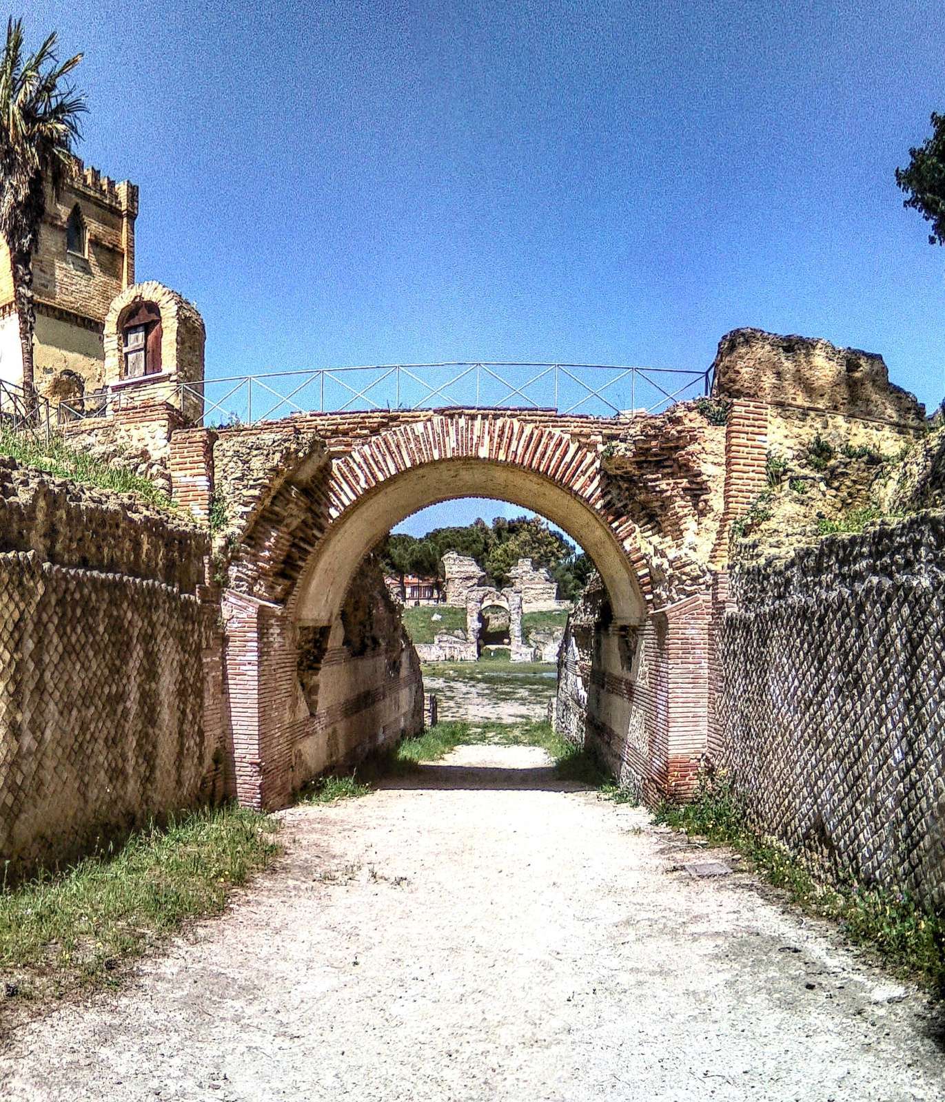
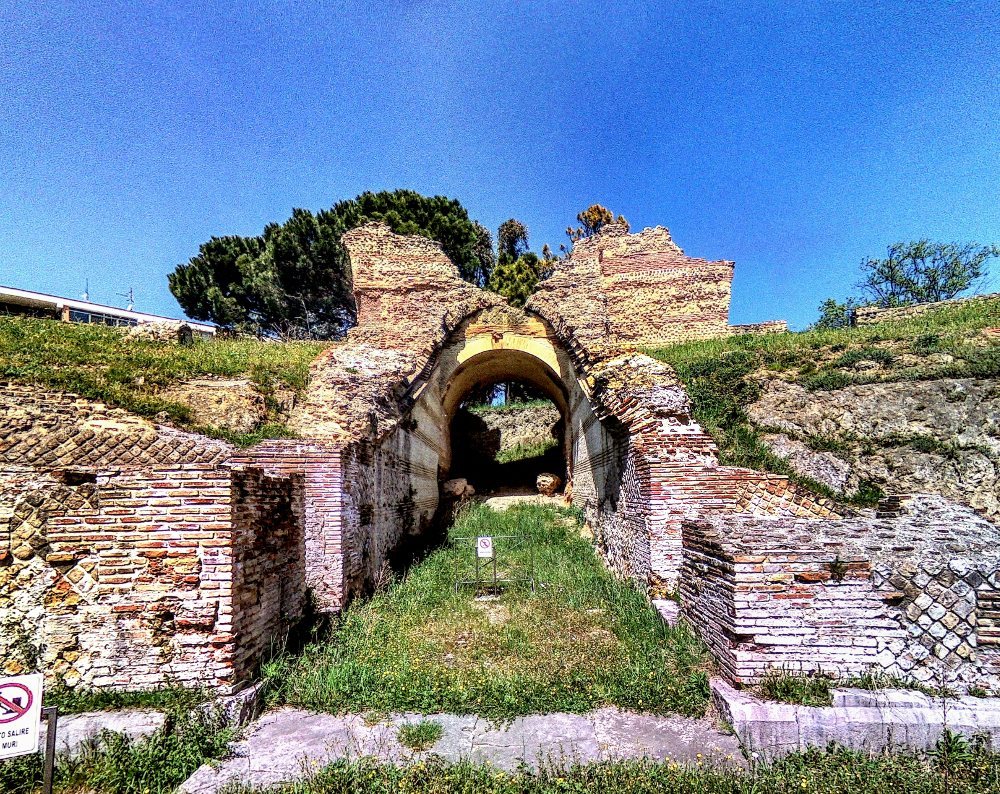
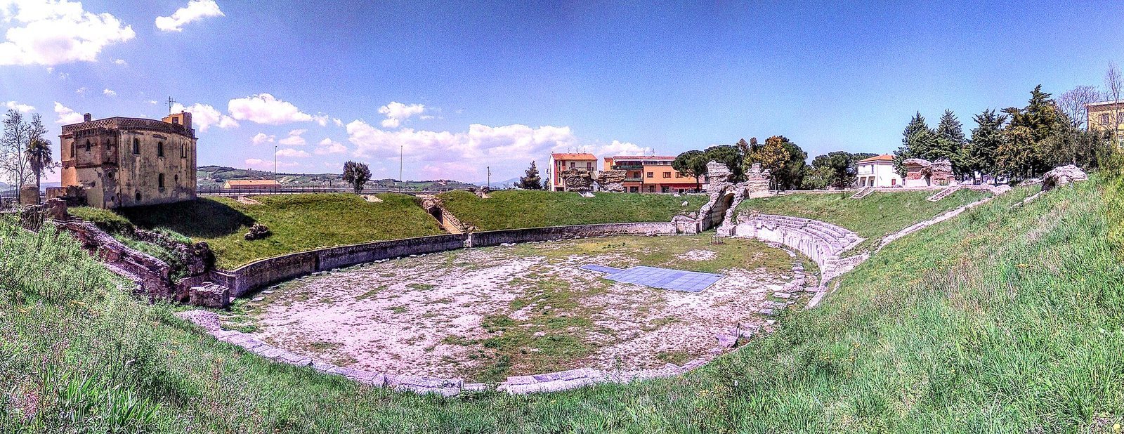
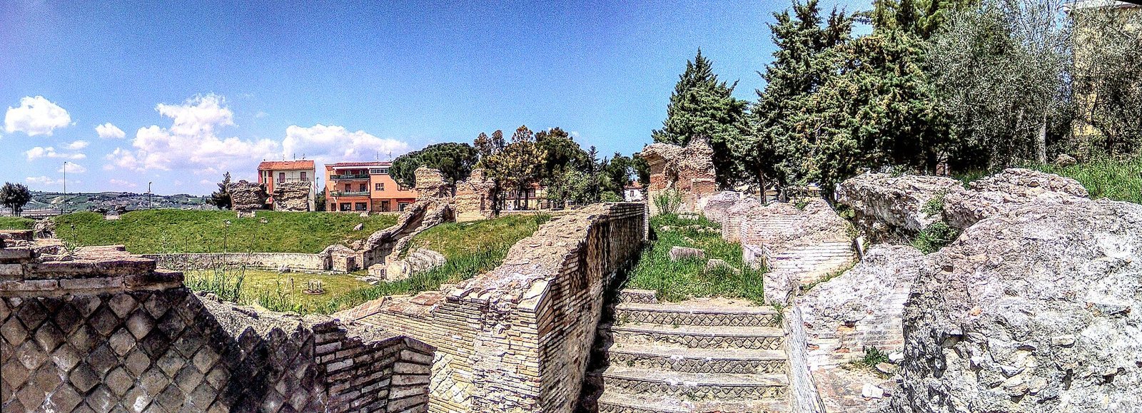
The Roman amphitheater is the most prominent surviving ancient monument at Larino and has long served as the city’s symbol. Parts of its ruins remained above ground, although later urbanization around the railway and state road affected the area. Brick components were removed during the early medieval period, and the eastern entrance ramp was later occupied by a lime kiln. The structure was also used occasionally for burials and temporary shelters.
Baths
The baths near the amphitheater contain polychrome mosaics showing fantastic animals, marine creatures, and geometric designs. The excavated complex includes rooms for hot, warm, and cold bathing, a praefurnium, or furnace installation, a room with suspensurae, the supports that raised floors above heated air, a large column or pier from the porticoes, and a substantial drainage sewer covered by tiles arranged in a pitched form.
The baths retain their hypocaust, an underfloor heating system in which furnace-heated air circulated beneath raised floors. Underground furnace spaces and service rooms survive, and the excavated remains are protected by a covering structure.
Mosaic floors
At least eight tessellated mosaics from Larino survive, dating from the 2nd century BCE to the 3rd century CE, with four using polychrome designs. Together they show the technical quality of mosaic production during the Imperial period and suggest the presence of both established and itinerant workshops.
Lion and Birds mosaics
The Lion Mosaic and Birds Mosaic were found in 1937 in a 3rd-century CE domus on Julius Caesar Avenue near the amphitheater. Part of the house’s walls survives with limestone-block reticulated facing. The two floors lay beside one another, separated by a single wall, and were detached, restored, and transferred to museum display in 1949.
The Lion Mosaic measures about 6.02 by 5.30 metres and is generally well preserved. Its central panel shows a roaring lion moving from the left while looking back, set against a white field with palm motifs. Plant decoration, stylized ivy, a four-strand braid on a black ground, and a broad white band with ivy tendrils form the borders. The Birds Mosaic measures about 5.07 by 5.30 metres and is more incomplete. Its central field contains different birds perched on vine shoots and turned inward, surrounded by ivy tendrils, ogival motifs, and polychrome braided borders on black.
Lupercal Mosaic
Discovered in 1941 near the railway station and the Agricultural Technical Institute, the Lupercal Mosaic measures about 6.08 by 7.17 metres and dates from the 3rd century CE. It shows the she-wolf nursing the twins Romulus and Remus in a cave, with two shepherds watching from a hill. The elaborate border contains acanthus sprays and spirals, six hunters carrying bows and javelins, and wild animals including felines, antelopes, and deer. The mosaic is in excellent condition.
Octopus Mosaic
The Octopus Mosaic belonged to the impluvium of the Hellenistic house at Torre Sant’Anna. Measuring about 2.72 by 4.60 metres, it depicts an octopus with eight tentacles, four groupers, and a schematic border of vines and grapes. First exposed in 1912 and again in 1949, it was detached and restored in 1981, then returned to its original position in 1985 beneath a protective metal structure.
Dolphins and apsidal mosaics
The Dolphins Mosaic was found in 1971 on Titus Livius Street near the municipal stadium. It measures about 6.70 by 4.90 metres and was uncovered in 1985, detached, restored, and mounted on movable fiberglass panels. Its design includes left-running waves, meandering swastikas, and figurative panels containing a skyphos, a Greek-style drinking cup, an aryballos, a small vessel for oils or perfumes, and dolphins. A large loss affects the entire right half.
An apsidal mosaic discovered at Torre Sant’Anna in 1973 measures about 5.10 by 7 metres. Its square central field contains geometric motifs, quatrefoils, and lotus flowers within three concentric frames and an apsidal lunette. It was uncovered in 1981, detached, restored, mounted on fiberglass panels, and returned to the site on a concrete base.
Kantharos and opus signinum mosaics
The Kantharos Mosaic was discovered in 1984 on Morrone Street beside the Palace of Justice during construction of a municipal kindergarten. It measures about 1.45 by 2.25 metres and was badly damaged during earthworks. Its geometric design uses octagons and lozenges, and it remains in poor condition. The excavation also revealed Archaic pit graves cut into tuff and later Hellenistic-Roman settlement structures.
The opus signinum Mosaic was found during excavations on Via F. Jovine in Piana San Leonardo in 1977 and 1978. Dating from the 2nd century BCE, it formed the floor of a large Hellenistic building in the sacred area, of which squared sandstone blocks survive. Its red surface contains a central lattice of lozenges and an outer band of squares alternating with swastikas. It was detached and restored in 1983, mounted on fiberglass panels, and placed in archaeological storage facilities.
Structures discovered within the modern urban area have generally undergone consolidation and restoration. Mosaic floors were placed on supports allowing removal when necessary, while preservation in their original settings was generally preferred. Protective measures have helped slow deterioration while retaining the relationship between the mosaics and the architectural remains around them.