Sanctuary of Hercules Victor: A Republican Roman Religious and Commercial Complex at Tivoli


Site at a Glance
- Rating
- 3.9
- Popularity
- Low
- Country
- Italy
- Primary era
- Classical
- External website
- Open
- Eras represented
- Classical, Medieval, Early Modern, Modern
- Civilizations
- Italian, Ostrogothic, Papal States, Roman
- Site type
- Religious
- Remains
- Sanctuary
On this page13 sections
History
The Sanctuary of Hercules Victor is a Republican Roman religious and commercial complex in Tivoli, Italy, built between the final decades of the second century BC and 82 BC in the Hellenistic sanctuary tradition. It was the largest Italic sanctuary dedicated to Hercules and one of the largest complexes of Republican Roman architecture. In the Mediterranean, it was considered second in size only to the sanctuary at Gades in Spain.
Earlier worship and Republican construction
Hercules had been worshipped at Tibur from an early period. The city associated him with military victory, especially the victory over the Aequi traditionally connected with the titles Hercules Victor and Hercules Invictus. He was also linked with commerce, the seasonal movement of livestock, land reclamation, water management, and the quarrying of travertine, an association expressed by the title Hercules Saxanus.
Tibur occupied a strategic position where the Aniene valley opened toward the Roman Campagna. Routes through this area connected the Apennine uplands with central Italian commerce and livestock movement, and later helped supply Republican and imperial Rome. The sanctuary developed in relation to these routes as both a sacred destination and a place where economic activity could take place.
Earlier remains include paved roads, basalt building elements, and more than 40 metres of aligned travertine blocks dating at least from the fourth century BC. Their original purpose is uncertain. They may have belonged to earlier temples or shrines of Hercules, or to buildings serving other functions. A proposed sanctuary near Acquoria, at a crossing of the Aniene, is regarded with considerable skepticism. That earlier place, probably dating from at least the seventh century BC, may instead have been dedicated to an unidentified water deity.
The monumental sanctuary was developed in at least two construction phases. The first project was probably conceived by the fourth decade of the second century BC, but widespread structural failure interrupted it. A substantially different design was then adopted, producing the large terraced complex known from its surviving remains. The second phase incorporated part of the clivus Tiburtinus, the final section of the Via Tiburtina, into a covered passage called the via tecta.
The road had been public rather than sanctuary property. An inscription records that two quattuorviri, magistrates serving as a college of four, commissioned its covering by decision of the civic senate. The work and the northern substructures were complete before 89 BC. Tibur became a Roman municipium, a community incorporated into the Roman state while retaining elements of local administration, in 87 BC after the Social War. It had previously been an independent city and then a civitas foederata, a city allied to Rome by treaty.
The road’s passage through the sanctuary may have accompanied a change in the way payments were collected. Tolls formerly gathered at bridges over the Aniene may have been replaced by offerings and payments framed within the religious complex, although the later existence of a direct toll on the via tecta remains a proposal. Transactions at the sanctuary were traditionally subject to a tithe paid in money or goods, including ten percent of livestock.
Religious, commercial, and civic centre
The sanctuary functioned as a religious, commercial, financial, residential, educational, and organizational centre. It received votive offerings, accommodated pilgrims and merchants, supplied lodging and food, and provided banking and lending services. Its rooms included areas for storage, trade, dining, meetings, schooling, workshops, and the activities of religious and professional associations.
Administration was carried out autonomously by a college of Magistrates Herculanei. The complex also housed an important college of musicians, the tibicines. Roman tradition held that musicians from Rome who protested restrictions on their profession took refuge at Tibur with the local musicians’ college. Hercules was also associated with a college of Salii, priests whose rituals included dances with three successive stamps of the foot. Religious songs and dances were celebrated on the Ides of August.
During the Augustan period, the complex received further work, especially around the theatre. Augustus, the first Roman emperor, who ruled from 27 BC to AD 14, is said by Suetonius to have administered justice beneath the sanctuary’s porticoes on numerous occasions. The sanctuary’s wealth formed part of the public treasury, and Octavian used its funds to equip the army for the battle of Philippi.
Prosperity continued during the imperial period through landholding, trade, lending, and donations from merchants, senators, proconsuls, and generals. Commercial activity included the oil trade with Delos. Under Hadrian, emperor from AD 117 to 138, the sanctuary probably reached its greatest wealth and prestige. Its estates extended along the Via Tiburtina from Vicovaro to Ponte Lucano, with land reaching roughly one kilometre on either side.
Decline, fortification, and changing religious memory
Activity declined between the Edict of Milan in 313, which permitted Christianity within the Roman Empire, and the Edict of Thessalonica in 380, which established Nicene Christianity as the empire’s official faith. Organized attacks on pagan temples in the Aniene valley caused damage, and Theodosian legislation of 391 and 392 ended the sanctuary’s religious activities. Civic authorities continued some social and recreational uses, while the removal of valuable materials probably began by the fifth century. Statues were concealed away from their original positions, including in the theatre’s curtain pit.
During the Gothic War of 535 to 553, a conflict between the Eastern Roman Empire and the Ostrogoths, the sanctuary became a fortified base and headquarters for operations against Rome. The Eastern Roman general Belisarius placed 500 Isaurian troops there under Magnus and Sintue. Totila, the Ostrogothic king, later occupied the fortress, probably after the Isaurians’ betrayal. He cut into the eastern rock support to strengthen the position and transferred the imperial treasury there, seriously damaging the complex.
New Christian traditions in the sixth and seventh centuries associated the area with Saint Symphorosa and her seven sons. A hagiographic account placed their martyrdom on the sanctuary’s open sacred area and their burial elsewhere within the wider sacred zone. The cult contributed to the loss of the site’s older identity as a sanctuary of Hercules. The area later became known as Votàni and Porta Scura.
Medieval reuse and early-modern occupation
From the medieval period, the sanctuary’s sacred enclosure, or temenos, was used as a vineyard. Benedictines and, from 1229, Franciscans occupied parts of the ruins. The Franciscans adapted rooms on the fourth level for the church of Santa Maria del Passo and its convent. Poor structural conditions, the noise of water, and the nearby road led to a request for relocation in 1240.
Clar nuns occupied other parts of the ruins, probably including the transformed temple area, until their transfer in 1477. In the fifteenth century, the Theobaldi family occupied two floors of the northern wing, inserting walls and creating a villa and an Italian-style garden. From the sixteenth century until almost the middle of the nineteenth century, the ruins were mistakenly identified first as the Villa of Augustus and later as the Villa of Maecenas.
In 1549, Ignatius of Loyola, founder of the Society of Jesus, received use of part of the complex from the Jesuit Luis de Mendoza. He established a free public school there, described as the first of its kind in continental Europe. The school operated until 1552 and enrolled as many as 92 pupils, most of them children of farmers, before Ignatius transferred it to the city centre.
Industrial transformation and archaeological recovery
From the late sixteenth century, the sanctuary became an industrial centre because of its strong structures, position near the road, and abundant water. The Forma and Brizio aqueducts supplied the installations, with later additions from drainage associated with Villa d’Este. Their water powered a foundry and a firearms factory established under Clement VIII and formally contracted under Paul V in 1608. Nail and screw factories, paper mills, and hydroelectric plants followed.
The Nerli-Giustiniani powder mill was moved downstream in the late seventeenth century after repeated explosions at its former location. Water discharged from the foundries helped create the Cascatelle di Mecenate, a feature frequently depicted by Grand Tour painters. In 1884, the Societa per le Forze Idrauliche per l’Industria e l’Agricoltura acquired the northern slope of Tivoli and the sanctuary complex. Engineer Raffaele Canevari directed the water into the Canevari channel and then to the Acquoria Mecenate 1 power station.
In 1892, alternating current from the plant was transmitted to Rome, in the Porta Pia district, in what was described as the first long-distance transmission of alternating current used to illuminate a city. The Tivoli paper mills, also called the Mecenate or Segre mills, continued operating within the sanctuary until the 1960s. The Acquoria Mecenate 2 power station replaced the first plant in 1902 and was later supplied by both the Canevari channel and an underground channel from the San Giovanni reservoir.
In 1962, the archaeologist Domenico Faccenna helped prevent development in the southern Votàni area, which then became state property. Enel abandoned its claims to the sanctuary in 1993, and the Canevari channel was sealed, leaving the area available to heritage authorities. Archaeological and restoration work in 2008 and 2009, particularly in the theatre, exposed parts of the original structures. Restoration was completed in June 2011. Since September 2016, the sanctuary has been administered within the autonomous Villa Adriana and Villa d’Este Institute, known as VILLAE. In 2022, the former Segre paper mill area hosted the Second General Conference on Industrial Heritage organized by AIPAI, the Italian Association for Industrial Archaeological Heritage.
Remains
The complex occupies a rectangular plan measuring approximately 188 by 144 metres. Its northern section, facing the Aniene, rose through five levels, while the levels descended toward the northwest and southeast to two levels resting against limestone bedrock. The sanctuary platform was formed partly by moving soil from the southern side toward the north. The underlying material consists largely of an irregular local form of fluvial calcium carbonate. Differences in the strength of the bedrock and artificial fill shaped the contrasting survival and collapse of the structures.
Covered road and terraced substructures
The via tecta crosses the complex diagonally from northeast to southwest on the third level. Rooms opening toward the northern slope grow progressively larger along the passage. Slightly more than half of the covered road and its adjoining rooms survives, with substantial collapses in the northwest and southeast sections.
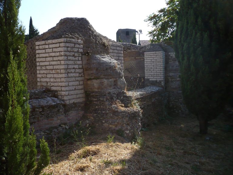
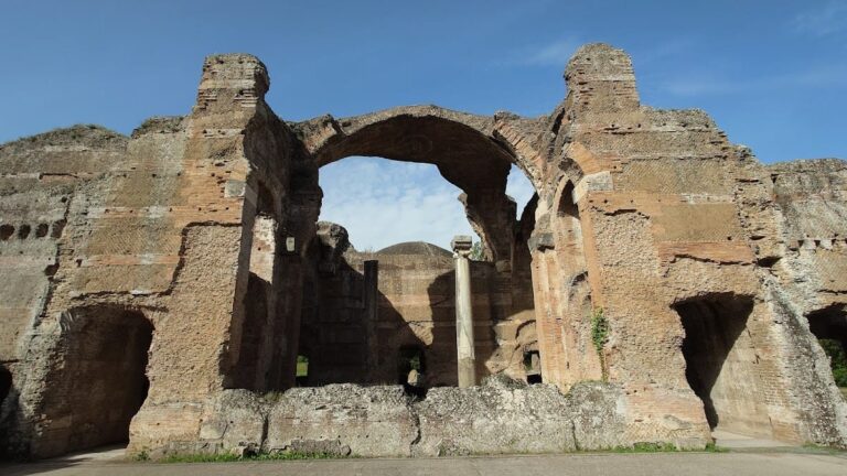
Behind the porticoes, rooms on the third, fourth, and fifth levels opened toward the northern side through large windows. Internal stairs connected them with the via tecta and its adjoining spaces. Built in Roman concrete, they contain sophisticated vaults and relieving arches that allowed upper walls to project beyond lower structures. On the road side, enormous travertine voussoir arches carried the load, and two remain in excellent condition. The rooms served as stores, stables, trading areas, inns, lodgings, banks, dining rooms, guest accommodation, schools, meeting rooms, shops, and workshops for votive objects.
Shops along the southern side of the via tecta belong to the first construction phase. They originally opened onto the uncovered road before its enclosure. Their segmental arches and barrel vaults are simpler than the concrete vaults of the second-phase rooms opposite them. A rail and the present floor level belong to the later industrial period.
Upper sacred terrace
Temple podium and staircase
The upper sacred terrace, or temenos, occupied the fourth level. The temple stood centrally toward the rear, with its front facing west toward Rome. The fourth side of the terrace opened toward the Roman Campagna. The temple podium was hollow, with blind chambers enclosed by strong walls and filled with earth. Two chambers beneath the rear of the cella remained open and may have served as an oracle room, a favissa, or a storage chamber for votive offerings. One of them had access by stairway.
The podium was 6.50 metres high and was externally faced with moulded travertine, part of which survives on the south side. A two-flight staircase connected the terrace with the temple. Projecting structures on either side contained monumental fountains. After the original staircase collapsed, supporting arches carried a longer and less steep replacement. The rear fountain was blocked and converted into a settling basin, while the front fountain continued to function and retained small statue bases at water level.
Temple and porticoes
The temple was an octastyle peripteral building, meaning that eight columns marked its front and columns surrounded its sides, without a rear colonnade. Its pronaos, or entrance porch, had three rows of columns, and its cella had two orders of columns. The building itself rose approximately 18.50 metres. Its gabled roof was painted yellow, and the complete structure reached about 25 metres, making it visible from Rome.
Two porticoes enclosed the temenos on three sides. The lower portico stood on the fourth level and opened directly onto the sacred terrace. Arches separated by concrete half-columns faced in opus incertum, a covering of irregular stone pieces, supported its barrel-vaulted roof. About half of the eastern section and about half of the northern side survive.
The upper portico occupied the fifth level, slightly behind the lower one. Its arches were nearly twice as large and opened onto a broad terrace with a balustrade and screens. Along with a walkway around the top of the temple podium, it formed a circuit of approximately 550 metres. The roof was gabled and lacked trusses, relying instead on large longitudinal beams resting on concrete spine columns. These columns were at least 9 metres high and about 90 centimetres in diameter. They were fluted in stucco and painted grey, with yellow bases and capitals. Honorary bases and statues of citizens, emperors, and sanctuary magistrates stood before the arched openings. A capital and column base from the upper portico are preserved in the Antiquarium, while another column base remains buried.
Theatre and archaeological finds
The theatre was inserted into the front terraces during the second construction phase. Its unusually steep profile led some archaeologists to propose that it was a semicircular staircase for distributing pilgrims across the temenos, rather than a theatre. Three vomitoria, entrance and exit passages for spectators, together with a stage, a curtain pit, and two audience entrances establish its theatrical function. Its steep slope resulted from the need to connect the surviving stage level with the level of the sacred terrace and temple podium.
The semicircular enclosure has a wall faced in opus reticulatum, a regular net-patterned covering of small masonry blocks, made here from limestone. This unusual material may reflect the supply of travertine created by demolishing structures from the first construction phase. The theatre’s curtain pit also formed one of the places where statues were concealed after the sanctuary’s ancient religious use declined.
The upper portico area produced the statue known as the General of Tivoli, now in the National Roman Museum at Palazzo Massimo in Rome. It represents a Roman military officer in heroic nudity, accompanied by a cloak and cuirass placed beside him. The individual is unknown. The proposal that the figure represents the Augustan general Lucius Munatius Plancus remains an interpretation rather than an established identification.
Water systems and industrial remains
The sanctuary’s ancient water infrastructure included the Forma aqueduct, excavated in the second century BC specifically for the construction and operation of the complex, and the Brizio aqueduct. Later channels carried water from Villa d’Este and the San Giovanni reservoir through the industrial installations. These systems connected the ancient sanctuary’s hydraulic needs with the later foundries, paper mills, and power stations.
The Torretta Canevari and its modern retaining wall date from the late 1880s. They replaced the fifteenth-century Torre Teobalda while retaining its general outline. The Canevari channel ran along the wall and carried water into a forced conduit within the tower toward the Acquoria Mecenate 1 power station. The former paper mill and hydroelectric installations remain part of the site’s industrial-archaeology landscape. A large water tank installed on the temple podium erased the remaining surface traces of the temple in that area.
Much of the temple podium’s travertine facing was removed and burned in two large lime kilns near its western end. The kilns probably operated during the twelfth and thirteenth centuries, when churches in the surrounding area were being built. Their presence, together with the medieval, early-modern, and industrial alterations, gives the surviving sanctuary a physical history that extends well beyond its Republican Roman foundation.