Roman Aqueduct of Metz: Water Supply for Divodurum
Site at a Glance
- Rating
- 4.4
- Popularity
- Low
- Country
- France
- Primary era
- Classical
- External website
- Open
- Eras represented
- Classical
- Civilizations
- Roman
- Site type
- Infrastructure
- Remains
- Aqueduct
On this page9 sections
History
The Roman Aqueduct of Metz is a Roman water-supply system in France, constructed around the beginning of the second century AD to serve Divodurum, the Roman city of Metz. Divodurum was the capital of the Mediomatrici, an ancient people whose territory centered on the region around the city, and stood where the Roman routes from Lyon to Trier and from Reims to Strasbourg met. With a population of about 20,000 in the second century AD, the city needed spring water for fountains, three public baths, latrines, and artisan workshops.
Water supply for Divodurum
The aqueduct carried water from the Bouillons spring near Gorze toward Metz. Its supply was supplemented by runoff from Mount Saint-Belin and by water from a stream near Ars-sur-Moselle. Divodurum also had other aqueducts, while the Carmel baths appear to have been one of the principal destinations for this system’s water.
The route extended through Gorze, Novéant-sur-Moselle, Ancy-sur-Moselle, Ars-sur-Moselle, Jouy-aux-Arches, Montigny, and Metz. From Jouy-aux-Arches, the conduit followed the Moselle briefly before crossing the present Frescaty airfield. Near Augny station it reached the D5, which follows the former Roman road from Metz to Toul, and then entered Metz at Montigny. It continued toward the Seille near the amphitheater, although its route beyond that point remains uncertain.
Protection and modern recognition
The aqueduct’s surviving route and structures were included in the first national list of French historic monuments in 1840. The classification was extended in 1980 and 1990, recognizing remains distributed across the communities along its course.
Remains
The aqueduct covered about 22 km between the Bouillons spring, at an elevation of 208 m near Gorze, and Divodurum, at 184 m. Approximately 12.7 km consisted of underground conduit, followed by an elevated bridge of about 1.1 km between Ars-sur-Moselle and Jouy-aux-Arches, and another 8 km of underground conduit. The system combined covered channels, settling and receiving basins, and a twin-channel bridge crossing the broad meander of the Moselle valley.
Underground conduit
The underground section from Gorze to Ars-sur-Moselle ran through the Gorzia stream valley, passing through or near Sainte-Catherine and Novéant-sur-Moselle before turning toward Ars near Ancy-sur-Moselle. A visible underground section survives between Gorze and Novéant-sur-Moselle. The conduit was about 1.20 m wide and 1.80 m high, with a semicircular vaulted roof, a paved floor, and two brick walls covered with waterproofing mortar. Regularly spaced inspection openings provided access for maintenance.
Local bricks were molded, air-dried, and fired in kilns for the channel walls. Locally produced lime was mixed with rubble and crushed brick to make the mortar, while the waterproof coating used fat lime combined with crushed brick. The channel’s roof protected the water from weather and frost. A gradient of about 4 m over the bridge’s 1.1 km helped limit winter freezing and sand deposits, although it increased wear on the lining.
Ars-sur-Moselle structures
Settling reservoir
At Ars-sur-Moselle, the underground conduit emptied into a rectangular settling reservoir built against the hillside. Its convex wall resisted pressure from the surrounding ground. A central square basin, measuring 4.4 m by 3.2 m and 1.3 m high, received the water and allowed suspended sand and other sediment to settle before the flow passed through a small drop and turned 90 degrees into the bridge’s two conduits.
The reservoir also received stream water and regulated the supply by sending excess flow toward the village through an overflow channel. Each conduit at the bridge entrance had a bottom valve, sometimes called a guillotine valve, which allowed the outlet flow to be controlled independently of the incoming water. A cut-stone vault and tiled roof covered the reservoir. Sculptures and paintings found there indicate a dedication to water deities.
Moselle aqueduct bridge
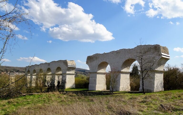
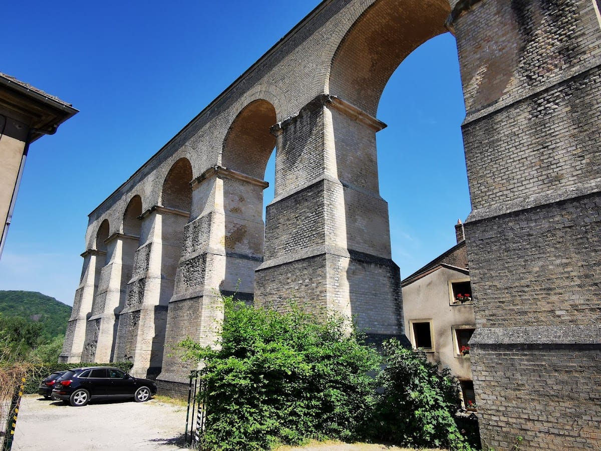
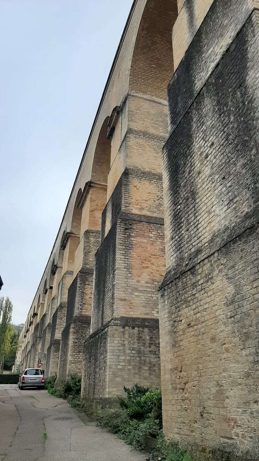
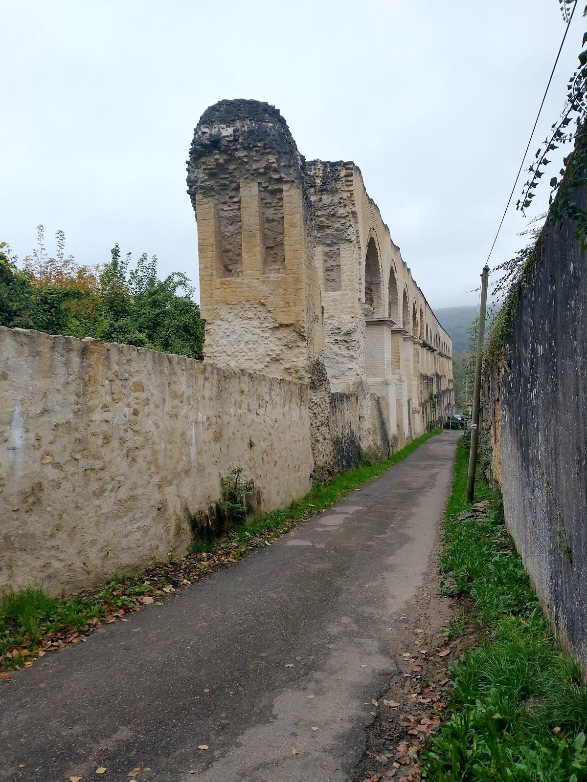
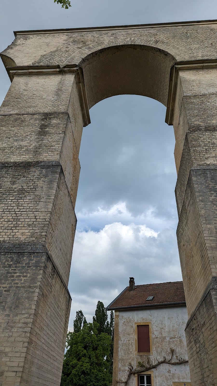
The elevated bridge crossed the Moselle valley for about 1.1 km, including approximately 630 m over the river. It originally had between 110 and 120 arches, with the tallest reaching about 30 m and spanning approximately 12 m. The surviving sections stand on both sides of the valley, including arches and piers at Ars-sur-Moselle.
The square piers rested on thick foundation platforms and measured about 5 m on each side at their bases. They narrowed in successive sections as they rose to about 23 m, while projecting imposts supported the arches and the water channels. Oak piles were driven deep into the ground beneath the foundations. The piers were then built in shoulder-high sections, with rubble and lime filling their dressed-stone facings as timber scaffolding rose with the work.
The arches were formed over temporary wooden supports. Their piers and imposts used dressed stone from nearby quarries, while their cores consisted of lime mortar mixed with crushed brick and rubble, producing Roman concrete. Two parallel conduits, each 85 cm wide, ran along the bridge. This arrangement allowed one channel to remain in use while the other was maintained and reduced pressure on the outer walls when both carried water.
Jouy-aux-Arches receiving basin
At Jouy-aux-Arches, a sequence of arches and a collecting basin survive. The bridge channel ended in a circular receiving basin designed to reduce the force of the rapidly moving water created by the steep gradient. Its outer wall measured about 6 m in diameter, while the inner basin was approximately 2.2 m across. A recessed receptacle caused the water to swirl before it continued onward.
The outlet turned 90 degrees from the incoming channel and entered the underground conduit toward Metz. A roof protected the water from contamination and winter frost. From Jouy, the covered conduit continued eastward through the landscape of the former Roman water system, linking the elevated bridge to the supply route leading into Divodurum.