Pella: An Ancient City of the Decapolis in Jordan


Site at a Glance
- Rating
- 4.2
- Popularity
- Low
- Country
- Jordan
- Primary era
- Medieval
- External website
- Open
- Eras represented
- Stone Age, Bronze Age, Classical, Medieval
- Civilizations
- Abbasid, Byzantine, Canaanite, Mamluk, Ptolemaic, Roman, Seleucid
- Site type
- City
On this page20 sections
History
Pella is an ancient city in Jordan whose occupation continued, with interruptions, from the Neolithic period through the Islamic era. Human activity in its surroundings extends back more than 500,000 years, while settled habitation is attested from about 6000 BC. The site developed through Canaanite, Hellenistic, Roman, Byzantine, and Islamic periods, becoming one of the principal urban centers of the region.
Early settlement and the Bronze Age city
The settlement’s pre-Hellenistic Semitic name was probably Baheil or Biheil. It appears in Egyptian texts of the Bronze Age, including nineteenth-century-BC Egyptian execration texts, and has been identified with Pihilum in Egyptian conquest lists.
During the Late Chalcolithic and Early Bronze Age, Pella grew into a substantial fortified settlement. Defensive platforms date to about 3200 BC, while city walls and associated structures have been dated in part to approximately 3400 to 3600 BC. By around 1800 BC, the Middle Bronze Age city was prosperous, with massive mud-brick fortifications, temples, and substantial residences. It continued to flourish through the Middle and Late Bronze Ages, approximately 1800 to 1200 BC.
Iron Age decline and Hellenistic revival
Pella’s urban power declined at the beginning of the Iron Age. Its urban center appears to have suffered major destruction in the late ninth century BC and did not fully recover. A severe earthquake around 800 BC has also been proposed as a possible cause of damage, but the precise explanation remains uncertain.
The city was re-established during the early Seleucid period. The Seleucids were a Macedonian-Greek dynasty that ruled Syria and much of the southern Levant, while the Ptolemies, their rivals, controlled Egypt and parts of the eastern Mediterranean. The identity of Pella’s founder is uncertain. A late tradition attributed the foundation to Alexander the Great, the Macedonian king whose conquests created the Hellenistic political and cultural world, while Ptolemy III has also been proposed. The name Pella may have preserved the earlier Semitic name or referred to the springs shared by the Jordanian city and Pella in Macedonia, Alexander’s birthplace.
The Ptolemies controlled Pella after conquering the region in 301 BC. Antiochus III, the Seleucid king, took the city during the Fourth Syrian War in 218 BC. Seleucid authority was secured after the victory at Panium in 198 BC. Pella was also called Berenike during the Hellenistic period, although that name rests on a single late source.
In this period, Pella became part of wider urban and cultural networks. Its well-appointed private houses, decorated with frescoes and statuary, followed broader Hellenistic urban standards. Many Hellenistic houses later suffered episodes of burning. This destruction has traditionally been connected with the Hasmonean ruler Alexander Jannaeus around 83 or 82 BC, when Pella was reportedly destroyed because its inhabitants refused to adopt Jewish customs. The identification of the Pella mentioned in that account has been questioned.
Roman Pella and the Decapolis
Pompey, the Roman general who reorganized the eastern Mediterranean after Roman victories over the Hellenistic kingdoms, brought the region into the Roman sphere around 63 to 64 BC. He restored Pella’s autonomy after Hasmonean control. Pella became one of the Decapolis, a group of predominantly Hellenized cities in the southern Levant that retained distinctive civic institutions and urban identities under Roman rule. It maintained a city council and minted coins during the Roman period.
Pella may later have been incorporated into Roman Judaea. Josephus records that the Roman commander Scaurus devastated the surrounding countryside. During the First Jewish Revolt, the city was plundered and destroyed amid wider violence between Jewish and Syrian communities.
Pella revived during the later first century AD, especially after Rome suppressed the Jewish revolt of AD 66 to 73. Roman settlement and construction increased, and coinage is attested by AD 82 to 83 and continued into the first quarter of the third century, including under the emperors Caracalla and Elagabalus.
Christian tradition and Byzantine prosperity
A tradition preserved by Epiphanius and Eusebius states that Jewish-Christian refugees from Jerusalem sought refuge at Pella before the Roman destruction of Jerusalem in AD 70. They were said to have returned to Jerusalem around AD 130. The claim that Pella contained one of the earliest Christian churches has not been confirmed archaeologically.
During the Late Roman and Byzantine periods, Pella became one of the region’s principal centers. From about AD 390 it belonged to the province of Palaestina Secunda, and it certainly had a bishop by AD 451. The city reached its greatest extent and probably its greatest prosperity during the Byzantine period.
Under the emperor Justinian I, the summit of the main tell was levelled and reorganized according to a new urban grid. Streets lined with shops, together with large commercial and residential buildings, formed part of an extensive redevelopment program. At least three churches and a bishop’s palace, dated approximately to AD 550, belonged to this later urban landscape.
Conquest, earthquake, and later settlement
In January 635, during the early Muslim conquest, Muslim forces defeated Byzantine troops in the Battle of Fahl on the Jordan Valley plain below Pella. The city surrendered by treaty and paid poll and land taxes, avoiding the destruction associated with military capture.
Under early Islamic rule, Pella’s churches, markets, and houses continued in use while being adapted to new social and political conditions. By the eighth century, the city had formally reverted to the Semitic name Fahl. Economic decline, partly associated with changing trade routes and the growing importance of neighboring cities, reduced its population.
A major earthquake in the mid-eighth century destroyed much of the settlement and led to its relocation toward the northwest, near modern Tabaqat Fahl. The reduced settlement of the eighth to eleventh centuries underwent substantial rebuilding and included commercial complexes interpreted as markets or khans, commercial and lodging centers for merchants, travelers, and pack animals.
Evidence for Crusader-period occupation is slight and consists mainly of a few pottery sherds. During the Ayyubid and Mamluk periods, the flattened summit supported a large village with a mosque, residential compounds, streets, and a large cemetery. A Mamluk mosque and an administrative complex date to approximately AD 1350. In the late sixteenth century, an Ottoman administrative record listed a village called Fahl al-Tahta in the Ajlun district. Wheat, barley, and sesame were cultivated there, while taxes were collected on goats, beehives, and watermills.
Archaeological investigation
Gottlieb Schumacher first published Pella as part of a regional survey. The first excavations took place in 1958 and revealed Bronze and Iron Age material in two soundings. From 1966 to 1967, R. H. Smith led a College of Wooster team that prepared a site plan and began excavations, but the work stopped because of the Six-Day War.
Joint University of Sydney and College of Wooster investigations explored Pella from 1978 to 1985. The College of Wooster ended its work in 1985, while the University of Sydney project continued. From 1994 to 1996, Pam Watson and Margaret O’Hea surveyed approximately 30 square kilometres of the hinterland to examine land use and settlement patterns.
Since the 1990s, excavations directed by Stephen Bourke have focused especially on Bronze and Iron Age temples and administrative buildings. A Canaanite temple was excavated between 1994 and 2003. In 2010, Bourke announced the discovery of city walls and other structures dating in part to the fourth millennium BC. Pella is included on Jordan’s tentative list for UNESCO World Heritage designation.
Remains
Pella occupies a well-watered setting in the eastern foothills of the Jordan Valley, near a rich spring. The ancient settlement extended across the main archaeological tell, the broad central Wadi Jirm, and the slopes and summit of Tell al-Husn, with Jebel Abu al-Khas to the east and the Jordan Valley to the west. The Hellenistic urban center lay in the upper part of Wadi Jirm, between Tell al-Husn, the earlier Canaanite settlement hill, and Jebel Abu al-Khas. A spring lies in the middle of the wadi.
Prehistoric and Bronze Age remains
Neolithic domestic remains dating to approximately 6000 BC have been excavated at Pella. Late Chalcolithic occupation extended along the central and southern slopes of the main tell, while storage complexes dating to about 4200 BC have also been found.
Early Bronze Age remains include stone defensive platforms dating to approximately 3200 BC. City walls and associated structures attributed to the fourth millennium BC indicate a large fortified settlement, with some reported walls dated to approximately 3400 to 3600 BC.
Bronze Age urban structures
Middle and Late Bronze Age architecture includes massive mud-brick city walls, temples, elite residences, local housing, streets, and civic buildings. Excavated areas known as Areas 3, 4, and 28 preserve several phases of Middle Bronze Age construction. A Canaanite temple uncovered between 1994 and 2003 forms part of the continuing investigation of Bronze and Iron Age religious and administrative buildings.
Hellenistic and Roman buildings
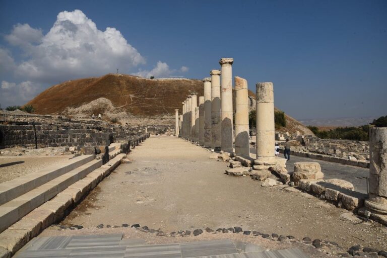
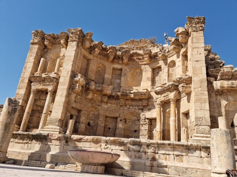
Hellenistic domestic architecture includes carefully appointed private houses decorated with wall paintings and statuary. The Roman city contained a small odeon, a building for performances and sometimes civic meetings, together with baths, a nymphaeum or monumental fountain, and a colonnaded central street.
Roman temple and Serapis sanctuary
Pella’s coins depict a large temple with a hexastyle portico, meaning a portico with six columns across its front, and a monumental flight of steps rising along a slope. The temple has been proposed for the summit of Tell al-Husn, but neither the building nor the steps has been found. The coin image may represent an idealized temple or the ceremonial entrance to the Serapis sanctuary. The sanctuary’s surviving monumental entrance stairs remained in use when a Byzantine basilica was built on the site.
Odeon and baths
The small odeon and the baths survived through their incorporation into the later Byzantine basilica complex. Their continued presence within that complex preserves evidence of the Roman city’s performance, meeting, and bathing facilities.
Byzantine churches and urban landscape
Civic-complex basilica
The main Byzantine basilica, probably the civic cathedral, stood at the southeastern end of the tell in Wadi Jirm. It contains two rows of columns with Corinthian capitals, whose foliage decoration is especially associated with acanthus leaves, and a peristyle court, a space surrounded by columns, in front of the entrance.
Western and eastern churches
A western church stood at the western end of the tell, while an eastern church occupied an elevated position on the slopes of Jebel Abu al-Khas. Another basilica lay several hundred metres northwest of the hill associated with the ancient Canaanite settlement, near the modern village of Tabaqat Fahl. After the Islamic conquest, the eastern basilica had gone out of use by about AD 700, the western basilica was converted into stables, and the central basilica remained in Christian use for the longest period. Part of its complex was also used to house camels.
Byzantine fortress
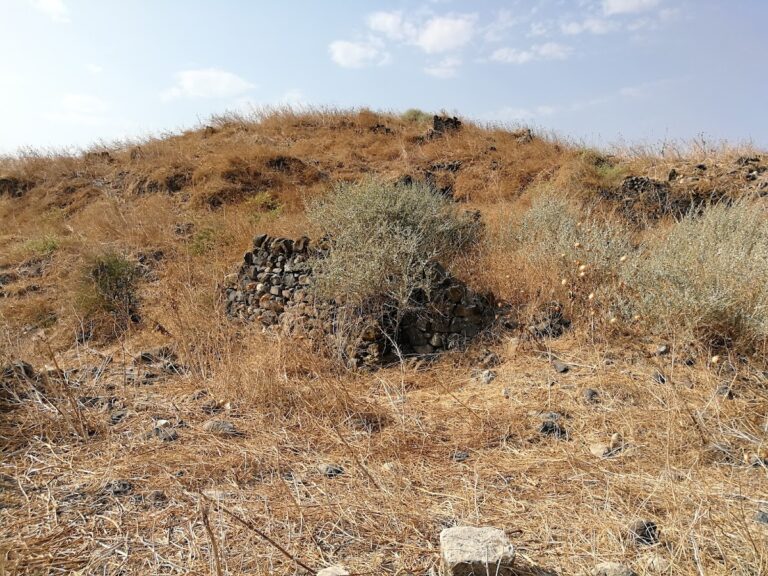
A Byzantine fortress occupied the summit of Tell al-Husn. Its surviving lower storey was built of stone, while the brick superstructure has disappeared. Numerous stables indicate that a cavalry unit was stationed there.
Early Islamic and later remains
The Byzantine city extended across the main tell, Wadi Jirm, and Tell al-Husn. Its urban grid included access streets, newly built shops, and large commercial and residential buildings. After the conquest, churches, markets, and houses continued in use with modifications.
Markets and workshops
A large market and workshop district was established beside the civic-complex church during the early Islamic period. The later commercial complex north of the tell had two enclosed courtyards and included installations interpreted as markets or khans. Evidence of glassworking has also been reported. An Abbasid khan, or caravanserai, dates to approximately AD 950.
Post-earthquake settlement
On the main tell, rebuilding after the mid-eighth-century earthquake is represented by wall foundations, plastered floors, rubbish pits, animal bones, and finely moulded glass vessels. The later Islamic settlement included a stone-built mosque with a minbar, the raised pulpit used for sermons, residential compounds arranged along lanes, a large cemetery, and an administrative complex dating to approximately AD 1350.
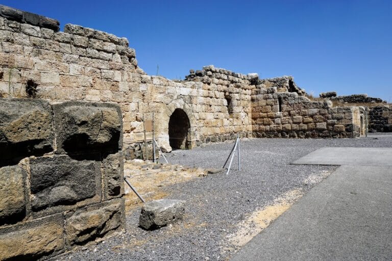
Pella’s ruins are only partially excavated. The surviving urban remains include temples, churches, domestic buildings, civic structures, streets, fortifications, markets, and other installations distributed across the tell, Wadi Jirm, Tell al-Husn, and the surrounding slopes.