Peña Cortada: A Roman Aqueduct in Valencia, Spain


Site at a Glance
- Rating
- 4.8
- Popularity
- Medium
- Country
- Spain
- Primary era
- Classical
- External website
- Open
- Eras represented
- Classical
- Civilizations
- Roman
- Site type
- Infrastructure
- Remains
- Aqueduct
On this page19 sections
History
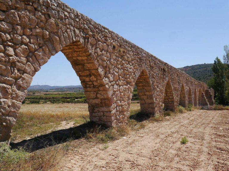
Peña Cortada is a Roman aqueduct in Spain, built under the Roman Empire probably in the late first or early second century AD. Also called the La Serrada or La Serranía Aqueduct, it carried water through the municipalities of Tuéjar, Chelva, Calles, and Domeño in Valencia Province. Its presumed destination was the plain around Llíria, known in Roman times as Edeta, although the system may also have supplied fields near Villar and Casinos.
Roman construction and extent
The surviving remains stretch for approximately 28.6 kilometres. The original system is calculated to have covered about 98.6 kilometres between the Serranía and the city of Valencia, leading to its description as the longest Roman aqueduct in the Iberian Peninsula and the sixth-longest hydraulic infrastructure of the classical world. Another reconstruction traces the route from a spring at Tuéjar to Valencia’s Plaza del Tossal, through Domeño el Viejo, Gestalgar, Pedralba, and Manises, with traces identified along nearly 60 kilometres.
Its water-conveyance system combined bridge aqueducts, open channels, and galleries cut through rock. This arrangement allowed the Roman builders to carry water across ravines and through rocky barriers while maintaining the route between the source and its presumed agricultural or urban destinations.
Historical investigation and preservation
The aqueduct’s destination and course have been examined since at least 1538, when Pere Antoni Beuter, a sixteenth-century Valencian historian, investigated which cities it had supplied. Later observations reveal the progressive destruction of the bridge over the Rambla de Alcotas. Escolano described six arches in 1611, and Marés recorded the same number in 1681. By 1795, Cavanilles found only one arch, two supporting piers, and a third pier retaining the springing of another arch.
Peña Cortada was declared an Asset of Cultural Interest in the monument category in Spain on 3 September 2004. The designation gave the surviving aqueduct formal heritage protection while preserving the remains as evidence of Roman hydraulic construction in the region.
Remains
The aqueduct begins near the Fuente del Saz in Tuéjar at approximately 580 metres above sea level, close to a spring described at about 585 metres. From there, its route alternates between channels cut into rock, open-air sections, galleries, and bridges. The channel, or specus, carried the water, while constructed open-flow sections were known as canalis structilis.
Water intake and channels
Source and initial channel
A simple transverse dam, or saeptum, diverted water from the spring into the specus. The first part of the channel was cut directly into the rock, establishing the watercourse before it continued through the varied terrain of the aqueduct’s route.
Torre de Castro
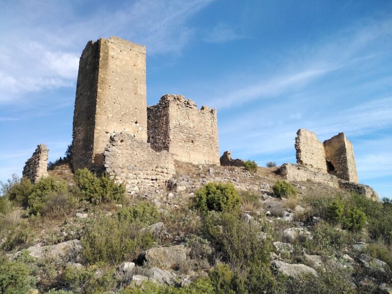
At the Torre de Castro in Calles, the channel follows the eastern and northern sides of the tower. Along this stretch it alternates between five open-air sections and four gallery sections. Another bridge aqueduct stood on the tower’s western side and crossed the Barranco de Mas de Solaz.
Domeño channels
Within the municipality of Domeño, covered and uncovered sections of channel continue the aqueduct’s course. These surviving sections form part of the wider system of open-flow and enclosed passages that carried water across the landscape.
Bridge aqueducts
Barranco del Convento bridge
In Chelva, a single-arch bridge crosses the Barranco del Convento. It is one of the structures that enabled the channel to pass over a natural depression rather than descend into it.
Rambla de Alcotas bridge
The bridge over the Rambla de Alcotas in Calles originally had six arches. One arch now survives, supported by two piers, while a third pier retains the springing of another arch. The remaining masonry corresponds to the stages of destruction described by observers between the seventeenth and eighteenth centuries.
Barranco de la Cueva del Gato bridge
The three-arch bridge over the Barranco de la Cueva del Gato in Calles is the most spectacular and best-preserved bridge on the aqueduct. It measures 36 metres in length and rises more than 18 metres above the ravine. Its three arches are approximately 4 metres wide. Along the summit, the channel is about 60 centimetres wide and 40 centimetres deep, with walls approximately 20 centimetres thick.
Roman construction in the bridge sections combined bridge-building with forms associated with honorary or triumphal arches. The masonry used regularly cut stone blocks, a technique known as opus quadratum, to support the water channel across the larger topographical obstacles.
Barranco de La Cabra bridge
The bridge over the Barranco de La Cabra in Calles had a single arch. It forms part of the sequence of smaller bridge structures used to maintain the aqueduct’s passage across the ravines.
Barranco del Zurdo bridge
At the bridge over the Barranco del Zurdo in Calles, only part of one supporting pier remains. The fragment preserves the position of a structure that once carried the channel across the ravine.
Barranco del Tío Roque bridge
The bridge over the Barranco del Tío Roque in Calles had a single arch. Only the beginnings of its supporting piers survive.
Barrancos del Arenal and Olivera del Arquillo bridges
The bridges over the Barrancos del Arenal and Olivera del Arquillo in Calles each had a single arch. Both are now severely destroyed or almost entirely disappeared.
Rock-cut passages
Peña Cortada rock cut
After crossing the Cueva del Gato bridge, the specus turns sharply east and passes through the rock-cut feature called Peña Cortada, or La Serrada. The nearly vertical cut is approximately 25 metres high and 50 metres long. Stone removed during its excavation was probably reused in constructing the bridge aqueduct.
Tunnel galleries
Eleven tunnels were cut through a rocky barrier. Each is approximately 1.8 metres high and 0.8 metres wide. Large openings brought light into the passages and allowed excavated material to be removed during their construction. Together, the tunnels demonstrate how the aqueduct continued through rock when an open channel was impractical.