Los Arcos Aqueduct, Alpuente: A Historic Water-Supply System in Spain
Site at a Glance
- Rating
- 4.4
- Popularity
- Very Low
- Country
- Spain
- Primary era
- Early Modern
- External website
- Open
- Eras represented
- Early Modern
- Civilizations
- Crown of Aragon, Spanish
- Site type
- Infrastructure
- Remains
- Aqueduct
On this page6 sections
History
Los Arcos aqueduct, also known as the Alpuente aqueduct, is a medieval-style water-supply structure in Spain, built between the sixteenth and seventeenth centuries. It carried water from the Nueva and Marimacho springs to Alpuente for irrigation, human consumption, livestock, and washhouses. The aqueduct formed part of a wider system that included the spring intakes, the Madre Canal, and the arched crossing over the Reguero river basin.
The water-supply system
Before reaching Los Arcos, the Madre Canal ran through a channel cut into the ground for about 230 metres. From the aqueduct, it continued for approximately three kilometres towards Alpuente, following the contours of the terrain. Branching channels diverted water to terraced agricultural plots between Alpuente and the right bank of the Reguero ravine. The first diversion served fields on the left side of the present CV-345 road and the ravine.
Water turns for the different groups of plots were passed on orally among the users rather than administered from a formal irrigation-community headquarters. Because the original open channel was vulnerable to contamination, its water was initially directed to livestock, agriculture, and washhouses instead of human consumption. During the 1970s, the canal was enclosed in pipes and buried. It later supplied the Purisima Fountain, while open stretches near the municipal sports centre continued to serve their original purpose.
Flood damage and rehabilitation
The aqueduct crosses the depression formed by the Reguero River basin. A flood in 1880 swept away the main arch over the river and damaged nearby arches. Between 1986 and 1988, rehabilitation works added two concrete arches to the two faces of the wall, following a line similar to that of the lost crossing.
Los Arcos was declared an Asset of Cultural Interest as a monument in 2005. This is a formal Spanish heritage designation for places valued for their historical, architectural, or cultural importance. The aqueduct also appears on Alpuente’s municipal coat of arms.
Remains
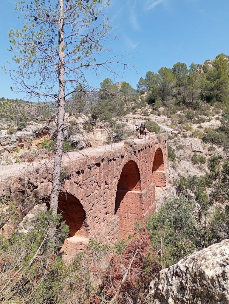
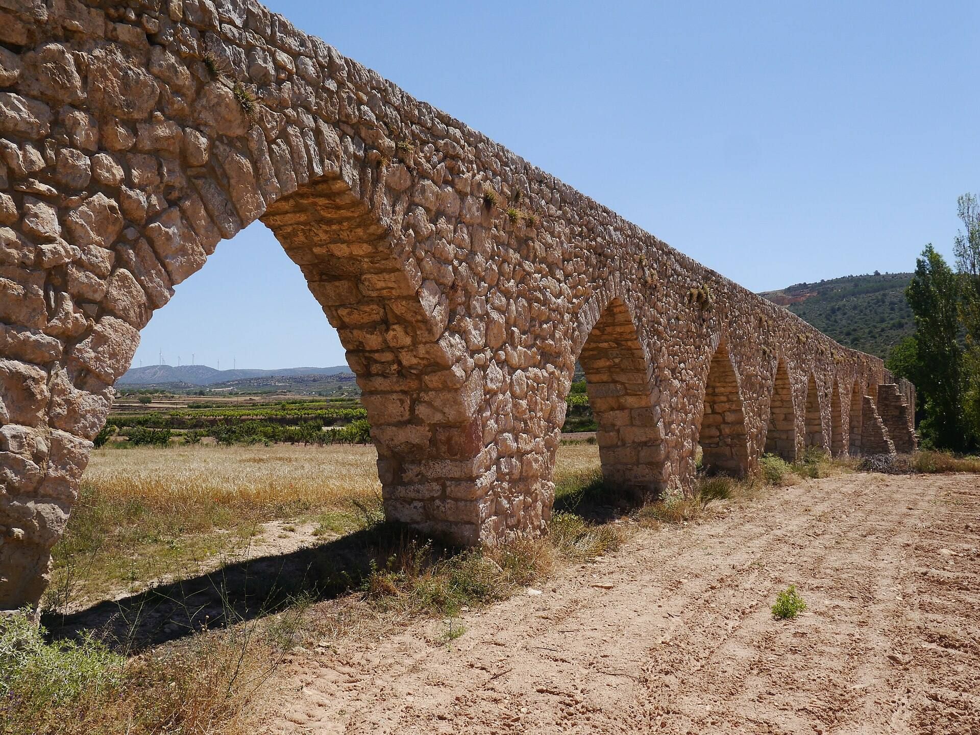
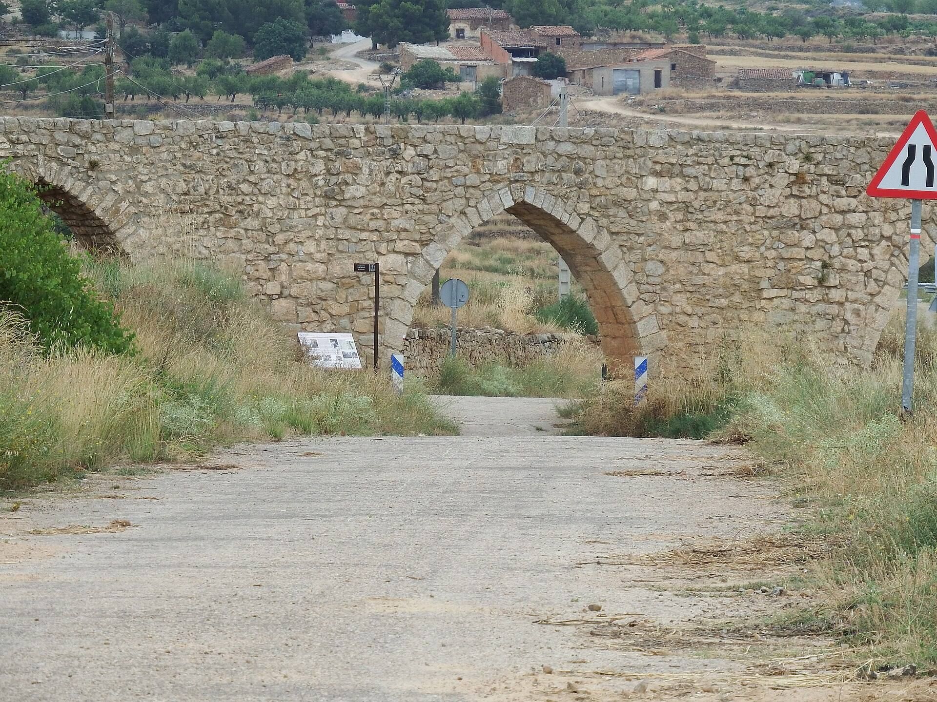
About 2.50 kilometres north of Alpuente, on the road to La Yesa, the aqueduct follows a mainly straight alignment of approximately 265 metres. It has a slight curve about fourteen metres from the beginning. The surviving structure consists of a regular sequence of pointed arches, whose tops rise to an apex, together with remains of the channel that brought water from the Nueva and Marimacho springs.
The arched crossing
The number of surviving and reconstructed arches is described differently in the available counts. One count gives thirteen arches, while Alpuente’s municipal authority counts eighteen. On the right, or southern, side of the river, ten arches are similar in form and are described as depressed arches, meaning that their profile is shallower and more horizontally stretched. The municipal count gives twelve arches for this group.
The river crossing was formerly marked by the principal arch of the arcade. It had an approximate span of 11 metres and a rise of about 6.50 metres before the 1880 flood destroyed it. The rehabilitation of 1986 to 1988 created two concrete arches, one on each face of the wall, with profiles resembling the former river crossing.
The Madre Canal
Sections of the Madre Canal remain open within several urban plots near the municipal sports centre. The channel includes diversion points that carried water from the main course towards the terraced fields. Together with the visible remains leading from the springs to Los Arcos, these surviving sections preserve parts of the system that connected the water sources, the aqueduct, agricultural land, and Alpuente.