Castillo de Sot de Chera: An Islamic-Origin Castle in Spain


Site at a Glance
- Rating
- 4.5
- Popularity
- Very Low
- Country
- Spain
- Primary era
- Medieval
- External website
- Open
- Eras represented
- Medieval
- Civilizations
- Taifa Kingdoms
- Site type
- Military
- Remains
- Castle
On this page7 sections
History
Castillo de Sot de Chera is an Islamic-origin castle in Spain, located in Sot de Chera, Valencia, whose beginnings are most plausibly placed in an eleventh-century Arab rural settlement that later developed into a fortress, manor house, or defensive position. A Visigothic origin has also been proposed, and earlier settlement at the site remains possible. The castle occupied a strategically important position above the Sot River, where roads led toward Chulilla, Gestalgar, and Siete Aguas.
Islamic Beginnings and the Christian Conquest
The proposed predecessor was an alqueria, a rural agricultural settlement consisting of a principal farmstead and associated cultivated land. Its transformation into a fortified site reflects the uncertain early development of the castle. During James I’s thirteenth-century conquest of the Kingdom of Valencia, the king granted the alqueria of Sot de Chera, together with Chera and several hamlets and farmsteads, to the Aragonese nobleman Hurtado de Lihori and his son Rodrigo. Their military support was the stated reason for the grant, which was entered in the Llibre del Repartiment, the medieval register of land distributions after the Christian conquest, on 17 January 1238.
The territory stood on the frontier between the Crown of Aragon and the Crown of Castile. Its position gave the castle a role in controlling movement along the roads toward neighboring settlements. Several outlying hamlets and farmsteads later disappeared during incursions and conflicts with Castile, while Sot de Chera and its fortress endured sieges and repeated devastation. The property remained in the family of Hurtado de Lihori until approximately 1371.
Castilian Occupation and Mont Palau Rule
After the war between Castile and Aragon in 1429, Sot de Chera was devastated and Castilian troops occupied the castle. The local population fled, leaving its houses abandoned. The Peace of Toledo, a settlement that ended the conflict between the two crowns, led to the return of the castle and its lands to Alfonso the Magnanimous, Alfonso V of Aragon. He then transferred them to the Mont Palau family.
The Mont Palau lords promoted the repopulation of the territory. In 1540, Miguel Ángel Mont Palau, lord of the barony of Gestalgar and Sot de Chera, issued a settlement charter, a legal instrument defining settlers’ rights, obligations, houses, and land. He expanded the lordship to include three inhabited centers. In 1628, the lordship became a county, a change reflected in the historical name “the Count’s oil mill” for the local almazara, or oil mill.
Gestalgar ceased to belong to the municipality of Sot de Chera in 1654, while Chera separated from it between 1836 and 1841. The fortress itself suffered several attacks between the thirteenth and sixteenth centuries, leaving traces in its remains before restoration.
The Peninsular War and Modern Preservation
In 1812, during the Peninsular War, the conflict caused by the French invasion of Spain, Sot de Chera served as a concentration point for guerrilla leaders operating in the areas of Cuenca and Teruel. The guerrilla associated with Romeu used the settlement during this period. French forces commanded by Captain Lacroix invaded the area and captured Romeu, who was taken first to Liria and then to Valencia, where he was hanged on 12 June 1812. Forty-five guerrillas were executed by firing squad in Sot de Chera during the French occupation.
Housing built around the castle severely affected its surviving fabric. Between 1980 and 1985, adjoining constructions were demolished and detached houses were built, causing further damage to the castle’s integrity. Later work focused on preventing the loss of the remaining structures. The tower, surviving walls, and associated castle remains were rehabilitated and consolidated as a protected heritage complex.
Castillo de Sot de Chera is protected under Spain’s general decree of 22 April 1949 concerning castles and under the Spanish Historical Heritage Law of 25 June 1985. It retains the designation of an Asset of Cultural Interest, a formal Spanish category for protected historical or cultural property.
Remains
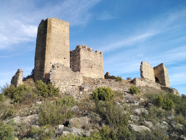
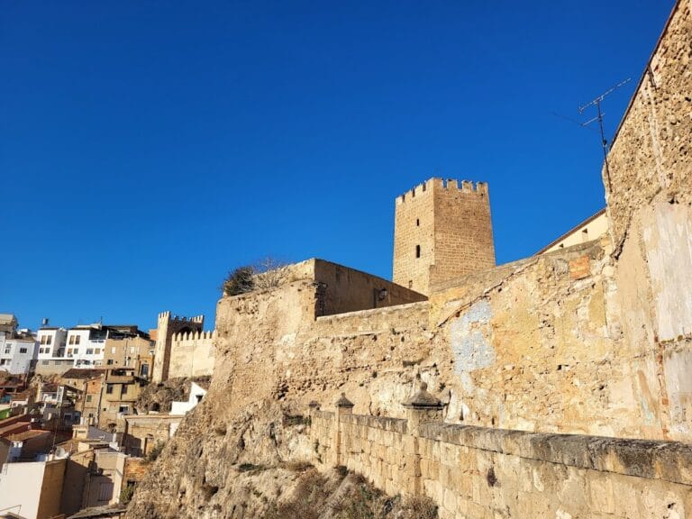
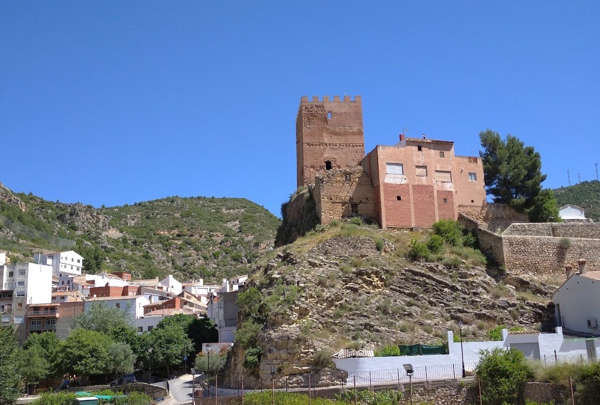
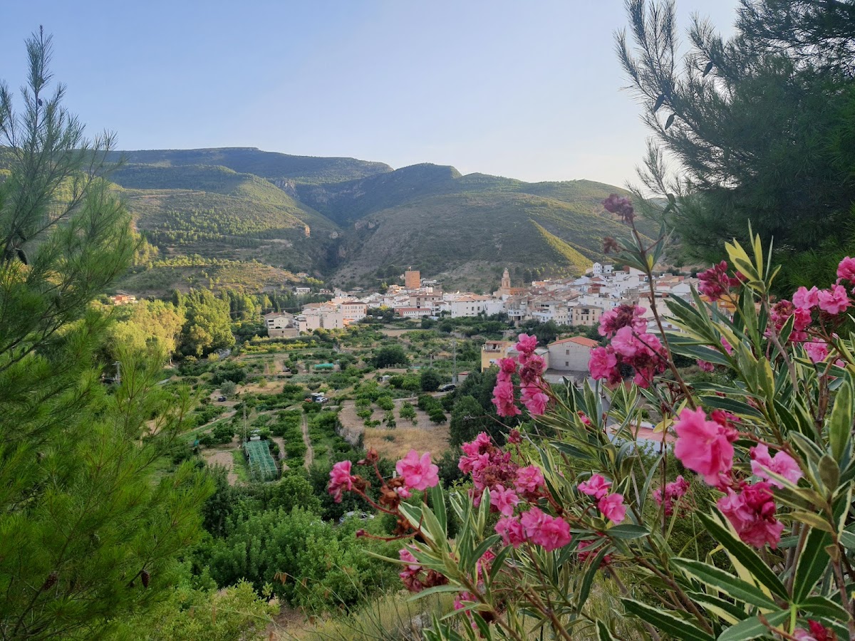
The surviving castle occupies a small rocky promontory in the center of Sot de Chera, above the Sot River. Its elevated position overlooks the settled area, the river, and much of the valley. The complex is centered on the main tower of the former settlement castle, with wall sections, a quadrangular tower, and other remains associated with the defensive enclosure. Rammed earth, formed from compacted earth, and rubble masonry, made from irregular stones set in a binding material, are the principal construction techniques.
The Main Tower
The main tower appears to have served as the keep, the castle’s principal fortified tower. It retains window openings and traces of battlements, the raised protective sections along a defensive top. Wooden floors once divided its interior into four levels, and the wall sockets that supported the timber structures remain visible. The walls narrowed as they rose, measuring four cubits at the base, just under two metres, three cubits at the first level, two cubits at the second, and one cubit at battlement height.
At ground level, the safest part of the tower functioned as a refuge, food store, and warehouse. A cistern, a tank for collecting and storing water, was found there, and water from the upper roof was probably directed into it. The two intermediate levels served defensive or residential purposes. The upper level formed the roof area, although its precise arrangement remains uncertain. It may have consisted of a continuous roof or a walkway around the upper termination in relation to the battlements.
Defensive Enclosure and Underground Features
A surrounding wall enclosed the tower on three sides. The western side relied on the steep, cut configuration of the rocky promontory for defense. Surviving wall sections and the remains of a quadrangular tower indicate the wider defensive complex that once protected the main structure. Tunnels and underground galleries from the same period as the castle have also been identified in some of the houses around it.