Cuahilama: A Xochimilca Ceremonial and Archaeological Site in Mexico City
Site at a Glance
- Rating
- 4.3
- Popularity
- Low
- Country
- Mexico
- Primary era
- Medieval
- External website
- Open
- Eras represented
- Medieval, Early Modern
- Civilizations
- Aztec
- Site type
- Religious
- Remains
- Sanctuary
On this page15 sections
History
Cuahilama is a hill and archaeological site associated with the Xochimilcas in southeastern Mexico City, Mexico. The Xochimilcas, a Nahua-speaking people, used the hill as a pre-Hispanic ceremonial center, probably from the period when their settlements developed around Lake Xochimilco. Its name is translated as “old woman’s head.”
Early settlement around Xochimilco
The wider Xochimilco area was inhabited by Preclassic communities between approximately 1500 and 200 BCE. The Preclassic was the Mesoamerican period before the rise of major urban states. These communities were associated with Cuicuilco, Copilco, and Tlatilco. During the Classic period, approximately 200 BCE to 700 CE, groups connected with Teotihuacan also occupied the region. The Classic period saw the growth of major cities and regional civilizations in Mesoamerica.
Acalpixca was apparently founded by the Xochimilcas around 1254. Around 1265, Acatonalli, described as the first lord or ruler of Xochimilco, founded a settlement on Cuahilama. Between approximately 1450 and 1521, Santa Cruz Acalpixca was a small settlement and the regional center. The rock engravings belong to this broader period.
Xochimilca expansion and agricultural life
Early Xochimilca communities are associated with the development of chinampa agriculture in response to food shortages. Chinampas were raised cultivation plots built in shallow lake or wetland environments with wooden supports and lake sediment. They created fertile, bounded fields for growing maize, chili, beans, squash, flowers, and other crops.
From Cuahilama, the Xochimilcas are said to have expanded along the southern shore of Lake Xochimilco, toward the islands of Tláhuac and Míxquic, and toward the Ajusco-Chichinauhtzin range. Cuahilama functioned as a natural boundary between access to the lake and the hills of Xochimilco. Its position between these environments was associated with the opposition or union of water and fire, elements connected with Chantico, a deity associated with hearth fire and, in the Cuahilama interpretation, with water and fertility.
Ceremonial and political functions
The site has Aztec cultural characteristics and was probably used for agricultural fertility festivals and solar worship expressed through astronomical and calendrical events. A New Fire ceremony was held there every 52 years. This major Mesoamerican rite marked the completion of a calendrical cycle and symbolized the renewal of cosmic order and the continuation of the sun.
The reliefs are associated with a festival of the veintenas, recurring 20-day periods in Mesoamerican calendrical systems. The sacred entities linked to the festival represented water, fire, fertility, and war. The site material also suggests that Cuahilama may have been used for the coronation of Xochimilca rulers through rites involving water and fire. The reliefs preserve astronomical, calendrical, geographic, military, agricultural, and religious imagery, although some individual interpretations remain conjectural.
Modern condition and protection
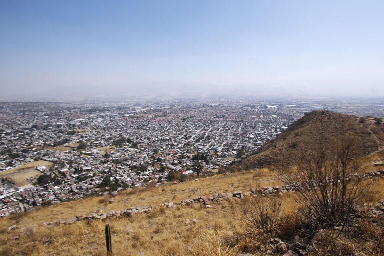
Urban growth, vandalism, graffiti, abandonment, and reported looting of archaeological pieces have affected Cuahilama. The hill and its petroglyphs have been described as inadequately protected. The area is privately owned, and the owners reportedly possess private contracts rather than formal land titles, which has prevented its purchase for protection. The Instituto Nacional de Antropología e Historia has reportedly treated Cuahilama as a site of limited relevance compared with many other archaeological sites in Mexico. Substantial maintenance and protection had not been carried out despite local complaints.
Remains
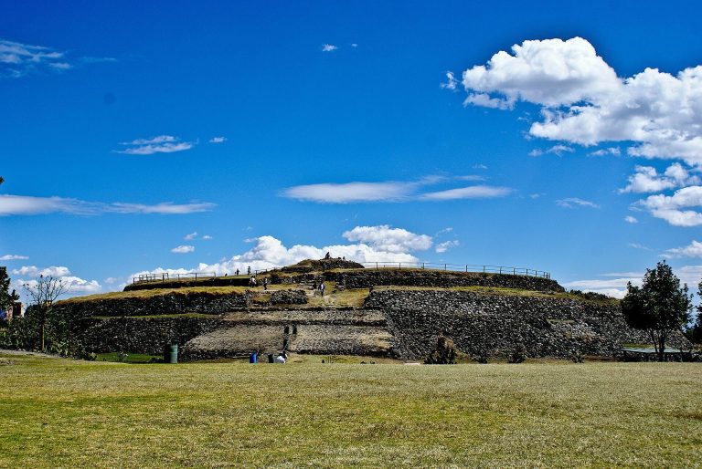
Cuahilama occupies a hill whose basaltic rock surfaces carry pre-Hispanic images on the hillside and lower slopes. The archaeological site includes an observatory, a shrine or adoratory, agricultural terraces, mounds, and the foundations of priestly residential buildings covering approximately 400 square meters. An east-west pre-Hispanic causeway led toward the upper part of the hill, where the ceremonial area was probably located. The site also included a Xochimilca field or installation used for military training.
Hilltop structures and agricultural features
Causeway and ceremonial area
The east-west causeway provided access to the upper part of Cuahilama. The elevated area probably contained the principal ceremonial zone, linking the hill’s access route with the observatory, shrine, and other pre-Hispanic features.
Terraces, mounds, and residential foundations
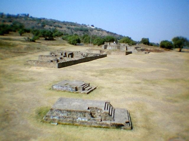
Agricultural terraces and mounds formed part of the hill’s built landscape. Foundations of buildings associated with priests covered approximately 400 square meters. Several mounds have disappeared, while the surviving remains have been affected by inadequate protection, urban growth, vandalism, and graffiti.
Observatory and shrine
The site included an observatory and a shrine or adoratory within the ceremonial area. Their presence relates to Cuahilama’s astronomical, calendrical, and religious functions, including solar worship and ceremonies connected with the agricultural cycle.
Basalt reliefs and petroglyphs
Ollín Nahui and celestial imagery
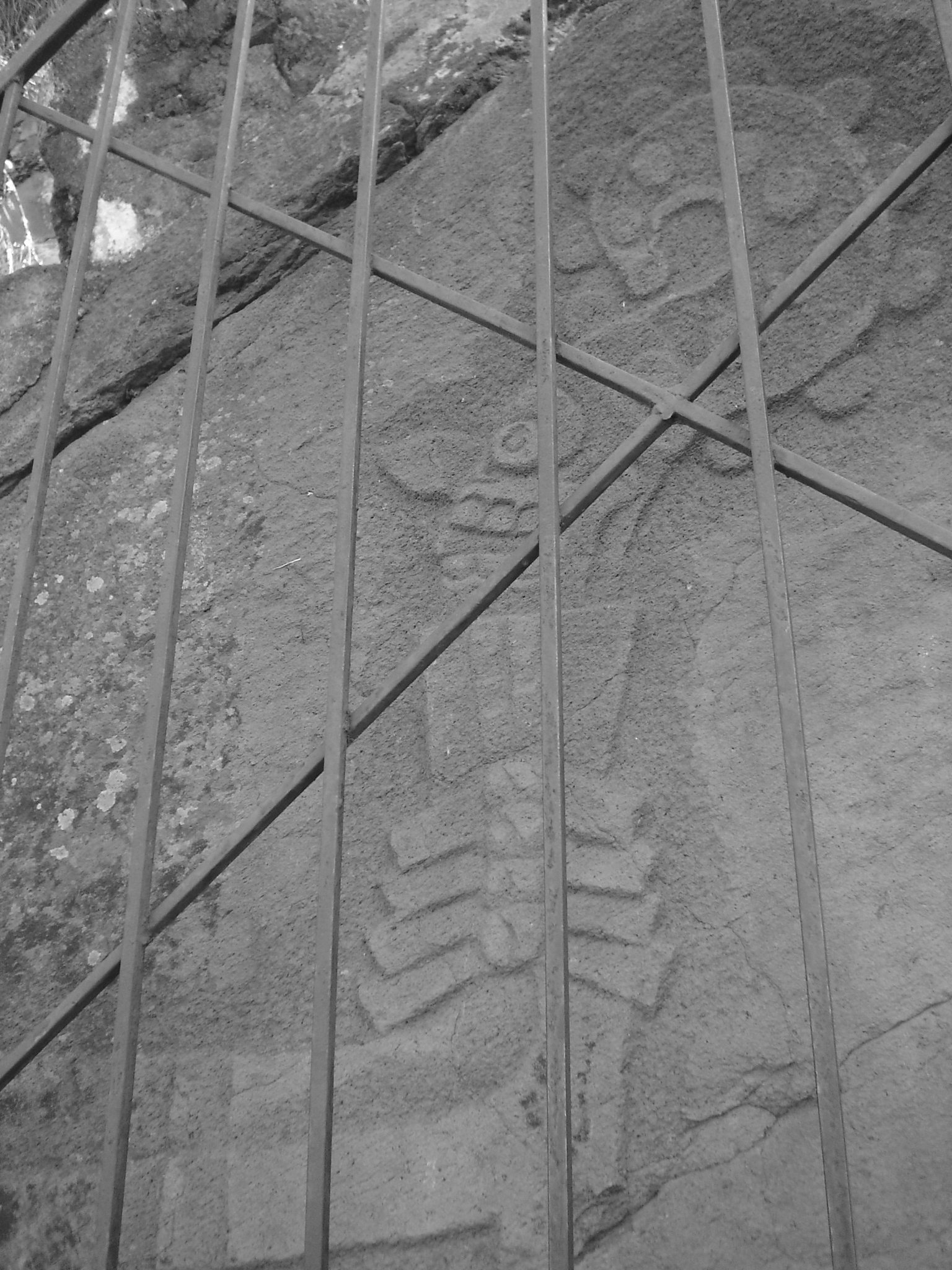
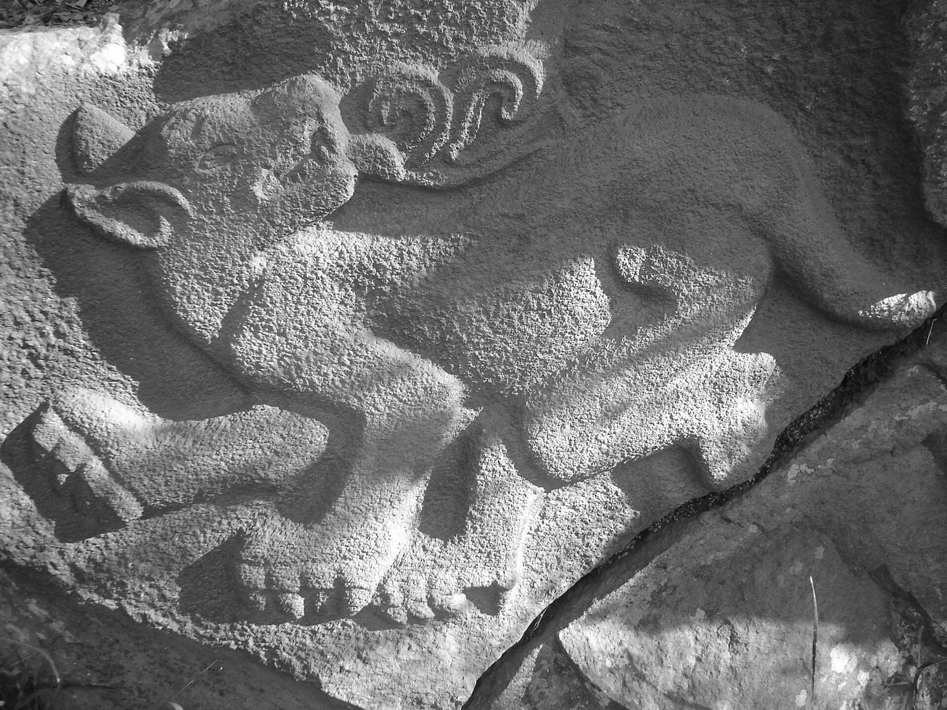
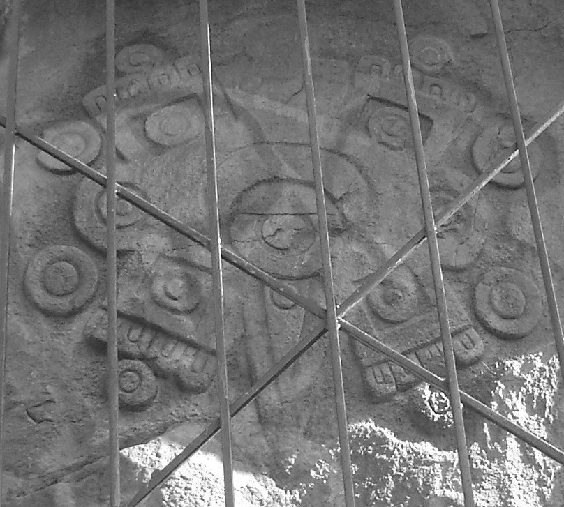
Ten pre-Hispanic petroglyphs remain in situ. A petroglyph is an image carved, pecked, or incised into a rock surface. The reliefs are generally dated between 1200 and 1500 and depict stars or other celestial bodies, cardinal directions, calendar signs, and figures associated with fertility worship and Xochimilca cosmology.
The relief called Ollín Nahui, or “Four Movement,” refers to the present Fifth Sun and the four earlier cosmic ages or humanities. It incorporates the four directions of the universe and four calendar numerals. The date “4 Movement” has been interpreted as indicating a period of worship dedicated to Xipe Tótec, a deity associated with renewal, agricultural fertility, and seasonal transformation. The relief lies on the northern slope and is illuminated by the sun during the summer solstices.
Calendar signs and sacred figures
Ce Cipactli, or “One Crocodile,” corresponds to the first day of the Mesoamerican solar calendar. The motif has been associated with Chantico or Cuauhxolotl, a deity connected with fishing and domestic fire, and may refer to a period when that deity was worshipped.
Huetzalin is identified as a priest who, according to the account attributed to Father Durán, led the Xochimilcas from Tula, an ancient city associated with the Toltec civilization. Itzpapalotl, the obsidian butterfly, symbolizes poetry, song, and dance. Its movement was also interpreted as an image of the sun’s movement represented by Ollín Nahui.
Xonecuili, translated as “curved foot,” appears as the staff or command baton of Quetzalcóatl, a major deity associated with rulership, priesthood, wind, and sacred knowledge. It was interpreted as representing the Milky Way and as being connected with warfare and sacrifice. Océlotl, or the jaguar, corresponds to the fourteenth day of the solar-calendar month and symbolizes war. Its nocturnal habits linked it with the nahualli, an animal manifestation or supernatural counterpart, of Tezcatlipoca, a deity associated with night, conflict, rulership, and divination.
Plants, rulers, and geographic imagery
Huacalxochitl is identified as a sacred Xochimilca plant used medicinally against infections and ceremonially to decorate military heroes and the tlatoani, a ruler of a Nahua polity. Acocoxochitl, or the dahlia, has a hollow, water-filled stem and had ornamental, nutritional, medicinal, and ceremonial uses from pre-Columbian times. It is regarded as Mexico’s national flower.
Ocelocóhuatl, also called Cihuacóatl, is among the recorded figures or motifs. Cihuacóatl was a mother and fertility goddess in Aztec religious tradition. The recorded imagery also includes a warrior, or yaoquizqui, and a magnolia flower called Yoloxochitl.
Nahualapa map stone
Nahualapa is a map stone recording Lake Xochimilco, 56 springs, eight buildings with stairways, and numerous paths. Its imagery places the local landscape within the wider geographic and ceremonial system represented on the hill.