Bledsoe’s Station: An Eighteenth-Century Fortified Frontier Settlement in Tennessee
Site at a Glance
- Rating
- 4.6
- Popularity
- Very Low
- Country
- United States
- Primary era
- Early Modern
- External website
- Open
- Eras represented
- Early Modern, Modern
- Civilizations
- Unclassified
- Site type
- Military
- Remains
- Fort
On this page14 sections
History
Bledsoe’s Station is an eighteenth-century fortified frontier settlement at 2895 Hartsville Pike in Castalian Springs, Tennessee, United States. Built by the longhunter and Sumner County pioneer Isaac Bledsoe, it probably took shape after his arrival in 1781, with his family moving into the fort in 1783. The station protected Upper Cumberland settlers and migrants during the first major post-Revolutionary movement of Euro-American settlers into Middle Tennessee and stood near Avery’s Trace, the principal route between eastern and middle Tennessee.
Native American landscape and early exploration
The area around Bledsoe’s Lick had a much longer history of human use. Mineral springs attracted buffalo and other large animals, followed by Native American hunters as early as 12,000 years ago. People camped there at intervals during the Archaic and Woodland periods. During the Mississippian period, approximately AD 1000 to 1450, a settled society occupied the nearby Castalian Springs Mound Site, where a village covered about 40 acres and contained at least 12 mounds.
By the mid-eighteenth century, the Cherokee, Chickasaw, and Creek claimed the area as a hunting ground. Longhunter expeditions, which were extended frontier journeys in search of game and furs, passed through the region in the 1760s and 1770s. Henry Skaggs led expeditions in 1765 and James Smith in 1766. Kasper Mansker returned in 1769, 1771, and 1772, with Isaac Bledsoe participating in the 1771 expedition. During the 1772 journey, Bledsoe followed buffalo paths to the creek and salt lick that later carried his name.
In the late 1770s, Thomas “Bigfoot” Spencer led a hunting party that camped near the lick. He spent the winter of 1778 there in a hollowed sycamore tree and built cabins during much of the year, believing incorrectly that the structures would establish his claims to the land.
Foundation of the station
Isaac Bledsoe and his brother Anthony were born in Virginia and had served in the French and Indian War. Anthony later served in the Virginia militia, commanded Fort Patrick Henry in 1776, joined the Virginia House of Delegates in 1777, and surveyed Middle Tennessee for North Carolina in 1779. Isaac took part in William Christian’s 1776 punitive expedition against the Cherokee and followed Anthony to Middle Tennessee in 1781.
Isaac probably began Bledsoe’s Station after reaching the area in 1781. The settlement, also called Bledsoe’s Fort, was established to protect families and travelers during a period of conflict associated with the expansion of permanent Euro-American settlement. Around the time it was completed, Anthony Bledsoe built Greenfield, another fort approximately 2.5 miles to the north. The Chickamaugas, a Cherokee-associated group that opposed the expansion of Euro-American settlement into Middle Tennessee, resisted the land concessions that enabled this migration.
Conflict and the changing travel corridor
Violence repeatedly affected Bledsoe’s Station and nearby settlements. George Hamilton, a schoolmaster, was shot and badly wounded at the station in 1787. After Anthony moved his family from Greenfield to Bledsoe’s Station for greater protection, he was mortally wounded there in 1788 after accidentally stepping into a part of the fort exposed to hostile fire. Isaac Bledsoe was killed while walking through a field near the station in 1793.
Other attacks in the region included the overrunning of Ziegler’s Fort in 1792 and attacks on members of the Bledsoe family near Rock Castle in 1794. The 1794 Treaty of Tellico, which ended the Cherokee-American wars referred to in this period, helped bring major hostilities in the Upper Cumberland to an end and reduced the station’s military necessity.
Avery’s Trace was completed in 1788, linking Fort Southwest Point with Nashville. The route passed a few hundred feet east of Bledsoe’s Station and made the settlement part of an important regional travel corridor. Visitors during the 1790s included the French botanist and explorer André Michaux and Louis-Philippe, Duke of Orléans, a member of the French royal house who later became King of the French.
Later ownership and preservation
General James Winchester purchased Bledsoe’s Station in 1797. After his death in 1826, his daughter Almira Wynne inherited the property that is now the Wynnewood State Historical Site. During this period, the name Bledsoe’s Lick changed to Castalian Springs, and the springs operated intermittently as a health resort until 1914.
Sumner County purchased the station site in 1989 and established the approximately 80-acre Bledsoe’s Fort Historical Park. The county owns the park, which is maintained by the Bledsoe’s Lick Historical Association. Middle Tennessee State University excavated the station in the late 1990s, locating the stockade and root cellars associated with log cabins. Bledsoe’s Station was added to the U.S. National Register of Historic Places on July 30, 1992.
Remains
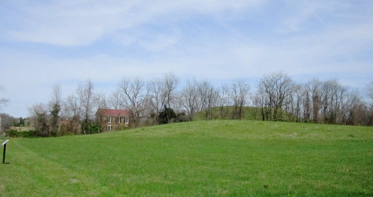
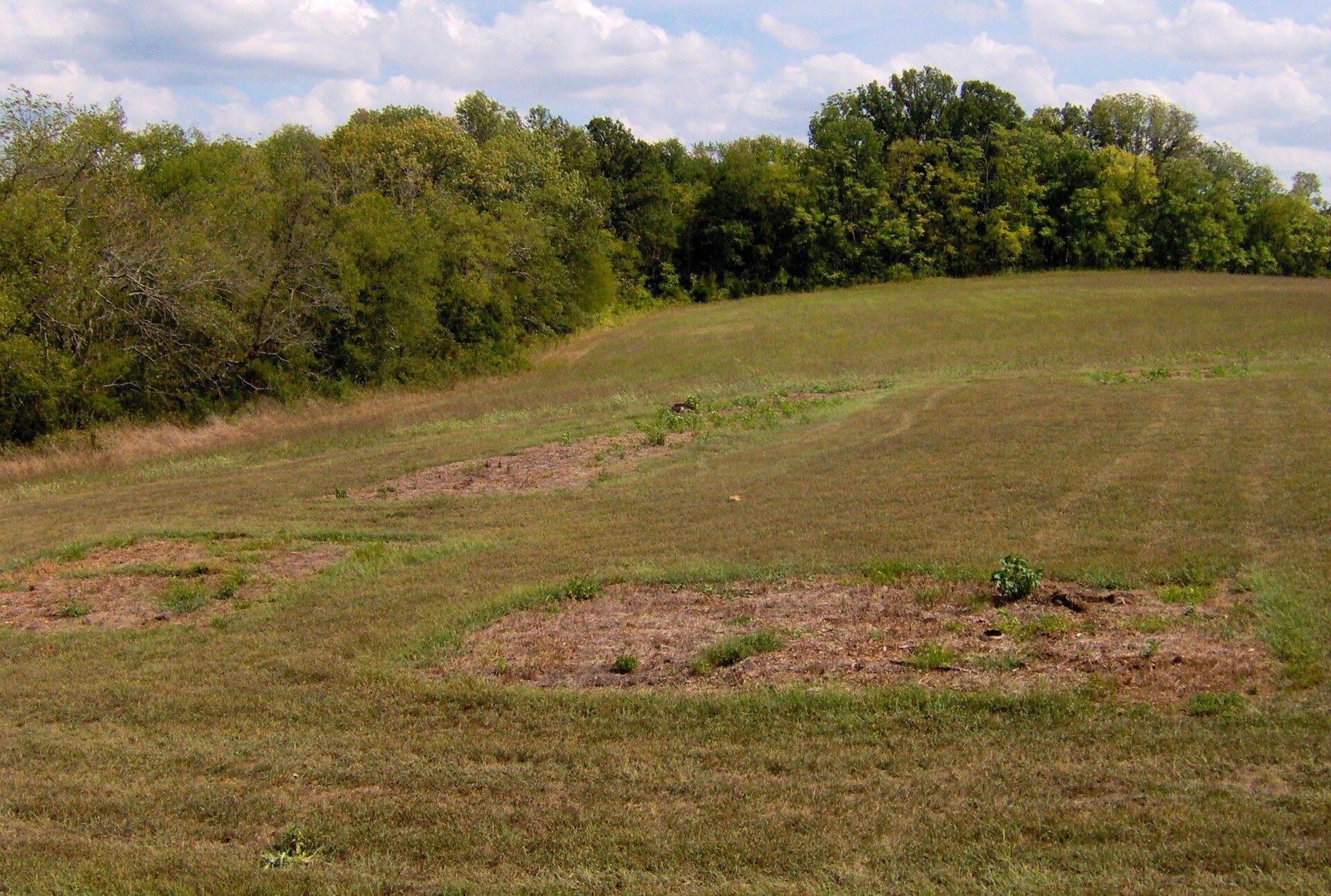
The site occupies a relatively blunt hill slope between Bledsoe Creek on the west and Bledsoe Lick Creek on the east. Both streams flow into the Old Hickory Lake impoundment of the Cumberland River slightly more than a mile to the south. The spring associated with Bledsoe’s Lick flows at the base of the hill a few hundred yards east of the fort site. Former excavation trenches outline the station’s walls, and a small platform overlooks the excavated area.
Fort site
Archaeological excavation verified the location of Bledsoe’s Station through the remains of its stockade and several root cellars. The cellars indicate that log cabins stood inside the fortified settlement. These features define the station’s basic arrangement as a stockaded community containing domestic structures, while the excavated outlines preserve the position of its defensive enclosure.
Historic buildings
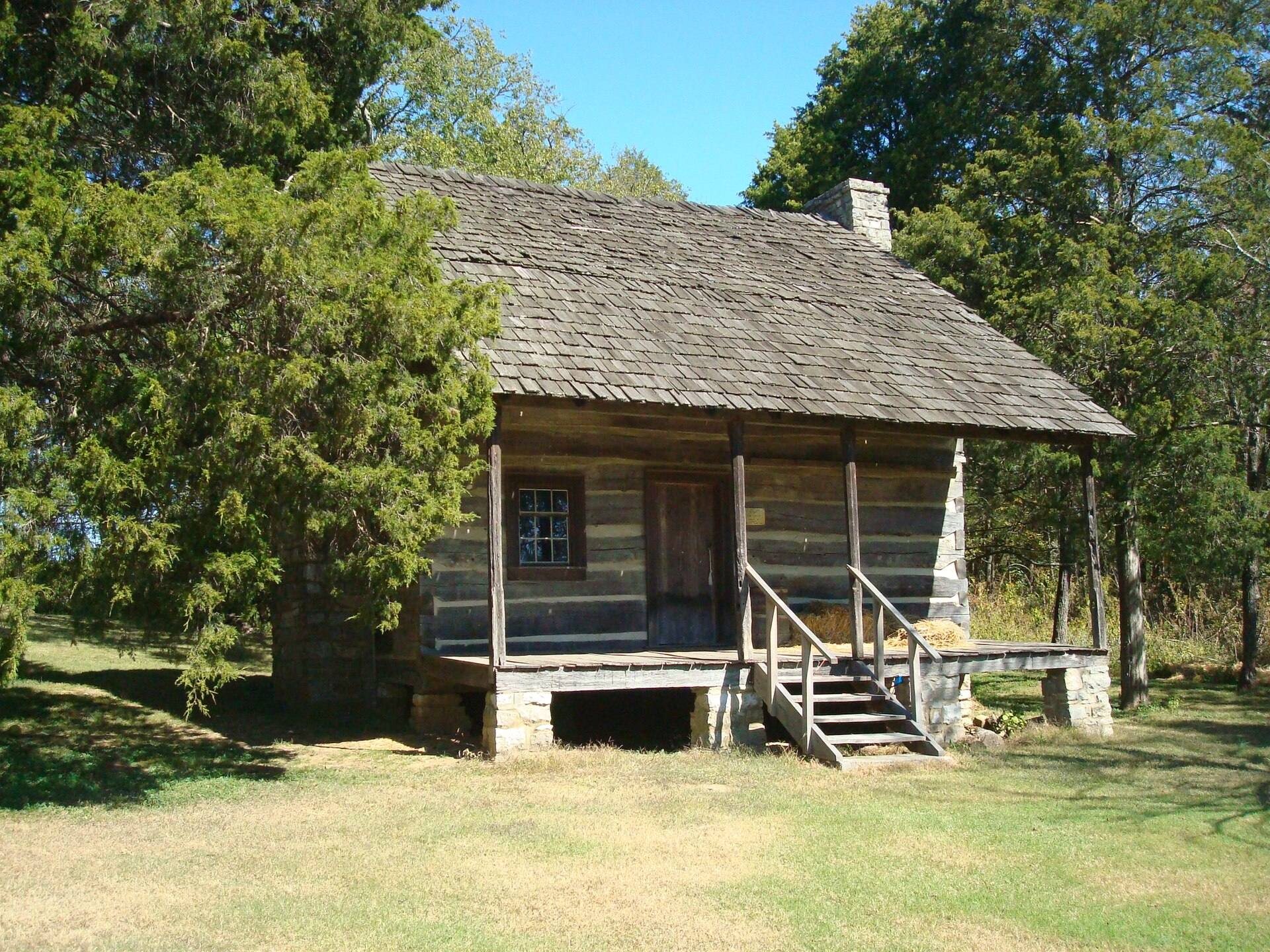
Nathaniel Parker Cabin
The Nathaniel Parker Cabin is a pioneer log cabin built in the 1780s. It originally stood a few miles north of Bledsoe’s Lick before being dismantled and moved to the park. Parker later married Mary Ramsey Bledsoe, the widow of Anthony Bledsoe, and commanded Greenfield.
Hugh Rogan Cottage
The Hugh Rogan Cottage is a stone cottage built around 1800 several miles north of Bledsoe’s Lick. Its low gabled roof and matching doors and windows reflect folk building traditions associated with Rogan’s native Ireland. The cottage was dismantled and moved to the park in 1998.
Associated archaeological and historic features
Belote Cemetery
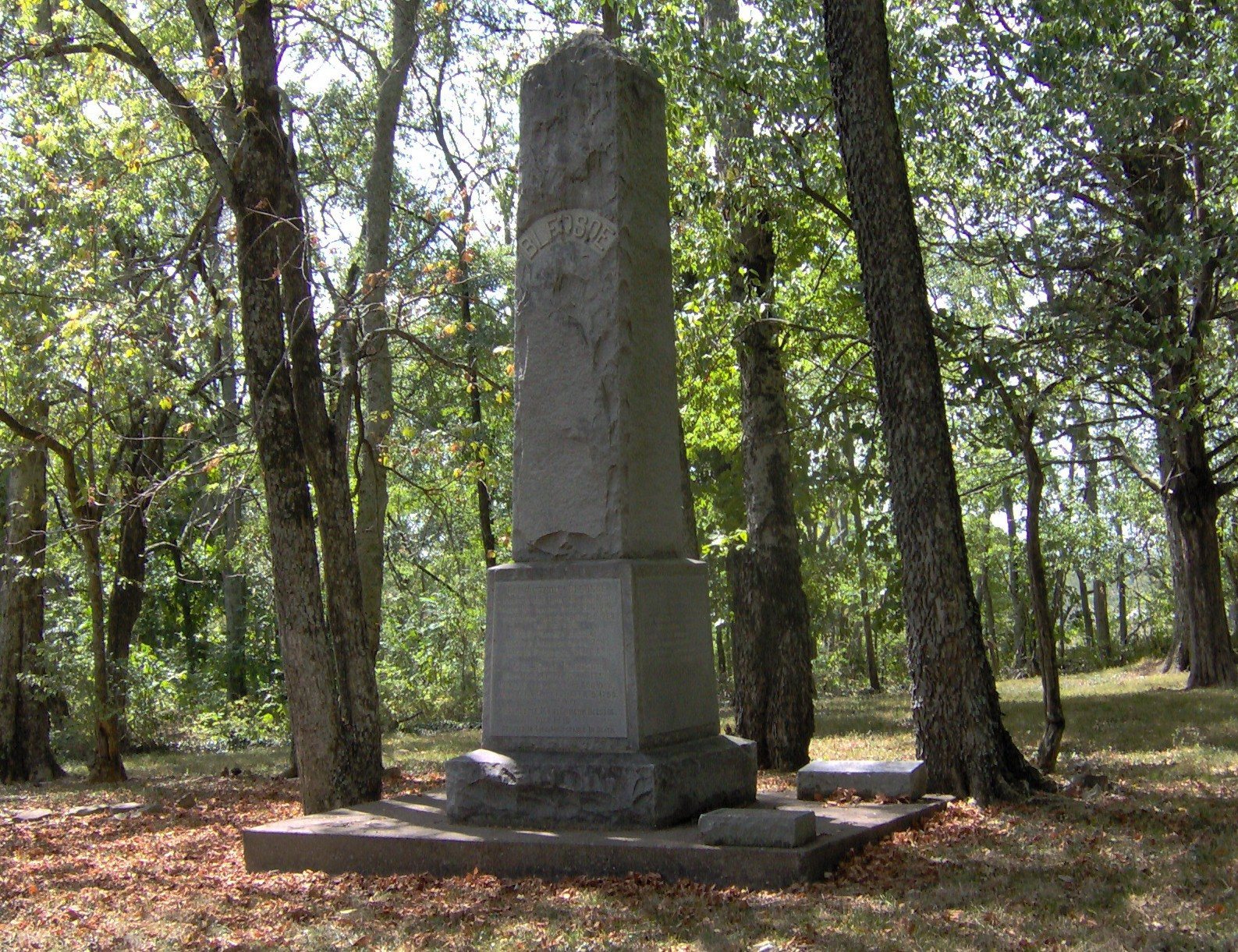
The Belote Cemetery, also called the Pioneer Cemetery, lies along Avery’s Trace a few hundred yards southeast of the fort site. It contains graves of early settlers from the Bledsoe’s Lick area. A 15-foot, or 4.6-meter, obelisk erected by the Bledsoe family in 1908 commemorates Isaac and Anthony Bledsoe.
Longhunter camp and springhouse
A longhunter camp demonstration area lies beside a spring near the ancient salt lick. Middle Tennessee State University constructed a lean-to there as a representative shelter for eighteenth-century longhunter base camps. Nearby are the ruins of a nineteenth-century springhouse used by the Belote family.
Cavern of the Skulls
The Cavern of the Skulls lies a few hundred feet east of the fort. Its entrance measures approximately 5 by 10 feet, or 1.5 by 3 meters. Nineteenth-century explorers reported human skulls inside. The possibility that people from the nearby Cheskiki Mound village stored trophy skulls there is supported, though not proven, by a ritual scene shown on a shell gorget found at the mound site.
A short loop trail follows part of Avery’s Trace and connects the fort site with these associated historical features, linking the station’s archaeological remains with the wider landscape of the Bledsoe’s Lick area.