Diocletianopolis: A Roman Spa City and Late-Antique Fortress in Bulgaria


Site at a Glance
- Rating
- 5
- Popularity
- Very Low
- Country
- Bulgaria
- Primary era
- Classical
- Eras represented
- Classical, Medieval
- Civilizations
- Byzantine, Roman, Thracian
- Site type
- City
On this page17 sections
History
Diocletianopolis is an ancient Roman city in Bulgaria, within the modern town of Hisarya. Built on the site of an earlier Thracian settlement, it became a Roman spa city and a major late-antique centre after Emperor Diocletian granted it city status in AD 293. Its importance rested on hot mineral springs, imperial patronage, trade, military protection, and its later development as a Christian centre in the province of Thrace.
Early settlement and Roman development
The location was inhabited from the Neolithic period, around 6000 BC or the sixth millennium BC. A Thracian settlement later grew there, and by the fourth and fifth centuries BC it had become an important market centre. Imported coins and pottery indicate commercial connections with Greek cities around the northern Aegean. The settlement and the surrounding area subsequently became part of the Odrysian kingdom, before Rome took control of the region in AD 44–46.
Under Roman rule, the settlement developed into a town initially known as Augusta. Its position was strengthened by the hot mineral springs around which the community was centred. Emperor Septimius Severus visited the settlement, and Emperor Diocletian, who ruled the Roman Empire from AD 284 to 305, came in AD 293, apparently attracted by the springs. He granted the town city status, renamed it Diocletianopolis, meaning “City of Diocletian,” and lived there for a time.
Earlier imperial attention had already given the area a special administrative position. Under Emperor Hadrian, who ruled from AD 117 to 138, the region centred on the settlement was declared an imperial domain in AD 135–136. An imperial domain was territory administered as the property of the emperor rather than as an ordinary privately held or municipally controlled district. An inscription found at the site preserves evidence of this status.
Prosperity in the Roman Empire
Diocletianopolis reached its greatest prosperity in the fifth and sixth centuries. It was described as the third-largest city in the province of Thrace, after Philippopolis, the ancient city corresponding to modern Plovdiv, and Beroe, corresponding to modern Stara Zagora. The city became a spa centre visited by people from different parts of the Roman Empire. Its population included people of Roman origin, freed slaves of various ethnicities, and indigenous Thracians.
Stoneworking and construction were among the city’s principal crafts, while agriculture also supported the community. Its public life included an amphitheatre, and its religious landscape changed after Christianity became the official religion of the Roman Empire. Pagan sanctuaries were demolished or replaced by churches, while some Christian basilicas were built over earlier structures, including military buildings.
Christian and Eastern Roman city
From the fourth to the sixth centuries, Diocletianopolis became an important Christian centre and an episcopal see subordinate to the metropolitan of Philippopolis. A bishop was the senior Christian cleric responsible for an ecclesiastical district, while a metropolitan supervised several bishoprics. The city was among the early bishoprics within the Roman Empire, and at least ten basilicas have been identified in and around the ancient settlement.
Following the political division of the Roman Empire, Diocletianopolis formed part of the Eastern Roman Empire, often called the Byzantine Empire. The city expanded beyond its fortified area during the fifth and sixth centuries. Hunnic attacks repeatedly damaged it, although the settlement was restored after some of this destruction. Diocletianopolis survived the Hunnic invasion of the mid-fifth century, but sections of its walls were destroyed and later rebuilt.
Attacks and migrations involving Avars and Slavs destroyed the city around the end of the sixth or the beginning of the seventh century. Its decline also followed the fall of the Moesian frontier system. A Bulgarian settlement arose among the ruins during the Early Middle Ages, probably around the ninth century. The modern settlement of Hisarya developed from it in the eighteenth century. Its name derives from the Turkish word for “fortress,” referring to the surviving ancient fortifications, and settlement continued at the location thereafter.
Rediscovery and preservation
In 1882, the government of Eastern Rumelia commissioned a complete chemical analysis of Hisarya’s hot mineral springs. The results associated the water with the treatment of kidney, bone, skin, and eye diseases, helping the town develop into an early centre of balneological treatment in Bulgaria.
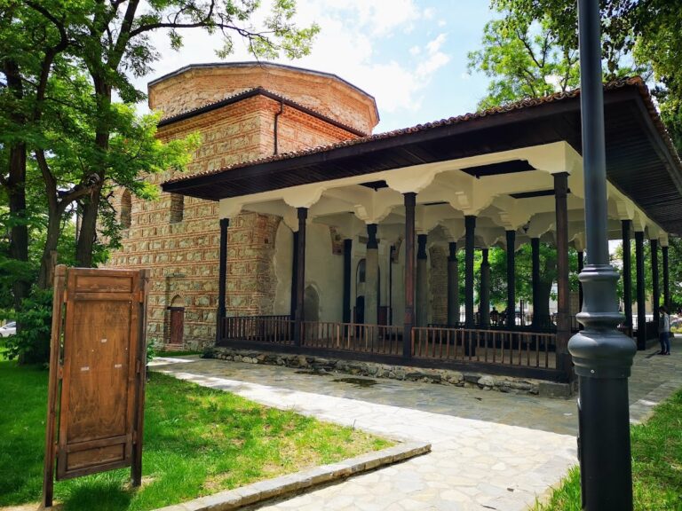
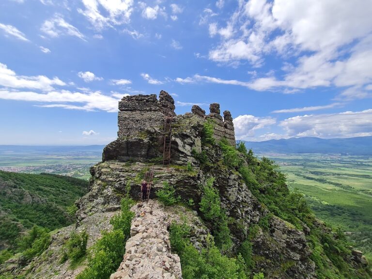
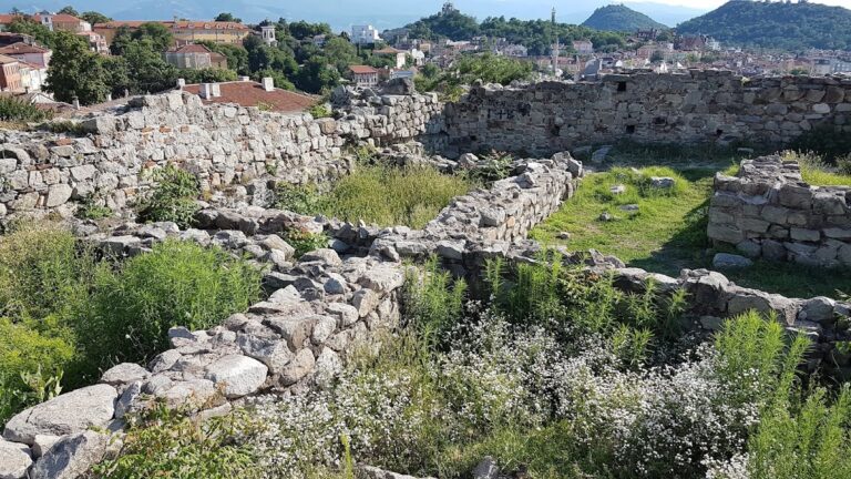
Archaeological research has revealed extensive Roman remains, and excavations continue to expose further parts of the ancient city. Much of the urban interior remains buried beneath a modern park, where ancient remains share the landscape with early twentieth-century villas, communist-era sanatoriums, and modern spa hotels. The principal remains, including the walls, central archaeological area, and necropolis, are preserved within the modern town, while an on-site museum houses objects recovered through archaeological work. The fortifications retain much of their original height and are among the best-preserved late-antique fortresses in Bulgaria. They remain a major part of Hisarya’s present townscape.
Remains
Fortifications and urban layout
Diocletianopolis occupied a natural terrace with valleys on three sides and was organized around its hot mineral springs. The city had a roughly quadrangular plan, with straight streets crossing at right angles. A water-supply system supported the settlement, while separate arrangements cooled and distributed hot mineral water. The fortified area covered about 20 hectares.
Walls, towers, and gates
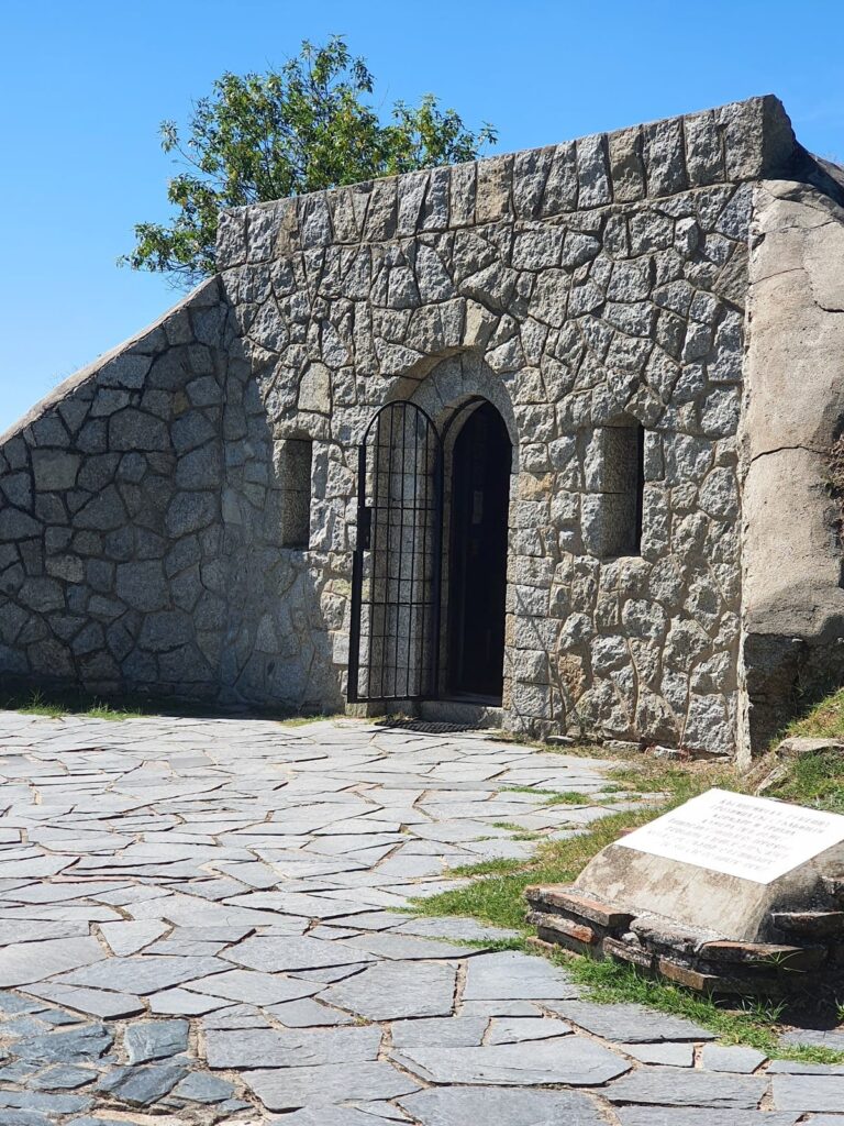
The defensive circuit extended for approximately 2,327 metres. Built from brick and stone, its walls were between 2.60 and 4 metres thick and reached about 11 to 12.5 metres in height. The principal gates rose to approximately 13 metres. Forty-four towers, four principal gates, and six smaller entrances formed part of the circuit, while a ditch and an earth rampart added further protection.
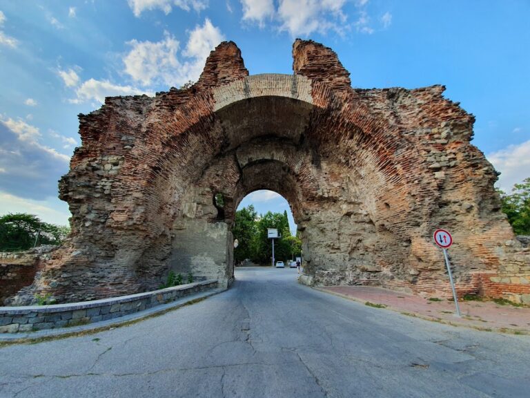
The northern section had no external valley to provide natural defence, so a second double wall was constructed outside it in response to increasing Gothic threats. The southern and western gates remain comparatively well preserved. The eastern gate, known as the Camels because its massive arch has a hump-like form, is the most visually prominent surviving entrance.
Military barracks
Roman barracks extended along the full length of the southern wall on both sides of the southern gate and continued along part of the eastern wall. Built during the second half of the fourth century, they housed a permanent garrison of approximately 600 soldiers. The barracks west of the southern gate have been exposed for display, and part of the complex was later incorporated into a Christian church.
Central public and bathing complex
The central urban area is preserved in situ in Momina Salza Park. Its remains include public buildings, shops, houses, the bathing complex, and the amphitheatre, arranged within the archaeological area. The city’s principal public building, described as a residence, was a large two-storey structure close to the baths. Its rooms ended in substantial vaulted constructions.
Thermal baths and spring sanctuary
The thermal-bath complex covered approximately 2,000 square metres and was supplied by the Toplitsa spring, whose water temperature is given as 51 degrees Celsius. The interiors were faced with marble. Rooms of different temperatures, two pools measuring 15 by 5 metres, and spaces for massage and balneological treatment formed part of the complex. Roman thermae were public bathing buildings that could combine heated rooms, pools, treatment spaces, and water-management installations.
The baths were heated by directing hot mineral water through the building rather than by using furnaces, an unusual arrangement by Roman standards. The complex remains connected to the hot springs and retains its pools, while parts of the structure are still being excavated.
A nymphaeum, a monumental fountain or shrine associated with water, was established around the springs by the middle of the second century and dedicated to the deities of the waters. Numerous votive objects indicate ritual use. At the end of the second century, the structure was enlarged with three rooms to form thermal baths. Major extensions to the south and west during the fourth century created the large complex that survives in the central archaeological area.
Amphitheatre
The amphitheatre stood unusually close to the city centre and inside the fortifications. Built in the third century, it had an irregular pear-shaped plan, an arena, and service rooms. The surviving arena and service spaces are described as well preserved. Sporting contests and animal fights took place there, including during the later period when Christian norms discouraged bloodshed after Christianity had become the official religion of the empire.
Christian buildings
The churches of Diocletianopolis preserve the city’s transition from pagan religious practice to early Christian architecture. They range broadly from the fourth to the sixth centuries and include buildings within the walls, churches outside the fortifications, and structures in surrounding districts.
Basilicas within the city
One unusual basilica had two aisles rather than the more typical one- or three-aisled arrangement. It was built in the middle of the fifth century over part of the barracks complex. An aisle is a longitudinal division of a church interior separated from the central nave by supports.
A church near the southern gate stood beside the inner side of the city wall and was converted in the middle of the fifth century from an earlier barracks building. Another church near the eastern wall, beside the present Archaeological Museum, was built during the first half of the fifth century over an earlier structure. A chapel and cemetery later occupied the same location in the ninth or tenth century.
Churches beyond the walls
The Church of Saint Stephen stood 120 metres outside the southern fortification. Built in the middle of the fourth century, it was reconstructed during the second half of the fifth century and was probably used until the tenth century. A church 200 metres north of the walls was built in the fourth century but was destroyed during construction of the railway station.
Other churches stood at varying distances from the fortified city. One was built 650 metres from the southeastern corner of the walls in the middle of the sixth century, while another stood 22 metres northeast of the eastern gate and dates from the late fifth or early sixth century. A church in the Momina Banya district was built during the first half of the fifth century. A three-aisled church 700 metres south of the southern gate was built in the late sixth century, apparently over an earlier necropolis.
Churches in the surrounding districts
A chapel was added outside the eastern wall during the fifth or sixth century. At the Yurta locality, five kilometres east of the city, another church was built in the second half of the fifth century. A single-aisled church in the Verigovo district dates from the sixth century, and a single-aisled basilica stood near Verigovo on Saint George’s Peak.
At the northern corner of the fortress, a three-aisled church was built in the middle of the fourth century over a destroyed pagan sanctuary. It was probably destroyed by the Huns and replaced during the second half of the fifth century by a larger three-aisled basilica. These successive buildings preserve evidence of religious change as well as rebuilding after military damage.
Necropolises and tombs
Five necropolises lay outside the fortifications, and five late-antique tombs survive. A necropolis is a cemetery or burial area. The largest and richest tomb stands approximately 300 metres south or southeast of the fortified city in Slavey Dol Park. It was built during the second half of the fourth century and used twice.
The tomb is underground and constructed from large stone blocks and masonry. A long corridor or passage leads to a staircase and a burial chamber, which is covered by a large earthen mound. The chamber retains a largely intact, colourful decorative floor mosaic. Sparse traces of frescoes survive on the walls, while the mosaic remains the principal surviving interior decoration.