Western Archaeological Zone, Kos: Hellenistic and Roman Civic and Athletic Complex
Site at a Glance
- Rating
- 4.4
- Popularity
- Very Low
- Country
- Greece
- Primary era
- Classical
- Eras represented
- Classical, Medieval
- Civilizations
- Byzantine, Greek, Roman
- Site type
- City
History
The Western Archaeological Zone on Kos in Kos, Greece, is an urban complex created and shaped first by Greek builders in the Hellenistic era and later expanded by Roman occupants. Its main phases span the late Classical and Hellenistic centuries into the Roman imperial period, and the site contained major civic and athletic facilities that anchored public life, including a gymnasium, a stadium and several large bath complexes. Over time those institutions gave rise to later religious uses, making the area a centre for athletic, social and then ecclesiastical functions in the city.
In the Hellenistic period, construction began on athletic and civic installations. Elements of a gymnasium and a stoa date to the fourth and third centuries BCE, and a covered exercise portico, the xyston (covered portico for athletic training), was built in the first half of the second century BCE. The stadium evolved from building activity that began in the fourth–third centuries BCE and reached a recognisable form by the first half of the second century BCE, taking advantage of the western slope for spectator seating.
During the Roman period the urban fabric was reshaped and enlarged. From the second into the third century CE there was intensive building and repair work across the zone: private houses received elaborate floors and murals, a large travertine seating block was added to the stadium’s western side, and several large bath complexes were erected or remodelled. A number of baths are dated to the third century CE, and under Roman occupancy earlier Hellenistic elements were often absorbed into new walls or reused as foundations.
A violent earthquake in 469 CE caused major collapses, including the eastern gymnasium portico (xyston), the western bath complex and the public latrine attached to the baths. After the seismic destruction parts of ruined structures were incorporated into new walls and, in some cases, the Roman bathing buildings were adapted for Christian purposes. Bath premises were converted into an Episcopal complex that included two basilicas, a baptistery and other halls, signalling a change in function from urban leisure to ecclesiastical administration and worship.
The western sector fell out of use in the medieval centuries and later emerged as an archaeological area. An archaeologist named Herzog revealed remains of the stadium starting line in 1900. Following a destructive earthquake in 1933, excavations carried out by Italian archaeological teams between 1936 and 1940 exposed much of the ancient fabric, prompted alterations to the modern urban plan, and led to restoration work that revealed porticoes, pillars and mosaic pavements.
Remains
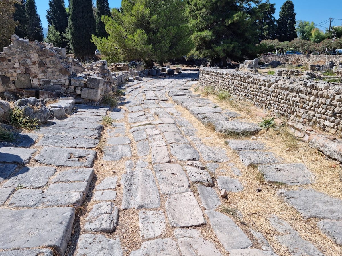
The site’s plan is organised around two main Roman streets that intersect in the southern quarter, creating a clear urban grid. The east–west road, the decumanus, has been cleared for roughly 150 metres with a maximum overall width approaching 10.5 metres and a narrower carriageway. A north–south street, the cardo, runs for about 160 metres in a northeast–southwest direction; travertine slab paving survives for roughly 120 metres. The cardo shows large travertine slabs bearing deep wheel ruts, narrow raised pavements on either side and a broad sewer beneath the carriageway covered by large porous stone slabs and vaulting, while a skilfully laid drain runs beneath the southern pavement of the decumanus.
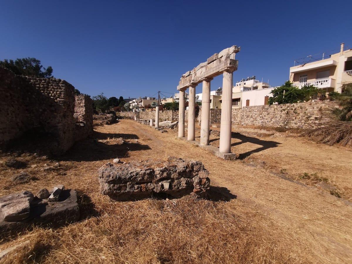
The West Gymnasium occupies an elongated block roughly 180 by 90 metres and centred on an open courtyard ringed with columns. Its eastern side once featured a covered portico, the xyston (covered portico for athletic training), erected in the early second century BCE and represented today by a restored group of island marble pillars aligned northeast–southwest. Part of the gymnasium’s eastern portico was revealed and rebuilt in 1940, leaving visible foundations, column bases and sections of the surrounding colonnade.
The stadium presents a rectangular field about 180 metres long and 30 metres wide and originally made use of the natural slope for tiered seating on the west. In the Roman phase a large travertine tribune was added to the western side. The starting line, or aphesis (starting line), survives as the remains of seven pillar supports that once anchored the starting apparatus for races.
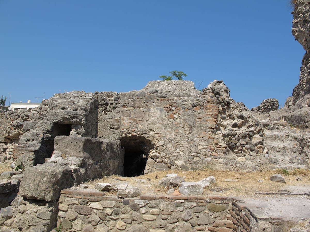
Several bathing complexes stand out. The West Thermae, dated to the third century CE, is a trapezoid block some 92 metres long and 33 to 35 metres wide; part of a vaulted chamber survives and mosaic and decorative floors were associated with its bathing rooms. The Northern Thermae, also given to the third century CE, lies northeast of 31 Martiou Street and includes a long vaulted room, hot-air spaces beneath the floors and Roman walls built around or incorporating travertine elements from earlier fourth–third century BCE structures. The Harbour Thermae, located close to the ancient harbour and city wall, centres on a round chamber flanked by stoas; its walls show heating bricks with perforations, and nearby pavements yielded figurative mosaics depicting a Medusa head, fish and a thyrsus (a staff tipped with a pine cone).
A large public latrine attached to the baths, often called the Forica or nymphaeum, dates probably to the third century CE and was wrecked by the 469 CE quake. The building forms a near square of about 18 by 20 metres and has a western entrance opening into a seven-metre inner courtyard with a central well. That courtyard was ringed by white-marble pillars and faced a western wall roughly 4.10 metres high, pierced by three deep niches each containing pools. The paved surface alternated marble slabs with geometric mosaics and included two dolphin panels. Traces of column pedestals survive (eleven pillars have been reconstructed on site), above which double rows of brick arches rose. Marble cladding about 1.85 metres high lined some interior walls. A wide sewer runs along the northern side and rests on porous-stone supports that form the stone seats used for defecation on three sides.
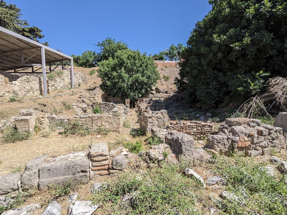
North of the decumanus a dense block of Roman houses displays rich floor mosaics and painted walls. Named houses include the House of the Abduction of Europa and the House of Silinos or Sitinos, titles drawn from the scenes shown in their mosaics. A private building south of the main thermae incorporates walling from a fourth–third century BCE dwelling that was remodelled into a Roman residence. At the north edge of the excavated zone a large second-century CE mosaic, about 14.20 by 6.65 metres and divided into three squares, depicts scenes of animal combat, while another Roman-period pavement at the site’s northern limit presents the Judgment of Paris.
Smaller civic and domestic features reflect a long sequence of reuse. A porous-stone stoa from the fourth–third centuries BCE stood east of the paved street and was rebuilt in the Roman era. Construction employed travertine seats, island marble pillars, porous stone and softstone foundations, with brick arches rising above in places; large porous blocks also serve as sewer slabs. Portions of porticoes and columned walks have been uncovered and conserved, including a line of gymnasium pillars reset in their original alignment. Unearthed mosaics and sculptural fragments are conserved and displayed in the local museum, and surviving elements on site range from partially preserved vaulted rooms and mosaic floors to travertine seating, exposed sewers and foundational courses.