Padovinys Hillfort: An Archaeological Complex in Lithuania
Site at a Glance
- Rating
- 4.7
- Popularity
- Very Low
- Country
- Lithuania
- Primary era
- Medieval
- Eras represented
- Classical, Medieval
- Civilizations
- Unclassified
- Site type
- Military
- Remains
- Fort
On this page10 sections
History
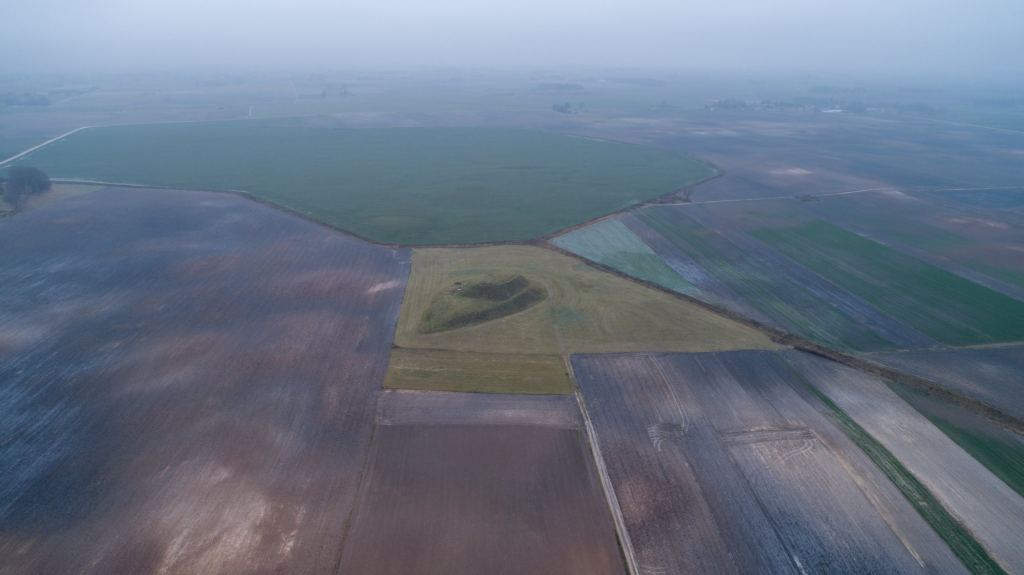
Padovinys hillfort is an archaeological complex in Lithuania, comprising a fortified hill and an associated foothill settlement dated from the first millennium to the beginning of the second millennium. The hillfort and settlement formed a connected centre of occupation, with the settlement extending around the base of the defended elevation.
Local Traditions and Early Investigation
The hillfort has long been known in the local area. Traditions maintain that ancient weapons and valuables were hidden there, while two mysterious lights are said to emerge from the hillfort at night and move through the meadow. These stories form part of the site’s local cultural memory.
Jonas Totoraitis, a priest and historian, mentioned Padovinys hillfort in 1908. In 1935, the State Archaeological Commission gathered information about the site and instructed its landowner, Juozas Grinius, to protect it.
Archaeological Research and Protection
The Institute of History of the Lithuanian Academy of Sciences surveyed the hillfort in 1954 and again in 1962. Archaeological finds were recovered from both the hillfort and the foothill settlement, confirming the wider extent of the occupied complex.
In 1972, the hillfort was declared an archaeological monument of republican significance under designation AR338. The hillfort and settlement were entered into the archaeological-sites register as a cultural-heritage complex in 1997, designated a cultural monument in 1998 under A237KP, and recognized as a state-protected monument in 2005.
Remains
Site Setting and Layout
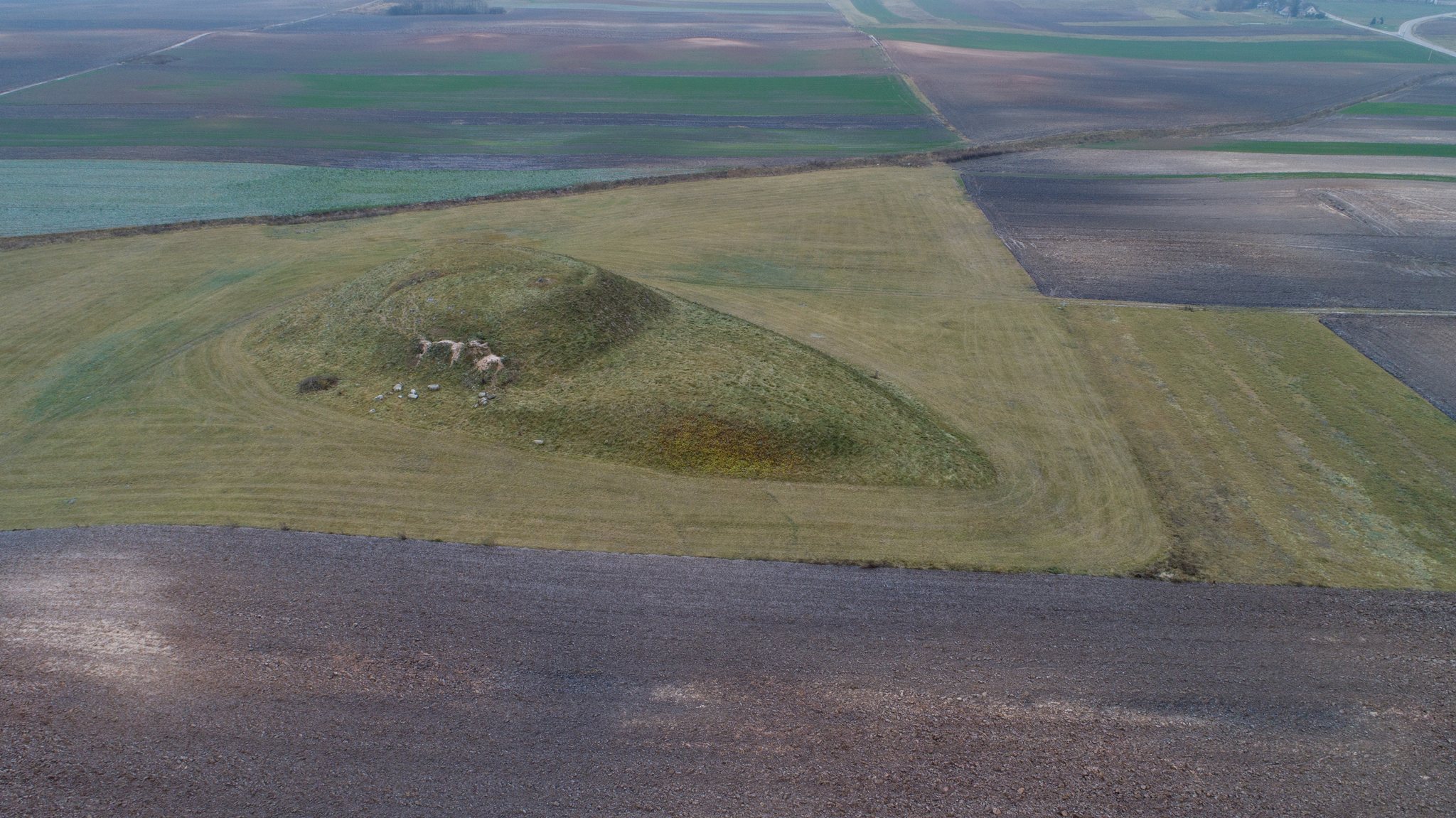
The archaeological complex covers 33,500 square meters. An unnamed tributary of the Dovinė River borders it on the north and east, while cultivated fields lie to the west and south. The hillfort occupies the highest, southwestern part of the complex. The settlement extends westward, northward, and eastward from the hillfort, and a field road crosses its central area and follows the eastern and northern foot of the hill.
Hillfort
Summit and Ramparts
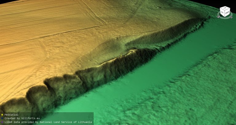
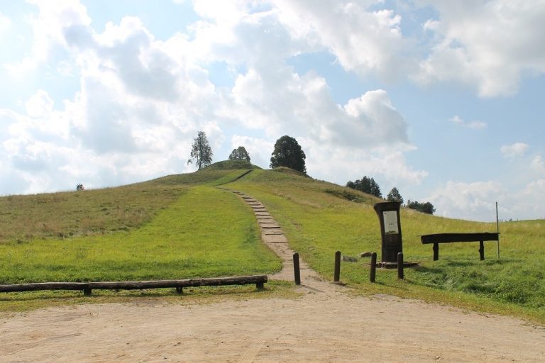
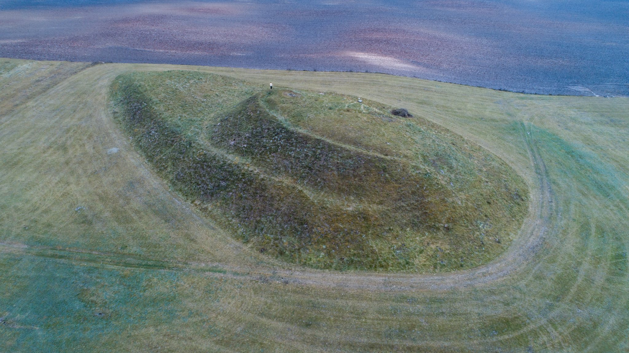
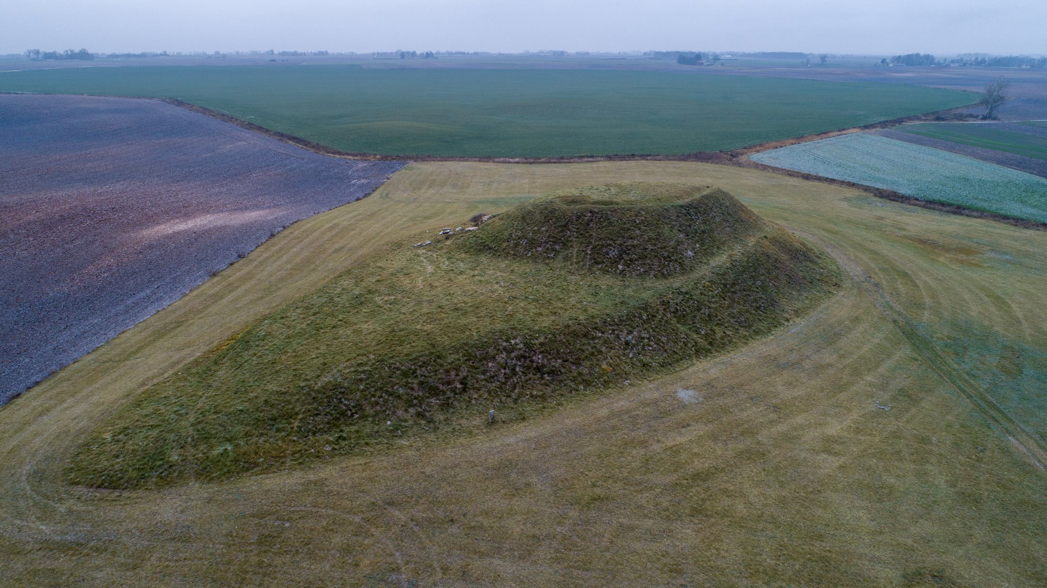
The hillfort stands on a separate hill measuring 120 meters from northeast to southwest and up to 60 meters across. Its northeastern part is higher, with slopes 9 to 11 meters high that become steep near the summit. The elongated, oval summit platform follows the northeast to southwest axis and measures 27 by 22 meters. A rampart 1 meter high and 12 meters wide runs along the southwestern edge, while traces of an earlier rampart remain visible at the northeastern end.
Terraces and Present Condition
A terrace occupies the southwestern part of the hillfort, 3 meters below the summit platform. It measures 30 by 30 meters and has a recorded height of 56 meters; its slopes are gentler than those elsewhere on the hillfort. Another terrace, between 1 and 4 meters wide, once encircled the hill approximately 6 meters above its foot. The northern and northwestern portions of this terrace have been destroyed.
Ploughing and trenches dug along the edges of the summit platform have disturbed the hillfort. Grass now covers the site.
Foothill Settlement
The ancient foothill settlement lies at the northern, western, and eastern foot of the hillfort and covers about 2 hectares. Its surviving area currently consists of relatively level, fallow fields. Sherds recovered there include smooth, striated, and rough-surfaced pottery, the same three pottery types found on the hillfort.
Archaeological Finds
Objects recovered from the hillfort include a silver bow brooch, a metal fastening pin used to secure clothing, a bronze buckle, two clay spindle whorls, and pottery with smooth, striated, and rough surfaces. A spindle whorl is a weighted object fitted to a spindle to help turn and tension thread. The excavated finds are held by the Lithuanian National Museum.