Aukuro kalnas: A Kernavė Hillfort and Ducal Castle Site in Lithuania
Site at a Glance
- Rating
- 5
- Popularity
- Very Low
- Country
- Lithuania
- Primary era
- Medieval
- Eras represented
- Classical, Medieval
- Civilizations
- Grand Duchy of Lithuania
- Site type
- Military
- Remains
- Castle
On this page12 sections
History
Aukuro kalnas is a hillfort in Kernavė, Lithuania, occupied from the first century BC and incorporated into a fortified settlement complex that developed from the first century to the beginning of the fifteenth century. It is one of the hillforts on the southern edge of Kernavė, beside the Neris valley. The site was formerly associated with an altar supervised by attendants of a sacred fire, but it is now more commonly interpreted as the location of Duke Traidenis’s estate. Its later importance came from the wooden castle that stood here during the thirteenth and fourteenth centuries.
Early settlement and fortification
The hill was inhabited from the first century BC to the first century AD. A long post-built structure stood along the edge of the summit during this early phase. It contained a stone-packed hearth and burned down. The site later became part of the fortified Kernavė complex, with defenses adapted to its elevated position above the valley.
In the fourth century, the wooden fortification was rebuilt. A pine-log trackway led across the marsh of Pajauta Valley toward the hillfort during this phase. In the middle of the fifth century, nomadic groups arriving from the south attacked the stronghold. They fired on it from both the valley and the upland side, destroyed it by fire, and were followed by a rebuilding of the defenses.
The ducal castle
A wooden castle occupied Aukuro kalnas during the thirteenth and fourteenth centuries. Its external defenses extended onto the neighboring Mindaugas Throne and Lizdeika Hillforts, while the Garrison Hillfort formed an outer defended area to the northwest. Imported goods found at the site indicate that the hillfort contained a ducal castle rather than only a local settlement.
The Kernavė area was attacked by the Livonian Order in 1279. The Livonian Order was a medieval Catholic military organization that fought for territory in the eastern Baltic. In the second half of August 1365, Butautas, the son of Kęstutis, captured the castle after advancing from Vilnius with an army of the Order.
From 1386 to 1392, Kernavė was governed by Vygandas, also known as Alexander, the brother of Jogaila. In 1390, the castle’s defenders set it on fire before the approaching Order army could take it. Vytautas, later Grand Duke of Lithuania, was then fighting on the Order’s side. Aukuro kalnas was not rebuilt after the destruction. Vytautas’s estate was probably established on Pilies Hill, where it is mentioned in 1398, 1409, 1429, and 1432.
Archaeological investigation and protection
Vladislovas Sirokomlė, also known as Ludwik Kondratowicz, attempted to excavate the hillfort in 1857 and found charcoal. The Institute of History surveyed it in 1970. Aleksiejus Luchtanas investigated 209 square metres on the hillfort in 1985 and 1992 to 1993, as well as an area at its northern foot in 1985. These investigations revealed a cultural layer, the accumulated deposit created by human occupation, that reached up to 2 metres in thickness and contained material from the first to the fourteenth century. The excavated finds are held by the National Museum of Lithuania.
The Kernavė archaeological site became a state cultural reserve in 1989 and was added to the UNESCO World Heritage List in July 2004. The complex contains more than 50 archaeological, historical, and cultural monuments, including Aukuro kalnas, the Mindaugas Throne and Lizdeika Hillforts, the Garrison Hillfort, the Kriveikiškis Hillfort, the Kernavė cemetery and burial mound, and settlements. The names of the hillforts were devised in the nineteenth century. Aukuro kalnas was declared a cultural monument by a Lithuanian government resolution of 23 December 1999, and its protected territory covers 13,000 square metres.
Remains
Hilltop and defensive setting
Summit platform
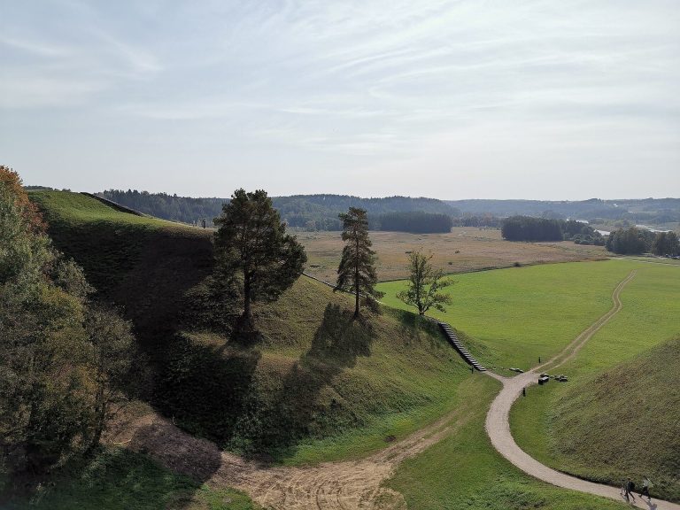
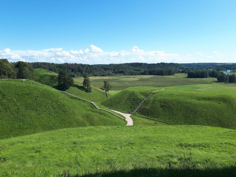
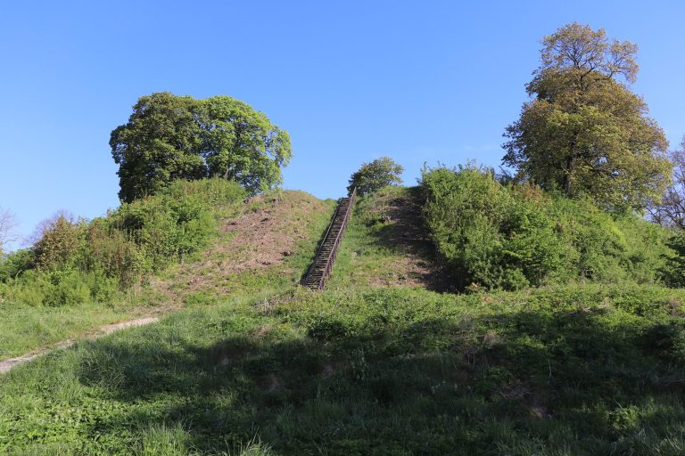
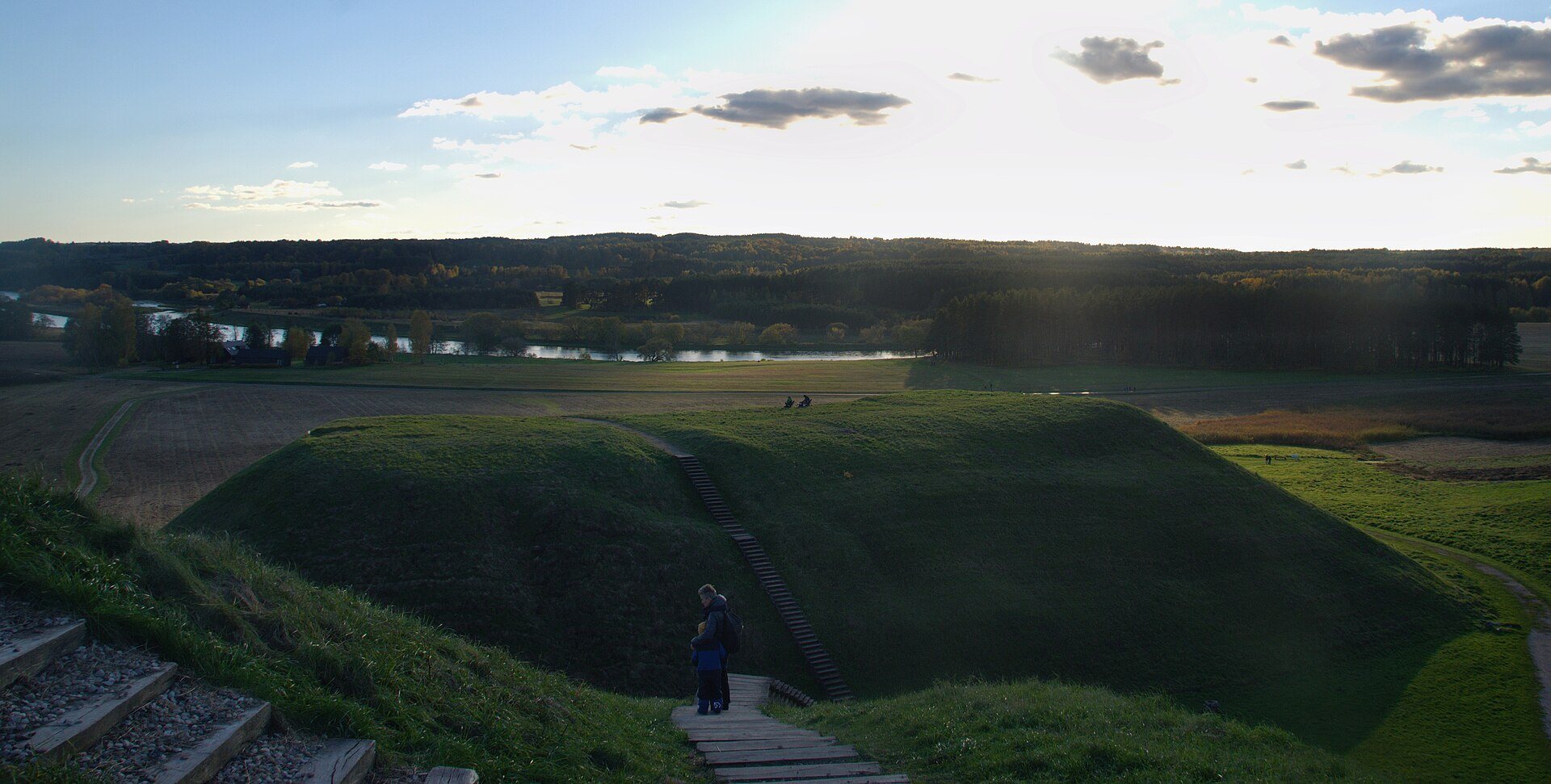
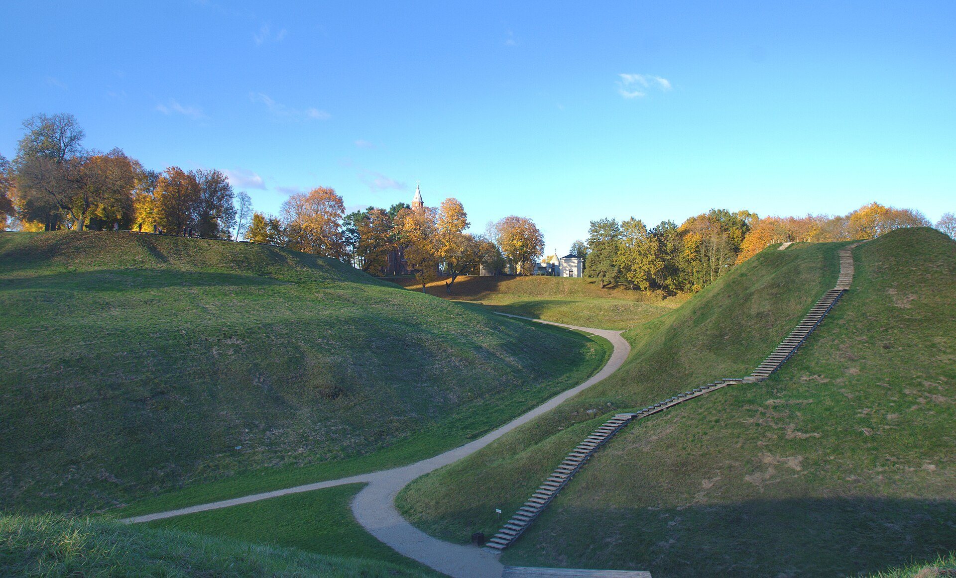
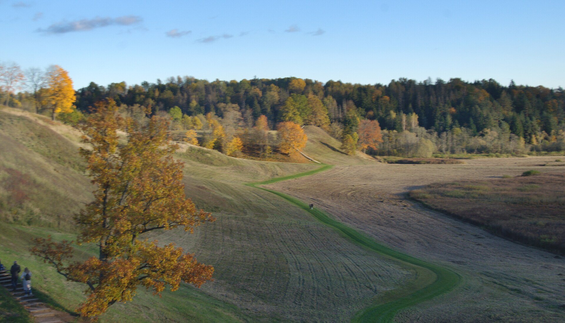
Aukuro kalnas occupies an isolated hill beside the valley of the right bank of the Neris. Its summit lies 9 to 17 metres below the upper Neris terrace. The roughly rectangular summit platform extends from east to west and measures 53 by 26 metres. Its steep slopes rise 13 to 18 metres above the surrounding land.
Ramps, ditches, and outer defenses
A crosswise ditch once ran at the northeastern foot, accompanied by a rampart about 2 metres high and 10 metres wide. The rampart was destroyed in 1985. Access from the upland side was strengthened by two external defensive enclosures, or foreworks, to the north and east. These corresponded to the Mindaugas Throne and Lizdeika Hillforts. A subsidiary defended area, the Garrison Hillfort, lay to the northwest as an outer bailey.
A 3-metre-deep ditch separated Aukuro kalnas from the Mindaugas Throne forework. Its eastern section contained a 2-metre-high clay embankment that acted as a dam, retaining water in the ditch. Finds from the ditch included a cylindrical iron lock, a belt buckle, fragments of bronze and glass bracelets, imported Middle Eastern glass vessels, wheel-thrown pottery, and animal bones.
Structures and archaeological layers
Early summit building
During the first century BC to the first century AD, a long building stood along the summit edge. It was constructed with wooden posts, measured 4 metres in width, and contained a hearth packed with stones. Its 0.9-metre-wide entrance opened toward the summit. The building was destroyed by fire.
Wooden castle defenses
The thirteenth- and fourteenth-century castle had a wooden wall following the edge of the summit. Posts supported the wall, and sharpened stakes angled outward were set into the ground beyond it. The pine-log trackway associated with the fourth-century rebuilding measured 2.3 to 2.7 metres wide and crossed the Pajauta Valley marsh from the southwest toward the hillfort.
Objects from the occupation layers
The earliest cultural layer contained bronze bracelets, tubes, spiral rings, iron knives, awls, a knife-sickle, a rod-shaped pin, an arrowhead, clay loom weights of Dyakovo type, fragments of clay moulds for flat temple ornaments, bone needles, parts of arrowheads or spearheads, brushed pottery, and animal bones. Dyakovo culture was an Iron Age archaeological culture centered in the upper Volga region, and the term here identifies the type of loom weight.
The layer created by the mid-fifth-century fire contained human bones, an iron spearhead, part of a fighting knife, grain, and animal bones. Material from the rebuilt fortification included clay spindle whorls, iron knives and awls, a sickle, thick-ended bronze bracelets, and rough-surfaced pottery.
The later castle produced two iron spearheads, part of a chain-mail garment, a sword crossguard fragment, a piece of a silver Lithuanian ingot, and a copper imitation plated with silver. Other finds included a complete Gothic brick, bone and slate spindle whorls, a gaming die, glass-bracelet fragments, beads, lead seals, imported yellow- and green-glazed pottery made from white clay, and fragments of Middle Eastern glass vessels. About 30 arrowheads came from the 1365 attack, when crossbows and bows were used against the castle from the valley side.
Parts of the hillfort were altered in the nineteenth century by a ditch cut across the site and by several pits excavated in its southern area. These changes form part of the later physical history of the hillfort alongside the archaeological investigations that revealed its earlier occupation and defenses.