Mindaugo sostas: A Fortified Forework at Kernavė, Lithuania
Site at a Glance
- Rating
- 5
- Popularity
- Very Low
- Country
- Lithuania
- Primary era
- Medieval
- Eras represented
- Medieval
- Civilizations
- Grand Duchy of Lithuania
- Site type
- Military
- Remains
- Fort
On this page13 sections
History
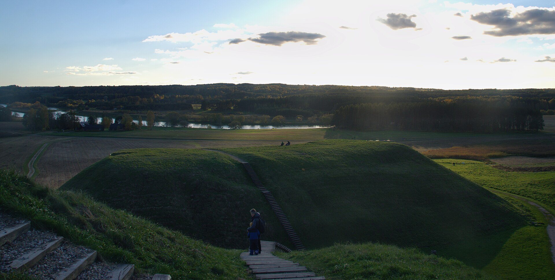
Mindaugo sostas is a fortified forework in Lithuania, located at Kernavė on the right slope of the Neris Valley. Associated with the hillfort known as Aukuro Hill, the site was probably established as a fortified enclosure in the fourteenth century, although habitation there began by the middle of the first millennium. The traditional name means “Mindaugas’s Throne,” referring to Mindaugas, the thirteenth-century ruler who became Lithuania’s first crowned king, but the name was created in the nineteenth century and does not establish a historical connection with him.
Early occupation and fortification
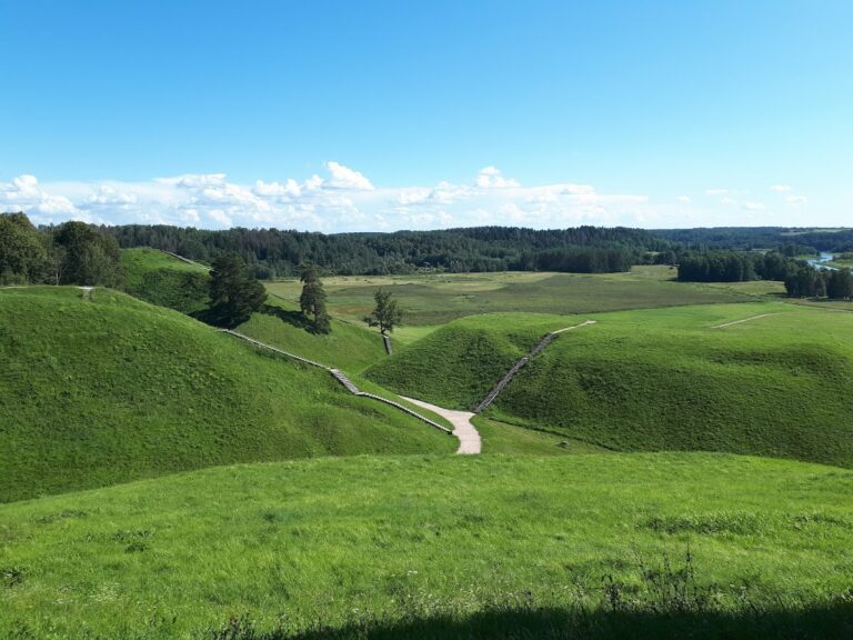
Mindaugo sostas formed part of the Kernavė hillfort group, a network of elevated settlements and defensive sites on the southern outskirts of the town. Its fortified phase included wooden buildings and a wooden defensive wall. The enclosure belonged to a wider archaeological landscape that also contained Aukuro Hill, Lizdeika Hill, Garrison Hill, Kriveikiškis Hillfort, cemeteries, and settlements. The names now used for the hillforts were created in the nineteenth century.
During an attack in 1365, the forework was burned. The enclosure was then levelled and rebuilt, receiving a new wooden defensive wall and utility buildings. This rebuilding created a distinct later phase in the site’s history and preserved evidence of the changes made after the attack.
Investigation and protection
Vladislovas Sirokomlė, also known as L. Kondratavičius, attempted excavations at the hillfort in 1857. The Institute of History surveyed it in 1970, while Pranas and Regina Kulikauskas excavated almost the entire enclosure between 1979 and 1982. Their work covered 564 square metres and revealed a cultural layer, the accumulated deposit produced by human occupation, measuring up to 2.5 metres thick. The finds extended from the fifth to the fourteenth centuries.
The eastern slope collapsed on 8 March 1979 and was later reconstructed. Erosion-control work followed between 1985 and 2004. The hillfort is broadly dated from the first millennium to the fourteenth century. A resolution of the Government of the Republic of Lithuania dated 19 May 1998 designated it a cultural monument, with a protected territory covering 10,800 square metres.
Mindaugo sostas is part of the Kernavė archaeological complex, which became a state cultural reserve in 1989 and was added to the UNESCO World Heritage List in July 2004. The UNESCO designation places cultural and natural sites considered to have outstanding universal value within an international heritage framework.
Remains
Enclosure and natural setting
Forework enclosure
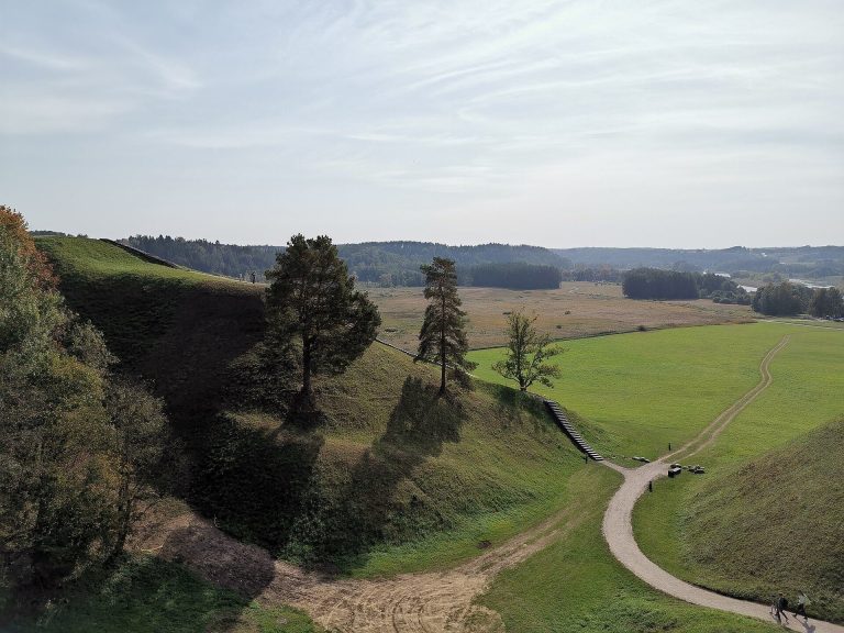
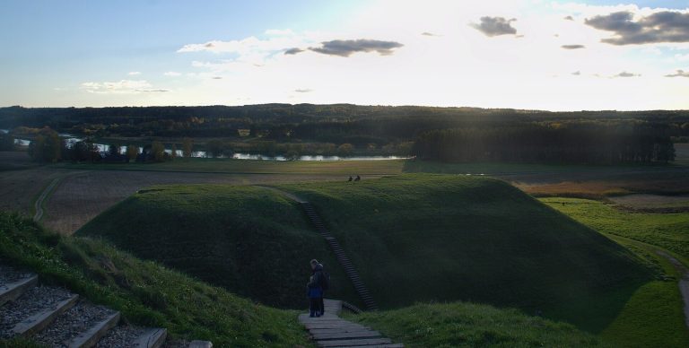
The forework occupies a highland promontory north of the main hillfort, beyond a natural ditch approximately 11 metres deep and 50 metres wide. Its enclosure is an irregular quadrilateral elongated along a north-south axis, measuring 57 by 24.5 metres. Steep surrounding slopes rise or descend across heights of about 20 to 22 metres, giving the fortified area a naturally elevated position.
Northern rampart
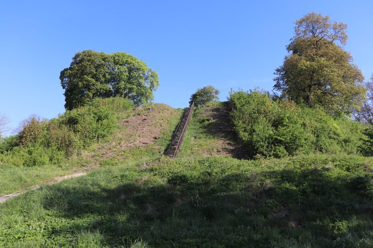
A rampart, an artificial defensive bank, was raised at the northern end of the enclosure. It is 5 metres high and 16 metres wide. Its outer slope descends for 15 metres into a spring-fed natural ditch about 10 metres deep and 45 metres wide. The eastern part of the forework slipped, and the eastern slope was reconstructed after the 1979 collapse. Further work between 1985 and 2004 stabilized the slope against erosion.
Wooden defenses and buildings
Earlier defensive phase
The earliest identified structures were wooden residential buildings equipped with stoves. A wooden defensive wall followed the uneven edges of the enclosure. Its position is marked by a pavement up to 1.5 metres wide, strengthened with clay and stones. The wall consisted of large logs set into the ground and joined together, then coated with clay.
Post-1365 rebuilding
After the fire of 1365, the damaged area was levelled with layers of sand between 0.5 and 1.5 metres thick, followed by clay layers measuring 0.3 to 0.8 metres. A new clay-coated wooden wall was erected around the enclosure edges. Utility buildings 3.4 metres wide were placed against its inner side, creating a rebuilt defensive and working area within the forework.
Archaeological finds
Objects from the earlier occupation
Material from the earlier phase includes coarse and wheel-thrown pottery, vessel fragments, animal bones, and a range of personal and household objects. These include a cast bronze horseshoe brooch, a cast circular plate brooch, part of a bracelet, fittings, an iron arrowhead, a metal mount, parts of cylindrical locks, knives, a clay egg, spindle whorls, and a bone awl.
Objects from the rebuilding phase
The later occupation produced an iron crossbow-bolt head, a punch, knives, a sickle, scissors, a razor, a spur, parts of cylindrical locks, the head of a bronze key, fittings, and a jingle bell. Wheel-thrown pottery and grains also belonged to this phase, providing evidence for work, storage, and daily activity after the forework was rebuilt.