Kale-i Tavas: The Fortified Settlement of Ancient Tabae in Turkey
Site at a Glance
- Rating
- 4.4
- Popularity
- Low
- Country
- Turkey
- Primary era
- Classical
- Eras represented
- Classical, Medieval, Early Modern, Modern
- Civilizations
- Byzantine, Ottoman, Roman, Seleucid
- Site type
- City
On this page28 sections
History
Kale-i Tavas is a ruined fortified settlement in Turkey, on an isolated limestone plateau immediately south of the modern town of Kale in Denizli Province. Built and occupied by successive Anatolian, Hellenistic, Roman, Byzantine, and Turkish communities, it preserves the remains of the ancient city of Tabae, whose occupation began by the Late Bronze Age and continued into the twentieth century.
Early occupation and the Hellenistic city
Pottery from the citadel places the earliest known occupation at approximately 2000–1200 BC, although no exact foundation date is known. Regional settlement extended back to the Chalcolithic period, while imported Corinthian and early painted Greek pottery points to activity at the site during the seventh and sixth centuries BC. The city stood in the southern Tavas plain near the boundary between ancient Caria and Pisidia, regions of southwestern Anatolia, and its population included Pisidian, Hellenic, and Phrygian elements.
Tradition attributed the foundation of Tabae to the reign of Alexander the Great. An ancient foundation story named the hero Tabenos as its founder and associated his supposed brothers with the cities of Kibyra and Kidramos. Historically, Tabae was a Hellenistic foundation. It was under Seleucid rule at the beginning of the third century BC, when it possessed the constitution of a polis, a self-governing Greek-style city-state.
Tabae was connected by the Carian road with Apollonia Salbake, Herakleia Salbake, Sebastopolis, Kidramos, and Aphrodisias. The city developed as a local center during the Hellenistic period. Workshops produced a varied range of pottery, and slag indicates metalworking and a possible foundry. Tabae also issued silver and bronze coins from the Hellenistic period until the reign of Gallienus. It was the only city in the Tavas plain known to mint silver coinage.
Roman rule and late antiquity
In 189 BC, during the Galatian campaign of the Roman commander Gnaeus Manlius Vulso, the Roman army defeated Tabae. The city surrendered after agreeing to pay 25 talents of silver and provide 10,000 medimni of wheat, an ancient measure of grain. After 167 BC, Tabae was described as a friend and ally of Rome, and Rome confirmed its autonomy in 81 BC.
The city remained largely peaceful after the reign of Augustus. Roman armies passed through Tabae during the reigns of Trajan and Caracalla, while local production and civic life continued. Roman-period remains and finds show the city’s continuing occupation, including pottery, oil lamps, coins, glass, metal sculpture fragments, and ceramic vessels.
During the Byzantine period, Tabae remained part of Caria and had become an episcopal center by the seventh century. Its bishopric was subordinate to Stauropolis, the late antique name associated with Aphrodisias, until the thirteenth century. Bishops named Rufinus, Severus, and Basil are connected with the councils of Ephesus in 431, Constantinople in 553, and Nicaea in 787. The city lost much of its earlier importance at the beginning of the twelfth century.
Seljuk and Menteşe rule
From 1206, the surrounding Denizli region came under Seljuk control. Kale-i Tavas was not taken immediately, and its prolonged siege was associated with Mirza Bey, a Seljuk commander and member of the Menteşe dynasty. The settlement was captured in 1260, after which many Christians left.
The fortress later became one of the principal cities of the Menteşe principality, a regional state ruled by a bey in medieval Anatolia. From about 1330 it was associated with the local Tavas principality and adopted the name Kale-i Tavas, meaning “Castle of Tavas.” For a period, the fortress was governed by Şücaeddin İlyas Bey. Ibn Battuta visited it in 1333 and described a strong castle ruled by İlyas Bey.
A fourteenth-century administrative account characterized Kale-i Tavas as a center governing more than 600 villages and maintaining an army of 14,000 soldiers, including 4,000 cavalrymen. Its position placed it between the principalities of Germiyanoğulları, Menteşeoğulları, Aydınoğulları, and Hamidoğulları, giving the fortress a strategic role in the political geography of southwestern Anatolia.
Ottoman administration and urban life
Kale-i Tavas entered Ottoman rule during the 1390s. It returned to Menteşe after Bayezid I was defeated by Timur at Ankara in 1402, then became permanently Ottoman under Murad II in 1424. In the Ottoman administrative system, the settlement belonged to the financial administration of the Menteşe sanjak, a provincial subdivision. Its lands were first classified as has estates, large revenue grants associated with the state, and later as timar holdings assigned in return for service. They were eventually given to Mihrişah Sultan, the mother of Selim III, and converted into foundations in her name.
During the sixteenth century, Kale-i Tavas had approximately 174 houses and 1,000 inhabitants, along with two mosques and the Cevher Paşa Hamamı. Nomadic groups also settled within the fortress. By the seventeenth century, the outer fortress contained approximately 300 houses, five mosques, ten markets, an inn, a bath, three primary schools, three public fountains, two religious lodges, and six zawiyas, small religious centers. About fifty households lived in the inner fortress.
The settlement’s economy combined agriculture, livestock raising, weaving, craft production, and caravan trade. Houses also functioned as workshops for wool textiles. The surrounding plain supported grain cultivation and village settlement, while the fortress remained an administrative and defensive center above the lowland.
Earthquakes, relocation, and archaeological work
A major earthquake sequence in 1702–1703 made parts of Kale-i Tavas uninhabitable and encouraged movement toward the modern town of Kale. The administrative center was transferred to Hırka, and Kale-i Tavas was later combined administratively with Yerengüme, now Tavas.
During the nineteenth century, the settlement gradually lost administrative importance to Yerengüme, which became the district center in 1868. Kale-i Tavas temporarily had village status from 1868 to 1895, then became a nahiye center, a smaller administrative district, after further administrative discussions and an imperial decree in 1895. An enumeration in 1893 recorded 3,921 inhabitants in 793 households within Kale-i Tavas itself.
The settlement remained inhabited into the 1950s, but accessible lowland locations had become preferable to defensible mountain sites. Earthquakes and landslides, especially after the 1954 Fethiye earthquake, destabilized the plateau and its excavated underground spaces. Evacuation began gradually in the late 1950s and culminated in the late 1960s, when residents moved to a newly established settlement about 1.5 kilometers away.
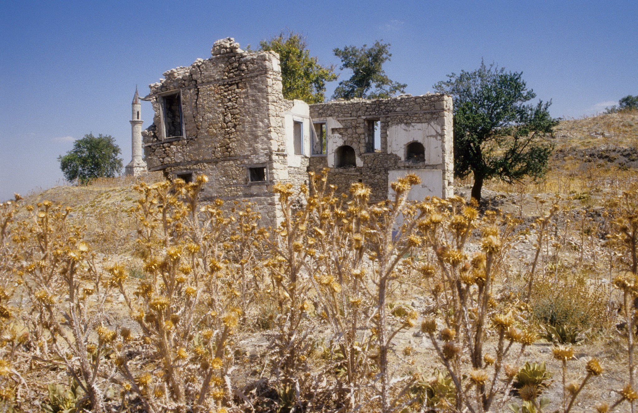
Most buildings were dismantled by their former residents, and stone and timber were reused in modern Kale and nearby villages. The settlement was progressively dismantled between the 1960s and 1990s. By the 1970s, only cellars and fragments of walls remained in many areas. The site is now commonly called Eski Kale, or “Old Castle.” Earlier names include Tabae, Tabai, Tabenos, Tabenon, Tabea, Davaz, Kale Davaz, and Nefs-i Tavas, while the name Kale-i Tavas appears in sources from approximately 1330 onward.
Archaeological investigations began in 2006, followed by systematic excavations in 2007. Work began under Bozkurt Ersoy of Ege University, continued from 2014 under the Denizli Museum and Pamukkale University, and was directed from 2015 by Mustafa Beyazıt. Excavations have addressed the citadel, mosques, baths, cisterns, wells, the historical cemetery, and Roman remains. Kale-i Tavas was declared a second-degree archaeological site in 1985. In August 2010, the designation was revised to first- and third-degree archaeological site status, protecting the ancient settlement, its medieval and Ottoman remains, and its archaeological deposits.
Remains
The ruins extend across a natural limestone plateau approximately 1,100–1,150 meters above sea level at the southern end of the Tavas plain. Steep slopes and deep ravines surround the plateau, which is reached by steep paths and bridges. The settlement covers approximately 1 square kilometer and stands on Lower Miocene marine limestone of the Kale Formation. This rock averages about 15 meters in thickness, varying from 7 to 20 meters, and rests on older gravel, sandstone, clay, and marl formations.
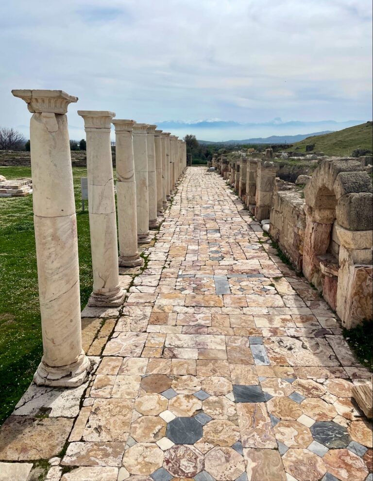
The limestone could be cut, hollowed, quarried, and shaped readily, making it the principal local building material. It also allowed inhabitants to create rock-cut dwellings, cisterns, wells, galleries, channels, and other underground spaces. The settlement had an inner citadel and an outer wall. Surviving evidence includes fragments of walls, bastion foundations, remains of the inner citadel, and a paved road exposed by excavation.
Rock-cut spaces and ancient performance building
Rock-cut dwellings and tombs
Rock-cut dwellings consist of single-room or two-room spaces, sometimes with wall niches and windows opening outward. Some rock-cut tombs were later enlarged and converted into churches during the early Christian and Byzantine periods. These spaces reflect the way the plateau’s limestone supported both domestic and religious construction below the level of the settlement surface.
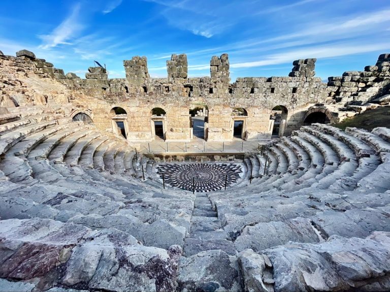
Odeon
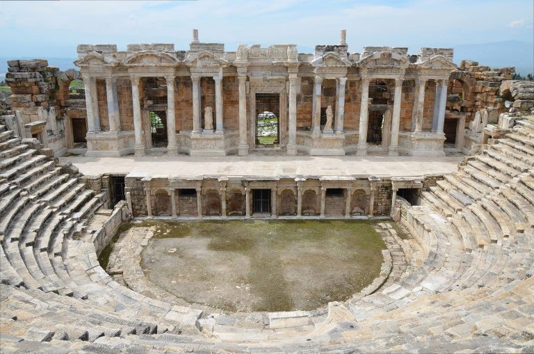
An Odeon, a small building for musical performances or assemblies, stood west of the Roman bath. Its surviving seating is represented by two rows, each approximately 4 meters long. Stones were removed from the seats and reused in mosques, while houses were later built over the upper remains during the late Ottoman or Republican period.
Water installations
Underground water system
The water system included cisterns, wells, channels, underground galleries, storage chambers, and possible tunnels. At least 366 ventilation or lighting shafts have been identified, although many underground spaces remain filled with sediment. Reservoirs were cut into the limestone down to the impermeable marl below, allowing rainwater to be collected and stored while reducing evaporation. A possible ancient water source was linked to the settlement by a covered channel found approximately 1 kilometer to the east. The channel may have carried water from a distance of 1–1.5 kilometers.
Roman Cistern I
Roman Cistern I lies between the lower and upper market areas. Cut into Lower Miocene limestone, it consisted of barrel-vaulted units supported by four square supports. Five central round arches divided the structure into two parts, and the cistern was larger than the settlement’s other known reservoirs.
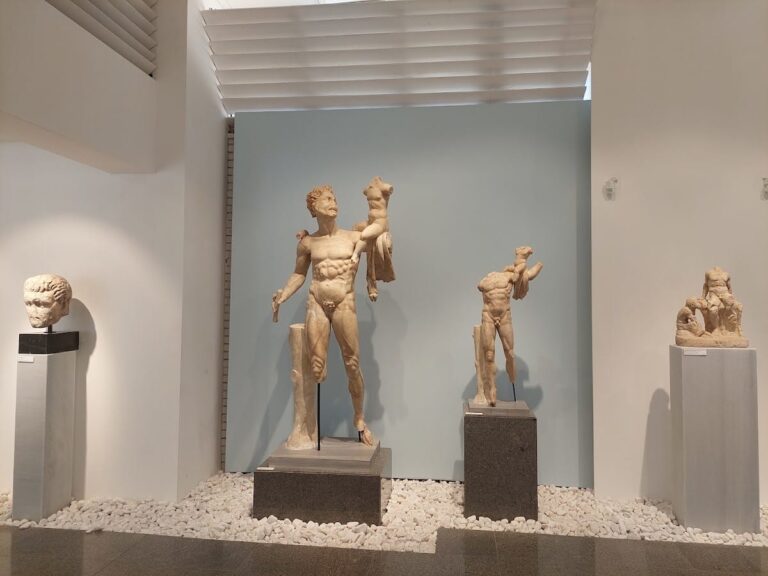
Bronze and marble statuary, coins, glass objects, and pottery were recovered from the cistern. A bronze statue head dates to the first century BC, while a marble female figure, possibly a Kore or Demeter, dates approximately to the second century BC. The latest datable coins belong to the reign of Gallienus. The cistern was probably used until the second half of the third century AD before gradually filling with sediment.
Cisterns II and III
Cisterns II and III stand together in the northeastern part of the built plateau, west of Well I. Both are irregular bottle-shaped reservoirs, approximately 3 meters in basal diameter and 4.5 meters high. Pottery from the first and third centuries AD places them in the Roman period.
Ottoman Well I
Ottoman Well I stands at the northeastern entrance. A 1-meter-long section of its wall survives, built from rubble and dressed stone that includes reused blocks. Wastewater left the well through a channel made from limestone slabs and entered the settlement’s drainage system. Three cisterns and three wells have been identified within the ancient settlement, and many water installations were concealed with rubble during use to prevent interference and limit water loss.
Public fountains
The Pazaryeri Fountain, southwest of the Pazaryeri Market Mosque, was built from stone and reinforced concrete and probably dates to the Turkish Republican period. The Hamam Yolu Fountain stands near the road to the Cevher Paşa Bath. It is attributed to the nineteenth century and was constructed from Lower Miocene limestone and mortar.
Bridges, churches, and Roman civic buildings
Roman bridge
The Roman bridge lies east of the plateau, immediately west of the modern highway, where it crosses the Masif Stream on the former Denizli–Muğla route. It has a single arch and is 7.90 meters wide. Its interior uses dressed stone, while the upper structure combines dressed and rubble stone. The bridge remained in use until the old settlement was abandoned and was later restored.
Possible rock-cut church
A possible rock-cut church, traditionally identified as a possible Church of Saint Michael, lies northwest of the inner citadel and southwest of the Cevher Paşa Mosque. Its two-level facade is cut into a vertical rock face. The lower level has two spaces with irregular arched openings and wall niches. The upper level contains a doorway, rectangular niches, a toothed triangular pediment, and small arched niches.
An elliptical apse, the curved end of a church sanctuary, indicates ecclesiastical use inside the structure. Its form suggests that it began as a rock-cut tomb and was later enlarged into a small single-aisled church. Three nearby Byzantine panels carry geometric designs and figures, including a haloed, winged angel holding a scepter and a globe. The figure probably represents the archangel Michael.
Roman bath
The remains of a large Roman bath lie southeast of the Pazaryeri Market Mosque. Its rectangular structure had wall foundations cut into the bedrock, with five niches in the northwest wall and three in the northeast wall. The complex also incorporated cisterns, shaft wells, and fountains.
Ottoman baths and mosques
Cevher Paşa Bath
The Cevher Paşa Bath occupies the northwestern part of the settlement on a slope descending from east to west at approximately 60 percent. The ruin measures about 12 meters from south to north and 21 meters from east to west, with walls surviving up to 5.5 meters high. It is attributed to the fifteenth century and to Cevher Paşa, a member of the Menteşe ruling family, although its precise construction date is unknown.
The bath was built mainly from Lower Miocene limestone, with rubble stone, reused blocks, and brick in the arches. Its arrangement included a changing room, cleansing area, warm room, hot room, furnace and heating area, and toilet. The central dome has an elliptical form. The building was repaired in 1819 and later used as a dye workshop until the settlement was abandoned.
Water weakened the walls on the valley side, so supports were installed after excavation. The conservation approach was consolidation, retaining the ruin’s existing structural and material character. Stabilization was approved in 2010, and the bath was excavated in 2013.
Cevher Paşa Mosque
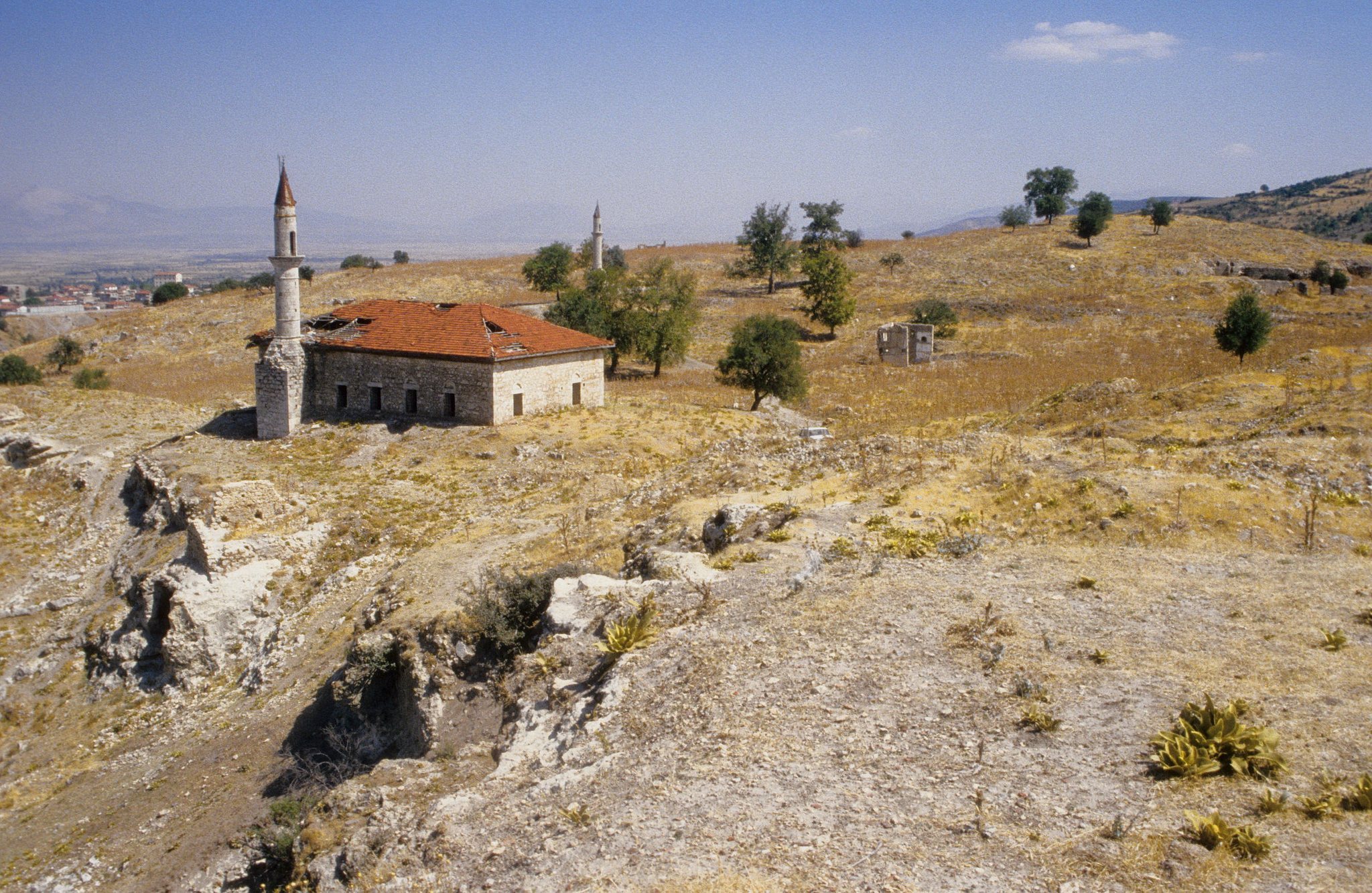
The Cevher Paşa Mosque was built mainly from flat-lying Lower Miocene limestone. Burgundy and gray slab limestone, brick, and sandstone were used especially around the entrance and in decorative elements. Its original flat roof was later replaced by a hipped roof.
The mosque has a northern narthex, or entrance hall, with six wooden columns, wooden stairs at both sides, and a round-arched entrance. A minaret stands at the northwestern corner. An inscription above the entrance bears the Hijra date corresponding to 1820 and may record a repair.
Two rows of four decorated wooden columns divide the prayer hall into three aisles. Ancient capitals were reused on the columns and painted in pencil technique. The interior includes inscriptions, floral and geometric designs, painted circular and square panels, and a raised mahfil, an elevated gallery or platform, supported by six decorated wooden columns. The mihrab, the niche marking the direction of prayer, has a draped-curtain design and a central Mizan motif associated with judgment in the afterlife. A triangular pediment with floral decoration surmounts it. The mosque was restored in 2006 after its roof deteriorated following the abandonment of the settlement.
Pazaryeri Market Mosque
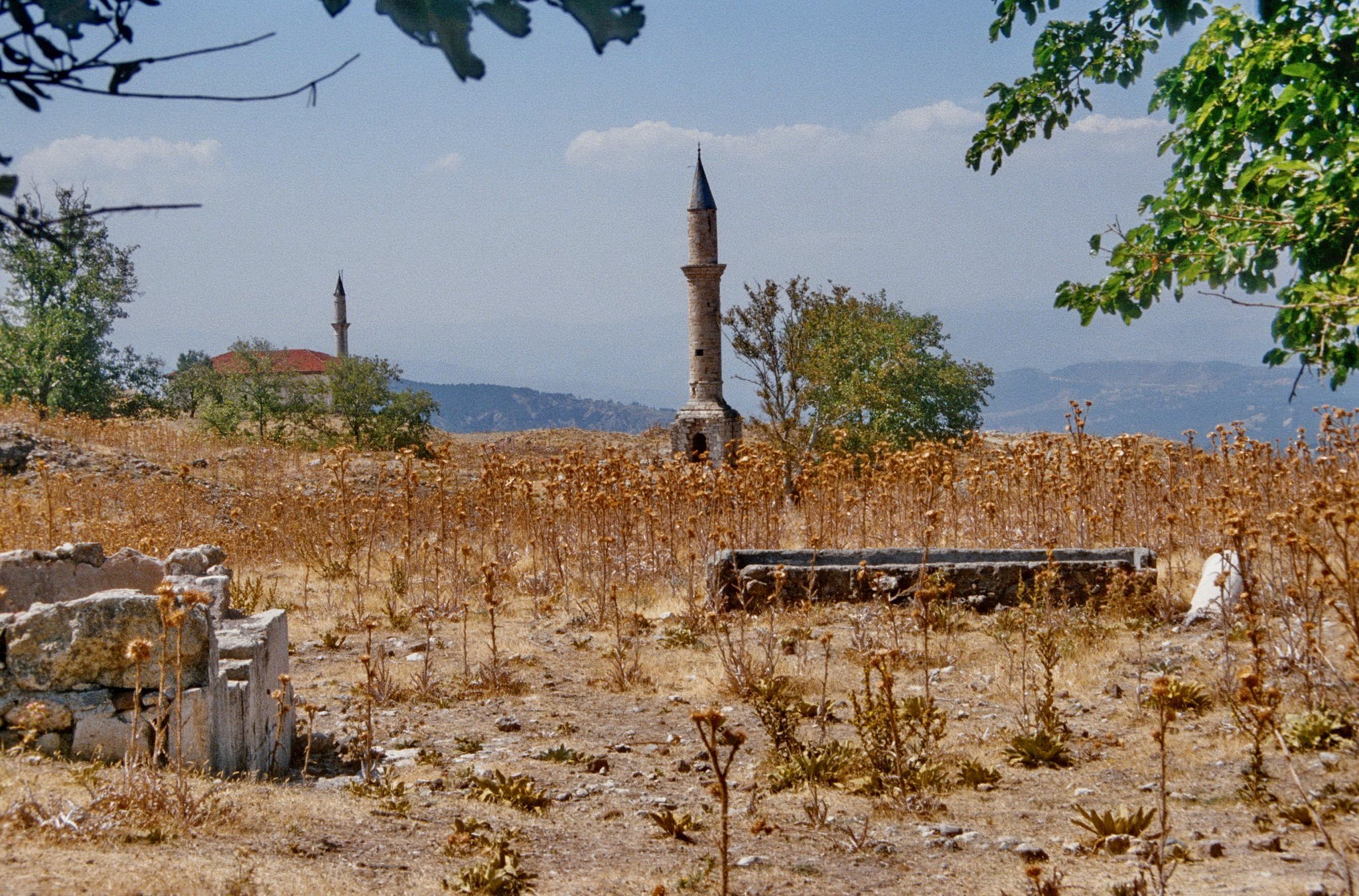
The Pazaryeri, or Market, Mosque stood northeast of the Cevher Paşa Mosque. During relocation to modern Kale, its walls were dismantled to an average height of 0.60 meters, while its minaret survived. The mosque probably dates from the eighteenth or nineteenth century, and its minaret was repaired in 1867–1868. Lower Miocene limestone, slab limestone, and brick were among its building materials.
Tekke Önü Masjid
The Tekke Önü Masjid was a small mosque probably dating from the eighteenth or nineteenth century. It was dismantled down to its foundations, and its stones were reused in the Yılancıoğlu Mosque built in modern Kale in 1965. Reused elements include dressed stones, an arched gateway, column capitals, column fragments probably from the Roman period, floral stones, and stones bearing the inscription “Mashallah.”
The former minaret was dismantled, numbered stone by stone, transported, and reassembled. Its doorway measures 1.70 by 0.67 meters, and it contains a marble Ottoman inscription dated to 1875–1876. The relationship between the Tekke Önü Masjid and the Hacı Mustafa Mosque remains uncertain. They may have been the same building, or the minaret may have been added during a later rebuilding.
Historic cemetery and archaeological finds
Ottoman cemetery
The historic cemetery is divided by the Denizli–Muğla highway into eastern upper and western lower sections. More than 3,000 Ottoman-period gravestones are recorded, and some may date as early as the thirteenth century. The earliest securely identified stone dates to 1635–1636. Republican-period graves continued Ottoman forms, materials, and decorative traditions.
Material evidence of occupation
Finds from the settlement range from Late Bronze Age pottery to material from the nineteenth century. They include Roman oil lamps, coins, metal sculpture fragments, glass, ceramic vessels, nearly 100 intact hand spindles, ceramic and stone weaving weights, and slag from metalworking. Together, these objects reflect long-term occupation, local production, trade, weaving, and craft activity.
Relocation removed much of the settlement’s built fabric. Stone and timber from demolished buildings were carried to the new town and nearby villages. By the end of the process, the ruins retained a mosque, an excavated mosque, the foundations of a masjid, two baths, and several cisterns and wells. Later aerial imagery indicates that the Cevher Paşa Mosque and the minaret of the Pazaryeri Mosque were the principal standing structures to survive.