Prämonstratenserstift Heiligenberg: A Premonstratensian Collegiate Foundation in Germany
Site at a Glance
- Rating
- 4.8
- Popularity
- Very Low
- Country
- Germany
- Primary era
- Medieval
- External website
- Open
- Eras represented
- Medieval
- Civilizations
- Carolingian
- Site type
- Military
- Remains
- Wall
On this page13 sections
History
Prämonstratenserstift Heiligenberg was a former Premonstratensian collegiate foundation in Germany, near Bruchhausen-Vilsen, established in the early thirteenth century within an older ring-wall complex. The Premonstratensians were a Catholic order of canons regular founded at Prémontré in northern France, whose communities combined communal religious life with pastoral and institutional duties. The foundation was first recorded in 1223, although Premonstratensians had taken possession of the site by 1218.
From aristocratic seat to religious foundation
Heiligenberg had already served as an aristocratic seat between the ninth and twelfth centuries. Archaeological evidence places the origin of its ring-wall complex in the Carolingian period, while ninth-century pottery indicates settlement activity. The fortification probably stopped functioning in the eleventh century and had ceased to serve that purpose by the foundation of the monastery.
The foundation was associated with six brothers from the Counts of Wernigerode. Archbishop Gerhard I of Bremen, who died in 1219, added the parish church of Vilsen to the new institution. The monastery was dedicated to the Virgin Mary and Saint Thomas of Canterbury. Thomas Becket, the archbishop of Canterbury murdered in 1170, had become a widely venerated medieval martyr whose cult could also carry political meaning because of his conflict with royal authority. His dedication at Heiligenberg points to connections with the Welf dynasty, represented at the time by Emperor Otto IV and Henry, Count Palatine.
In 1217 or 1218, Gervasius, abbot of the Premonstratensian mother abbey at Prémontré, wrote to Pope Honorius III seeking protection for the planned abbey. The letter names a Count C. or G. of Wernigerode as the leading founder among the six brothers. Regional historical research identifies this founder as their eldest brother, Konrad I.
Growth, administration, and regional influence
The foundation existed within a changing network of ecclesiastical and territorial authority. Bishop Adolf of Osnabrück initially served as its spiritual protector. The Counts of Oldenburg-Bruchhausen may have held secular guardianship from the 1230s. After the County of Bruchhausen was acquired by the Counts of Hoya, the bailiwick passed to them. As Hoya developed its own territorial church government, Heiligenberg was increasingly described as a monastery.
Heiligenberg extended its influence in the fourteenth century by founding the monastery of Heiligenthal near Kirchgellersen. Heiligenthal later established a foundation in Lüneburg. The prosperity of Heiligenberg during this period is reflected in archaeological remains of brick and roof tile associated with fourteenth-century monastic use.
The community also possessed a substantial library. A catalogue made in 1539 lists 129 titles. A late Gothic chalice from the monastic inventory later came to the Lutheran parish church at Asendorf in the Diepholz district. A cartulary, a book preserving copies or registers of charters and other legal documents, was once offered to a publisher after having been considered lost, but its present whereabouts are unknown. A reliquary casket decorated with images of Thomas Becket was found at the former Premonstratensian collegiate church in Clarholz. It probably reached Clarholz from Heiligenberg through the Counts of Tecklenburg.
Reformation and secularization
The Premonstratensian community at Heiligenberg dissolved in 1535 during the Reformation. Some canons remained until the final secularization in 1543, while others became Lutheran pastors and sextons. Count Jobst II of Hoya carried out the final secularization, bringing the institution’s religious existence to an end.
By 1563, the monastery church had fallen into ruin. Between 1563 and 1620, the economic buildings and estate were operated as a Vorwerk, an agricultural and administrative complex linked to a larger residence or estate, belonging to the Bruchhausen dower residence of the last Countess of Hoya. The abandoned ecclesiastical buildings supplied stone and other material for the construction of her castle at Bruchhausen. The remaining monastery buildings were demolished in 1607.
Later estate use and archaeological investigation
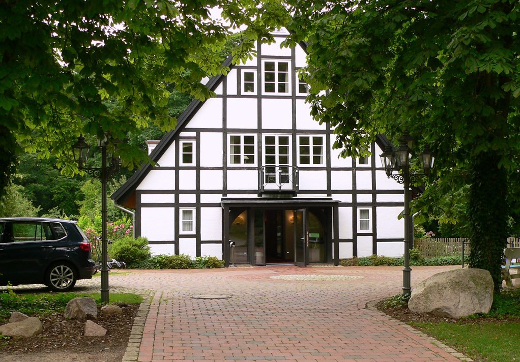
In the second half of the seventeenth century, the Dukes of Brunswick-Lüneburg at Celle used Bruchhausen Castle as a summer residence and hunted herons at Heiligenberg. In 1794, the Vorwerk building became a mounted forester’s residence with a tavern licence. The forestry office sold it in 1962, and a restaurant opened there in 1966. The establishment was expanded into a hotel and conference centre in 2001.
Archaeological investigation began in autumn 2011 before construction of a hotel guesthouse. Geophysical surveying and airborne laser scanning followed in 2012 and 2013 across approximately 4 square kilometres. Excavations in 2014, 2018, and 2019 established that Heiligenberg had previously been a lordly seat with a main castle, inner bailey, and outer bailey covering more than 7 hectares. The 2019 work separated two periods of monastic use. The earlier, fourteenth-century phase belonged to a prosperous period of expansion toward the Lüneburg region. The later phase belonged to the sixteenth-century end of the complex, when Count Albrecht of Hoya sold the buildings for demolition and the remains were blown up and pulled down. Some of the resulting material was later reused in a small building.
The excavations also revealed evidence of an exceptionally intense fire, including ash, charcoal, and bricks altered by glazing and vitrification. In 2018, Bruchhausen-Vilsen marked the monastery’s eight-hundredth anniversary with a commemoration. An interdisciplinary conference on the Premonstratensians in northern Germany was held at Heiligenberg and in Bruchhausen-Vilsen in cooperation with the University of Vechta.
Remains
The ring-wall complex
The monastery occupied the Ringwall “Heiliger Berg,” a fortification on a terrace surrounded on three sides by stream valleys. This setting gave the site a spur-like form. The fortified area covers approximately 3.5 hectares and has an irregular plan measuring up to 465 by 240 metres. Steep slope edges protected the north-eastern side, where only low ramparts were raised along the edge. The complex is described as the third-largest castle complex in Lower Saxony.
The south-western side was defended by a cross-rampart 15 to 20 metres wide and surviving up to 8.40 metres high. A forward ditch is visible through geophysical prospection, while parts of the rampart’s inner parapet were paved with stones. A gate probably stood at the northern end of the main rampart. From there, the fortification continued south-eastward as a perimeter rampart about 1.5 metres high before ending at a hollow way, a sunken route formed by long use or erosion. Further rampart remains beyond the hollow way probably belonged to a recessed gate with overlapping terminal sections. Construction before the First World War and during the Second World War disturbed the south-eastern part of the ring wall.
South of the principal enclosure, an erosion channel begins beside another cross-rampart. This earthwork measures up to 2 metres high, 10 metres wide, and 95 metres long, with a forward ditch 10 metres wide and 2 metres deep. Farther south, a weaker and discontinuous rampart extends for 360 metres, reaching up to 5 metres in width and 1 metre in depth.
Archaeological evidence of occupation
Early settlement and castle areas
The 2011 investigation covered almost 1,000 square metres and identified about 100 archaeological features, including postholes and refuse pits. Ninth-century pottery fragments indicate settlement activity before the monastery. The wider complex included a main castle, inner bailey, and outer bailey, while rectangular subsurface structures detected by geophysical prospection and airborne laser scanning point to additional buildings.
Outer bailey rampart
In 2014, a 17-metre-long and 4-metre-wide trench cut through the outer bailey rampart. The rampart stood 1.8 metres high and consisted of fine sandy silt beneath a 10-centimetre layer of humic soil. Individual pottery sherds and iron fragments came from the earthwork. A flat-bottomed forward ditch, 2 metres deep and 1.20 metres wide, protected it. Its construction indicates an earthwork formed without timber or stone reinforcement.
Monastic building remains
The 2011 excavation identified the remains of a building measuring approximately 13 by 15 metres, with a tiled roof. It may have been a church belonging to the Premonstratensian monastery. In 2018, excavation inside the fortification exposed a brick-built wall corner in an area measuring 4 by 20 metres, probably part of another monastery building. Finds from the area included fragments of curved and flat medieval roof tiles known as “monk and nun” tiles, greenish window glass, and iron nails.
The 2019 excavation examined two rubble layers and recovered ceramics that separated the monastic occupation into two phases. Brick and tile remains belonged to the fourteenth-century phase, while the sixteenth-century layer contained fire debris, ash, charcoal, and heat-altered building materials. Some of the later debris was incorporated into a small building after the destruction of the monastery.
Water features and surviving associated structures
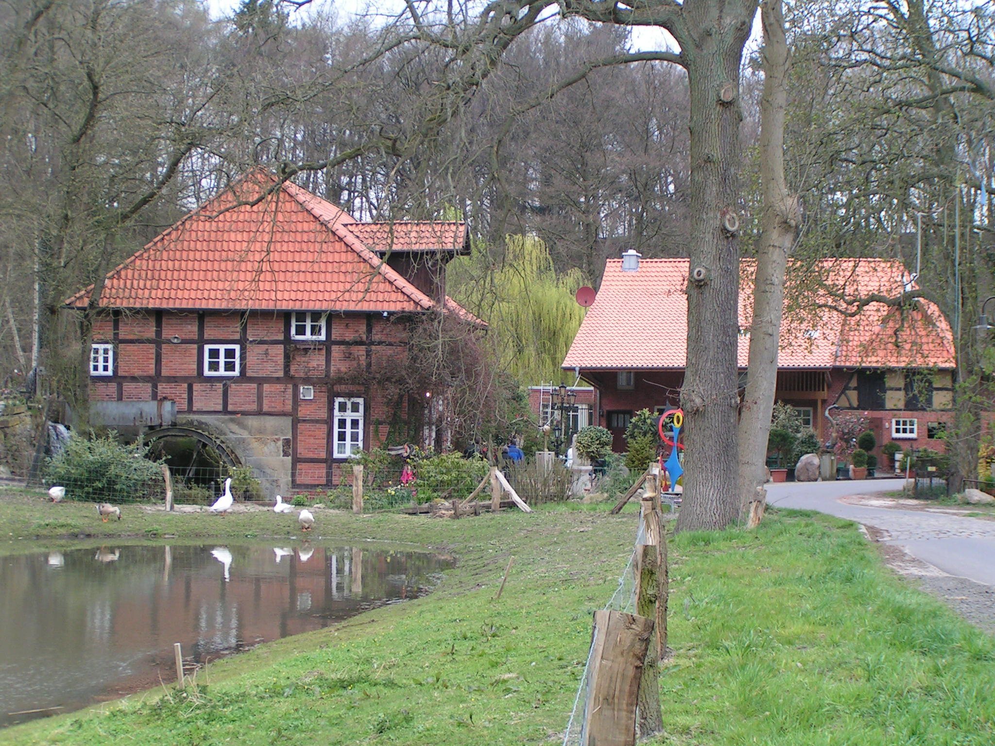
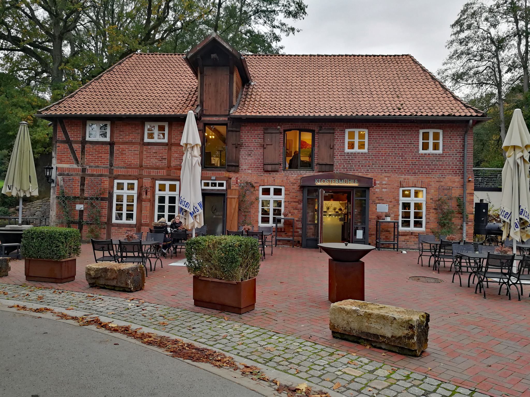
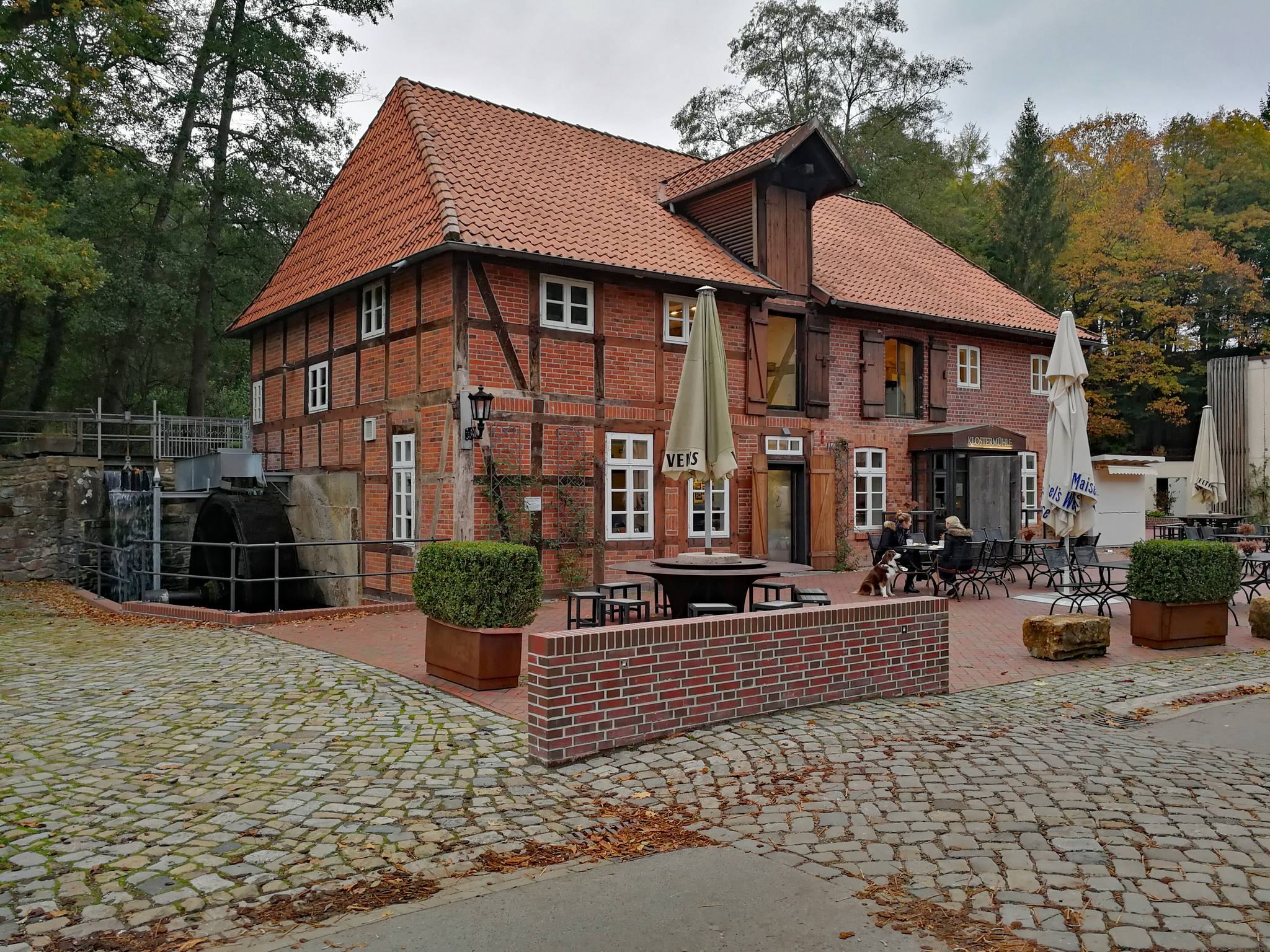
In 2013, excavation exposed the sandstone surround of the Paterborn, a possible prehistoric spring in the valley north of the former monastery. The present recreational area also includes surviving sections of the ring wall, an artificial watercourse leading toward the centuries-old monastery mill, and the former forester’s building. The mill now operates as the Klostermühle inn, while the forester’s building is the Forsthaus Heiligenberg restaurant and hotel. An old draw well beside the restaurant and a fragment of a gravestone showing kneeling figures are also associated with the site.
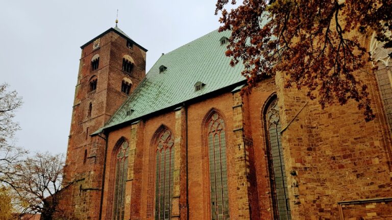
A footpath crosses the mill dam and follows a hollow way northward to the parish church of Saint Martin at Vilsen. The church served as the monastery’s collegiate church until the Reformation. Its dedication is to Saint Martin, not Saint Cyriacus.
The Jacob Pil seal matrix
Among the archaeological finds associated with the wider history of Heiligenberg is a copper-alloy, pointed-oval seal matrix from around 1240 to 1250. A seal matrix, also called a typar, is an engraved object used to impress a seal into wax or another sealing material. The matrix bears the inscription “SECRETUM IACOBI PIL BREMENSIS” and shows a Jew at the rear of a pig. It was first attributed to a Jewish pawnbroker, but later research considered a Bremen citizen or ministerial more likely to have used it. The reason for Jacob Pil’s insulting choice of image remains unresolved. The object is the oldest surviving Bremen civic seal and one of the oldest German examples.