Castro de Ulaca: A Vettonic Hill-Fort and Regional Center in Spain
Site at a Glance
- Rating
- 4.6
- Popularity
- Low
- Country
- Spain
- Primary era
- Iron Age
- External website
- Open
- Eras represented
- Iron Age
- Civilizations
- Unclassified
- Site type
- City
On this page16 sections
History
Castro de Ulaca is a Vettonic hill-fort settlement and oppidum in Spain, near Villaviciosa in the municipality of Solosancho, Ávila. The large fortified community developed mainly between the seventh and first centuries BC, with its principal oppidum phase in the third to first centuries BC. Built and occupied by the Vettones, a pre-Roman people of western and central Iberia, it became a major regional political, economic, defensive, and ritual center.
Early occupation and Vettonic development
Archaeological remains at Ulaca extend from the Chalcolithic, or Copper Age, into the Middle Ages, although the Vettonic period shaped the settlement most strongly. The community was probably occupied mainly from the seventh century BC onward. Around the third century BC, the large oppidum appears to have been founded or expanded during a reorganization of the surrounding territory.
Its position within Vettonic territory and its substantial population point to a highly organized community. Estimates place the population at roughly 1,000 to 1,500 people. Some residents may have lived at Ulaca permanently, while others may have gathered there for protection during periods of danger. Craft activity included metalworking and pottery production, and granite was quarried on a scale beyond the needs of individual households.
Abandonment and changing political control
Ulaca was probably abandoned during the Romanization of the Iberian Peninsula, the gradual adoption of Roman political, cultural, economic, and settlement systems by communities incorporated into the Roman world. A destructive fire has been linked to one of Hannibal’s incursions into central Iberia, but that explanation remains unconfirmed. The settlement’s later archaeological sequence extends into the Middle Ages, although the principal fortified community belongs to the pre-Roman period.
Archaeology and protection
Ulaca entered modern archaeological scholarship in the early twentieth century. A regional monument catalogue begun in 1901 was published in 1931. Raymond Lantier and Henri Breuil visited the fortification around 1915, and their findings appeared in 1930. Systematic investigations followed in the 1940s, with further campaigns during the 1970s, 1990s, and 2003–2004.
Excavation during the 1970s included the restoration of two houses, while later work revealed the foundations of more than 250 houses within the fortified area. The site was declared a historic-artistic ensemble in 1931 and became a Property of Cultural Interest in 1986, the highest level of protection under Spanish heritage law. The archaeological zone was delimited in 1994, with a protected archaeological-zone declaration also recorded in 1995.
Remains
Setting, enclosure, and settlement layout
Fortifications and natural defenses
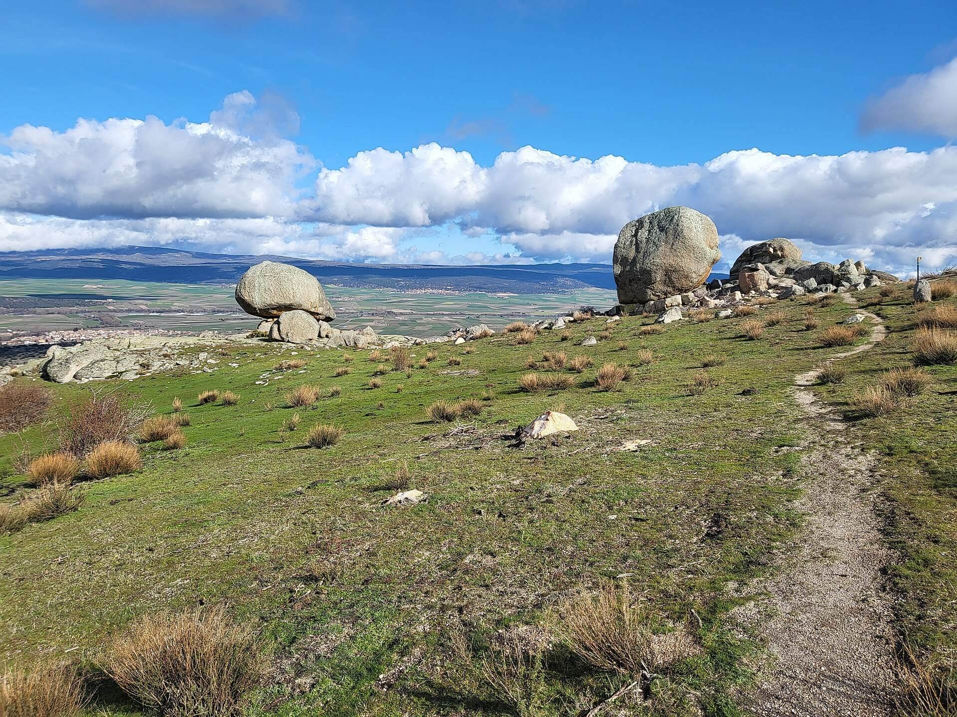
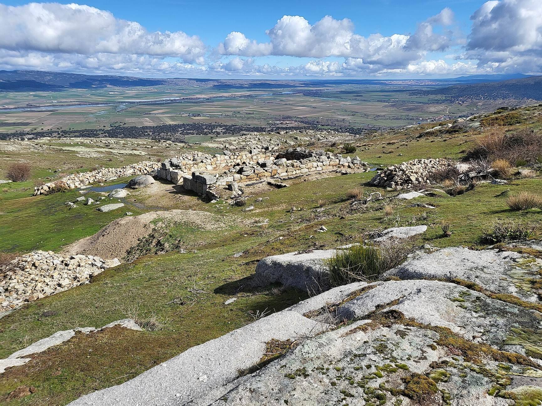
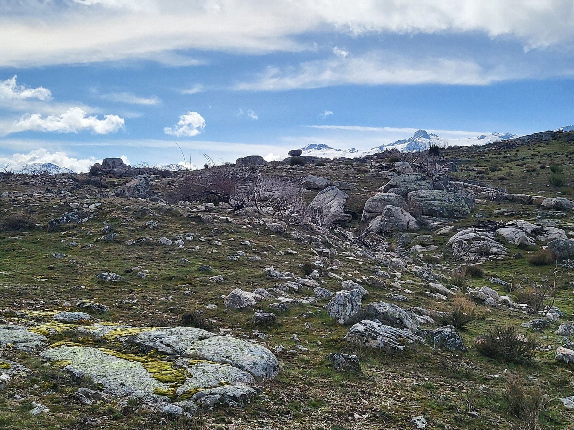
Ulaca occupies a rocky promontory about 250 metres above the surrounding terrain, on the northern foothills of the Sierra de la Paramera. The Arroyo de los Portillos and the Picuezo River flank the settlement and strengthened its natural defenses. The site overlooks the Amblés Valley, with views toward Pico Zapatero.
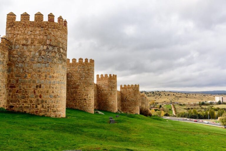
The oval settlement was enclosed by a defensive wall more than 3 kilometres long. The surviving work is described as a double wall at least 2 metres high, constructed with rubble and earth between its faces. Additional walls may have protected houses outside the main enclosure to the northeast, although these survive poorly. The extramural settlement suggests that the fortification did not necessarily reflect constant danger, since open areas inside the settlement could accommodate people during conflict.
Houses
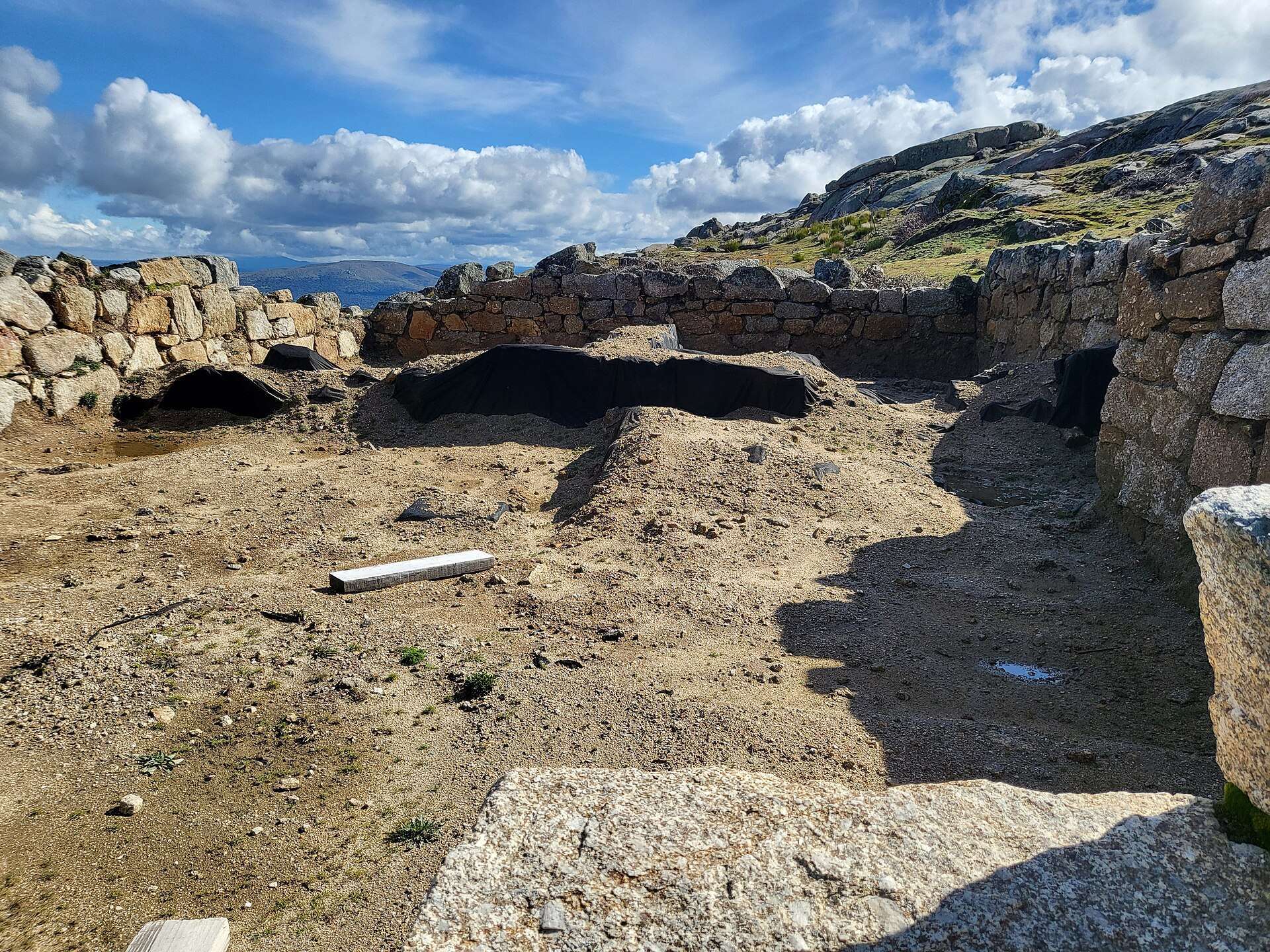
More than 250 structures stood inside the enclosure, and the total approaches 300 when houses beyond the walls are included. Most dwellings had square or rectangular plans with heavy stone walls. Their foundations commonly used two-faced stone construction and were about 80 to 100 centimetres thick. Some houses consisted of one, two, or three rooms and covered roughly 40 to 80 square metres, while more complex buildings reached about 250 square metres and contained additional compartments.
Several excavated foundations were reconstructed to a height of approximately 50 centimetres. Large granite slabs formed the door jambs. The roofs probably used broom, although none has survived. Wall extensions may represent porches, entrance vestibules, or small attached enclosures. Most entrances faced east, toward the sunrise, while the roofs probably drained toward the gullies in front of the façades. Hearths, wall benches, storage areas, and sleeping spaces are possible elements of the internal arrangements.
Monumental and public structures
A large monumental building stood within the settlement. Its purpose remains uncertain, and it has been interpreted either as a lookout or as another public structure. The oppidum also contained spaces and installations intended for ritual or ceremonial activity, indicating that public functions extended beyond domestic life.
Sanctuaries and ritual installations
Northwestern sanctuary
In the northwestern sector, apart from the houses, a sanctuary was partly cut into the rock. It originally measured about 16 by 8 metres and had entrances on its southeastern and western sides. Sections of its enclosing stone walls remain standing to about 2 metres, while fallen stones mark other collapsed portions.
Altar of the Sacrifices
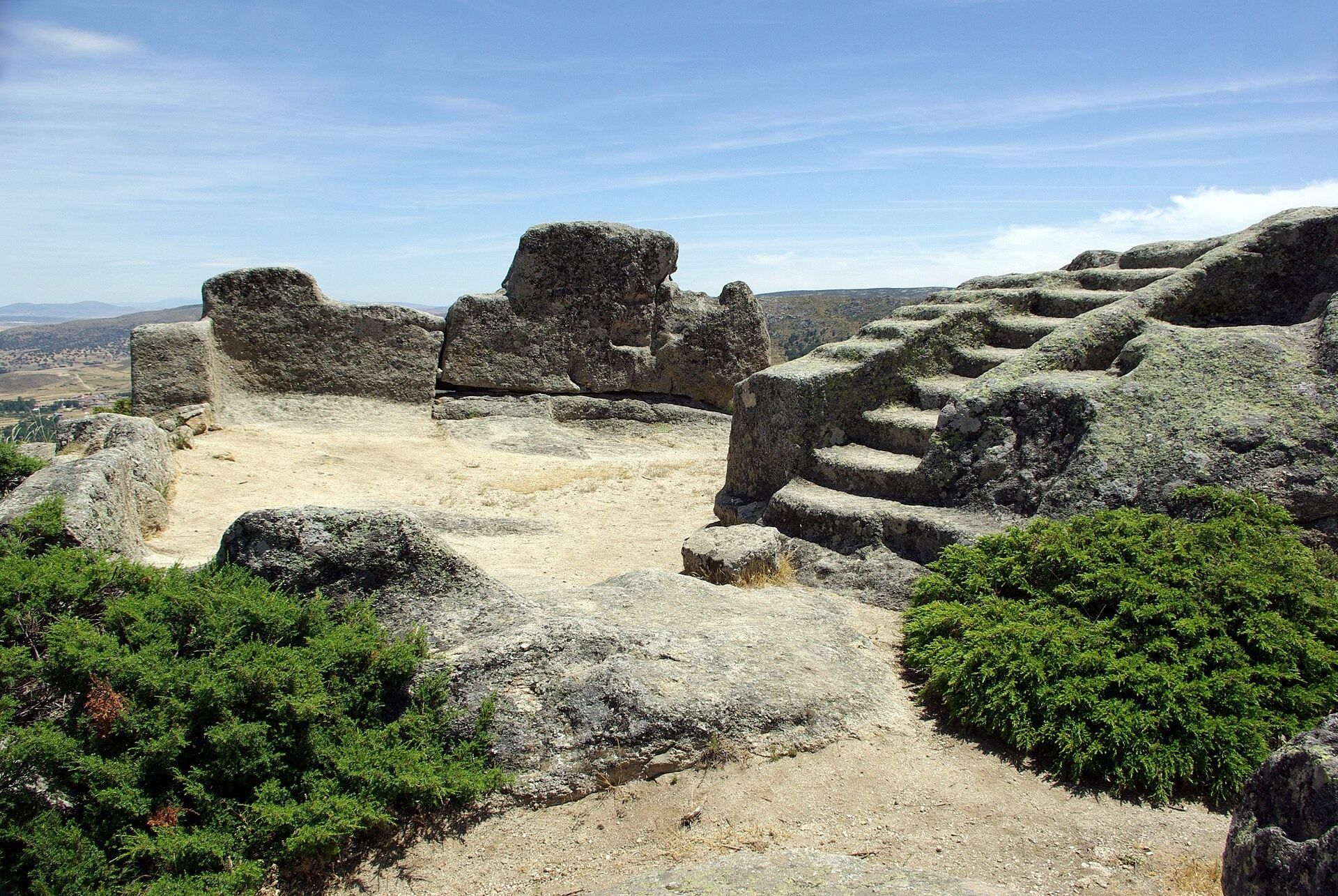
About 200 metres from the sanctuary, in the northwestern part of the settlement, stands the open-air granite monument known as the Altar of the Sacrifices. It includes a large rectangular area cut into exposed granite blocks and a rock platform reached by two flights of carved steps. The steps have nine carved risers. Two roughly circular cavities are connected on the platform, and one drains into a third cavity through a channel cut into the rock.
The cavities may have collected rainwater for sacred water or libations, ritual offerings made by pouring liquid. The monument has been interpreted as a cult installation, and animal or human sacrifice has been proposed, but its precise function is uncertain. Comparisons with the sanctuary at Panóias do not establish an identical use, since the two sites differ in date and form. At Ulaca, the steps lead to connected natural cavities rather than to cult buildings with identifiable foundations. Several monoliths bound a platform at the foot of the steps, which may have served as a ritual area or an assembly space.
Forge-oven or sauna
Near the centre of the settlement, about 200 metres from the altar, is a partly subterranean structure known as the forge-oven or sauna. It was cut partly into a large granite outcrop and partly enclosed by stone walls, particularly on the north and possibly also on the east and west. Once regarded as a furnace or forge, it has also been compared with the sauna buildings of the northwestern castro tradition, a tradition of fortified settlements often placed on elevated ground.
The structure has been given a possible ritual role involving warrior initiation and ceremonial cleansing. Its main chamber follows the rock on three sides, while rubble masonry closed the fourth. The entrance is arched and cut into the rock, a feature that may indicate knowledge of Roman construction methods.
Quarries and archaeological finds
Granite quarries
Granite quarries occupy the western and southwestern sectors of Ulaca. Quarrying followed natural veins and fractures in large slabs. Workers probably cut short grooves at intervals of about 28 and 36 centimetres with chisels and hammers, then inserted wedges to split the stone. Wooden poles and levers could move blocks measuring about 60 to 120 centimetres or more.
The quarries preserve unused wedge grooves, blocks at the beginning of extraction, partly worked stones, and finished blocks that were never transported. The western quarry probably supplied building stone for nearby houses. The quarry at the southwestern corner, close to the wall, appears more closely associated with large ashlar blocks for the defenses. Ashlar is masonry made from regularly shaped, carefully cut stones. The standardized dimensions and extensive working suggest organized quarrying and possibly specialist labor.
Objects and sculpture
Excavated material includes ceramics, agricultural implements, tools connected with livestock, pottery-making equipment, stone mills, and other objects. Many were looted in earlier periods. A verraco, a pre-Roman stone animal sculpture associated especially with Vettonic territory, represents a bull or boar from Ulaca and was erected in the town of Solosancho.