Jaketsuzan Kofun: A Late Seventh-Century Burial Mound in Japan


Site at a Glance
- Rating
- 4.2
- Popularity
- Very Low
- Country
- Japan
- Primary era
- Medieval
- Eras represented
- Medieval
- Civilizations
- Yamato
- Site type
- Burial
- Remains
- Burial Mound
On this page7 sections
History
A late Kofun-period burial mound
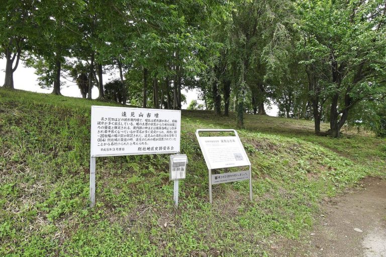
Jaketsuzan Kofun is a late seventh-century square burial mound in Japan, located in Sōja, Maebashi, Gunma, and built during the final phase of the Kofun period. The Kofun period was an era of large-scale burial-mound construction for members of Japan’s political and social elite. Jaketsuzan formed part of the Sōja Kofun Cluster on the Maebashi Plateau, at the southeastern foot of Mount Haruna and west of the Tone River, in an area where many kofun were concentrated.
The mound followed Hōtōzan Kofun and is regarded as the last of the large square mounds in the Sōja cluster. Together with the Atagoyama and Hōtōzan mounds, it belongs to a group distinguished in the former Kamitsukeno region, an earlier name for the area later called Kōzuke, by its scale and contents after the construction of keyhole-shaped tombs had ended.
Connections with ancient Kōzuke
Jaketsuzan and Hōtōzan share stone-processing techniques with the Sannō Temple Ruins, the remains of an ancient Buddhist temple southwest of the cluster. Their construction helps explain the close relationship between the Sōja area and the Yamato polity, an early Japanese royal polity centered in the Kinai region whose political influence expanded across ancient Japan. The tombs also belong to the development of Sōja as a political and cultural center of ancient Kōzuke Province, a process later associated with the establishment of the Kōzuke provincial capital, provincial temple, and provincial nunnery. These were state-supported Buddhist institutions established in the provinces.
Later references and archaeological investigation
The name Jaketsuzan comes from a snake design carved into the rear wall of the stone chamber during the Edo-period Kanbun era, from 1661 to 1673. The mound may also be referred to in the medieval Shintōshū, dated here to 1352–1361, as the “Rock Chamber of the Snake Mound.” A description from the late seventeenth century calls it the “Rock Chamber of Hachirō Gongen,” while an 1786 diary also records the site. These references indicate that the chamber had already been open and suggest that the surrounding moat may have become a pond by the fourteenth century.
Archaeological investigation began in 1975, when excavation during site improvements established that the mound was square. Further surveys to confirm its boundaries took place in 2007 and 2009, followed by excavation in 2021 and three-dimensional recording of the stone chamber in 2022 and again in 2023–2024. Jaketsuzan Kofun became a National Historic Site in 1974, its protected area was enlarged in 2021, and in 2024 it was incorporated into the expanded National Historic Site designation of the Sōja Kofun Cluster.
Remains
Mound and surrounding earthworks
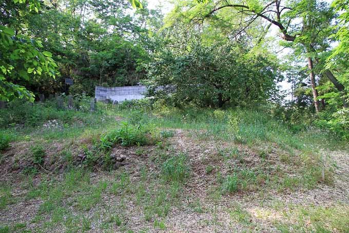
Jaketsuzan is a square mound, or hōfun, measuring approximately 44 metres on each side and about 5 metres high. Its principal axis runs 13 degrees east of north, and the earthwork is thought to have been built in three tiers. Fukiishi, stones laid over a burial mound to protect its earth and finish its exterior, cover the mound’s surface.
A moat and an outer ditch create a double surrounding system, giving the complete tomb complex sides of approximately 82 metres. The moat averages 11 metres wide and measures between 1.1 and 1.9 metres deep. Later digging altered it, so its original dimensions remain uncertain. Between the moat and outer ditch is a bank about 5 metres wide at the top and 6.5 metres at the base, rising approximately 1.2 metres on its inner side and 0.5 metres on its outer side. The outer ditch is about 3 metres wide on average, ranging from 2.8 to 3.3 metres, and between 0.2 and 0.6 metres deep.
The intervening bank appears to have been formed by cutting the natural ground rather than adding artificial fill. Flat stones were laid horizontally in a staggered pattern on both its inner and outer faces. Hōtōzan Kofun lies about 120 metres west, and the precincts of the two tombs are separated by roughly 20 metres. Jaketsuzan has the bank and outer ditch beyond its moat, while Hōtōzan has a moat. Their orientations also differ, with Hōtōzan’s axis running 32 degrees east of north.
Stone burial chamber
The burial facility is a horizontal stone chamber opening toward the south-southwest. Paired side extensions frame the entrance. The arrangement comprises a main chamber, a small connecting area resembling the remains of a passage, and a trapezoidal forecourt. The main chamber is 3.00 metres long, 2.57 metres wide at the front, 2.61 metres wide at the rear, and 1.80 metres high. The connecting area measures 1.07 metres in length and 1.57 metres in width, while the forecourt is 3.90 metres long, 6.30 metres wide at the front, and 2.12 metres wide at the rear.
Precisely cut blocks of pyroxene andesite form the chamber in finely fitted cut-stone masonry. Seven stones make up the principal elements: the side walls, rear wall, ceiling, two entrance frames, and capstone. Doorposts are carved into the entrance frames. The capstone carries carved horizontal elements and a structure resembling a decorative openwork panel. Grooves around the entrance indicate that door stones were used to close the chamber. The stone surfaces retain light water polishing and traces of plaster. A cut block of Ushibuse sandstone beside the rear wall is thought to have served as a stand for the coffin.
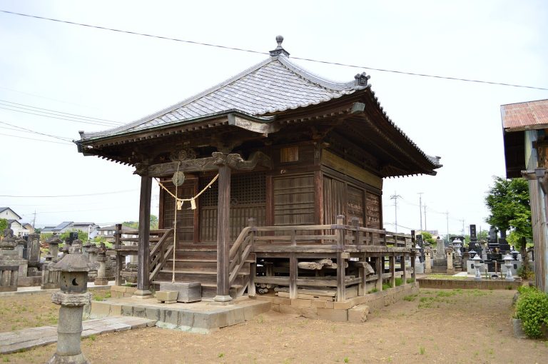
The chamber is believed to have been open since antiquity, leaving the burial goods undetermined. A former Imperial Portrait Sanctuary, a building used to enshrine an imperial portrait and the Imperial Rescript on Education, once stood on the mound. It was later moved and is now the building of Goryō Shrine south of Sōja Elementary School.