Taguma Ishihatake Site: A Yayoi Settlement and Burial Complex in Japan
Site at a Glance
- Rating
- 3.6
- Popularity
- Very Low
- Country
- Japan
- Primary era
- Classical
- Eras represented
- Classical, Medieval
- Civilizations
- Yayoi
- Site type
- Burial
- Remains
- Necropolis
On this page11 sections
History
Taguma Ishihatake Site is an archaeological complex in Munakata, Japan, used by Yayoi communities from the late Early to the first half of the Middle Yayoi period. The Yayoi period was Japan’s era of wet-rice agriculture, permanent settlement, metalworking, and increasingly differentiated social groups. The site later contained Kofun-period building remains and medieval ditches and wells, showing that the area continued to be used after the Yayoi settlement and cemetery.
Discovery and archaeological investigation
The site came to attention in 1933, when Yukio Tanaka, a teacher at Fukuoka Prefectural Munakata Girls’ High School, discovered it while the school occupied the area. Tanaka reported the discovery in the same year in the journal Archaeology. After the high school moved, Munakata City Chuo Junior High School was established on the land. When that school later relocated, the former grounds remained vacant for many years within the urban area.
Excavation took place on the privately owned former school grounds in 2008 and clarified the extent and character of the site. The main remains belonged to the late Early through Middle Yayoi periods, while later evidence included Kofun-period buildings and medieval ditches and wells.
Emergence of a local elite
The central discovery was a Middle Yayoi burial area containing nine graves, six of which were excavated. Each excavated burial held at least one bronze weapon, producing 15 bronze swords, spears, and halberds in total. This is the largest number of bronze weapons found in a single burial group of this period. The concentration indicates the presence of an influential social group, and Burial 1, with five bronze weapons, is regarded as the grave of a central individual. Metal-detector responses at the three unexcavated burials suggest that they may also contain bronze weapons.
The settlement appears to reflect the formation of a local community. People associated with the Togo Noboritachi Site, east of Taguma Ishihatake, are thought to have moved their base to this plateau during the late Early Yayoi period. An elite able to place bronze weapons in graves emerged during the early Middle Yayoi period.
Taguma Ishihatake also reflects a cultural boundary in northern Kyushu. Jar-coffin burials, in which a large ceramic vessel serves as the coffin, occur sparsely west of the site in the Koga area but are absent east of the Aoyagi River. Taguma Ishihatake itself has no jar-coffin burials. Its bronze weapons are dominated by slender forms, with some medium-slender examples, a pattern associated with connections to the San’in region and the western Seto Inland Sea. Pottery combines characteristics linked to the Hibiki Gulf area to the east and the Genkai Sea area to the west, placing the site at a point of contact between eastern and western Yayoi cultures.
Protection and interpretation
Taguma Ishihatake Site became a National Historic Site in 2010. Its protected area was expanded through additional designations in 2013 and 2017. The excavated bronze weapons, stone ornaments, and glass beads were designated National Important Cultural Properties in 2014. In 2015, the area was developed as Taguma Ishihatake Site Historical Park, which preserves and interprets the archaeological remains through reconstructed features and a museum.
Remains
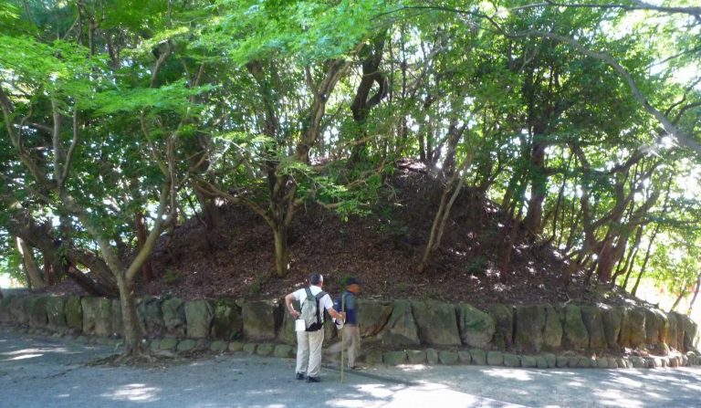
The site occupies a plateau about 12 metres above sea level on the left bank of the middle reaches of the Tsuri River. Its Yayoi remains include a circular boundary ditch, buildings, storage pits, and a concentrated burial area. The archaeological park presents these features through reconstructions of the ring moat, pit dwellings, and storage features, together with a museum.
Yayoi settlement and cemetery
Ring moat
A ring moat, a circular ditch marking or enclosing a settlement boundary, occupied the northeastern part of the excavation area during the late Early Yayoi period. Its reconstructed diameter is approximately 60 metres.
Buildings and storage pits
The settlement buildings lay outside the ring moat, south of the surveyed area and east of the burial area. Six circular building traces were identified, including pit-dwelling traces and postholes. The buildings were detected but not fully excavated, so their details remain unclear. Across the excavation area, 170 earthen pits and storage pits were identified, most dating from the Middle Yayoi period. Reconstructed pit dwellings and storage pits form part of the archaeological park.
Burial area
The burial area measures approximately 14 metres from north to south and 8 metres from east to west, covering about 112 square metres. It contains nine burial pits. All six excavated graves used wooden coffins. Burials 1 through 4 are considered to have used split-bamboo-shaped coffins, hollowed-log coffins whose form resembles a length of split bamboo, based on traces on their floors. Burials 6 and 7 may also have used this type, although their traces are unclear. Burial 5, which was not excavated, preserves clear traces of an assembled wooden coffin made from timber joined in a lattice pattern. The coffin types of Burials 8 and 9 are unknown.
Burial goods
Burial 1 contained one slender bronze sword, three medium-slender bronze swords, one slender bronze halberd, two jade pendants, and 19 jasper tubular beads. Burial 2 held one slender bronze sword, two slender bronze spears, one slender bronze halberd, and eight jasper tubular beads. Burial 3 contained one slender bronze sword.
Burial 4 contained one slender bronze sword, one slender bronze spear, one slender bronze halberd, two jade comma-shaped beads, and 133 jasper tubular beads. Burial 6 held one medium-slender bronze sword, one jade comma-shaped bead, and one small glass bead. Burial 7 contained one slender bronze sword, one jade comma-shaped bead, and 48 jasper tubular beads. Together, the weapons and ornaments include bronze arms, jade pendants, jade comma-shaped beads, jasper tubular beads, and a glass bead.
Later archaeological remains
Kofun-period building remains and medieval ditches and wells were found in the area alongside the earlier settlement and cemetery. The Kofun period was associated with large elite tombs and emerging regional political authorities in Japan. The medieval evidence belongs to a later phase of use, including the Muromachi period, the era from the fourteenth to the sixteenth century.