Tago Stele: An Eighth-Century Monument of Japanese County Administration


Site at a Glance
- Rating
- 4
- Popularity
- Low
- Country
- Japan
- Primary era
- Medieval
- External website
- Open
- Eras represented
- Medieval
- Civilizations
- Japanese
- Site type
- Civic
- Remains
- Monument
On this page13 sections
History
The Tago Stele is an ancient stone monument in Japan, erected around 711 during the Nara period by the early Japanese state to commemorate the creation of Tago County in Kozuke, the historical region corresponding broadly to present-day Gunma Prefecture. Its inscription records the transfer of 300 households from Kataoka, Midono, and Kanra counties and reflects the centralized institutions and written procedures of the early Ritsuryo system, Japan’s system of law and government modeled partly on continental East Asian practice.
The creation of Tago County
The stele gives the proclamation date as March 9, 711. The Shoku Nihongi, an official chronicle compiled in 797, places the division of six local administrative units in the third month of the same year and dates the decision three days earlier, to March 6. The difference may indicate that the stele marked the public announcement of a decision already made by the central government.
The inscription names the officials associated with the order: Tajihi no Miyakemaro, Middle Controller of the Left; Hozumi Prince, head of the Council of State; Isonokami no Maro, the left minister; and Fujiwara no Fuhito, the right minister. Its opening expression, translated here as “order of the Controller’s Office,” has several possible administrative meanings. It may refer to another name for a Council of State directive, an independent document type, an imperial order transmitted through an official bureau, or a command expressed through the word for “order.” The precise meaning remains uncertain.
The inscription also contains a disputed character represented here by “sheep” in the phrase concerning Tago County’s administration. Proposed explanations identify it as the personal name of the first county governor, a directional reference, a provision involving an actual sheep, an abbreviated or conventional character, or a scribal error. The personal-name interpretation, particularly associated with Kizao Ozaki, has connected the figure with an immigrant community, although the absence of a surname alone does not establish immigrant origin. Local tradition later associated the character with Sheep Taifu, a legendary figure whose historical identity is uncertain.
Political reorganization and the county center
The formation of Tago County has been interpreted as a political reorganization that incorporated territories associated with the Sano imperial estate and the Mononobe lineage. One interpretation views the stele as a public assertion of the new county’s legitimacy and administrative order. Another links its erection to competition between immigrant groups and older local lineages. The surrounding area was an advanced production zone, with large-scale tile manufacture and other activities associated with immigrant communities. The unusually large lettering may likewise have functioned as a deliberate display of authority.
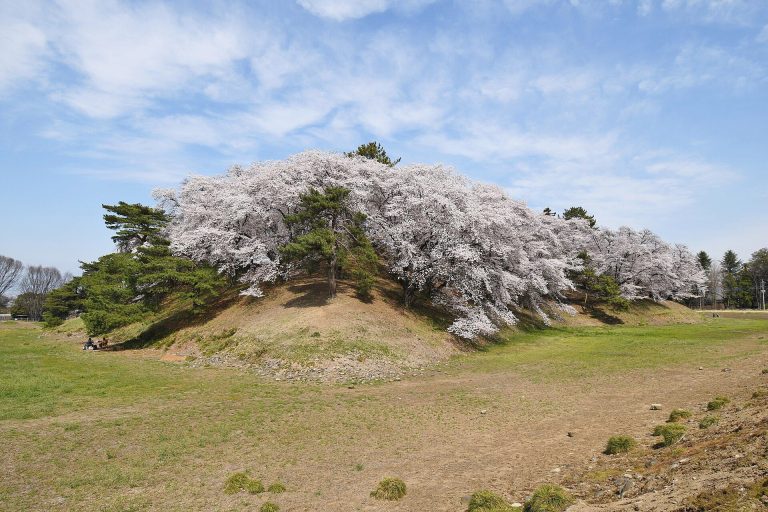
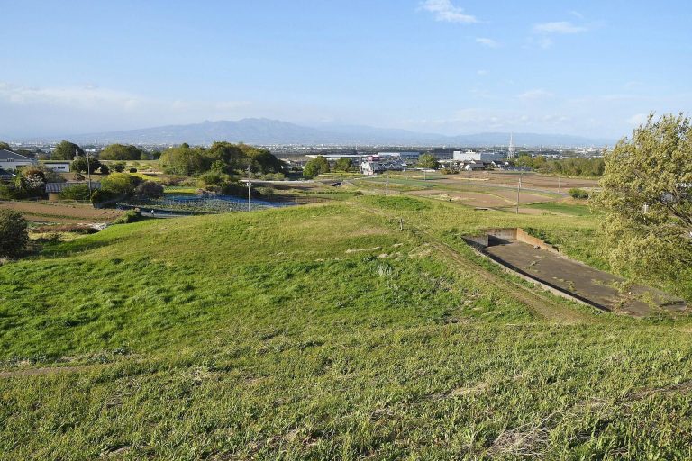
The place-name Mikado has prompted the proposal that the monument stood near the county administrative center. Excavations in 2016 uncovered remains of a warehouse complex probably used to store tax rice, together with a pit-like structure and pottery from other investigations. These discoveries support the possibility that the area contained the Tago county center, known under the Ritsuryo system as a gunga. The precise location of the settlement named in the Shoku Nihongi remains debated.
Later memory and scholarly transmission
Tago County’s administration began to decline from the latter ninth century, after which the stele disappeared from written records for about 700 years. It reappears in 1509, when the poet and renga master Socho referred to it in Azumaji no Tsuto as the “Benkankyoku Stele of Tago County.” During the Edo period, scholars, calligraphers, and other cultural figures became increasingly interested in the monument. Local tradition placed it beneath an enoki tree, and some accounts described it as having been excavated from the soil before being protected by a hall or worship hall. It was also mistakenly identified as the tomb of Hozumi Prince.
Takahashi Dozai made rubbings and compiled the Jomo Tago County Stele Album, while Sawada Toko helped bring the stele’s calligraphic value to wider attention. Its lettering reached the Korean peninsula through a Korean embassy in 1764 and was later carried to China by a diplomatic mission. The Qing scholar Yang Shoujing reproduced 39 characters from it in Kaiho Sokugen, extending the monument’s influence beyond Japan.
Protection and modern conservation
After Gunma Prefecture was established, Governor Motohiko Katori promoted the stele’s protection in 1876, and the government purchased the surrounding land. A wooden cover and earthen platform were installed around 1882. In 1921, the Tago Stele was designated a Historic Site together with the Yamanoue and Kanaizawa stelae. The three monuments form the Three Stelae of Kozuke, a rare concentration of ancient Japanese inscribed monuments in southwestern Gunma, and they were later registered in UNESCO’s Memory of the World, an international program for documentary heritage important to humanity’s historical memory. The Tago Stele became a Special National Historic Site in 1954.
In September 1945, after the Second World War, the stele was temporarily buried in a specially prepared pit 56 meters east of its original position to prevent requisition by occupying forces. It was excavated and returned in 1946, although the treatment of its capstone and base during concealment remains uncertain. A reinforced-concrete protective building was completed in 1967. Conservation carried out from December 2023 through 2024 repaired a crack in the capstone with plaster and sandstone, strengthened the support beneath it, and restored the stone to its presumed original front-to-back orientation.
Remains
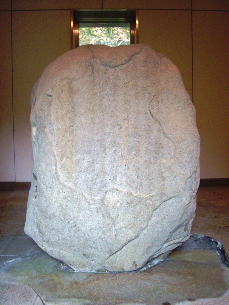
The monument consists of a rectangular stone body set on a base and covered by a capstone. All three elements are made from locally quarried Ushibuse sandstone, a lithic wacke. From the top of the concrete-supported base to the top of the capstone, the stele measures 152.5 centimeters. Its column-like form is unusual in China. In Japan, comparable forms include the Nasu Kunizo Stele, the Awa Kunizo Stele, and the Josuiji Stele, while its design may combine features associated with Korean columnar monuments and Silla monuments with capstones.
Inscribed stone and upper elements
Stele body
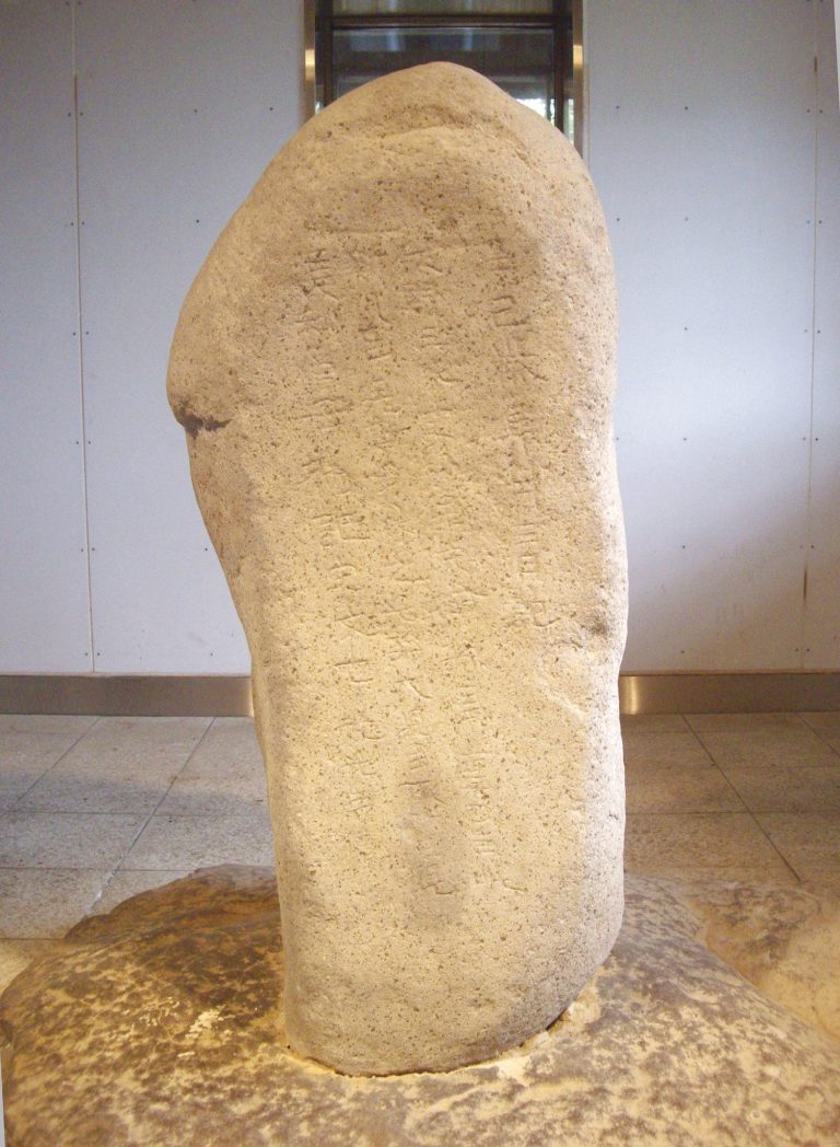
The stele body is 129 centimeters high, 69 centimeters wide, and 62 centimeters thick. Its front carries 80 characters arranged in six lines. The inscription is cut with rounded-bottom strokes, and its broad, forceful lettering uses a rounded form of regular script. The style has been compared with cliff inscriptions of China’s Northern and Southern Dynasties.
The upper lines are more evenly aligned than the lower ones. Bands of hard iron-hydroxide aggregates within the sandstone forced the carver to avoid particular areas when placing characters and strokes. Weathering has altered the carved surface and made some original forms difficult to recognize. Although the cuts were once commonly described as V-shaped, the rounding of their edges through weathering has supported the interpretation that the original carving had rounded bottoms. Edo-period rubbings preserve earlier forms of some characters before later recutting, including those corresponding to “county” and “correct.”
Capstone
The capstone is approximately 95 centimeters wide and 90 centimeters deep. It is 27 centimeters thick at the center, while its eaves measure 15 to 17 centimeters. A crack divides the stone. Its orientation changed several times between the Edo period, the late nineteenth century, the mid-twentieth century, and the modern period. Examination of the workmanship indicates that the narrowest surface created by the crack originally faced the front. Recent conservation repaired the fracture and restored the capstone’s presumed original orientation.
Base and protective setting
Stone base
The original base was a truncated square pyramid marked with the character meaning “country.” Its lower section is now embedded in concrete, which conceals the character and much of the original form. The base itself changed over time. Paving surrounded it during the Edo period, and it was probably set in its present position when the protective structure and earthen platform were constructed in the late nineteenth century.
Protective building and museum
The stele is normally viewed through the glass of its reinforced-concrete protective building. The adjacent Tago Stele Memorial Museum, established in 1996, presents research materials, archaeological materials, and ancient Chinese rubbings. The surrounding grounds form Yoshii Stone-Monument Village Park.
Administrative inscription
The inscription identifies the creation of Tago County, names the three counties from which its territory was taken, and specifies 300 households. In the early-eighth-century county system, 300 households represented six local units because 50 households formed one unit. The monument therefore joins its physical form and calligraphic presentation to a precise statement of administrative change, while the wording of its official order preserves the complexity of early Japanese governmental terminology.