Kanaizawa Stele: A Nara-Period Buddhist Monument in Japan

Site at a Glance
- Rating
- 4
- Popularity
- Low
- Country
- Japan
- Primary era
- Medieval
- External website
- Open
- Eras represented
- Medieval
- Civilizations
- Yamato
- Site type
- Civic
- Remains
- Monument
On this page10 sections
History
The Kanaizawa Stele is a Nara-period Buddhist monument in Takasaki, Japan, erected in 726 by members of the Miyake family and their devotional associates. The Nara period, conventionally dated from 710 to 794, saw centralized government, provincial administration, Buddhism, and written record-keeping expand across Japan. The stele is especially important because its inscription preserves the earliest known written use of the place-name Gunma and reflects the administrative language of the early eighth century.
The Buddhist dedication
The inscription records a vow made by members of the Miyake family, an aristocratic family associated with Takada Village in Shimosanu Ward, Gunma County, in Kōzuke Province. The dedicators prayed to the Buddha for seven generations of ancestors and for the safety of their parents, while also invoking heaven and earth. Nine people are named or identified. Six belonged to the principal family group, including four women, while three were connected through a Buddhist devotional association. The latter group included two Miyake men and a smith from the Isobe family.
The inscription follows a family-register format associated with the ritsuryō system, Japan’s early centralized legal and administrative order. Its terminology reflects a short-lived township-and-village system in which counties were followed by named townships and villages. That arrangement operated for roughly two decades, between 711 and 740. The stele therefore provides evidence for the system’s local implementation as well as for the spread of Buddhism among non-elite communities in the northern Kantō region.
Uncertain family relationships
Several details in the inscription have produced competing interpretations of the Miyake genealogy. Its opening reference to the Miyake family may mean “the descendants of Miyake,” or a partly illegible final character may belong to a personal name identifying the petitioner. The choice affects how the six people in the first group are related. The phrase concerning the parents may refer to deceased parents or to parents who were still living. Another uncertain passage about a woman serving in the household may describe an independent individual or introduce the woman named immediately afterward. The exact reading of one woman’s surname and another woman’s name also remains unsettled.
The Miyake family was traditionally identified with the Sano Miyake mentioned on the nearby Yamanoue Stele. Recent archaeological investigations have made the existence of another, previously unknown Miyake more certain, so the family named at Kanaizawa may have been distinct from the Sano Miyake. One reconstruction places the petitioner in Gunma County and the other Miyake men in Kataoka County, with the petitioner representing the senior branch. Another connects the petitioner with the burial occupant of the Urushiyama Tumulus and the two men with the occupant of the Yamana Iseduka Tumulus. These proposed relationships remain interpretations rather than established facts.
Local estates and political authority
The Miyake, Mononobe, Otada, and Isobe groups have been interpreted as a kinship network and locally connected alliance united by Buddhist belief. One theory proposes that the Miyake originated among occupational clans involved in administering the Sano and Midono imperial estates. In this interpretation, the family descended from local elites buried in large keyhole-shaped tombs, burial mounds with a circular rear section and a projecting rectangular front.
The stele stands in the hill country of Yamabe Township in Tago County, while its inscription associates the petitioner with Takada Village in Gunma County across the Karasu River. This geographical difference has been interpreted as evidence that the Miyake family’s sphere of influence extended on both sides of the river. It has also supported the proposal that the Sano estate crossed the later boundaries of Gunma, Kataoka, and Tago counties. The name Miyake may itself have derived from responsibility for administering the Sano estate.
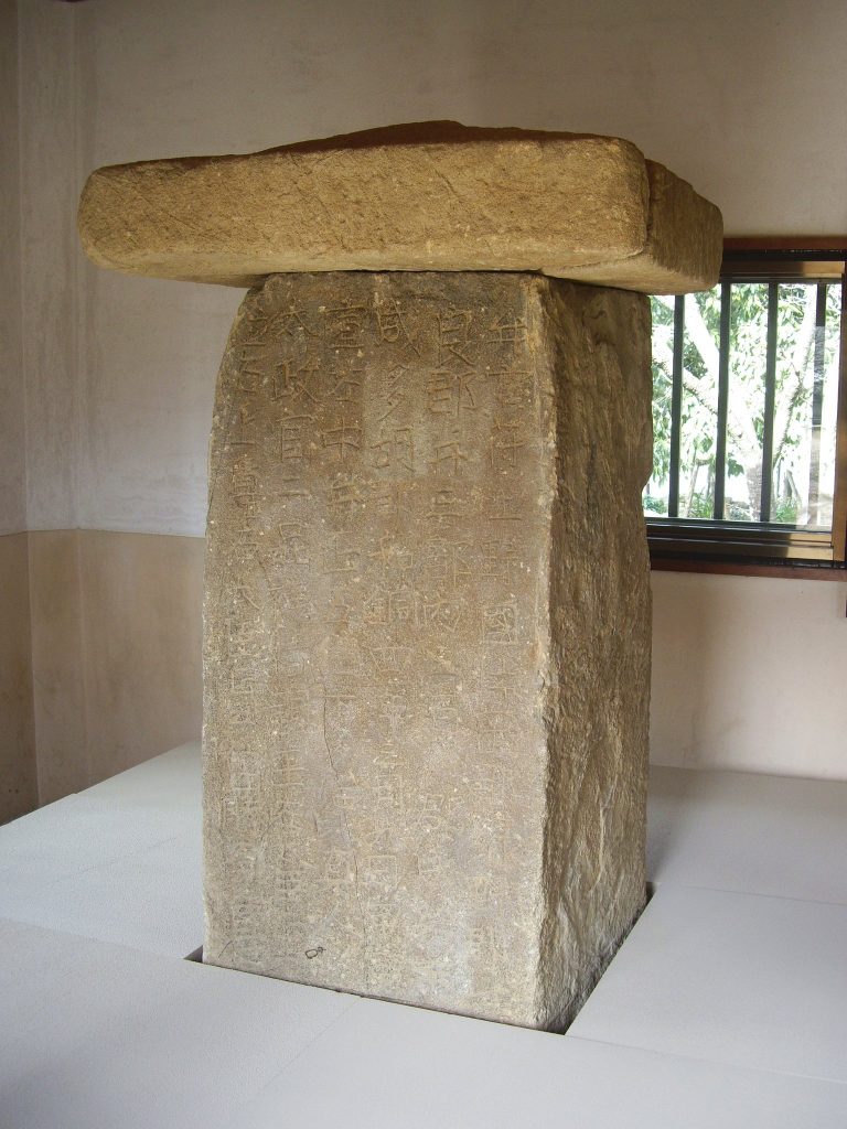
The nearby Yamanoue Stele preserves a genealogy linking Takemori-no-Mikoto, regarded as the first administrator of the Sano estate, with the woman Kurome-no-Toji and her son, the monk Chōri. One reconstruction places Kurome’s memorialization around 681 and estimates that Chōri was then about fifty. Tracing five generations backward places Takemori-no-Mikoto in the late sixth century, during the reign of Emperor Kinmei. He has consequently been interpreted as a deified ancestor representing the generations who established and managed the Sano estate.
After the Taika political transformation, the abolition or reorganization of provincial chieftaincies and imperial estates made appointment as a county governor an important means of maintaining ties with the central government. The emphasis on estate administration in the Yamanoue and Kanaizawa inscriptions has therefore been interpreted as both ancestor worship and a political claim in local disputes over official appointments. Later, the Midono estate became Midono County, while the Sano estate was divided between Kuruma County, later called Gunma County, and Kataoka County instead of becoming a separate Sano County. This division has been interpreted as a political defeat for the descendants of the estate administrators.
The Miyake family was also politically disadvantaged when Tago County was created in 711 under the leadership of the prominent local figure Hitsuji. The Tago Stele’s covered-stone form and distinctive calligraphy have been interpreted as a cultural and political assertion of the new county’s legitimacy, contrasting with the Yamanoue Stele. The Kanaizawa, Yamanoue, and Tago monuments consequently belong to the same local historical group, later known as the Three Stelae of Kōzuke.
Discovery and protection
The stele was reportedly found during the Edo period after a landslide buried it or brought it to the surface. Local tradition says that farmers used it as a washboard in a nearby stream. Another tradition holds that its discovery led to its enshrinement as a sacred object at a Hachiman shrine. Hachiman is a major Japanese shrine deity traditionally associated with protection and warfare. The diary Yamabuki Nikki recorded in 1786 that the monument had been dug up in the surrounding area, and it appeared in an inventory compiled by Matsudaira Sadanobu in the 1790s.
Protection began under Gunma governor Katori Motohiko in 1878. In 1884, the prefectural government authorized the purchase of the land, placed the stele on a new base stone, and built a small protective structure. The monument became a National Historic Site in 1921 and a Special National Historic Site in 1954. In 2017, it joined the Yamanoue and Tago stelae in the Three Stelae of Kōzuke inscription on UNESCO’s Memory of the World Register, a program for documentary heritage judged to have outstanding global significance.
Remains
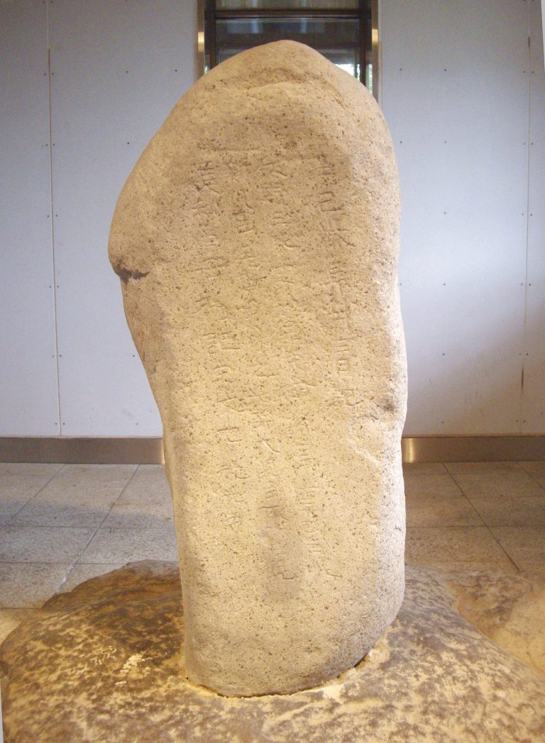
The Kanaizawa Stele is a single stone monument of pyroxene andesite, measuring 110 centimeters high, 70 centimeters wide, and 65 centimeters thick. Its surviving form combines a substantial inscribed face with a replacement base and a later protective structure. The stele was found lying horizontally on the southern slope of a hill facing the hamlet of Kanaizawa, near a stream associated with the tradition of its earlier reuse. It now stands within a protective structure built in 1991 and can be viewed through a window.
Stone monument
The stele was carved from one block of pyroxene andesite. Its face contains 112 characters arranged in nine lines. The inscription was cut directly into the stone and includes the date 726, the names or designations of the dedicators, their family relationships, their Buddhist devotional association, and their prayer for ancestors and parents. The monument now rests on the replacement base stone installed during its nineteenth-century protection.
Inscription and writing
The characters are carved in regular script with rounded, fully formed shapes. The lettering also preserves features of the older clerical script, as does the nearby Yamanoue Stele. The register-like arrangement and administrative vocabulary connect the physical inscription with eighth-century writing practices under the ritsuryō system. The text includes the earliest known written occurrence of the place-name Gunma, giving the stone an importance that extends beyond its Buddhist dedication.
Some parts of the text remain difficult to interpret. One character is illegible, and another is written with the horse radical and a “claw” component for which no certain English rendering is available. These uncertainties affect the reading of names, household relationships, and the genealogy presented by the dedication. They also explain why several reconstructions of the Miyake family’s connections continue to coexist.
Relationship to nearby monuments
The Kanaizawa Stele belongs to a concentrated group with the Yamanoue and Tago stelae. The three monuments stand within an area of approximately three kilometers in southwestern Gunma and share a historical connection with local families, Buddhist belief, and changing systems of political administration. Together, they preserve related evidence for how local communities used inscribed stone to express religious commitments, family identity, and claims connected with estate management.
Associated burial mounds
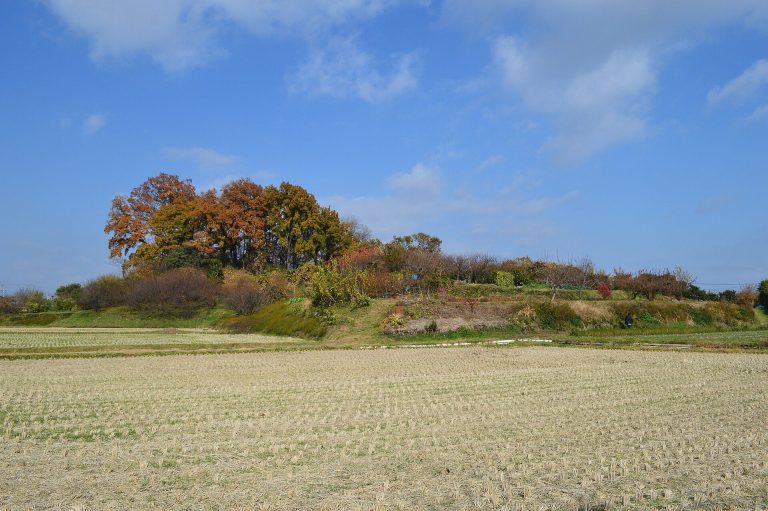
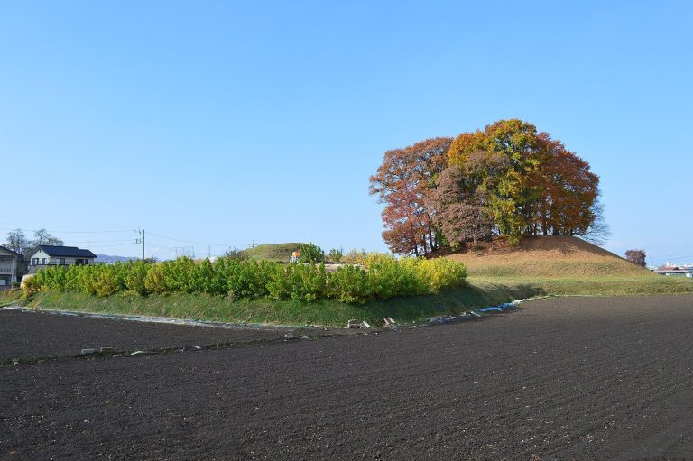
The Urushiyama and Yamana Iseduka tumuli have been proposed as the tombs of members of the early elite associated with the Sano estate and the communities connected with the stelae. Each is approximately 60 to 70 meters in scale. Their finely made horizontal stone chambers use cut Tate tuff in the burial chambers and natural rounded stones in the passageways. A horizontal stone chamber is entered through a passage from the side of a burial mound, while cut tuff is a relatively soft volcanic stone shaped into masonry blocks. Because of their similar construction, the two tombs have been characterized as “sibling tombs.”
The plain east of the Karasu River was an established agricultural zone from the early Kofun period, when large burial mounds were built for elite individuals. The western hills were developed later. Two eruptions of Mount Haruna between the late fifth and early sixth centuries caused large floods that may have disrupted the earlier irrigation network. The occupant of the Urushiyama Tumulus has been interpreted as helping restore irrigation and rice cultivation through water-management technology associated with the Sano estate, while the occupant of the Yamana Iseduka Tumulus may have led development on the western bank.