Xochicalco: An Epiclassic Mesoamerican Urban and Ceremonial Center
Site at a Glance
- Rating
- 4.9
- Popularity
- Very Low
- Country
- Mexico
- Primary era
- Medieval
- Eras represented
- Medieval
- Civilizations
- Maya
- Site type
- City
On this page30 sections
History
Xochicalco is a pre-Columbian urban and archaeological site near Temixco in Morelos, Mexico. The city developed into a major center during the Epiclassic period, approximately AD 650 to 900, after the decline of Teotihuacan, a major urban and political power in central Mexico. Nearly all of the monumental architecture visible today belongs to this period. The city is traditionally associated with the Olmeca-Xicallanca, described as Maya traders from Campeche, and its name derives from Nahuatl, commonly translated as “in the house of flowers.”
Origins and Epiclassic growth
Xochicalco was first occupied by about 200 BC, but it did not become a large urban center until the late first millennium AD. Its expansion followed the weakening of Teotihuacan and may have taken advantage of the political and economic conditions created by that decline. Connections visible in its architecture and imagery extend across the Maya area, Oaxaca, Veracruz, the Gulf and Pacific coasts, Guerrero, Michoacan, the Toluca Valley, and central Mexico.
The city stood on major Mesoamerican exchange routes. Long-distance trade and specialized craft production supported its growth, while its elite controlled access to luxury materials such as marine shells, greenstone, obsidian, cacao, mica, pyrite, turquoise, and metal ornaments. At its height, Xochicalco may have housed between 10,000 and 20,000 people. Its functions included administration, residence, commerce, defense, ceremony, and religious activity.
The surrounding agricultural conditions were poor, making trade and defense important factors in the city’s development. Xochicalco occupied elevated limestone hills that allowed surveillance of the surrounding landscape and of routes used for exchange. Terraces, walls, ditches, caves, watchpoints, and restricted entrances gave the settlement a strongly defended character. The Acropolis served as the central administrative precinct and royal palace, while enclosed plazas concentrated political and ceremonial activity.
Destruction and later occupation
Xochicalco was burned and destroyed at approximately AD 900. Excavated houses and temples contain burning and destruction layers over the main Epiclassic deposits, and objects left in place point to a rapid collapse and abandonment. A smaller population continued to live on the lower slopes. Around AD 1200, Nahuatl-speaking Tlahuica communities recolonized the site.
Xochicalco was traditionally connected with the cult and deification of Quetzalcoatl, the Feathered Serpent. In different Mesoamerican traditions, Quetzalcoatl was associated with rulership, priesthood, wind, knowledge, creation, and celestial cycles. At Xochicalco, religious and political imagery also addressed warfare, astronomy, rain, calendrical cycles, and broader Mesoamerican cosmology. These associations later influenced Toltec and Mexica traditions.
Rediscovery and conservation
The ruins were mentioned by Bernardino de Sahagun at the end of the sixteenth century. Jose Antonio Alzate y Ramirez published an eyewitness description in 1791, followed by illustrations and a description by Alexander von Humboldt in 1810. Maximilian, Emperor of Mexico, also visited the ruins.
Leopoldo Batres restored and consolidated the Temple of the Feathered Serpent around 1910, after stones had been removed for nearby haciendas and sugar-making machinery. Eduardo Noguera conducted further excavation and restoration between 1934 and 1947. Kenneth Hirth began mapping and excavating houses and obsidian workshops in 1976. Major excavation and restoration programs directed by Silvia Garza Tarazona and Norberto Gonzalez Crespo followed between 1984 and 1994.
The Xochicalco Archaeological Monuments Zone became a UNESCO World Heritage cultural site in 1999 under criteria III and IV. On 30 March 2015, it was included in the International Register of Cultural Property under Special Protection of the 1954 Hague Convention.
Remains
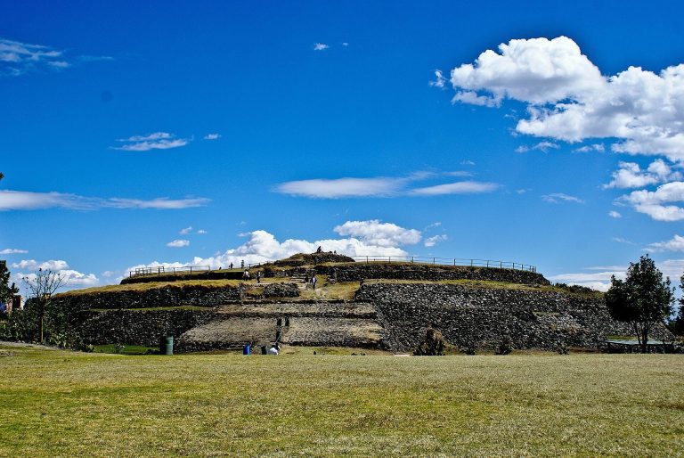
Xochicalco occupies several limestone hills, including La Bodega, La Malinche, and Xochicalco, which rise approximately 120 meters above the valley floor. The inhabitants reshaped the hills by quarrying, cutting, filling, surfacing, and decorating their slopes. This work created artificial terraces, plazas, roads, stairways, building platforms, and drainage systems. The main ceremonial center stands on an artificially leveled hill, while long terraces contain residential remains, many of which remain unexcavated.
Terraces, defenses, and access
Fortifications and roads
A ring of defensive walls surrounds the principal hill. Ditches, high flat-faced walls, restricted entrances, internal fortifications, watchpoints, and circulation barriers occupy the lower slopes. A partly excavated and reconstructed gateway opens onto a partially exposed masonry road leading toward a higher level. Large plazas are generally bordered by ceremonial buildings and linked by paved or masonry roads.
Cerro de la Bodega citadel
The eastern hill of Cerro de la Bodega contains a small citadel with three courtyards, an enclosing wall, and a paved approach road bounded by walls. The complex may have served a ritual purpose and may have included an unexcavated temple dedicated to Quetzalcoatl. A rock-cut ditch surrounds the citadel, although the work was left unfinished.
Most buildings have rectangular or nearly square plans. Broad entrances were divided by two masonry pillars and led through a narrow entrance room and a passage into an antechamber. A principal interior room lay beyond. Roofs probably used wooden beams covered with stone and stucco. Traces of wooden posts survive in some plastered floors.
Southern Plaza and ceremonial ascent
Temples C and D
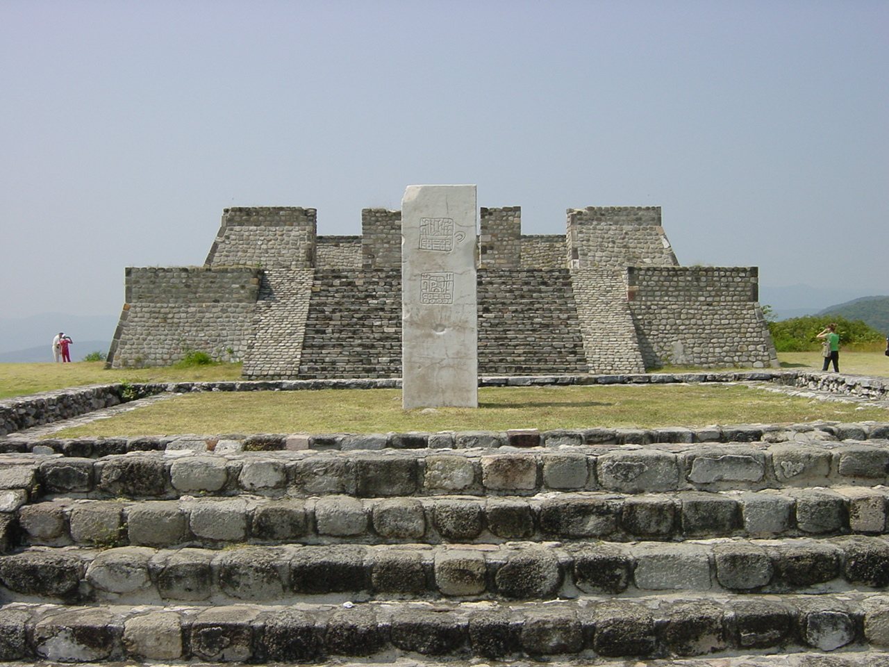
The Southern Plaza lies between Temples C and D, which were built as mirror-image structures on pyramid platforms. Each had a broad entrance divided into three sections by two masonry pillars, a large entrance room, and a narrower passage leading to a shallower temple room. A low platform at the center of the plaza was enlarged repeatedly and supported the Stele of the Two Glyphs.
Building E and the Great Ascent
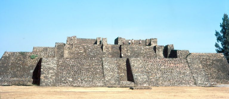
Building E, also called the Great Pyramid, forms the northern side of the Southern Plaza. Its apparent pyramid is partly the elaborately designed retaining wall of a third terrace. The structure uses superimposed sloping-and-vertical architectural bodies known as talud-tablero, in which a sloping lower wall supports an upright panel. A broad central staircase led upward, while only slight remains of the temple enclosure survive at the top.
The southern edge of the plaza was bounded by two nearly symmetrical buildings with two rows of rooms on either side of a broad passage. A wide stairway connected them to a lower level. From this area, a paved road led west toward Ballcourt 1, the palace, and the largely unexcavated Malinche Pyramid.
The Great Ascent included a passage building with a central wall, porticoes, broad wall projections, and stair remains leading to the roof. It restricted access to a rectangular plaza framed by the stepped slope of the highest terrace. A partially restored monumental staircase, a second passage building, a square plaza, and a narrower stairway connected lower and upper levels.
Secluded courtyard complex
East of the Great Pyramid is a secluded complex arranged around a slightly sunken rectangular courtyard. Portico-like rooms open onto it through passages divided by pillars. A staircase on the western side led to roof level and formed the complex’s only access.
Central Plaza and elite compounds
Central Plaza
The Central Plaza occupies the highest level of the hill. Low buildings border it on the east, while Building A and an entrance structure occupy the southeast and south. The Acropolis stands to the west, and the upper perimeter wall forms its northern boundary. Two buildings with identical plans stood slightly east of the plaza’s center. The southern building is the Pyramid of the Feathered Serpent.
Acropolis
The Acropolis is a connected group of buildings west of the Central Plaza and forms Xochicalco’s highest built level. It contains several courtyards, rectangular room complexes, porticoes, pillar-divided entrances, small rooms, roof stairways, and rooms with recessed rainwater-collecting areas called impluvia. Its location and arrangement indicate a residential complex for the city’s rulers. The pairing of several buildings may also reflect divisions among elite family lines.
Building A and the Salón Sureste
Building A occupies the southeast corner of the Central Plaza. It stands on a two-level pyramid platform reached by a broad western stairway. The complex includes a portico, a slightly sunken courtyard, northern and southern rectangular rooms, and a square central temple on a low pyramid base. A brick-lined recess within the temple held three broken stelae, or carved stone monuments, covered with red pigment. Their placement appears to have formed a ritual burial.
South of Building A, the structure known as the Salón Sureste contained rich offerings, including large marine conch shells covered with red pigment. The offerings appear to have been placed before the building was deliberately destroyed.
Building B
Building B, north of Building A, is an approximately 90-meter-long upper-class residential complex or palace. It contains three structural units, broad porticoes, pillar-divided passages, interconnected rooms, and an eastern portico. An impluvium surrounded by pillars occupied part of the complex. Its arrangement has strong architectural similarities with comparable complexes at Teotihuacan.
Eastern Plaza and observatory
Eastern Plaza
The Eastern Plaza lies on the second level east of the Central Plaza. It contains large courtyards, porticoed halls, three medium-sized pyramids with poorly preserved temple rooms, and the Eastern Ballcourt. The Animal Ramp is a well-preserved stone-paved ramp decorated with shallow reliefs of animals.
Observatory Cave
Structures in the western area stand above the Observatory Cave, which was created inside a modified cave reached by carved steps. The observatory includes a passage, a large chamber, and a chimney 8.7 meters high from its base to the surface. Its slightly inclined hexagonal opening projects a hexagonal shape and the image of the sun onto the cave floor.
The cave was originally coated with stucco and painted black, yellow, and red. Direct sunlight enters for 105 days, from 30 April to 15 August. Around 14 to 15 May and 28 to 29 July, the sun reaches the zenith and the beam passes directly through the chimney. The observatory was used to study the sun and probably also served religious ceremonies and the determination of the agricultural cycle. It has undergone conservation.
Ballcourts, altars, and water management
Ballcourts
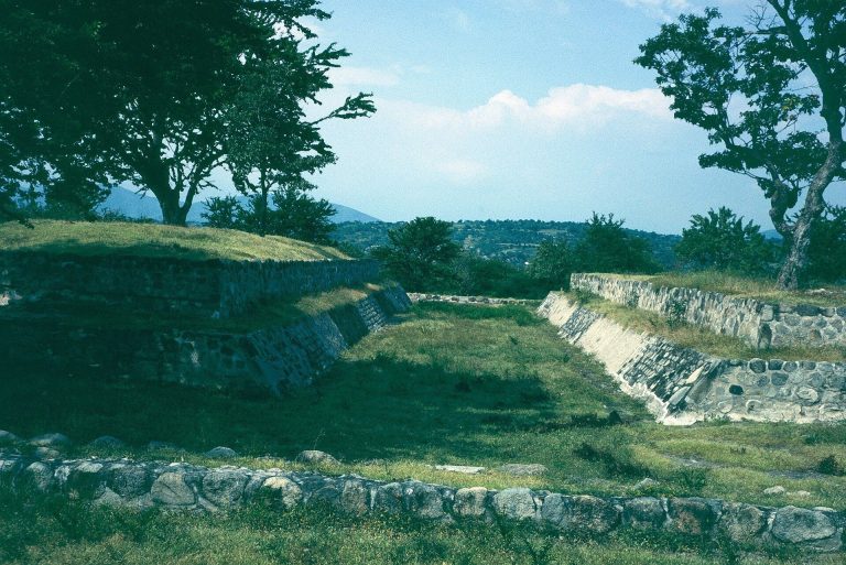
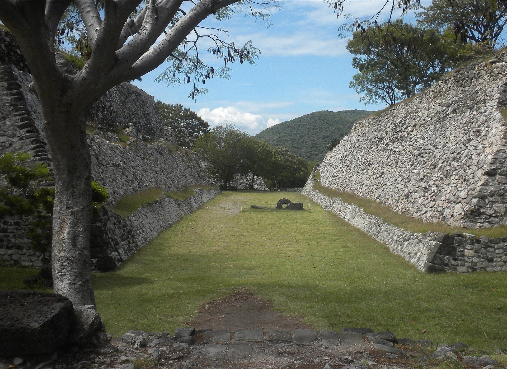
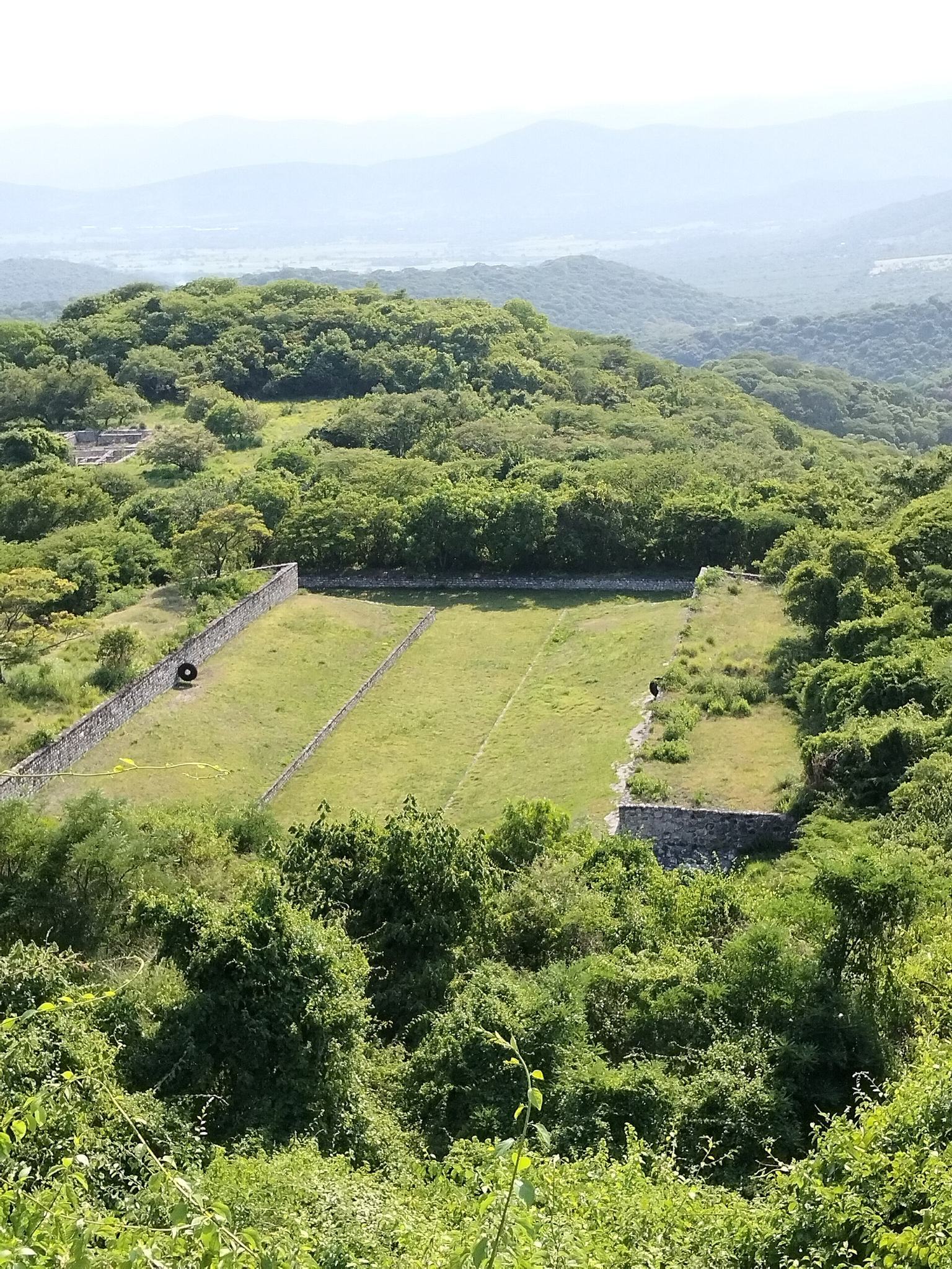
Xochicalco has three ballcourts. The largest occupies the lowest level west of the hill near the Malinche Pyramid. A second stands east of the hill on the middle level, and a third is integrated into the perimeter wall on the northern side of the third terrace. Their differing plans may reflect distinct ritual purposes associated with drought and rain or with day and night. Each had large monolithic ballcourt rings decorated with reliefs.
Altars and drainage systems
The site contains several sweat baths, palaces, step-pyramid temples, and other residential and ceremonial structures. An unusual group of twenty circular altars and one square altar may have supported calculations connected with the 260-day ritual calendar.
Extensive rainwater drainage systems used prefabricated tubes joined in sequence. Water flowed into cisterns for use during the approximately seven-month dry season and was distributed through the architectural complexes. The system may also have been connected with a cult of the rain deity.
Pyramid of the Feathered Serpent
Structure and reliefs
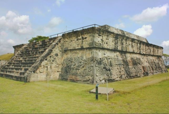
The Pyramid of the Feathered Serpent was built as the city’s principal architectural axis. Its earliest construction stage was a small porticoed room measuring approximately 10 by 11 meters. The room was enlarged and later covered by the pyramid. The surviving structure consists of a sloping base, a projecting cornice and upright panel, and a temple of which only one course of sloping stones remains. Carefully fitted basalt and andesite blocks form the masonry without mortar. The lower structure remains substantially intact, while upper elements were partly reconstructed.
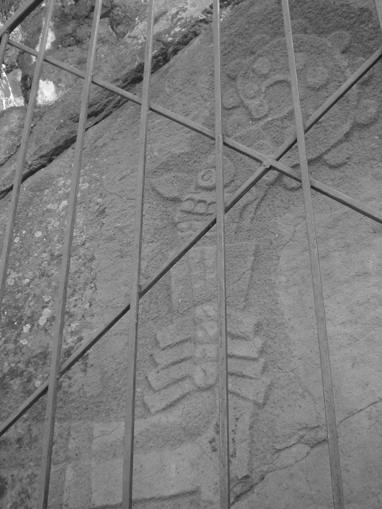
Eight feathered-serpent reliefs decorate the sloping base, with six on the eastern, southern, and northern sides and two smaller examples on the western side. The serpents have feathered heads and bodies, rattles, long feathered tails, undulating forms, and shell-like markings. Seated human figures occupy the spaces between the coils. Their headdresses, ornaments, speech-scroll signs, calendrical signs, place signs, and smoke volutes connect the reliefs with rulership, ritual, and timekeeping.
The imagery includes dates such as “9 Reptile Eye,” “6 Reed,” “11 Monkey,” “9 or 10 House,” “10 Solar Ray,” “13 Monkey,” and “3 Reed.” Smoke volutes have been interpreted as references to the New Fire, a calendrical renewal ceremony associated with the completion of a 52-year cycle. One scene shows a headless seated figure called “2 Movement,” carrying a priestly bag and a half-ballcourt motif interpreted as the “Bearer of the Universe.” The dates “10 Solar Ray” and “9 Reptile Eye” may refer to the pyramid’s inauguration or commissioning.
The eastern rear wall was divided into eight rectangles, probably for twenty-eight seated priests with censers, day signs, and place signs identifying their origins. The northern and southern sides include seated priests, eclipse signs, warriors, place signs, calendrical signs, and representations of animals, plants, rivers, and people. Upper temple imagery includes warriors, a woman warrior carrying a macuahuitl, a seated warrior with arrows, a shield, and a staff of office, as well as figures associated with eagles and felines. A macuahuitl was a wooden weapon edged with sharp volcanic-glass blades.
The upper imagery also includes dates connected with the New Fire, a coyote, a tree, a possible pulque deity, ballplayers, a possible feathered-eye sign known from the murals of Cacaxtla, and additional place signs. The stairway side-walls show the ventral scales of feathered serpents. Their upper ends probably held serpent heads and their lower ends rattles. Large seated warriors holding shields appear above what may have been benches set over cultivated fields.
Twin Pyramid
The northern pyramid beside the Pyramid of the Feathered Serpent has the same general plan but apparently lacked relief-panel cladding. It is often called the Twin Pyramid. Only minimal remains of its upper temple survive.
The Pyramid of the Feathered Serpent was never completely covered by earth and rubble, allowing much of its relief decoration to remain visible. Leopoldo Batres fully exposed and restored it in the early twentieth century, although some relief blocks were placed arbitrarily. Blocks on the eastern side and at the western entrance appear to retain their original arrangements. Several reliefs remain undeciphered, while others may concern relationships between calendrical systems and a possible 28-day cycle.
Stelae and religious imagery
Stelae from Building A
César Augusto Sáenz discovered three quadrangular stelae within Building A in 1962. Their imagery combines designs, numbers, names, calendrical signs, and religious themes. They have been interpreted either as representations of the sun, earth, and rain deities or as records of rulers’ achievements.
Stele 1 shows Quetzalcoatl emerging from a serpent’s jaws and refers to a Nahua creation myth concerning the Fifth Sun, or cosmic era. It also refers to the planet Venus and includes the calendrical sign “7 Reptile Eye,” fire symbols, “9 Rabbit,” and “5 Reed.” Stele 2 shows Tlaloc, a central Mexican rain and fertility deity, with a time-symbol headdress, fangs, water-related signs, a bifid tongue, and a water sign with the numeral 7. Its reverse includes “9 Solar Ray,” an arrow, maize, ascending feet, the time sign, “13 Solar Ray,” and a vulture head.
Stele 3 is a rectangular cubic sculpture carved in low relief on all four sides. It shows Quetzalcoatl with the sign “4 Movement,” a heart emitting three drops of blood, the numerals 10 and 13 with ascending feet, a crenellated temple, further calendrical signs, and a feline with a bifid tongue. The heart and blood imagery has been compared with motifs from Cacaxtla and Teotihuacan and interpreted as Quetzalcoatl’s self-sacrifice in the creation of the Fifth Humanity.
Stele of the Two Glyphs
The limestone Stele of the Two Glyphs remains in a shrine at the center of the Central Plaza. One face bears the calendrical signs “10 Reed” and “9 Reptile Eye,” whose association may refer to the city’s foundation. The three stelae from Building A are now in the National Museum of Anthropology in Mexico City. Other inscriptions and carved stones are held in the local site museum.
Site museum
The site museum occupies 12,676 square meters and includes access areas, gardens, an entrance patio, three interior gardens, six exhibition rooms, administrative areas, a restaurant, and service spaces. Its covered areas total approximately 1,870 square meters, and a large window faces the archaeological zone.
Designed by the Mexican architect Rolando J. Dada y Lemus, the museum project began in 1993, construction ended in 1994, and the building opened in 1996. It was designed to operate without urban water, drainage, or electricity. Cisterns collect rainwater and hold 556 cubic meters, while domes, mirrors, and prisms direct natural light indoors. Photovoltaic electricity supplements the lighting, and double walls, air circulation, and chimney-effect ventilation regulate temperature. The form and subdued appearance were intended to blend with the surrounding hills and avoid visual competition with the ruins.