Wotanstein: A Standing Stone in Gudensberg, Germany
Site at a Glance
- Popularity
- Low
- Country
- Germany
- Primary era
- Unclassified
- Eras represented
- Unclassified
- Civilizations
- Unclassified
- Site type
- Civic
- Remains
- Megalithic Monument
History
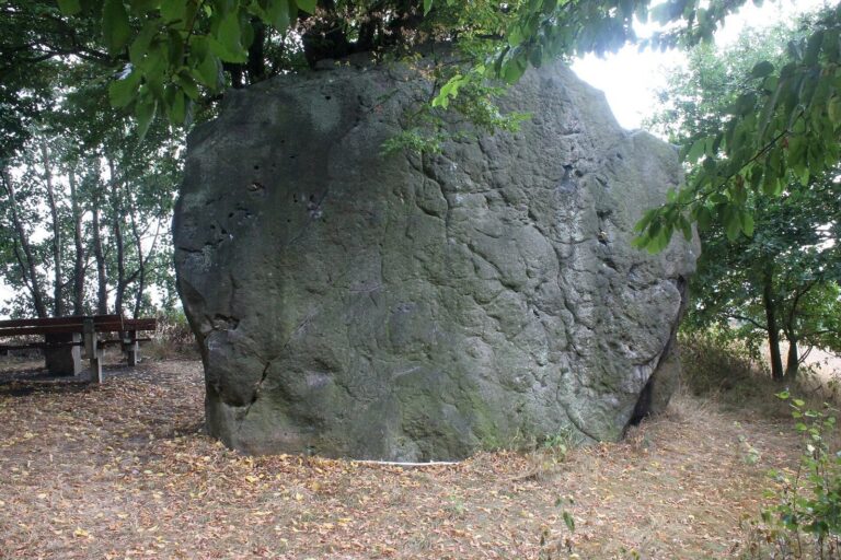
Wotanstein is an upright standing stone at the southwestern edge of Maden, in Gudensberg, Germany. Its date is uncertain, though it may be prehistoric, and its original purpose is unknown. It may have been used by the Chatti, an ancient Germanic people, to worship Odin, a Germanic god also known as Wotan, around the first century BC. This proposed association remains uncertain; possible uses include religious rites, assemblies, or court proceedings.
Written reference and later traditions
A record from 1407 describes Wotanstein as a long stone at Maden. Local tradition links it to an episode during the Seven Years’ War, the international conflict fought from 1756 to 1763. People reportedly dug beneath the stone in search of rumored treasure, found human bones, and discovered that it continued underground about as far as it rose above ground.
Another legend connects the stone with the first Christian church at Fritzlar, said to have been built by the Anglo-Saxon missionary Boniface using timber from Donar’s Oak. Donar was a Germanic thunder god commonly identified with Thor. In one version, the Devil, said to live at Mader Stein or nearby Lamsberg, tried to throw the stone at the church, but it caught in his sleeve. In another, the archangel Michael deflected it with his shield. Both versions say it fell in a field near Maden. The three oak trees around the stone are registered as a natural monument.
Remains
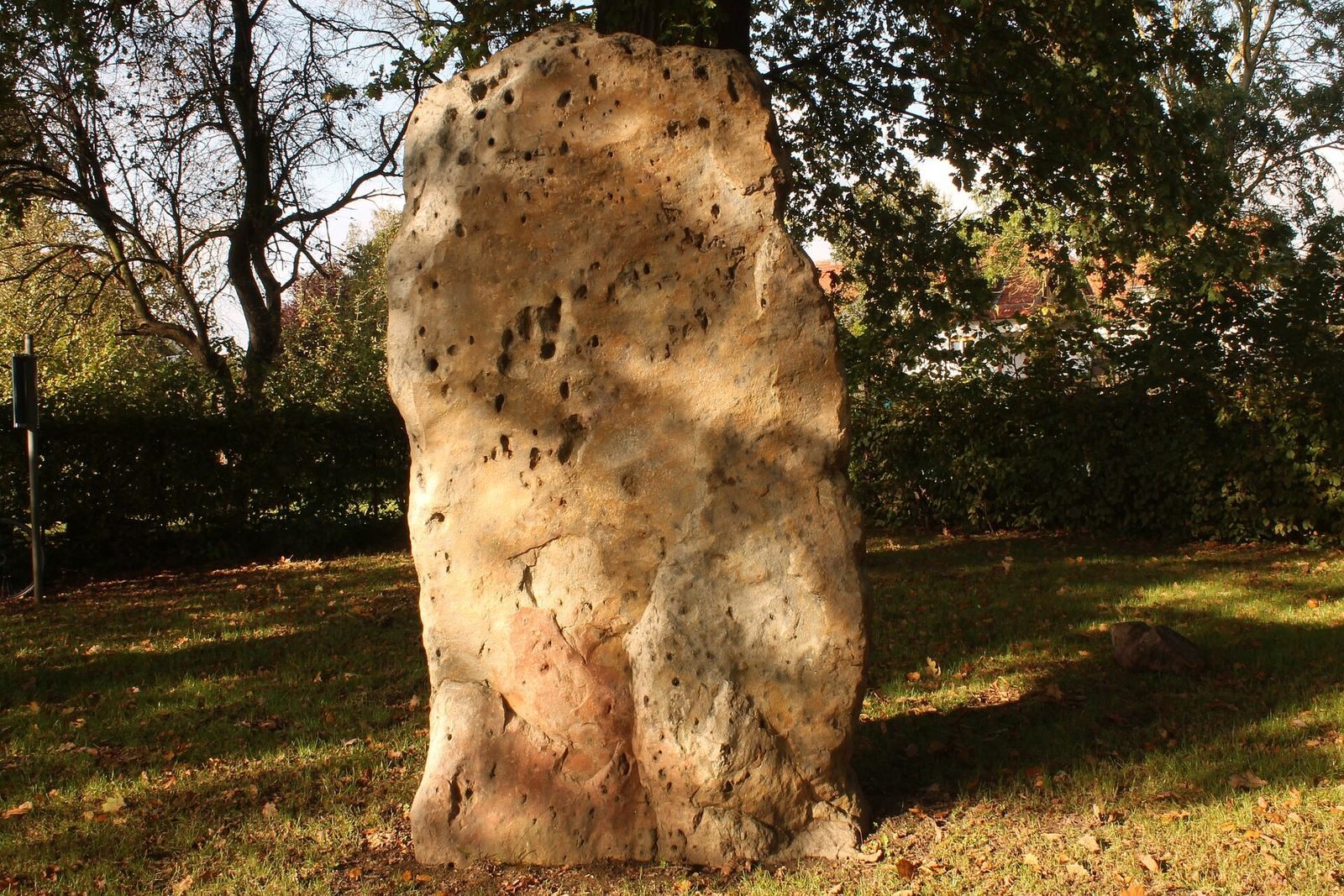
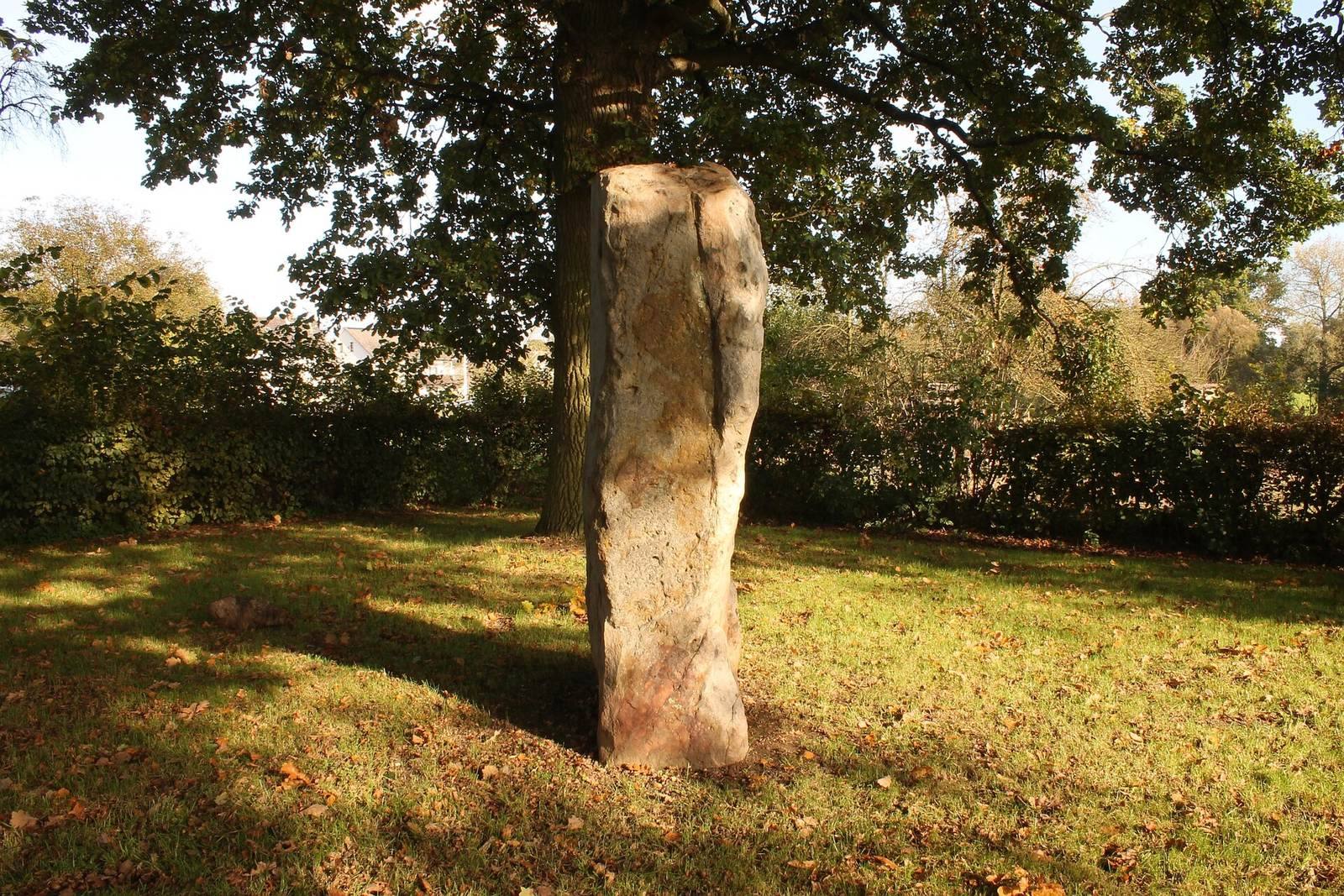
The site consists of a single upright quartzite stone. It stands on a rise about 177 metres above sea level, between the Goldbach stream to the east and Henkelborn to the west. The stone is on the eastern side of the road toward Obervorschütz, a few metres southeast of the road.
The stone measures about 2.12 metres high, 1.2 metres wide, and 0.55 metres thick. Its portion above ground has an estimated volume of 1.4 cubic metres and a mass of about 3.7 tonnes; its estimated mass, including the buried portion, is about 7.5 tonnes. The longest horizontal axis runs roughly northeast to southwest, on a bearing of 065 degrees, plus or minus five degrees. Its broadest faces point approximately south-southeast and north-northwest.
The stone is made of quartzite formed in the Miocene epoch, part of the Neogene geological period. The rock developed through intense weathering of Triassic red sandstone in a tropical climate. Quartzite does not occur locally; the nearest outcrops are near Fritzlar, Borken, and Melsungen, indicating that the stone was brought to Maden. Impressions, scratches, and holes on its surface are associated in local legend with the Devil’s claws.