Wayland’s Smithy: A Neolithic Chambered Long Barrow in Oxfordshire
Site at a Glance
- Popularity
- Very High
- Country
- United Kingdom
- Primary era
- Stone Age
- Eras represented
- Stone Age
- Civilizations
- Unclassified
- Site type
- Burial
- Remains
- Burial Mound
On this page8 sections
History
Wayland’s Smithy is a chambered long barrow, a long burial mound with an inner tomb, near Ashbury in Oxfordshire, United Kingdom. Farming pastoral communities built its first phase around 3590–3550 BCE, during the Neolithic, the prehistoric era associated with farming and settled communities. A stone-chambered mound followed later in the fourth millennium BCE. The change from timber to stone may have taken as little as 50 years, after agriculture reached Britain from continental Europe.
Neolithic construction and use
The first mound may have provided a place for community ceremonies and expressed a group’s claim to land. The later tomb may have remained in use for several centuries. Radiocarbon dating places its burials among the relatively late uses of this tomb style, while West Kennet Long Barrow had already been in use about 200 years earlier.
The name and its folklore
Saxon settlers, Germanic peoples who settled parts of Britain in the early medieval period, probably named the monument after Wayland, also called Wolund, a legendary Germanic smith known from Norse mythology. The name appears in a land deed concerning Compton Beauchamp dated 908, preserved in a charter issued by King Eadred in 955, roughly four millennia after the monument was built.
In 1738, antiquary Francis Wise wrote down local stories about Wayland Smith. One tale promised that a traveler who left a silver penny beside the mound would find replacement horseshoes, without ever seeing the smith. Other local folklore linked the place with witch relics. On 3 October 1758, Anna Stukeley, daughter of antiquary William Stukeley, mentioned the monument in a letter to him.
Walter Scott called it Wayland Smith’s Forge in his 1821 novel Kenilworth, and an 1828 Ordnance Survey map used the same name. Folklorist and archaeologist Leslie Grinsell later suggested that Scott’s novel influenced the map’s wording.
Excavation and protection
Wayland’s Smithy became a scheduled monument on 18 August 1882, a legally protected historic site in the United Kingdom, and is in the care of English Heritage. An excavation around 1920 exposed disturbed human remains in the later tomb. Archaeologists Stuart Piggott and Richard Atkinson excavated the monument in 1962–1963, established its two construction phases and oversaw its restoration. Prehistorian Alasdair Whittle examined it again in the 1980s.
Modern ritual use
Visitors have left coins in cracks in the stones since at least the 1960s. Since the late twentieth century, modern Druids and Heathens, religious communities drawing on pre-Christian traditions, have also used the barrow for rituals. Heathen practice is especially associated with Germanic traditions. Anthropologist Thorsten Gieser interpreted rituals involving communication with ancestors, earth spirits and an earth goddess as symbolically connected with the site’s folklore and prehistoric use as a burial place.
In 2019, concern was raised about ritual use by Woden’s Folk, a neo-Nazi Heathen movement. The National Trust, a conservation organization, said it would increase ranger visits.
Remains
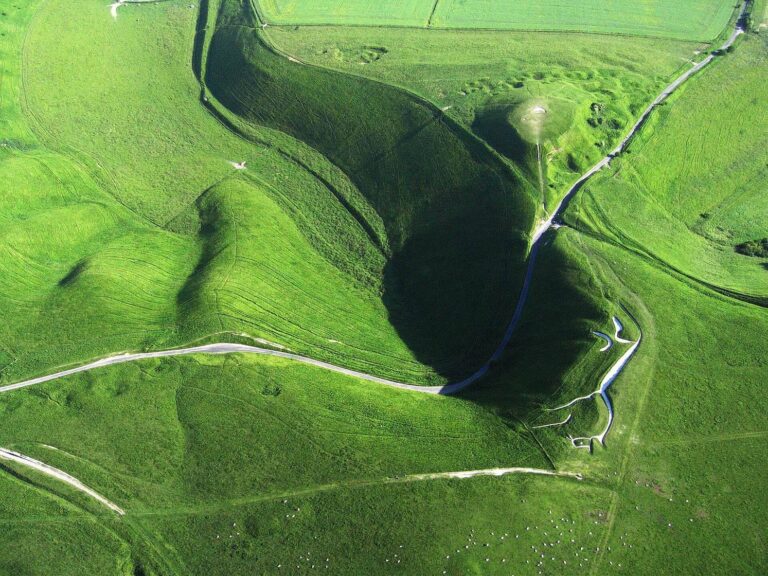
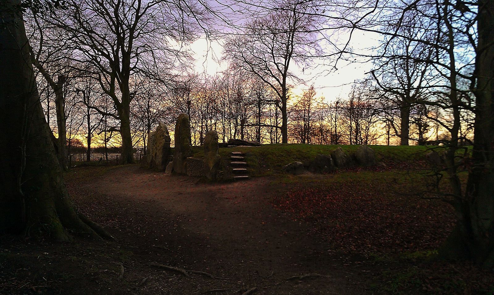
Wayland’s Smithy stands on a low hill near the Uffington White Horse, in the same hill range as Uffington Castle and close to the Ridgeway, an ancient trackway across the Berkshire Downs. Its earthworks preserve two successive building phases, with a timber burial chamber in the earlier mound and a stone tomb in the later one. The site is among the best-surviving examples of its regional type.
The earlier timber-chambered mound
The first mound was oval and about 16.5 metres long. Builders shaped it from locally dug chalk and earth from two flanking ditches, about 4.6 metres wide and 1.8 metres deep, then edged it with stone slabs. Its timber burial chamber had a paved stone floor and two large posts, one at each end. Postholes at one end have been interpreted as evidence for a timber front. The chamber held the remains of 15 people: one crouched burial lay at an end, with the mostly separated bones of 14 others in front. The bodies had been left for their flesh to be removed before burial, and their remains may represent as many as four separate deposits.
The later stone-chambered mound
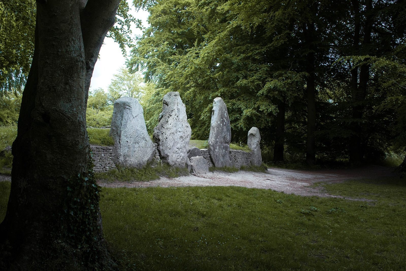
The later mound completely covered the first and formed a more regular trapezoid about four times its length. It was built from chalk and earth taken from two large flanking ditches, with a stone edging that retained the mound. Tall stones bounded its broad end, which contained a stone-built burial chamber and side chambers; toward the other end, the mound slopes gently and is edged with smaller slabs. The burial complex has a cross-shaped plan, with a long entrance chamber connecting to two opposing side chambers and a terminal chamber. The disturbed remains represent at least eight people, seven adults and one child. Four large sarsen stones, blocks of hard sandstone, now stand at the entrance as part of an original six-stone group. The four stones were returned to upright positions after the 1962–1963 excavation.