Walls of Ston: A Defensive System of the Republic of Ragusa


Site at a Glance
- Rating
- 4.7
- Popularity
- Medium
- Country
- Croatia
- Primary era
- Medieval
- External website
- Open
- Eras represented
- Medieval, Early Modern
- Civilizations
- Republic of Ragusa
- Site type
- Military
- Remains
- Wall
On this page10 sections
History
The Walls of Ston in Croatia are a defensive system built under the Republic of Ragusa, also known as the Dubrovnik Republic, during the second half of the fourteenth century. Construction began in 1358 after Ragusa acquired the Pelješac Peninsula from the Serbian Empire. The fortifications protected Ston, the narrow connection across the peninsula, and the salt pans that helped support the republic’s wealth.
Foundation and expansion
The walls formed a defensive line across the narrowest part of the Pelješac Peninsula, linking Ston with Mali Ston. Their protection extended to the salt works and an area devoted to mollusc farming. The salt pans reportedly brought the Republic of Ragusa 15,900 ducats each year and remain in operation. The complex was maintained and renovated throughout the republic’s existence, with its form changing over almost four centuries as the terrain and military installations were adapted.
Between 1461 and 1464, the Florentine architect Michelozzo designed the Great Wall on Podzvizd, a 1,200-metre defensive section intended to guard against neighbouring powers. Tradition places its construction at 18 months and its cost at 12,000 ducats. Michelozzo, Bernardino Gatti of Parma, and Giorgio da Sebenico, also known as Juraj Dalmatinac, are associated with work on the wider walls project.
Earthquakes, demolition, and restoration
A catastrophic earthquake in 1667 caused approximately 0.5 kilometres of wall to collapse. Further serious damage followed earthquakes in 1979 and 1996. After the fall of the Republic of Ragusa, demolition began. Austrian authorities later reused wall materials for schools, community buildings, and a triumphal arch built for the visit of the Austrian Emperor in 1884. The wall around Mali Ston was also demolished on the stated grounds that it harmed public health, although this work stopped after the Second World War.
Restoration and reconstruction began in 2004, first with the aim of making the route between Ston and Mali Ston usable. By 2008, the original section above Ston had been restored. The route to Mali Ston was restored by June 2013. The historical-town planning ensemble of Ston and Mali Ston, including the connecting walls, Mali Ston Bay nature reserve, Stonsko Polje, and the salt pans, forms part of a World Heritage property designated in 2005.
Remains
The surviving fortifications form a limestone defensive complex between Ston and Mali Ston. The walls originally extended for more than 7 kilometres; the present system includes a 5.5-kilometre wall between the two towns. Its irregular pentagonal plan incorporates the walls of Ston and Mali Ston, the Great Wall, towers, and fortified centres. The restored route joins the original section above Ston with the road leading to Mali Ston.
Walls, towers, and fortresses
The Great Wall
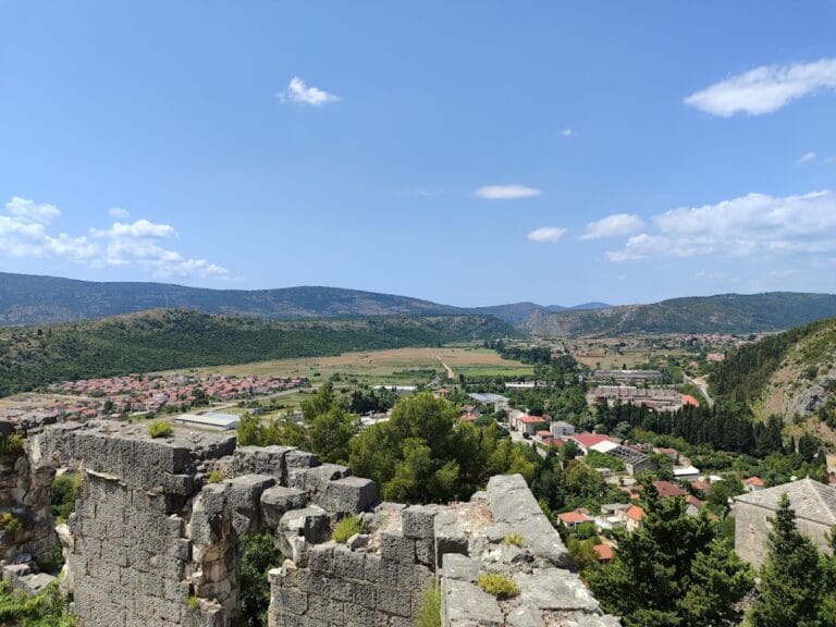
The Great Wall runs across Podzvizd and measures 1,200 metres. It was built as a defensive barrier on the peninsula and forms part of the wider limestone fortification system. Podzvizd Hill rises to 224 metres and carries one of the complex’s three principal fortified centres.
Fortresses and towers
The defensive complex comprised 40 towers and five fortresses, of which 20 towers have survived. Its wider arrangement is described as including 10 round towers, 31 square towers, and six semicircular bastions, which are projecting defensive works incorporated into a wall. The three principal fortified centres were Veliki Kaštio in Ston, Koruna in Mali Ston, and the fortress on Podzvizd Hill.
Planned settlement of Ston
Streets and gates
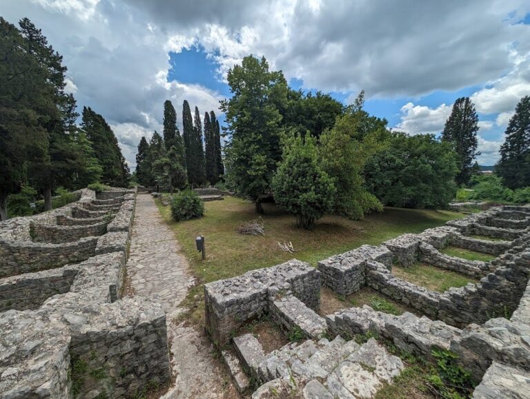
Within the walls, three streets ran north to south and three ran east to west, creating 15 equal blocks with 10 houses in each. Residential buildings were arranged around the edges of the planned settlement. The main streets were 6 metres wide, except for the southern street, which measured 8 metres, while the side streets were 2 metres wide. Two city gates provided access to the town. The Field Gate, or Poljska vrata, contains a Latin inscription dated 1506. Latin was widely used for formal and official texts in medieval and early-modern Europe.
Public buildings
The Gothic Chancellery of the Republic and the Bishop’s Palace were prominent public buildings within the fortified settlement. The urban plan of Dubrovnik served as a model for Ston. Because Ston was built on prepared ground, that model was followed there more closely than in Dubrovnik itself.
Nearby sites