Walled town of Vidoški: Historic Fortress Above Stolac
Site at a Glance
- Rating
- 4.6
- Popularity
- Low
- Country
- Bosnia and Herzegovina
- Primary era
- Early Modern
- Eras represented
- Classical, Early Modern, Modern
- Civilizations
- Habsburg, Ottoman, Roman
- Site type
- Military
- Remains
- Fort
On this page16 sections
History
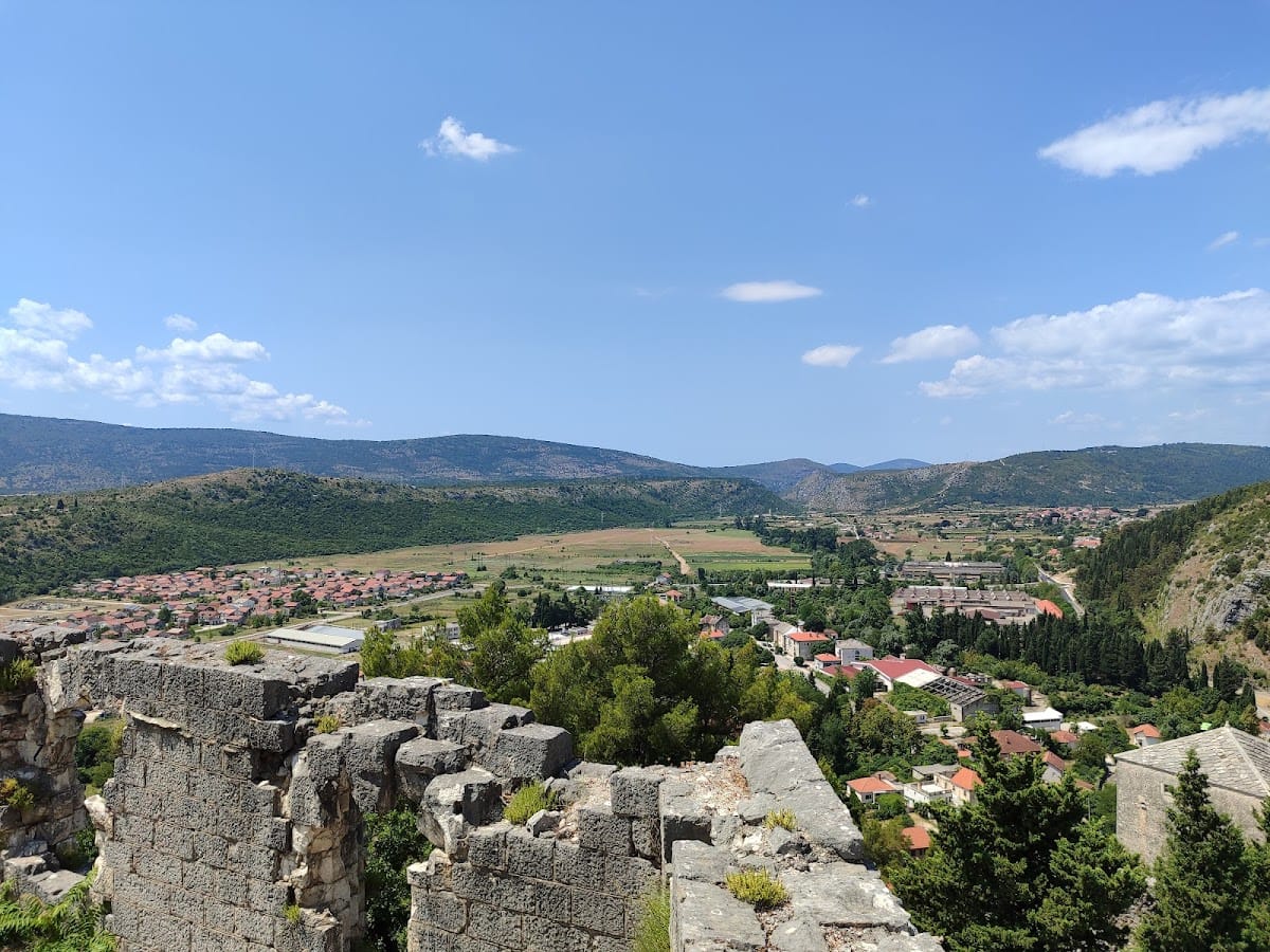
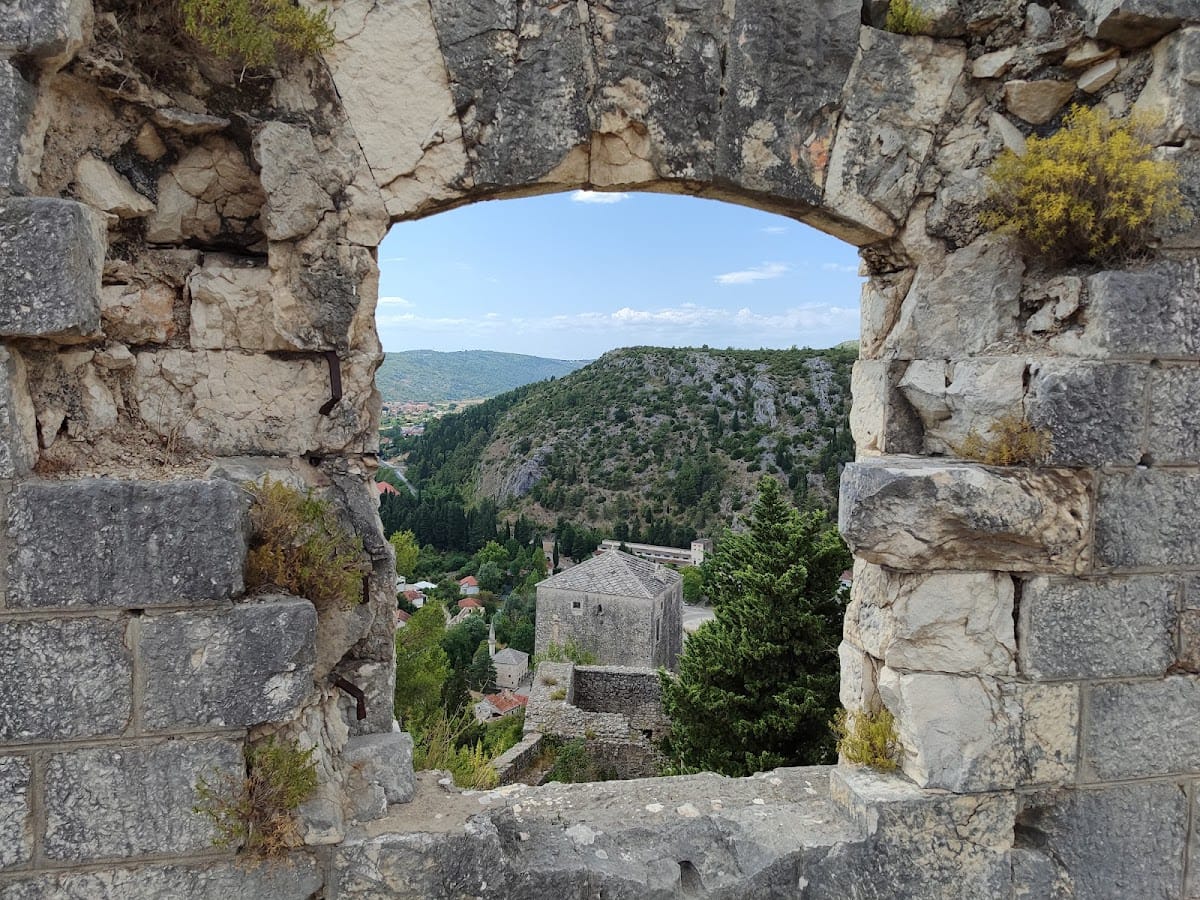
The Walled town of Vidoški is a historic fortified settlement in Bosnia and Herzegovina, on Križevac hill above Stolac and the left bank of the Bregava River. The fortress developed through medieval, Ottoman, and Austro-Hungarian phases, while the surrounding area had an urban settlement in antiquity. It later became part of the Kosača possessions and an Ottoman military centre before being adapted for modern warfare under Austro-Hungarian rule.
Antiquity and the early medieval period
An urban settlement existed in the Stolac area during antiquity. It was once identified with the ancient municipium Diluntum, a town with Roman civic status, although the discovery of an inscription at Trebinjsa led later scholars to propose that the settlement was a different municipium. The area’s importance is reflected in the establishment of the Sarsenterensis bishopric in 533, whose seat was at Sarsenterum.
The settlement was seriously devastated during the Migration Period, the era of population movements and incursions that reshaped Europe and the Mediterranean world in late antiquity and the early Middle Ages. The earlier settlement’s name was lost, but the region later regained importance. Possible prehistoric activity has been proposed on the northwestern part of Križevac toward Podgrad, while late-antique substructures were found beneath the northern fortification, below Towers I–IV.
The origin of the name Vidoški remains uncertain. It has been associated either with Vidoštica, an earlier name for the Bregava, or with the cult of Saint Vitus, which may have replaced worship of the Slavic deity Svetovid during Christianization. Vidovo Polje appeared in a Dubrovnik document of 1417 as “Planum Sancti Viti.”
Medieval Vidoški and the Kosača possessions
During the Middle Ages, the territory belonged to the parish of Vidoši. Stolac was mentioned in 1420 in connection with the robbery of merchants and appeared again in 1436. The fortress probably existed before the first surviving reference to it, and it may previously have belonged to Sandalj Hranić Kosača.
Vidoški was first documented on 19 February 1444, when Alfonso V, king of Aragon and Naples, confirmed the possessions of Duke Stjepan Vukčić Kosača. The Kosačas were a powerful noble family in the region, and Stjepan Vukčić later became known as the Herceg of Saint Sava. The document referred to Vidoški as a castle with its surrounding territory. It was mentioned again by Frederick III, the Holy Roman emperor who held the title King of the Romans before his imperial coronation, on 20 January 1448, and by Alfonso V on 1 June 1454 as a city with castles and dependencies.
In 1444, men of Stjepan Vukčić Kosača from Blagaj and Vidoški attacked and robbed the Dubrovnik merchant Andrija Rastić while he was travelling toward the Bosnian ruler. Dubrovnik records from 1463 referred to the fortress and the settlement below it as Stolac. The fortress was conquered by the Ottomans in 1465 and incorporated into the Herzegovina Sanjak, an Ottoman provincial administrative district. A road through the fortress, called “via de Vidouschi,” was recorded in 1468. The names Stolac and Vidoški continued to be used together in historical practice until almost the end of the nineteenth century.
Ottoman and Austro-Hungarian transformation
Reliable evidence for a permanent Ottoman garrison begins only in the early eighteenth century. After the 1699 Treaty of Karlowitz, the fortress was repaired and enlarged, and an administration headed by a dizdar, the commander or governor of an Ottoman fortress, was established. The Stolac Captaincy, an Ottoman military-administrative district governed by a captain, was created around 1706.
The Austro-Hungarian army occupied the fortress in 1878 and adapted the Ottoman defences to contemporary military requirements. Under Austro-Hungarian rule, the complex formed part of the so-called second defensive line facing the Montenegrin front. It included the large Stari grad Stolac fortification, also called Werk Stari grad or Oberes Kastell Stolac, two identical guard fortifications at Komanje Brdo and Ošanići, and a defensive barracks complex.
The fortress subsequently housed a district office, military-station command, military hospital, supply warehouses, a gendarmerie unit, customs and financial guards, a post office, and a telegraph. A water-supply system was built, and telephone service began in 1912. Archaeological work in 1976 did not clarify the medieval town. Medieval remains are thought to lie beneath the Austro-Hungarian fortifications, and the medieval phase remains poorly understood because the fortress has not been sufficiently investigated.
Vidoški was declared a national monument of Bosnia and Herzegovina in 2003. Since 2015, the public institution Radimlja has organized the medieval fair known as Stolačka tarča at the old fortress.
Remains
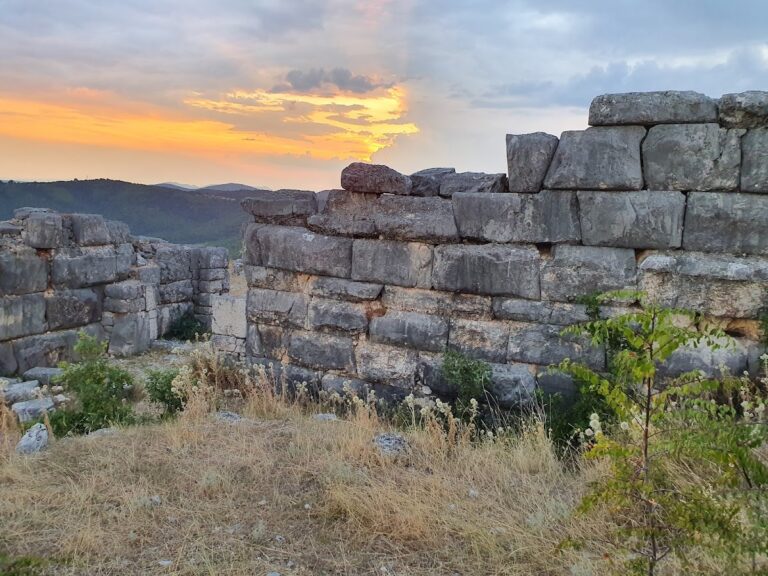
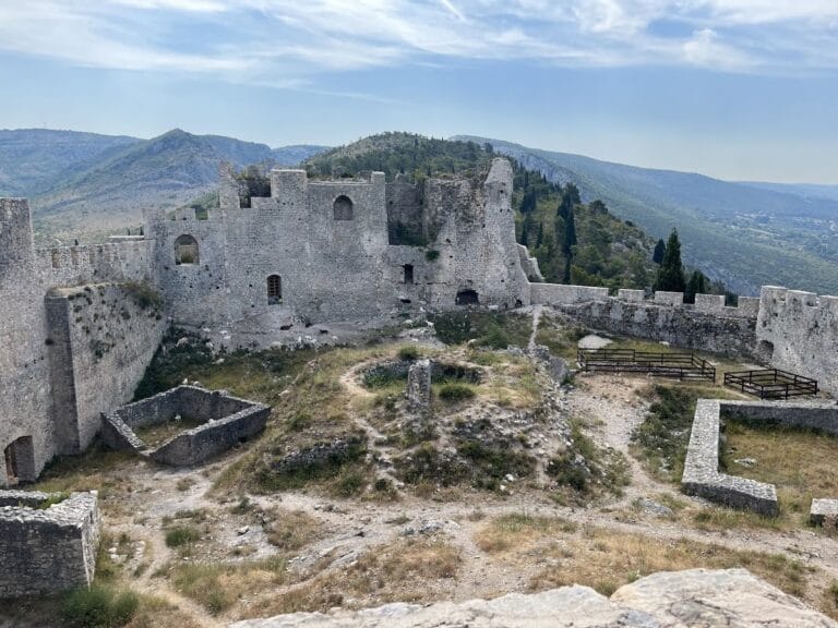
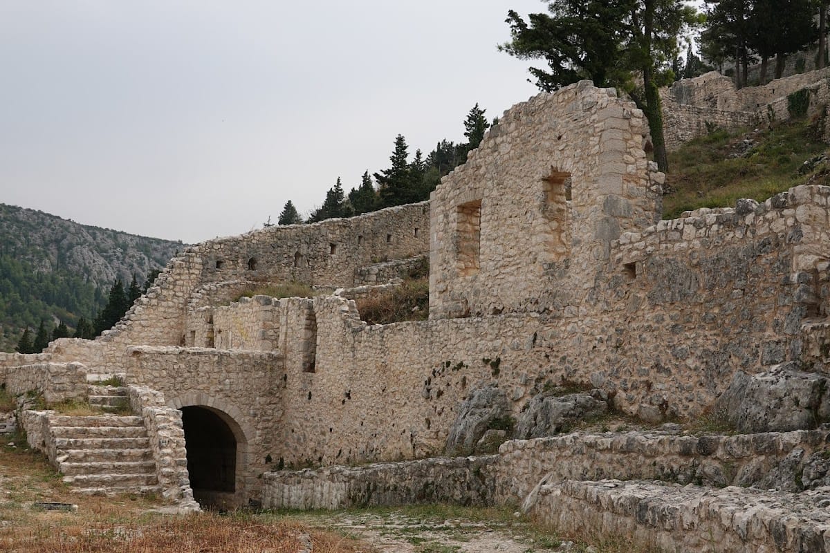
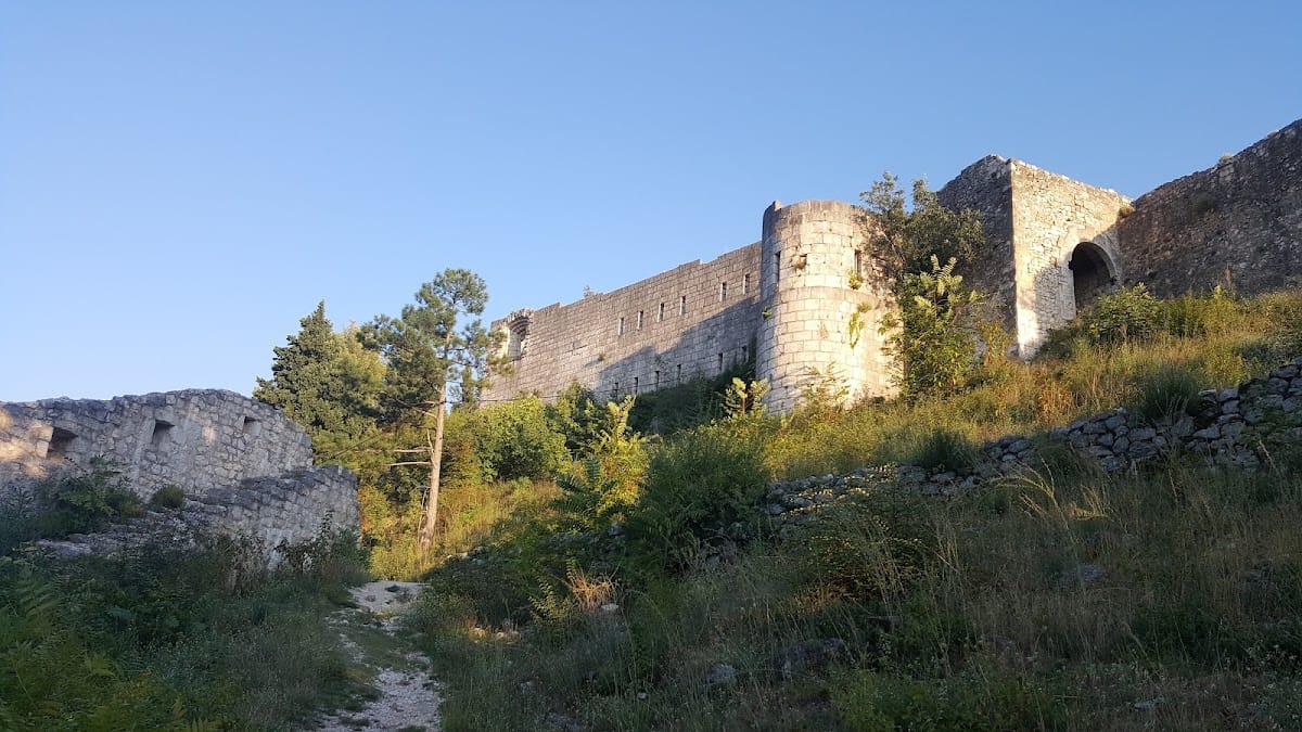
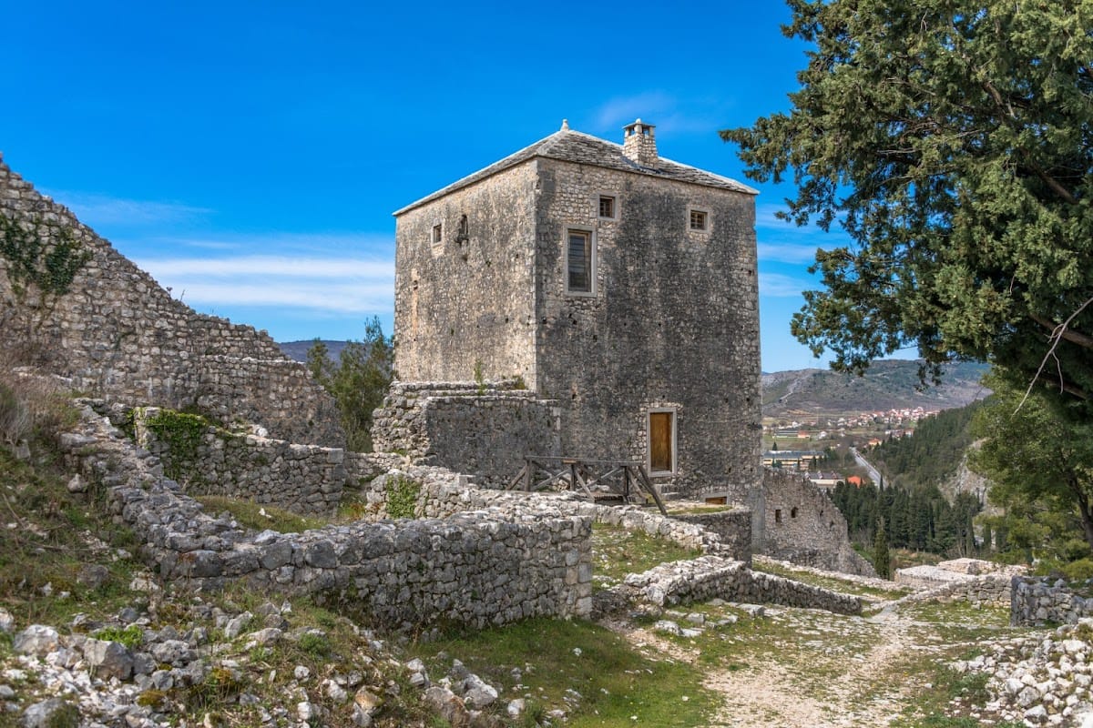
The fortress is a large defensive complex covering approximately 20,503 square metres. Stone towers and curtain walls, generally about 2 metres thick, enclose its three main sections. The walls were built from dressed blocks of local grey limestone. The Lower Town lies on the northwestern side and covers 8,481 square metres. The Middle Town occupies the central part, while the Upper Town lies above and east of it and covers 8,579 square metres. The Middle Town’s precise area is uncertain in surviving descriptions.
Lower Town
Entrance and Veli-dedina Mosque
The Lower Town is defended on its northeast, north, and southwest sides. Its principal entrance opens through a northeastern wall 44.95 metres long, with a guardroom above the vaulted entrance and a cistern beside it. Above the entrance stands the Veli-dedina Mosque, which covers 113.42 square metres. A water cistern is set into the mosque floor, while the southern wall preserves the remains of an octagonal stone minaret and a mihrab. The mosque walls were approximately 1 metre thick. The building was damaged in 1906 and was never rebuilt, leaving its surviving remains visible within the fortress.
Northern towers and connecting walls
Four towers occupy the northern part of the Lower Town and are linked by walls containing two rows of loopholes. The first tower covers 96.72 square metres and is ruined, with a cistern nearby. The second covers 108.29 square metres and is better preserved. The third covers 107.20 square metres, while the fourth, on the northwestern side, covers the same area and has a wall surviving to a height of 12 metres where the structure has been destroyed above it.
The wall between the first and second towers measures 22.25 metres, the next measures 25.50 metres, and the third measures 22.25 metres. A 29.62-metre wall connects the fourth tower with the fifth, which covers 116.46 square metres and is almost completely collapsed. The fifth and sixth towers are joined by a 41.60-metre wall. The sixth covers 97.52 square metres, has a cistern between it and the fifth tower, and is the best-preserved tower in the complex.
Eastern continuation of the Lower Town
A 22.75-metre wall links the sixth and seventh towers. The seventh covers 105.30 square metres, and its wall continues for another 36.62 metres toward the eighth tower, which covers 65.11 square metres. Beyond the eighth tower, a wall 113.62 metres long runs toward the ninth tower in the Upper Town, continuing the defensive enclosure across the complex.
Middle Town
Central military area
The Middle Town forms the central section of the fortress. It was built of white dressed limestone brought from the island of Brač. The area contains several military buildings, three water cisterns, a fortified wall section, and an ammunition storehouse. Its entrance has been restored, while the walls are considerably damaged.
Upper Town
Towers and defensive circuit
The Upper Town lies at nearly the same elevation as the Middle Town and contains five towers. The ninth tower covers 93.39 square metres and is connected by a 48.40-metre wall to the tenth tower, which covers 104.53 square metres. A 33.88-metre wall joins the tenth and eleventh towers. The eleventh covers 231.70 square metres.
From the eleventh tower, a 42.42-metre wall continues to the twelfth tower, which covers 86.72 square metres. A further wall, 40 metres long, leads to the thirteenth tower, covering 69.16 square metres. From there, a 94.50-metre wall continues toward the southeastern corner. The thirteenth tower served as a storehouse for explosives and ammunition and was destroyed twice by lightning strikes.
Austro-Hungarian fortification
Oberes Kastell Stolac
The Austro-Hungarian Oberes Kastell Stolac extends northeastward from the older fortress. Built in 1888–1889, it has a polygonal plan and two five-sided artillery platforms at its eastern and western ends. Each platform was armed with a 90-millimetre gun. The fort also contained rooms for personnel, equipment, and horses, and a new access road was constructed for supply transport.
Caponier works and interior features
Three flanking caponiers were built as part of the Austro-Hungarian defences. A caponier is a covered defensive passage or projecting work used to protect a ditch or provide flanking fire. The northern caponier beside the entrance is semicircular and well preserved. A semicircular caponier on the eastern side is partly preserved, while the polygonal southern caponier survives only in barely visible traces.
The windows of the Austro-Hungarian fortification had metal plates resembling machicolations, projecting defensive devices with openings for attacking below a wall, and these served a caponier function. Other surviving or identified elements include the Lower Town entrance and adjacent cistern, a staircase, the semicircular caponier beside the Middle Town entrance, and an interior artillery platform.
The complex also contains ten water cisterns, a flour storehouse, residential buildings, military and economic facilities, and the remains of the mosque. Together, these features reflect the fortress’s development from a medieval walled settlement into an Ottoman stronghold and an Austro-Hungarian military installation.
Nearby sites