Römerlager: An Early Medieval Hilltop Fortification in Germany
Site at a Glance
- Popularity
- Very High
- Country
- Germany
- Primary era
- Medieval
- Eras represented
- Medieval
- Civilizations
- Carolingian
- Site type
- Military
- Remains
- Fort
On this page10 sections
History
The Römerlager is an early-medieval hilltop fortification in Germany, dated from its form and scale to approximately the eighth or ninth century. It may have been built to defend royal property, although this proposed purpose is not certain.
Possible Carolingian purpose
One interpretation links the fort to Westera, a saltworks in the Bad Sooden-Allendorf area that belonged to the Frankish ruler in the eighth century. Charlemagne transferred the saltworks to Fulda Abbey, a major monastery in the Frankish realm, sometime between 768 and 779. If the fort protected royal holdings, it may have been Carolingian, a term for the dynasty and period associated with Charlemagne.
The later Westerburg near Sooden, to the northwest, may have taken over the fort’s role and preserved its original name. This proposed connection remains an interpretation rather than an established account of the fort’s history.
Rediscovery and later names
After its rediscovery in the late nineteenth century, the fort was called “Römerschanze” in 1886 and “Römerlager” from 1890. These names are later labels, not the site’s original name. A separate section fortification on Weidschen Kopf, about 750 metres to the south, was also called “Römerschanze” and is a different site.
Remains
Landscape setting
The fort stands about 1.8 kilometres southeast of Bad Sooden-Allendorf, at roughly 202 metres above sea level on a ridge running west to east. A saddle links the ridge to the higher Hirschberg, at 243 metres. The Werra bends around the ridge from south to north by way of its eastern Kleinvacha bend. The enclosure occupies a middle terrace in the valley: the ground slopes gently north, meets a steeper northern edge, and opens south onto the Ihringsberg plateau. The Werra floodplain and the ponds now called Bruchteiche lie to the north, while steep cuts bound the ridge to the east and west.
Enclosure and defenses
Enclosure form
The enclosure is roughly oval and aligned northeast to southwest. Measurements taken from laser-based terrain mapping (LiDAR) give an approximate size of 102 by 82 metres from ditch to ditch, a perimeter of 287 metres, and an area of 0.63 hectares.
Rampart and ditch
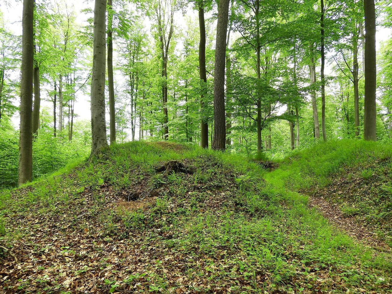
The rampart-and-ditch defenses are clearest on the eastern and southern sides. The works are leveled in the north, while erosion or burial has obscured much of the western side. A pointed-bottom ditch probably once ran around the enclosure. It is about six metres wide at the top and survives to a depth of 2.5 metres. The inner rampart reaches up to ten metres across at its crest and generally rises about three metres above the ditch bottom, reaching four metres on the north. It is thought to include the collapsed remains of a wall built from timber, stone, and earth. Its form has been compared with early-medieval earthwork defenses associated with resisting Hungarian incursions, but the resemblance does not establish the fort’s date or purpose.
Eastern entrance and approaches
An old gap in the eastern rampart marks the original entrance. The ditch at this point is now filled and was probably crossed by a wooden bridge. Sunken paths, formed by repeated travel along a route, descend east of the enclosure toward the Werra valley; one rising from the valley was described as an additional ditch. Near the eastern entrance, a path curves around an area of about 200 square metres, creating a further defensible space outside the main enclosure. Of four rampart gaps described in 1886, the northern and southern ones were later road cuts; terrain-relief mapping shows as many as seven breaks.
Nearby archaeological features
Eight prehistoric burial mounds lie about 350 metres south of the fort and are not considered contemporary with it. The deserted medieval settlement of Glimmerode stood about 300 metres northeast, on the Werra-facing slope of the Hirschberg.