Via Belgica: A Roman Road Connecting Bavay, Tongeren, and Cologne
Site at a Glance
- Popularity
- High
- Country
- Belgium
- Primary era
- Classical
- Eras represented
- Classical
- Civilizations
- Roman
- Site type
- Infrastructure
- Remains
- Road
On this page22 sections
History
The Via Belgica was a Roman road associated with Rue Théodore De Cuyper in Brussels, Belgium, and formed part of a route connecting communities across northern Gaul with Cologne on the Rhine frontier. Roman construction is generally dated to around 10 BC. The road carried trade and communications as well as troops and military supplies, linking Boulogne-sur-Mer, an important port for travel to Britannia, with settlements that supported the frontier forces.
Roman construction and regional use
Some stretches may have followed an earlier Celtic trading route. Julius Caesar may have used such a route during his campaign in 57 BC, but his passage is uncertain. The proposed location of the Battle of the Sabis at a crossing with the Selle is also disputed. Later, Roman forces used the road during the Batavian Revolt, an uprising against Roman rule in AD 69–70.
Bavay, capital of the Nervian civitas, the Roman administrative territory and its civic community, was established between 19 and 15 BC. Seven roads connected it with neighboring civic centers, facilitating Roman movement through the region. A monument erected in Bavay’s forum in 4 BC commemorated a visit by the emperor Tiberius, which appears to have encouraged the town’s growth. Farther east, Tongeren supplied Rhine-border troops with grain from the fertile Hesbaye region.
The route appears on the Peutinger Table, a medieval copy of a Roman road map, and is described in broadly similar terms in the Antonine Itineraries, lists of routes and distances. Its western course remains open to interpretation. One reconstruction places the coastal terminus at Boulogne-sur-Mer and treats a road branching from Bavay through Cambrai toward Amiens as part of the network. Another regards Bavay to Cologne as the main road and proposes a straighter continuation through Cambrai and Amiens toward Rouen. Supporters of the latter view question a Boulogne route because it would require a pronounced turn at Cambrai.
Names, settlements, and later history
“Via Belgica” is a modern name, probably introduced by archaeologists Titus Panhuysen and Marjorie de Grooth in 1999 and popularized afterward. At Cologne, the road was also called Via Agrippinensis. Historian Jona Lendering has argued that Via Belgica does not fit Roman road-naming conventions. He proposed that, if the road through Belgica had been built by Marcus Vipsanius Agrippa, it might instead have borne a name honoring him. In the Middle Ages, the western section was known as the Chaussée Brunehaut, one of several roads associated with Bavay.
The name Brunehaut Road became linked to a legend about Brunhild, queen of Austrasia. According to the tradition, she completed road-building begun by her husband, Sigebert. The story says that Chlothar II captured and executed her after trying to take her lands, and that a standing stone at Hollain marked where she was found. This is a legend, not a reliable account of the Roman road’s construction.
The road continued in use after Roman rule, especially between Tongeren, Maastricht, and Cologne. Some stretches near towns remained maintained, while others gradually fell out of use. After Roman rule ended in the fourth century, the section west of Jülich was abandoned in favor of a route toward Aachen; the road deteriorated and settlements along it were deserted. The western section’s earlier fame as a landscape feature helped prompt debate over its origins. In modern times, parts of the route continued to serve travelers and merchants.
Archaeological investigations gradually clarified the route and the locations of its settlements. In the early nineteenth century, Martin Cudell traced sections through Belgian and Dutch Limburg and identified the Wurm crossing at Rimburg; Jos Habets continued this work. Excavations at the Rimburg settlement followed from 1926 to 1930, and Roman traces at Baesweiler were found during work in 1952. Systematic excavations at Geminiacum began in 1956, while research in the second half of the twentieth century supported the identification of Vogdoriacum with Waudrez. Work in the 1980s traced the route as far as Rimburg, and the settlement at Baesweiler was identified later.
Remains
The road extended for about 235 km in a straight line between Bavay and Cologne; the full route from Cologne to the Atlantic coast is described as approximately 400 km. Tongeren lies near its midpoint. Long, relatively straight stretches run between Bavay and Tongeren, Tongeren and Maastricht, and Cologne and Jülich. Elsewhere, the road follows ridges to skirt marshy ground. Its remains include road layers, milestones, settlement sites, bridge crossings, fortifications, and traces incorporated into later towns and buildings.
Route and road construction
Alignment and roadbed
Near Gognies-Chaussée, the route bends by about five degrees and follows the border for roughly five kilometers. The settlement was divided between France and the Netherlands by an 1820 boundary treaty and later lay on the France–Belgium border. Archaeological soundings along the road reveal a bed built on leveled ground from at least two layers of local material. Fine, compact material formed the base, covered by stone or gravel. The surface was generally tightly packed stone rather than fine paving, and resurfacing layers were uncommon.
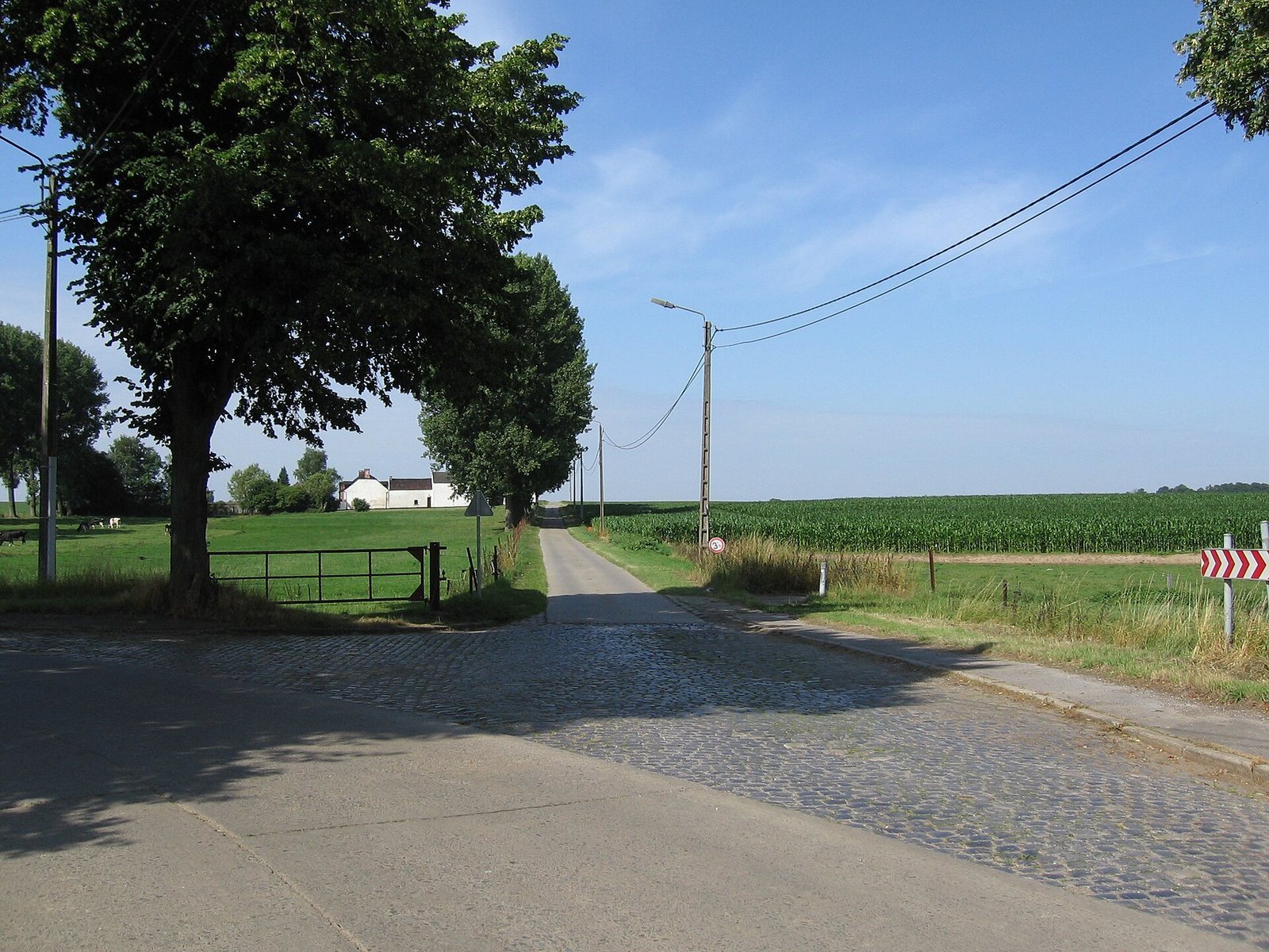
The road’s raised center sloped toward the edges to drain water, sometimes with one or two ditches for additional drainage. Side ditches about 20 m from the centerline marked the original public right-of-way, while a groove indicated the road’s central axis. In the present landscape, some sections follow through-roads, local roads, or paths, and other stretches are interrupted. Between Bavay and Chapelle-lez-Herlaimont, parts of the route follow the D932 and N563. Some alignments between Maastricht and Rimburg remain uncertain, including proposed alternatives around Landgraaf and Übach-Palenberg.
Milestones and route markers
A second-century milestone found at Péronnes-lez-Binche gives the distance from Bavay as 22 Roman miles. A milestone at Tongeren, dated to the second or third century, provides place-names and distances in leugae, a Gallic unit of distance. Milestones from Constantine’s reign were found in the Church of St John the Baptist at Eygelshoven, and a fragment was found at Rimburg around 1800. Other fragments came from near Baesweiler and Lich-Steinstraß. A third- or fourth-century fragment discovered west of Koslar in 2008 preserves part of an inscription that could be completed as “son of the emperor.” It is now held at the Rhenish State Museum in Bonn.
Settlements along the western and central route
Waudrez and the Vogdoriacum site
The archaeological site at Waudrez covers about 70 hectares and is identified with the Roman station Vogdoriacum. Its remains include a large Roman dwelling with baths and a well about 3 m wide and 14 m deep. Excavations have also yielded coins, pottery, iron and bronze objects, and terra sigillata, a distinctive Roman fine pottery.
Estinnes agricultural estate
At Estinnes, the road connected with routes serving villas, water sources, religious centers, and more distant areas. The agricultural estate, or fundus, was active from the first through the fourth century and appears to have extended across more than 2,000 hectares. A large villa stood beside the road, with smaller villas farther inland. The area had already been a Nervian center of farming and craft production before Roman arrival. The estate supplied nearby legions and probably also served as a substantial regional trading center.
Braives settlement and fort
The settlement at Braives, identified with Pernacum, developed on both sides of the road from the early first century. It grew into a prosperous vicus, or smaller settlement, with stone houses. In the third century, a small castellum, a fortified position, was built there with a broad earth wall, a palisade, and a V-shaped ditch. Around AD 310, frequent Germanic raids prompted the replacement of the palisade with a wall.
Tongeren, Maastricht, and Heerlen
Tongeren’s Roman enclosures
Tongeren, the Roman Atuatuca Tungrorum, was founded after Caesar’s campaigns. It is not the earlier Aduatuca fortress described by Caesar, whose account does not fit Tongeren’s landscape. The town’s first Roman enclosure, built from the second century onward, measured about 4,544 m in length and was roughly 2 m thick, with a height of 5 to 6 m. Built of flint and sandstone, it had circular towers about 9.5 m across and two outer V-shaped ditches. Gates opened onto roads to other regional centers. A smaller enclosure, constructed in the fourth century, measured about 2,680 m and had approximately sixty towers.
Maastricht bridge and road through the city
At Maastricht, a Roman bridge from the time of Augustus carried the road across the Meuse. It remained in use until 1275 and stood about 200 m south of the medieval stone St Servatius Bridge, aligned with present-day Plankstraat. A Roman fort built near the crossing in 333 protected the bridge, and the road passed through the fort. Within the modern city, the route followed Brusselsestraat, the north side of the Vrijthof and Grote Staat, then turned south before the river and east again at Plankstraat.
Excavation at the northwest corner of the Vrijthof in 2003 showed that the road there had been renewed at least thirteen times, including seven renewals in the Roman period. Remains of the route have also been found near Meerssenerweg and Mariënwaard in Maastricht and at Putweg in Houthem. Roman graves were found along Cremerstraat in Broekhem, and two Gallo-Roman burial mounds lie just north of the road near Herderen. Roman villas have been recorded around Maastricht and Heerlen. Near the Goudsberg, along the route by Valkenburg, a Roman watchtower once stood.
Heerlen and Coriovallum
At Heerlen, the road ran along the present Valkenburgerweg. The Roman settlement Coriovallum was established around 5 BC and expanded under the emperor Hadrian. Its baths date from about 120 to around 400, and their remains have been excavated. Roman stones are built into the walls of St Pancras Church, and five villas have been recorded in the area. Heerlen also formed a junction with the road between Trier and Xanten.
Crossings and settlements east of Heerlen
Rimburg and the Wurm crossing
At Rimburg, the road crossed the Wurm on a wooden bridge. Excavation of the vicus on both sides of the crossing revealed the bridge foundations. A surviving base of a Roman milestone stands between house numbers 53 and 55 on Broekhuizenstraat.
Baesweiler and Jülich
A smaller north–south road crossed the Via Belgica at Baesweiler. At Jülich, the vicus occupied a bend of the Elle near its meeting with the Rur. A bridge is considered likely at each river. A roof tile stamped with the Sixth Legion Victrix indicates that its soldiers guarded the crossing. The inscription may place the legion there after it helped suppress the Batavian Revolt in AD 70 and before it moved to Britain before AD 121. A sandstone statue of Jupiter seated on a throne dates to the first third of the third century. In AD 357, the historian Ammianus Marcellinus described Jülich as enclosed by fourteen towers.
Hambach and Tiberiacum
Before the Hambach lignite mine was excavated, archaeologists investigated the road in that area. They found twelve successive road layers along a stretch of about eight kilometers, later covered by the mine. Excavations also revealed two sarcophagi, several buildings including four rural villas, and about ten graves. Near Bergheim-Thorr and Grouven, the settlement Tiberiacum lay by the seventeenth milestone, about 22 km from Cologne. It is identified with Zieverich, less than a kilometer from the location once proposed at Bergheim. Three rural villas have been identified there.
Cologne and its western approach
Near Weiden, 8.6 km west of Cologne’s Roman wall and just north of the road, an elaborately decorated tomb chamber belonging to a Roman rural estate was excavated in 1843. The Heidenburg burgus, a small Roman fortification, was excavated in Königsdorfer Wald. From the west, the road entered Cologne through the middle western gate, whose ground plan lies east of the Basilica of St Aposteln, and continued along present-day Aachener Straße. At the gate it met the city’s principal east–west street, the decumanus, represented today by Schildergasse. Cologne’s Roman enclosure was built in AD 70, extended about 4.5 km, and had 21 towers and nine gates.
Later memorials
Bavay monument and the Hollain standing stone
A small monument erected in Bavay in 1872 commemorates the tradition that Brunhild built roads. It survived a Second World War bombing without damage. The Pierre de Brunehaut at Hollain is a large upright standing stone, or menhir, associated with the same legend.