Verulamium: The Roman Town at St Albans
Site at a Glance
- Popularity
- Very High
- Country
- United Kingdom
- Primary era
- Classical
- Eras represented
- Iron Age, Classical
- Civilizations
- Roman
- Site type
- City
On this page36 sections
History
Verlamion before Roman rule
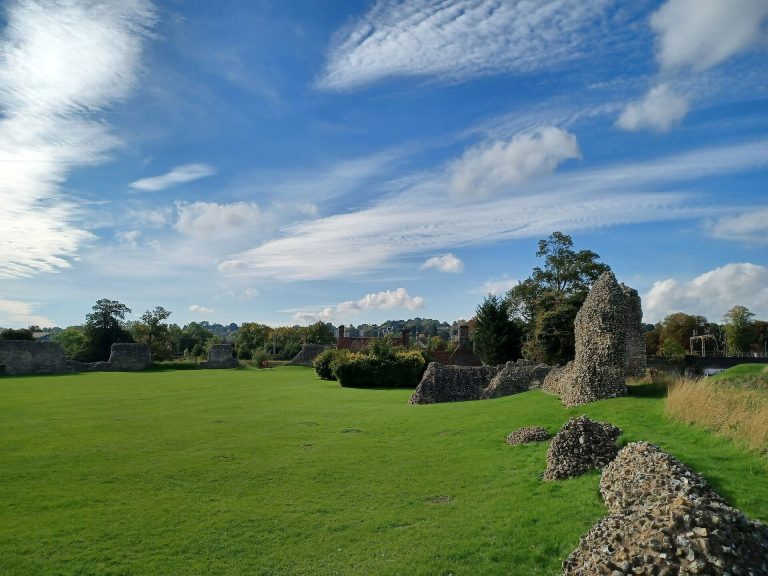
Verulamium was a Roman town at the site of modern St Albans, in the United Kingdom. Before the Roman conquest, a major centre of the Catuvellauni, a people of pre-Roman Britain, stood here under the name Verlamion. It was probably founded by their leader Tasciovanus, who minted coins there. Verlamion was among the earliest places in Britain known by name, although the origin of its name is uncertain.
The pre-Roman settlement spread beyond the area later occupied by the Roman town, including to the west and north, but its central focus has not been established. Its cemetery at Harry Lane was used from about 25 BC to AD 25. One richly equipped burial has been tentatively connected with a historical individual; if it dates instead to about AD 45–50, it may have belonged to a ruler allied with Rome.
Roman town and civic centre
Rome invaded Britain in AD 43. A small military post may have followed at Verulamium, though this remains uncertain. The town developed beside Watling Street, a major Roman road linking London with routes farther north and west. The shift from the more dispersed pre-Roman settlement toward the road may have reflected the advantages of access to this route.
Around AD 50, Verulamium received the status of a municipium, a privileged kind of Roman town with a defined civic standing for its inhabitants. Tacitus later described it as holding this status by AD 61, but that dating is uncertain. Verulamium became one of the largest towns in Roman Britain.
During Boudica’s revolt in AD 60 or 61, the Iceni queen’s uprising against Roman rule, Verulamium was looted and burned. An ash deposit marks the destruction. The town was rebuilt, at first largely with timber buildings. A record dated 21 October AD 62 describes provisions contracted for delivery from London to Verulamium, showing that the settlement was functioning again soon after the attack.
A major fire around AD 155 prompted another rebuilding phase, this time with more stone construction. Recovery was gradual, and some parts of the town remained unused. Many small timber buildings gave way to larger houses. A further fire occurred around AD 250. Roman occupation came to an end at some point in the fifth century, although building and urban activity continued into that century.
Economy, religion, and the town’s later history
The town’s prosperity appears to have rested mainly on farming and its role as a market for the surrounding countryside. Nearby villas supplied food. Pottery was made in Verulamium and the surrounding area, particularly in the first half of the second century, when local wares reached London and military settlements along Hadrian’s Wall. Production became less important from the middle of that century. Finds point to metalworking, although its scale and the extent of new production are uncertain. A market building and animal bones also suggest that meat was traded.
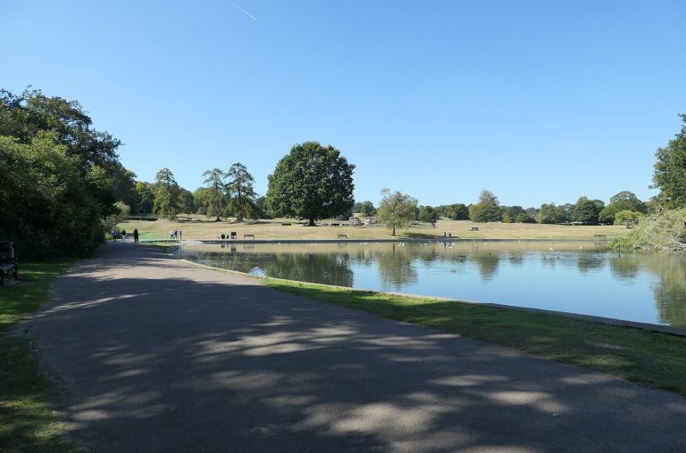
The River Ver crossed the valley and joined the Colne several kilometres to the south. It was not navigable in modern times, but small craft may have used it in antiquity. In the medieval period, Watling Street was realigned to bring trade toward St Albans.
Saint Alban, regarded as Britain’s first Christian martyr, is linked by tradition to Verulamium. The story says that he sheltered and was converted by the priest Amphibalus before being put to death. Alban’s martyrdom is dated variously to the third or early fourth century. The historian Bede provides written evidence for a church in the Roman town, but its location is unknown, and Christian worship there has not been securely established through archaeological finds.
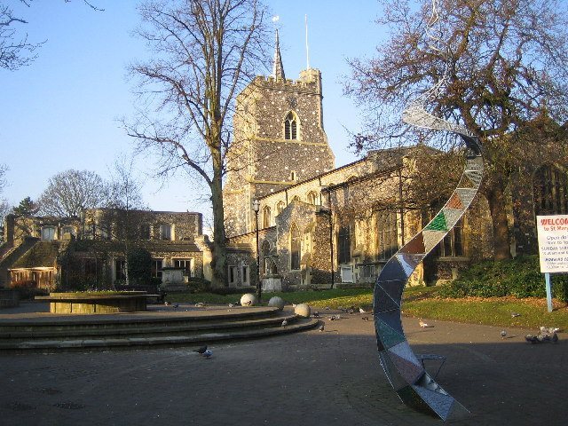
In the Middle Ages, St Albans Abbey and its associated settlement grew northeast of the Roman town, on or near a cemetery outside its walls. The area was believed to be connected with Alban’s execution or burial. Builders quarried Roman masonry for the abbey and other medieval works, removing much of the ancient town’s fabric.
In the early modern period, Francis Bacon built a small house within the Roman walls. It has since disappeared. The seventeenth-century antiquary John Aubrey described the house and noted surviving stretches of the town wall. When Bacon was made a peer in 1618, he took the title Baron Verulam from the ancient town.
Excavation and protection
The location of Verulamium remained known, and parts of its walls could still be seen. Systematic excavation of the theatre began in 1847. Work at several locations between 1898 and 1911 helped identify the forum. From 1930 to 1933, extensive investigations examined town blocks, houses, a temple, and parts of the wall. Further excavations, especially in the centre, were led from 1955 to 1962, with smaller investigations continuing afterward. The theatre was excavated again in 1933 under Kathleen Kenyon after its location had been lost.
Excavated areas represent only part of the former town, whose remains extend beneath parkland, farmland, and later buildings. Ploughing has damaged buried layers, including mosaic floors, and ground-penetrating radar has revealed damage to structures in the northwest. Verulamium and much of its surroundings are protected as a scheduled monument, a legally protected archaeological site in England. The Verulamium Museum was established after the excavations of the 1930s to present the town’s Iron Age and Roman history.
Remains
The Roman town occupied a river valley and followed a grid of streets, with buildings arranged in city blocks. By the early third century it covered about 50 hectares. Its surviving fabric includes a long flint-and-brick wall, gates, civic and market buildings, temples, baths, houses, and burial remains. The town’s successive boundaries are not fully understood, and some proposed expansions may have been only partly completed.
Town plan and defenses
Enclosures and street grid
An early ditch enclosed roughly 40 hectares, although its date is disputed. A second ditch is attributed to the second century, but its route and its relationship to the earlier boundary remain unclear. A later enlargement may have extended the town to about 90 hectares, possibly without being completed. The wall enclosed an area of approximately 80–81 hectares.
City wall
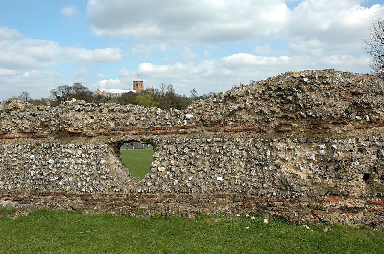
The town wall extended for about 3.6 kilometres. Built of flint and brick, it was around 2.5 metres thick and probably about 4 metres high. Towers projected from its exterior as solid semicircular forms, with internal rooms measuring approximately 5 by 5 metres. At least four gates pierced the wall. The River Ver protected one section of the town’s boundary. The wall is probably third-century, though its date has not been settled.
London Gate
The southern gate, now called London Gate, is the best-preserved. It stood on the road to London and measured more than 10 metres across. Two towers flanked four entrances: a pair of central openings, each about 3 metres wide, carried wheeled traffic, while narrower side openings were for pedestrians.
Chester Gate
The northwestern Chester Gate followed a similar general plan to London Gate, but survives less completely.
Southwestern gate
The southwestern entrance also had towers and separate passages for people and vehicles. Its corner towers were rectangular, and the entrance area was about 10 metres wide. It had two pedestrian openings and may have had just one central passage for wheeled traffic.
Civic, commercial, and performance buildings
Forum
The forum occupied the centre of the street grid and measured about 161 by 117 metres overall. Its open central space was large, although its precise dimensions are uncertain. Completed in AD 79, it was rebuilt or altered more than once. Rooms along its northeastern side probably served as shops, with a second row opening toward the interior. A basilica, a large hall for civic business, adjoined them. The open forum area lay beside the basilica, with entrances on its southeastern and northwestern sides. Three buildings stood to the southwest; the central one may have been a council chamber.
Fragments of a Purbeck marble inscription found in 1955 preserve parts of the names of Emperor Vespasian and governor Gnaeus Julius Agricola. Vespasian ruled from AD 69 to 79, and Agricola was governor of Britain from AD 78 to 84. The inscription dates to AD 78 or 79 and supports the forum’s completion in AD 79.
Market hall
The market hall stood northwest of the forum. Established around AD 85, it had a building phase dated to about AD 100. Its first structure measured roughly 40 by 20 metres and included a courtyard with a drain and small rooms along both long sides. Two rows of shops and a water supply from the nearby river are also associated with the building. Animal bones found close by suggest that meat may have been sold there.
At the end of the second century, the first structure was replaced by a building about half its size, with a rounded-ended feature in its courtyard. A monumental front and two courtyard bases were added in the fourth century. The market hall was probably abandoned soon afterward, and less well-preserved buildings took its place.
Theatre
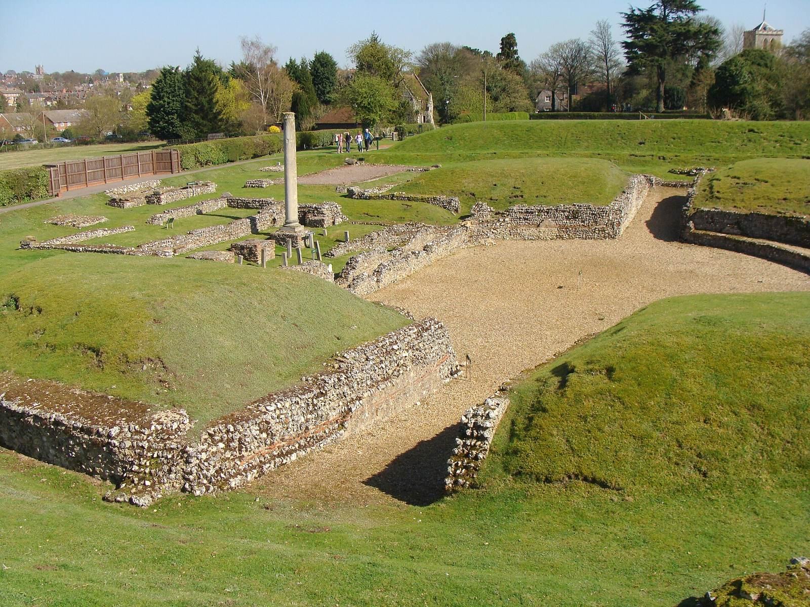
The theatre stood beside the market hall and was built around AD 140. It may have replaced an earlier theatre on the same site. Its first form had an oval performance area in front of the stage, which faced northeast. Seating was probably made of wood and set on banks of sand. The partly sunken building combined a semicircular seating area with the performance space and stage, making it about 24.3 metres across. It was designed for plays and may also have been used for events usually held in an amphitheatre.
A second building phase, perhaps around AD 150, extended the stage into the performance area and added a Corinthian-style frame around its opening. In a later phase, the stage was widened at the sides and given a stone rear wall. The building deteriorated during the third century, then was renovated near the century’s end with a larger seating area and a new outer wall. Its connection with the nearby temple precinct is highly probable, and religious events may have taken place there. Parts of the theatre survive above ground.
Bath buildings
Baths in Insula XIX
Rescue excavations in this city block found a sunken part of a building, a wall with pilasters, column fragments, and high-quality wall paintings. The building may have been a public bath and appears to have remained in use until the end of the first century.
Baths in Insula III
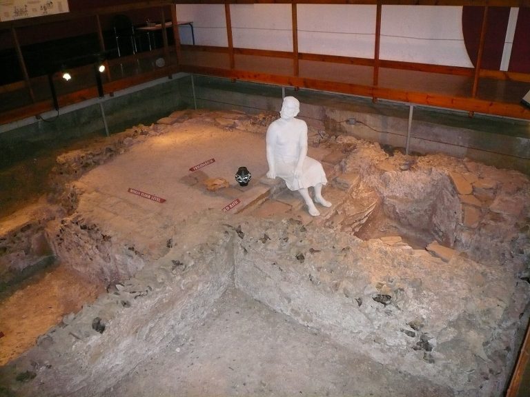
A likely bath building in this block was constructed at the end of the first century and destroyed in the fire around AD 150. Three rooms have been excavated, including one with a hypocaust, an underfloor system that circulated heat. Its arrangement and the numerous toilet objects found there suggest a public bath. Its central location and rich fittings, including Purbeck marble, indicate that it may have been the town’s principal bath.
Northeastern bath complex
A large bath complex northeast of the town, beside a major temple area, may have been used chiefly for ritual purposes. The excavated part measures at least 55 by 30 metres; additional rooms to the north and west remain unexcavated. Built around AD 140, it was abandoned in the second quarter of the third century. Evidence for changes to the building is limited.
Private baths are also known in Houses IV.4 and V.1. Aerial photographs suggest another bathing suite within a house in Insula XXXVII.
Temples and sacred precincts
Insula XVI precinct
A walled temple precinct occupied the whole of Insula XVI, a Roman city block, and measured about 91 by 48 metres. Its construction date is uncertain. It opened to the north toward the theatre and was probably linked with it. The central temple had an enclosed shrine chamber surrounded by a walkway, as well as two long annexes. Gates at the two short ends controlled entry; the eastern gate led directly toward the theatre.
Southern triangular precinct
A small temple enclosure stood in a southern city block opposite a town gate. Dated to the late first century BC, it had an unusual triangular plan shaped by the surrounding streets. Its long sides measured about 29.5 metres, while the shorter sides measured about 9.4 and 25.3 metres. Its columns were almost 5 metres high.
Other temples
Two temples of classical form probably stood in the forum. Other identified or proposed sanctuaries used a design with a central shrine surrounded by a walkway. Two of these have been excavated; others are known from aerial photographs.
Houses and workshops
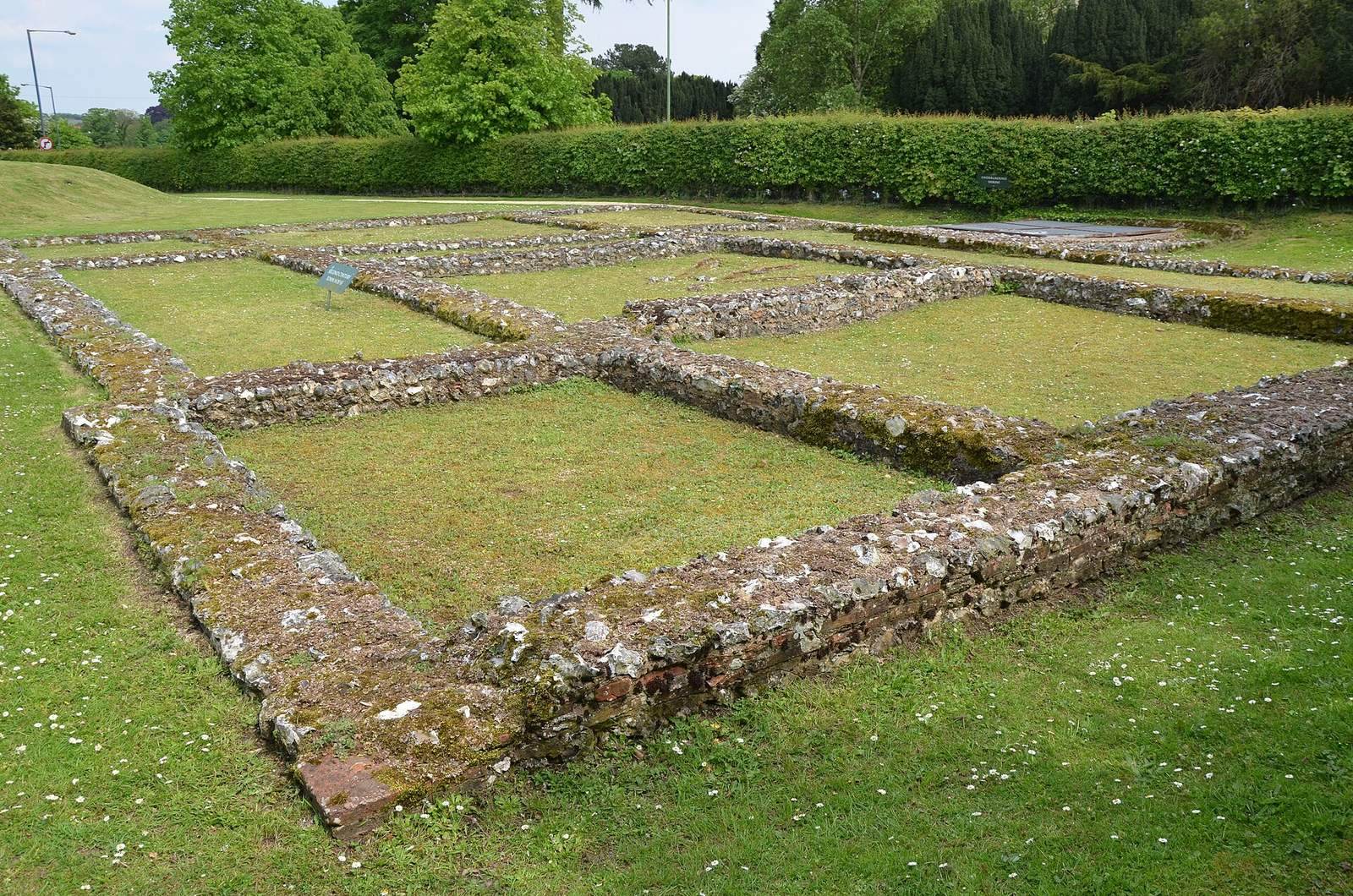
The earliest Roman buildings clustered near the later forum. First-century and early second-century homes were generally modest timber structures, while stone buildings became more common in the second century. Larger houses, some with columned courtyards, mosaics, and heated floors, appeared in the third and fourth centuries. Many second-century villas, especially in the east, were built with local flint.
Insula XIV shops and houses
Timber buildings from the middle of the first century in this block were burned during Boudica’s revolt. They probably included shops and workshops along the street, with a shop at the front and a room behind. A covered colonnade ran along the street, and an upper floor may have provided living space. One shop contained evidence of metalworking. During the first half of the second century, shops and workshops with rooms behind them continued to occupy the block, including buildings with a street-side colonnade. One house contained two small household shrines and wall paintings.
House III.2
House III.2 measured about 45 by 45 metres and was arranged around a courtyard. Its two building phases date to around the middle of the second century and the end of the third century. The earlier house had numerous rooms with heated floors and mosaics.
Houses IV.8 and II.1
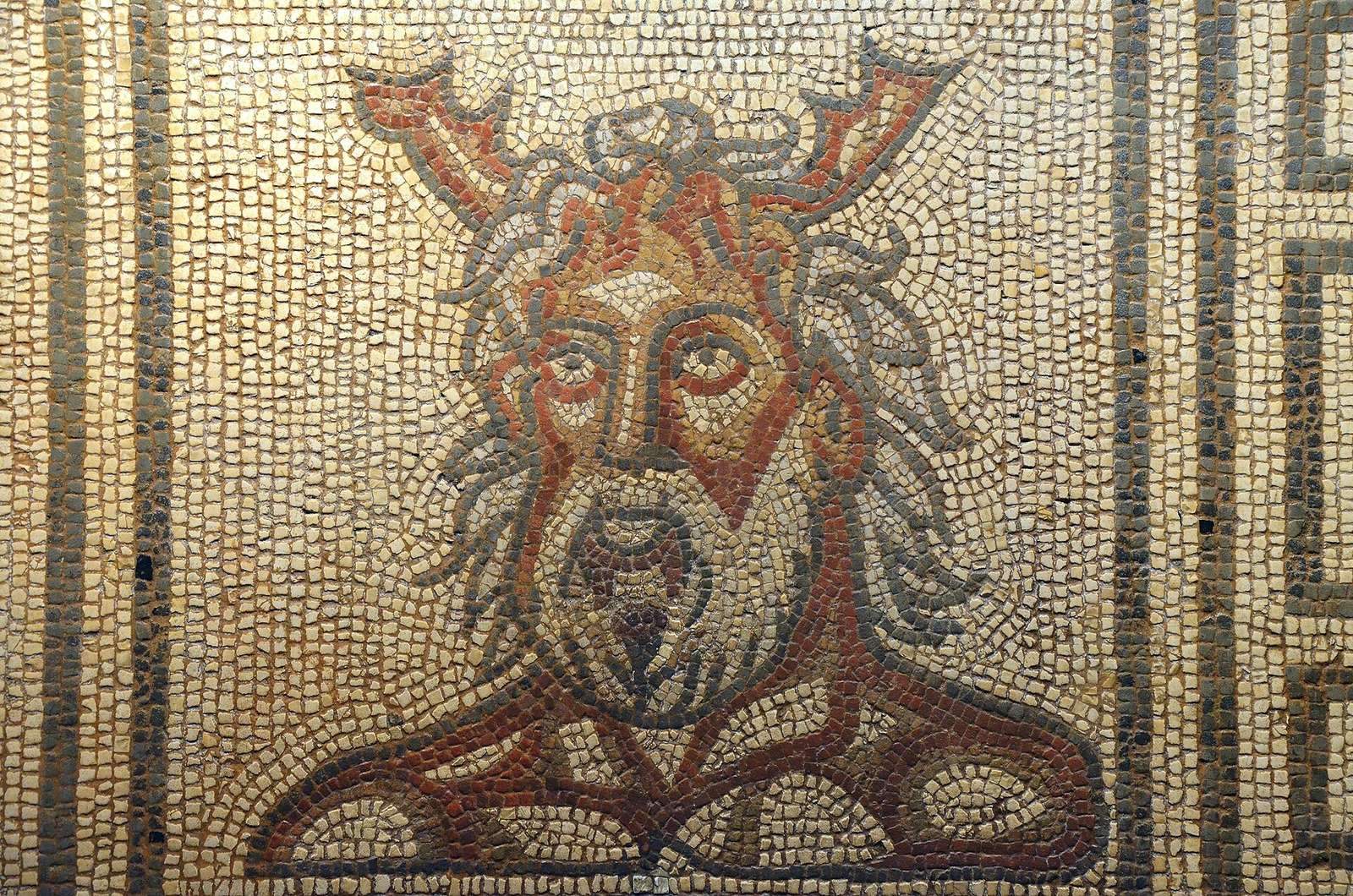
House IV.8 was built in the middle of the second century and extended about 40 metres, with wings to the north and south. The southern wing survives relatively well, while the northern part is represented mainly by foundations and foundation trenches. A large southern room had a geometric mosaic; an adjoining smaller room contained a mosaic with a deity’s bust. Most rooms were heated. A mosaic from the house, dated AD 160–190, depicts a sea or woodland deity.
House II.1 may have had a plan like that of House IV.8, but its remains are less complete. An apsidal, or rounded-ended, room contained a semicircular mosaic showing a shell, dated to about AD 150.
House XXVIII.3
Built around AD 150 between the theatre and forum, House XXVIII.3 was a timber building with ten rooms. Two wings faced the street, with a courtyard behind. The mosaic in its largest room showed a two-handled drinking cup and dolphins. Red wall panels were separated by bands with floral designs, while corridor paintings imitated marble and columns. A further room also had painted decoration and a mosaic. The house burned around AD 155, after only about five years of use.
House XXI.2
House XXI.2 was built of flint around AD 180 near the forum. Three wings enclosed a courtyard, with the northern and eastern wings running alongside Roman streets. A medieval road damaged part of the building. The southwestern wing is best preserved; its central room measured 7.47 by 4.42 metres and had a lion mosaic. Wall decoration included a red lower section and green panels framed in red.
A corridor on the courtyard side east of the central room was 2.36 metres wide and originally about 15 metres long. Its wall paintings included birds and delicate floral garlands. Plant designs divided its purple ceiling into squares, most containing birds and some animal heads. At its southern end, the corridor turned west, forming an L-shaped plan. This section had a similarly patterned ceiling on a red ground and simpler wall panels. Both passages had floors partly laid with small red mosaic pieces. A room north of the central room had apparently plain white walls and a simple cement floor.
The northern wing was largely destroyed in the medieval period and lies beneath a modern road; stone robbing also damaged the northeastern wing. Rooms in that wing faced the street, while a corridor ran along the courtyard. The house remained occupied through the third century, although its southwestern wing was later abandoned and levelled. Its surviving wall paintings and mosaics show that its decoration continued to be maintained.
House XXVII.2
House XXVII.2 stood just north of the forum, across a street. Timber buildings of the Flavian era on the block were destroyed in the fire around AD 155, after which the site was briefly unused. A later house had three wings around a courtyard open to the street. Its date is disputed. One interpretation places its construction around AD 380, based on coins, and its occupation into the middle of the fifth century. Another favours a late second-century date, interpreting the coins as material incorporated during repairs and the mosaics as earlier in style.
Under the later chronology, the house was replaced in the mid-fifth century by a large hall of uncertain use, perhaps a storehouse. That building was itself demolished during the fifth century, before a drain was cut across the site.
Cemeteries, monuments, and museum collections
Cemeteries
Burial grounds lay mainly beside roads outside the walls. Southern cemeteries were used most in the first and second centuries, while burials along northern and eastern roads also date from the third century onward. An eastern hill became the main cemetery area in the fourth and fifth centuries. Cremation was customary in the first and second centuries; burial of the body became known from the second century and common from the third. Finds include lead coffins, stone sarcophagi, and foundations of elaborate tombs.
Triumphal arches
Two triumphal arches have been excavated. The southern arch measured about 15 metres long and 5 metres wide. It probably had a flint core and two openings, but only slight traces of its foundations survive. Marble facing found nearby may have covered it. A second arch east of the theatre was made of brick and may date to around AD 300; excavation recorded one supporting pier.
Heating system and visible remains
A hypocaust survives in place beneath a mosaic floor. Parts of the theatre and city wall are also visible above ground.
Verulamium Museum
The museum stands on the forum site, now at the edge of Verulamium Park. Its collections include mosaics, wall paintings, plaster designed to resemble marble, pottery, jewellery, tools, coins, and bronze vessels. Among the objects is the second-century bronze figure called the Verulamium Venus, which may depict Venus or Persephone. It was found in a cellar of a house in Insula XIV. A sarcophagus containing a male skeleton and the forum inscription came to light during building work rather than formal excavation.