Kastell Schaan: A Late Roman Frontier Fort in Liechtenstein
Site at a Glance
- Popularity
- Low
- Country
- Liechtenstein
- Primary era
- Classical
- Eras represented
- Classical, Medieval
- Civilizations
- Carolingian, Roman
- Site type
- Military
- Remains
- Fort
On this page20 sections
History
Kastell Schaan is a mid-fourth-century Roman fort in Schaan, Liechtenstein, built in Raetia prima, the western part of the Roman province of Raetia. It formed part of the late Roman Danube–Iller–Rhine frontier, a defensive system along those rivers, and stood on the road between Bregenz and Chur. The fort may have helped protect routes to the Alpine passes.
Roman roads and frontier defence
The Roman army occupied the area of present-day Liechtenstein in 15 BC, and the territory was later incorporated into Raetia. In the first century AD, a military road from Milan to Bregenz crossed the Schaan area. The route continued over Alpine passes toward Augsburg.
During the third century, repeated incursions by the Alamanni, a Germanic people, and the abandonment of the Upper Germanic-Rhaetian frontier led Roman forces to rely again on the Rhine and Danube as defensive lines. A fortified settlement was established on Krüppel, the hill above Schaan, between 260 and 270. It was probably abandoned around 352, and construction of the fort at Schaan may have followed the settlement’s decline.
Kastell Schaan was built in the middle of the fourth century. Its construction may have been linked to a frontier-building programme associated with the emperors Valentinian I and Gratian, which was under way from about 369. The fort lay roughly midway between Bregenz and Chur, beside the Rhine Valley road connecting Clunia, present-day Feldkirch, with Magia, present-day Maienfeld.
The fort probably relayed messages, watched movement along the road and helped secure the pass crossing. If Alamannic forces entered the region, its soldiers could block the road and slow their movement south. It may later have stored provisions for troops guarding the Rhine frontier, or served as a grain store under the province’s civil administration.
Late Roman occupation and the church
A fire probably damaged the fort later in the fourth century. Coins indicate that Roman soldiers, or Germanic troops serving Rome under treaty agreements, continued to occupy it or returned after a rebuilding into the late fourth or early fifth century. A small church was established among the fort’s ruins in the fifth century, with burials around it. The church is considered the earliest archaeological evidence of Christianization in Liechtenstein.
A baptistery, a place used for Christian baptism, and an extensive cemetery are associated with the continuing presence of Raeto-Roman Christians under Germanic rule. The church occupied former Roman state land that later passed to the Frankish kingdom. A church listed as royal property in a register of Raetian estates from 842–843 is very likely to have been St Peter. This is the earliest written reference to a church in Schaan.
In the ninth or tenth century, St Peter was enlarged and altered. Schaan then had two churches serving different communities: St Peter was associated with the Raeto-Roman population, while St Lawrence served the Alamannic community. The area around the former fort later became the core of the medieval settlement.
Rediscovery and excavation
The fort was described in writing in 1847, when Liechtenstein historian Peter Kaiser noted substantial remains of a large rectangular building. A fire devastated much of Schaan in 1849, and clearance work exposed the ruins again. Objects recovered there came to the attention of Joseph von Bergmann through the court chaplain Johann-Franz Fetz. In 1864, Ferdinand Keller published an inaccurate plan based on proposals by Paul Immler and misidentified the ruin as the ancient town of Magia.
An excavation proposed by archaeologist and conservator Samuel Jenny began in 1893, led by Friedrich Stellwag von Carion and an engineer named Mathausch. The work appears to have concentrated on recovering objects rather than making a systematic record of the fort. From 1956 to 1958, David Beck and Bernhard Marxer excavated for the Historical Society of the Principality of Liechtenstein, investigating the eastern defences, gate, bath, parts of the barracks, a tower and early medieval graves. Work inside St Peter from 1958 revealed Roman walls and remains of an earlier church. The fortified settlement on Krüppel was identified in 1960, and a rescue excavation on Reberastrasse examined further graves in 2006.
Remains
The fort stood on the east bank of the Rhine, on the hill called the Bühel, with the Roman road running beside its western wall. It covered about 0.38 hectares and had a slightly irregular quadrilateral plan, measuring 60 by 59 metres. Projecting rectangular corner and intermediate towers formed part of its late Roman design. Later levelling and building west of St Peter removed the fort’s western half. The walls and towers used local limestone, with mortared stone facing around rubble cores; dressed tuff, rock formed from compacted volcanic ash, strengthened tower corners. Lime and Rhine sand were mixed into the mortar, often with river pebbles.
Fortifications and entrance
Enclosing walls
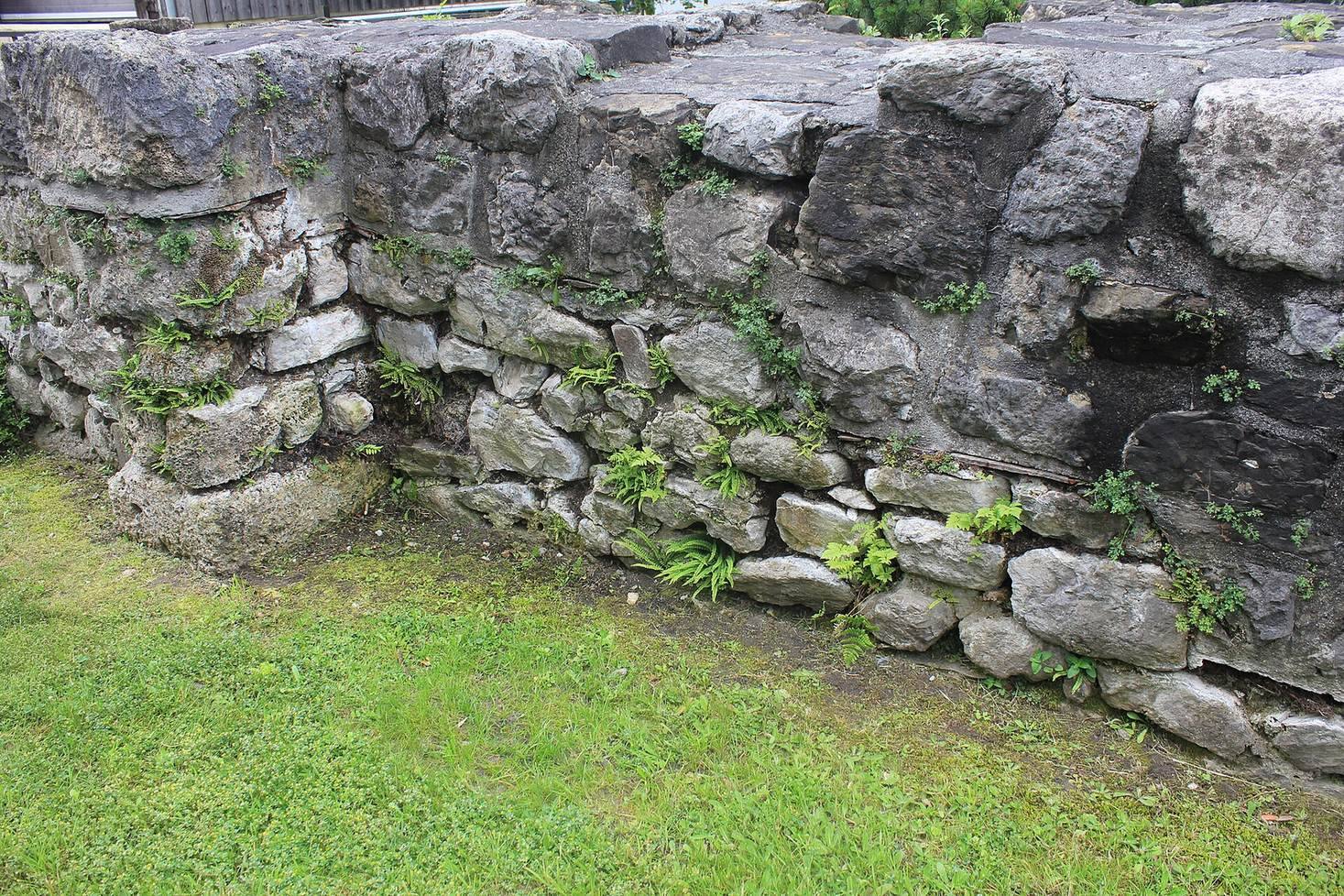
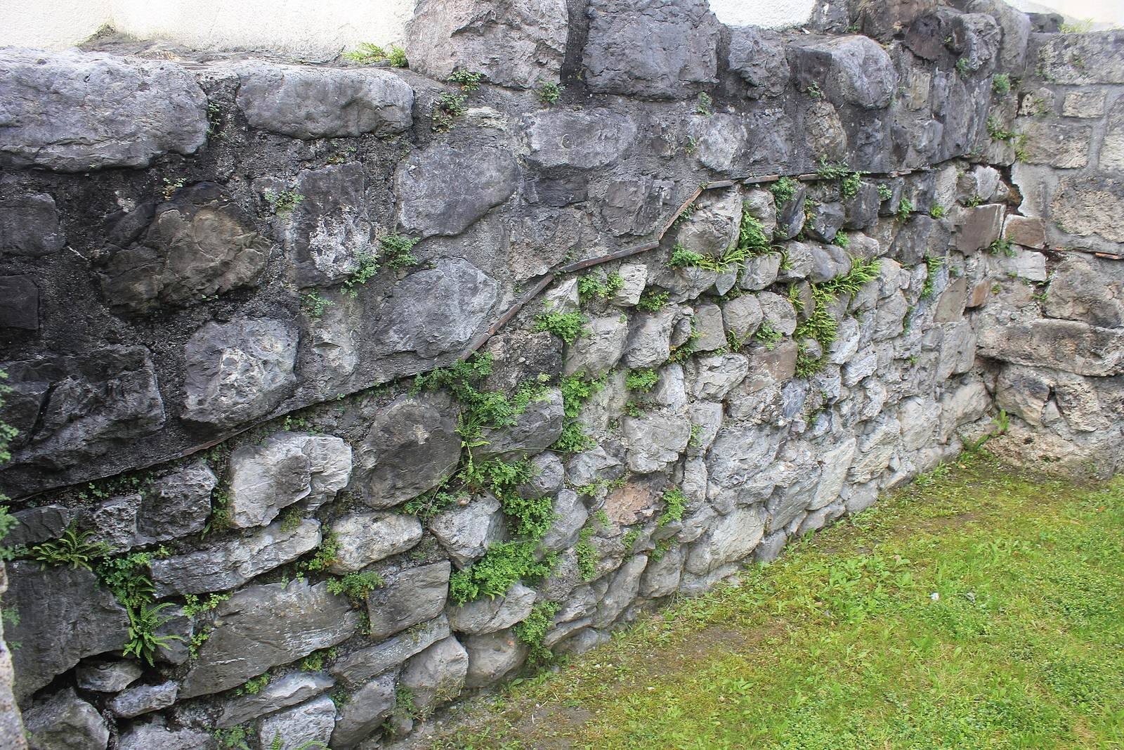
The east wall was about 3.6 metres thick and survives to heights of 1.5 to 2.4 metres in places. Its exposed section extends from the sacristy, a room for church vestments and objects, to the southeast tower. Much of its outer facing was removed over time, leaving portions of the rubble core exposed beneath rough plaster. A five-metre length of the south wall was excavated west of the southeast tower; it was similarly thick. Farther west, building work covered and damaged the wall, while a short section remained west of the gate-tower.
Towers
The southeast tower measured 7.9 metres square, with walls 1.9 metres thick and an interior measuring 4 metres square. Its foundations projected about 30 centimetres and extended 30 to 40 centimetres below ground. The entrance was probably raised about 1.5 metres above the fort’s average interior floor level. Charred beams found outside the tower suggest that fire destroyed at least some of its roof timbers. Mortar in exposed upper wall joints is weathered, while deeper courses remain well preserved.
Evidence of the northeast tower includes an exposed corner, further foundations in the cellar of house number 34, and masonry beneath part of the church sacristy. The south intermediate tower was removed in 1868 during construction of a dairy.
North gate
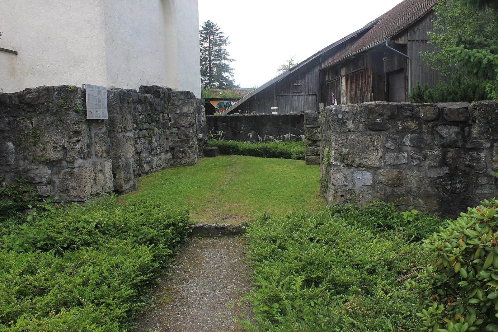
A rectangular gate-tower projected both inward and outward from the centre of the north wall. Including its foundation, it measured 7.6 by 8.5 metres. The entrance passage was 2.9 metres wide, with flanking walls 2.35 metres thick, and opened into a chamber measuring 4.1 by 4.2 metres. Square holes in the outer gate cheeks held a locking beam. Dressed tuff blocks formed the corners and cheeks, and also faced the inner gate.
Two iron circular plates found at the inner gate corners probably served as pivot bearings for the gate leaves; a worn sandstone block may have served the same purpose. The outer entrance now rises only 10 to 20 centimetres, while the inner walls reached 1.2 metres when excavated. The gate-tower walls have been conserved and partly rebuilt to a height of about two metres.
Buildings and water supply inside the fort
Bath
The bath stood beside the eastern wall, near St Peter and the northeast tower. Measuring 15 by 5 metres, it had two building phases and five rooms. In the furnace room, Room A, two mortar floors show that the floor was renewed at least once; later walls partly covered the furnace channel. Room B, the hot bath, had a raised floor supported by heating pillars of brick tile and tuff, with flue pipes along an interior wall. Tiles projecting from the wall finish may have helped leave spaces for hot air to circulate.
Room C served as the warm bath, receiving hot air from Room B through channels. It retained parts of its tile heating pillars, a section of terrazzo flooring, a finish made with stone fragments in mortar, and three flue pipes. Room D was the cold bath. Its renewed mortar floor rested on stone, and its basin had a tile lining, overflow and drain. A doorway between the warm and cold rooms was blocked in late antiquity. Room E may have been an entrance hall or changing room; it had a mortar floor, a tile-lined hearth and drainage openings. Wastewater from the cold-bath basin flowed to a soakaway in its southeast corner.
Barracks and workshops
Probable barracks stood south of the church, near the main gate. Their walls were 0.7 to 1 metre thick, and traces of floors survive in places. Early workshop buildings in the southern part of the fort were probably made of timber. Five hearths and round masonry settings for upright posts were found about 4.5 metres in front of the east wall. Four hearths had tile linings; a larger, semicircular hearth with a reddened floor may have been an oven. The post settings and hearths indicate work buildings, although their arrangement does not establish a complete plan.
Building E, east of the barracks, may have been connected with the bath. Across from the gate, workshop remains were later replaced in the southern part of the fort by a possible storehouse.
Storehouse and possible commander’s residence
A later hall-like stone building in the south may have served as a storehouse. Its surviving east–west wall, which joined the eastern enclosure wall, was 23 metres long and 0.9 to 1 metre thick. Three shallow wall projections, or pilasters, stood along its north side at intervals of six metres. The enclosure wall probably formed the building’s rear, giving it an estimated interior width of 13 to 15 metres. A mortar floor survives.
Walls identified as Rooms G and H turned north and south near the fort gate. The southern section was cut by construction of a grain silo, while the northern continuation led to a small cellar containing burnt debris and later iron equipment. These remains may have belonged to the fort commander’s residence, thought to have stood west of the bath.
Water channel
A channel measuring 30 by 30 centimetres passed through the east wall to supply the fort and bath. Water may have travelled through wooden pipes, and fragments of lead pipe were also recovered. Fine sediment in a pit inside the wall near the channel’s outlet may have accumulated in a water-collection basin.
Church, baptistery and burials
St Peter and the baptistery
St Peter stands over the late Roman fort walls. The earliest identified church, dating to the fifth century, was a hall church with a single, undivided nave, the main body of the building. It was approximately the size of the present church and was built over the northeast tower foundations and the north gate. The oldest surviving church masonry dates to the fifth or sixth century.
A later church of the Carolingian period, named for the Frankish ruling dynasty of Charlemagne and his successors, had three altar foundations. Two lie beneath the present sacristy and one south of it, beyond the current church’s footprint. In the ninth or tenth century the nave was enlarged by reducing the baptistery, and a sacristy was added south of the choir, the area around the altar.
The baptistery lies beneath the present nave. Its round baptismal basin measured 1.10 metres across and survives to a height of 30 to 40 centimetres, with a finish of red brick mortar. The room was later divided, and its southern part was used for burials. A masonry block placed partly over the basin may have served as an altar base or supported a portable baptismal basin.
Burials
Four well-preserved skeletons, including that of a child, were found in the southern part of the baptistery, partly cut into the Roman-period floor. Scattered bones indicate repeated burial there. The surviving skeletons lay west to east and had no grave goods. Twelve early medieval graves were found along the church’s north and south walls, and further burials were recorded at Im Reberle and Im Winkel.
Six additional graves were excavated on Reberastrasse in 2006, about 80 metres from St Peter. They held one newborn, two children and three adults. Stone linings carefully marked the grave edges, and the burials contained no grave goods. Their position near the fort and church suggests a possible connection with the Raeto-Roman community.
Finds from the fort
Coins, pottery and worked objects
Finds from a Roman-period layer in one test trench included pottery fragments and a copper-rich bronze dagger from the Early Bronze Age. Other objects, including pottery, tools and decorated belt fittings, belong to the fourth century. One Roman coin dates to the reign of Augustus; other coins date to the third and fourth centuries. Coins issued under Constans, Constantius II, Theodosius I, Valentinian II and Arcadius were recovered in 1956 and 1957.
The pottery includes steatite vessels, used in part for cooking, as well as Argonne ware, North African fine ware and green- or brown-glazed vessels. Fragments of terra sigillata, fine Roman tableware with a red slip, and many grinding bowls were also found. Other objects include bronze items and worked bone and antler. Antler fragments near a hearth had been shaped into objects such as handles or combs, and a richly decorated bone comb came from the bath. The important excavation finds are held at the Liechtenstein National Museum in Vaduz.
Animal remains
Animal bones show that people at the fort ate sheep, goats, pigs and cattle, as well as deer, chamois, ibex, wild boar and elk. A cat was also identified among the remains; domestic cats became established in the region with the arrival of the Romans. An elephant tusk recovered in front of the church portal was later sent to Vienna for safekeeping by the local governor, Pokorny.