Uxmal: A Major Maya City in Yucatan, Mexico
Site at a Glance
- Rating
- 4.8
- Popularity
- Very High
- Country
- Mexico
- Primary era
- Medieval
- External website
- Open
- Eras represented
- Medieval
- Civilizations
- Maya
- Site type
- City
On this page31 sections
History
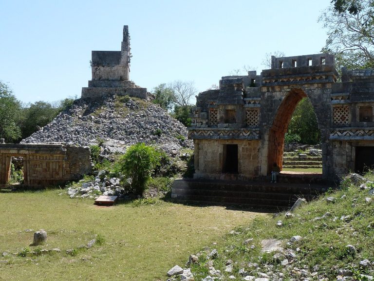
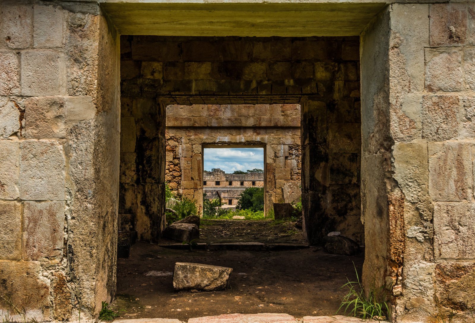
Uxmal is the ruin of a major Maya city in the Puuc region of Yucatan, Mexico. It flourished especially during the Late Classic and Terminal Classic periods, reaching its greatest architectural and political development during the ninth and early tenth centuries. The city’s buildings belong predominantly to the Puuc tradition, a northern Yucatec Maya style known for plain lower walls, carefully cut stonework, and richly ornamented upper façades. Uxmal had already been important several centuries earlier, but the expansion directed by Chan Chak K’ak’nal Ajaw, also known as Lord Chac, created much of the monumental city visible today.
Origins and growth in the Puuc region
The name Uxmal has been connected with Yucatec Maya expressions meaning “three times” or “three times built,” although its etymology remains uncertain. Another proposed meaning is “what is to come.” These interpretations belong to a later history of the site and do not establish the city’s original name or foundation date.
Settlement in the Puuc region became more attractive as Maya communities developed ways to collect and store rainwater. Natural depressions, reservoirs, and underground cisterns provided essential supplies in an area where groundwater lay approximately 65 meters below the surface, beyond the reach of Maya wells. Uxmal benefited from this environmental adaptation, from the agricultural potential of deep soils, and apparently from immigration as several Puuc centers expanded.
Traditional accounts associate Uxmal with the Xiu lineage. Colonial chronicles and the Chilam Balam books, Maya texts written in Latin script that preserve later historical, calendrical, and religious traditions, connect the Xiu arrival with an ancestor of the lineage. Their dates have been interpreted as approximately AD 731 to 751 in some traditions and as belonging to the tenth century in others. Because these accounts were written centuries after Uxmal’s decline, their chronology and their identification of the city’s earliest rulers and inhabitants remain uncertain.
The ninth- and tenth-century city
The only ruler of Uxmal securely identified through contemporary hieroglyphic inscriptions is Chan Chak K’ak’nal Ajaw. Inscriptions associated with his reign date approximately from AD 895 to 907. He oversaw the major expansion that produced the Governor’s Palace, the Nunnery Quadrangle, the ballcourt, and other principal monuments. The ballcourt inscription gives its dedication as AD 901, while inscriptions on its rings refer to January 9, AD 905 in the Julian calendar.
Uxmal maintained political and cultural contacts with Chichen Itza. Colonial traditions describe relationships among Uxmal, Chichen Itza, and Mayapan, including the so-called League of Mayapan. Archaeological evidence does not establish that these cities were necessarily contemporaneous or that such a league existed in the form later accounts describe. The extent, duration, and consequences of interaction between Uxmal and Chichen Itza therefore remain unresolved.
Uxmal’s inscriptions are few and concentrated mainly around the transition from the ninth to the tenth century. They include a small group of reliable dates, painted dates on vault stones from AD 906 and 907, and calendar references on eroded monuments dating approximately from AD 810 to 928. Many other texts are pseudo-hieroglyphs, signs that imitate writing but cannot be read. For this reason, the sequence of Puuc architectural and decorative styles is central to the reconstruction of the city’s history. The Late Uxmal style is known only at Uxmal, making the site particularly important for the study of Puuc architectural development.
Decline, later occupation, and abandonment
Monumental construction ended during the tenth century or around its middle. Uxmal’s political authority and economic resources no longer supported the building of large stone complexes, although a smaller population continued to live in the city for an uncertain period. Some monumental buildings were altered for residential use. Broad entrances were blocked, leaving narrower openings, and numerous C-shaped structures were built or occupied during this late phase. These buildings had partly perishable walls and roofs and occur mainly in palace courts.
The date of final abandonment remains uncertain. One interpretation places it roughly one or two centuries after the tenth-century decline, while another places abandonment in the thirteenth century. Later visitors deposited offerings in the ruins of collapsing buildings. Traditions associated with the Xiu state that the lineage later transferred its capital from Uxmal to Mani. Accounts of conflict between the Xiu and the Cocom, including the killing of Xiu pilgrims at Chichen Itza in 1536, preserve memories of long and possibly hostile relations between the political communities, but these accounts were recorded long after the city’s monumental period.
Rediscovery, research, and conservation
By the sixteenth century Uxmal was abandoned or largely ruined. Fray Diego de Landa was said to have visited the abandoned city in 1573, and Alonso Ponce’s inspection in 1588 produced an early detailed description through his secretary, Ciudad Real. Modern knowledge of the ruins expanded after Jean-Frédéric Maximilien de Waldeck visited in 1835 and published the first modern description. John Lloyd Stephens and Frederick Catherwood then recorded Uxmal during visits in the early 1840s, helping make the city widely known in Europe and North America. Some architectural elements removed by Stephens were later destroyed in a fire in New York.
Désiré Charnay photographed Uxmal in 1860. Teobert Maler, William H. Holmes, Eduard Seler, and Sylvanus G. Morley subsequently produced important photographic, architectural, and surveying records. Morley made reliable measurements in 1907 and mapped buildings that had previously been overlooked. Frans Blom measured the Nunnery Quadrangle in detail in 1930, while Robert H. Merrill prepared an early precise map of the principal ruin groups. A reproduction of the Nunnery Quadrangle was made for the 1933 Chicago World’s Fair, although the reconstruction was not preserved.
The first Mexican government conservation project began in 1927. Restoration and consolidation followed from 1936 under José A. Erosa Peniche, and the National Institute of Anthropology and History continued stabilization and restoration from the 1940s onward. By about 1970, work had made the central area accessible and substantially halted the deterioration of its best-preserved buildings. Later interventions increasingly involved hypothetical reconstruction of heavily ruined structures. Excavations and architectural studies have remained limited, and older cultural layers continue to appear beneath some reconstructed buildings.
Uxmal was inscribed in 1996 as the UNESCO World Heritage property “Pre-Hispanic Town of Uxmal,” under cultural criteria i, ii, and iii. In 2015 it was added to the International Register of Cultural Property under Special Protection of the Hague Convention. The official archaeological zone covers more than 10 square kilometers. Much of the ancient settlement remains beneath dense forest and outside the publicly accessible area. The central zone is estimated to have housed approximately 25,000 people, while the wider settled area extended across roughly 10 square kilometers.
Remains
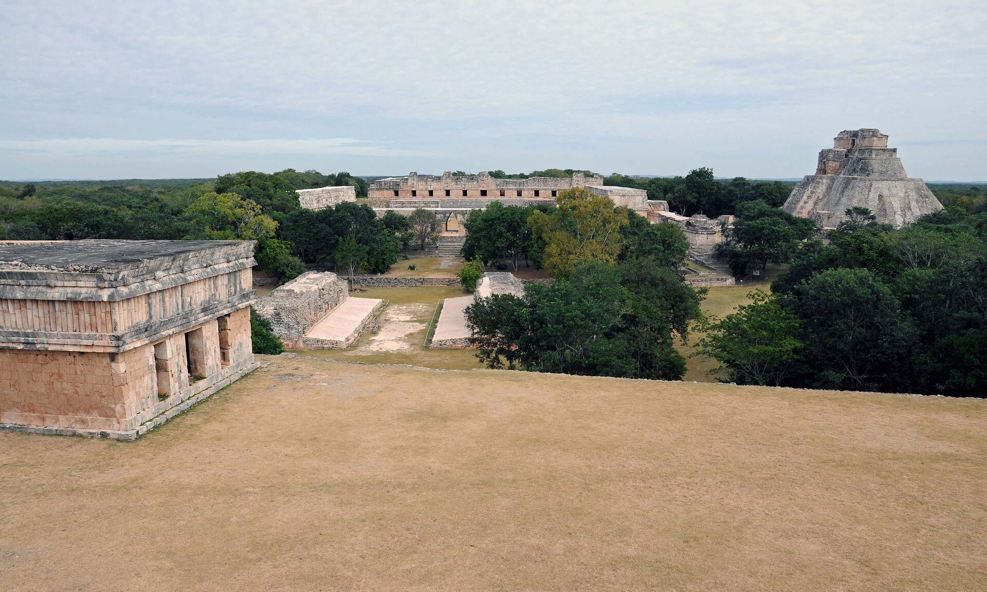
Uxmal occupies gently undulating karst terrain at approximately 50 meters above sea level. Natural depressions collected rainwater, while reservoirs and numerous underground cisterns supplemented the supply. The ancient central area was enclosed by a low wall with many interruptions, a boundary that appears to have marked a symbolic or administrative zone rather than a defensive fortification. Buildings are generally arranged around large, approximately square courts, with long palace buildings enclosing three sides and a raised building or pyramid occupying the fourth. The principal plazas are broadly aligned north-south, while the central buildings stand approximately 17 degrees clockwise from the cardinal directions.
The surrounding dry forest is largely secondary growth created by repeated clearing for Maya milpa agriculture. The present appearance of the central courts also differs from the ancient landscape. The original courts had white stucco floors and fewer trees, while many trees now growing among the ruins were planted after 1980. Platforms, terraces, courts, reservoirs, and cisterns formed an integrated physical setting for the city.
The Governor’s Palace complex
Governor’s Palace
The Governor’s Palace stands on a platform approximately 185 by 164 meters and between 7 and 14 meters high. The platform incorporates a natural rise, has six or seven stepped exterior levels, and rests on a lower platform that regularizes the uneven ground. Two northern stairways lead upward, one directed toward the Turtle House and the other toward the palace. Another ascent approached from the west behind the Old Chenes Temple, while the existence of an eastern stairway near the Great Pyramid remains uncertain.
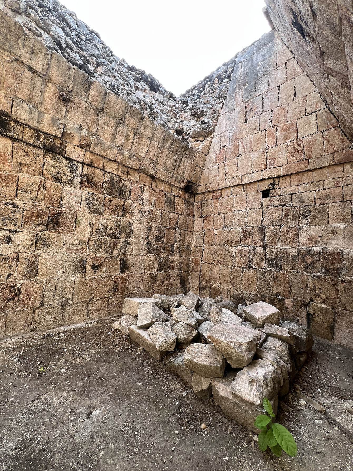
The palace is approximately 100 meters long and stands on a secondary platform about 109 meters in length, reached by an eastern stairway approximately 40 meters wide. Fourteen rooms are arranged in two parallel rows, with the rear rooms set slightly higher. The central room of the main façade has three entrances and receives the strongest decorative emphasis. Its unusually high rooms have corbel-vaulted roofs, formed by masonry courses projecting inward until they meet or support a capstone. The original doorways used pairs of Chicozapote-wood lintels, later replaced with concrete during restoration.
The façade follows the Late Uxmal style. Its upper level carries stepped meanders, lattice panels, rows of masks of Chaac, the Maya rain deity, serpent heads, pseudo-hieroglyphic bands, feathered headdresses, and a seated dignitary above the central entrance. Projecting three-dimensional serpent heads appear at the corners, contributing to an elaborate stone mosaic that covers much of the upper façade.
Jaguar Throne
A stone throne made from two joined jaguars stands on the terrace beside the Governor’s Palace. Known as the double-headed Jaguar Throne, it is associated with the ruler and may also have served as a ceremonial altar.
Turtle House
The Turtle House stands a few meters north of the Governor’s Palace on a later addition to the palace platform. Individually carved turtles decorate its upper cornice. Rooms occupy the two short sides and the south side, while the north side has a single entrance and interior rooms arranged at different levels. The building is a Classic Puuc structure with plain lower walls, projecting and sloping cornice bands, and columns in the upper façade. Its masonry is especially refined. The collapsed central section was reconstructed around 1968.
Associated platform buildings
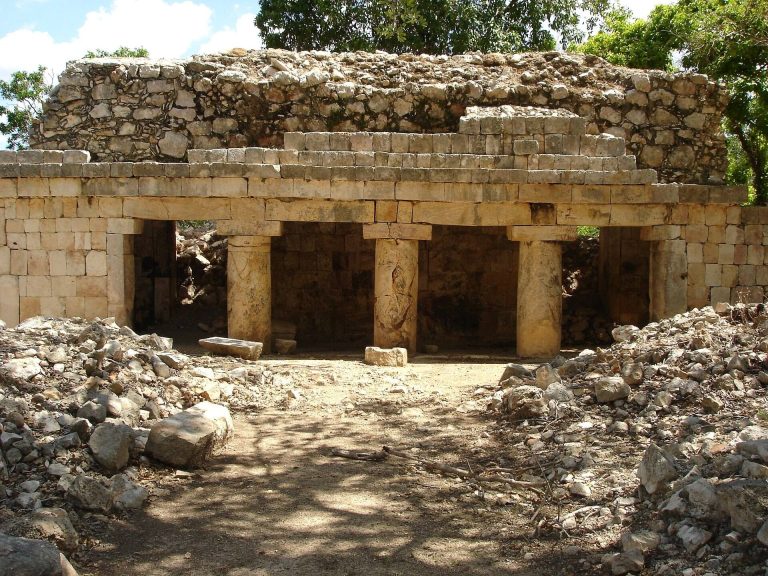
A large, partly unexcavated C-shaped building stands on the Governor’s Palace platform. It is the largest known building of this type at Uxmal and differs from the usual arrangement because it frames the platform rather than occupying the interior of a court. An unexcavated building opposite the palace probably had a portico with three rooms behind it. Near the northern foot of the palace platform, a small excavated building has stone columns dividing its entrance. Its side entrances were later blocked, and an unusually well-preserved vault stone found inside was replaced by a replica during reconstruction.
Two earlier buildings partly enclosed by the Governor’s Palace platform occupy a broad intermediate terrace. Each had two rows of three rooms. The southern building included a Chenes-style façade, while the northern building had a Classic Puuc façade with column decoration.
Ballcourt and Pyramid of the Magician
Ballcourt
The ballcourt lies between the Nunnery Quadrangle to the north and the Governor’s Palace to the south and is aligned approximately north-south. Its playing alley measures about 34 by 10 meters between two massive side walls approximately 7.4 meters high. A ballcourt was a Mesoamerican complex for a ritualized game in which players propelled a solid rubber ball through or toward stone rings without using their hands or feet.
The smooth side walls provided rebound surfaces. Stone rings were set into the middle of each wall, but only fragments survive; the present rings were reconstructed from original pieces. Sculpted rattlesnake bodies decorated the side benches. Buildings with three-part entrances once stood above the walls, although these structures are now largely destroyed.
Pyramid of the Magician
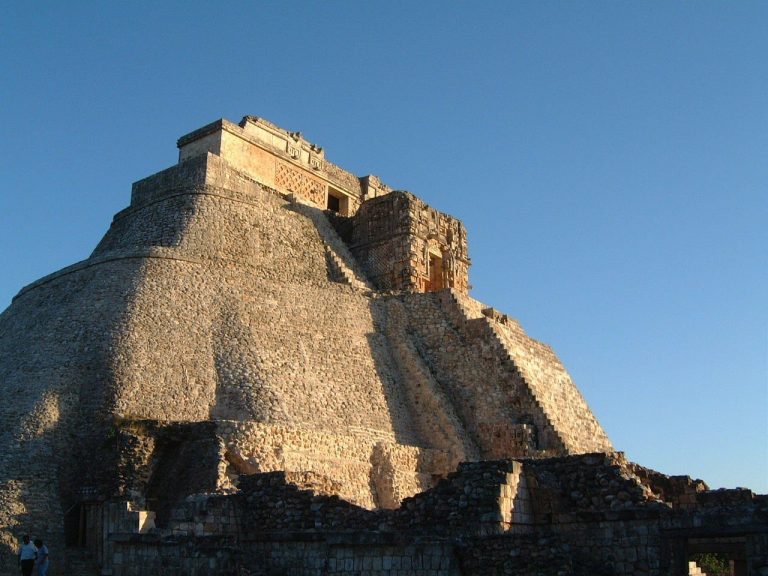
The Pyramid of the Magician, also called the Pyramid of the Diviner, dominates the site. Its rectangular plan has broadly rounded corners, an unusual form among Maya pyramids, and at least five construction phases were superimposed upon one another. The earliest component was an independent building east of the later Bird Plaza. It had two parallel rows of five rooms, with the rear rooms reached through the front rooms, and transverse rooms at both ends. Its central entrance was later buried beneath the western stairway.
The earliest building used Classic Puuc features including low columns, smooth stone surfaces, projecting corner columns, sculpted cornices, fish, foliage, crossed bones, pseudo-hieroglyphic or hieroglyphic motifs, and stacked Chaac masks. A wooden lintel from the building has a radiocarbon date of AD 740 to 760, with a one-sigma confidence interval. When later pyramid stages were built, the earliest rooms were partly filled with rubble, probably to stabilize the structure. A sculpture once called the Queen of Uxmal was removed during restoration. It is actually a partly tattooed or scarified male face emerging from a stylized serpent’s mouth and is now held in the National Museum of Anthropology.
The second pyramid stage reached approximately 22 meters and supported an east-facing portico probably carried by eight columns. The number remains hypothetical because excavation did not reach both ends. The portico was later divided into three rooms. Temple III was then attached to the rear of this building. It had two rooms and a largely vanished stairway, and was subsequently partly blocked to support Temple V. Access to Temple III is through a modern archaeological tunnel.
The Chenes building was constructed over Temple III. Its staircase rises from the Bird Plaza, crosses the earlier façade, and carries a continuous chain of Chaac masks. Its high interior and dragon-mouth entrance follow Chenes and Rio Bec traditions, with the vault springing more than four meters above the floor.
Temple V is the latest and highest building on the pyramid. It has three narrow north-south rooms and stairways on both the east and west sides. The western façade contains crossed chimez stones, meanders, and projecting supports for lost figures. The more damaged eastern façade represents a traditional thatched-roof house. A hurricane affected the pyramid, and climbing is no longer permitted for stability reasons. Only the lowest building remains accessible.
Bird Plaza and Nunnery Quadrangle
Bird Plaza
The Bird Plaza lies between the Pyramid of the Magician and the Nunnery Quadrangle. Four buildings surround the court, which also contains a conical altar stone. The eastern building is the only one that remained standing, while the other three were largely reconstructed between 1988 and 1994.
The western building has a reconstructed vaulted passage and façades decorated with columns, latticework, stepped motifs, palm-leaf patterns, reptile mouths, and stone birds. Twenty-two small pseudo-hieroglyphic elements were found in the debris of its entrances, but they contain no readable text. The northern building has two rows of rooms and three entrances on each side, some of which were later blocked. Its reconstructed façade is partly hypothetical. The southern building consists of a thirteen-column portico in front of three rooms, with a masonry seat platform; its reconstruction is also hypothetical.
House of the Iguana
The House of the Iguana stands south of the Bird Plaza. It is a long portico carried by eleven columns. The structure had completely collapsed and was fully reconstructed, so its façade and other details cannot be established securely.
Nunnery Quadrangle
The Nunnery Quadrangle consists of four palace buildings around a sunken rectangular court approximately 65 by 45 meters. The buildings occupy different levels and have different plans and façades, but form an integrated complex. Its modern name comes from its resemblance to a convent. The complex is interpreted as palatial and administrative rather than monastic or residential.
The southern building consists of two long, mirror-image sections approximately 80 meters in length. A vaulted entrance passage from the monumental southern stairway connects them. Each section has two rows of rooms, while the façades combine plain wall surfaces, lattice panels, stylized thatched houses, and Chaac masks.
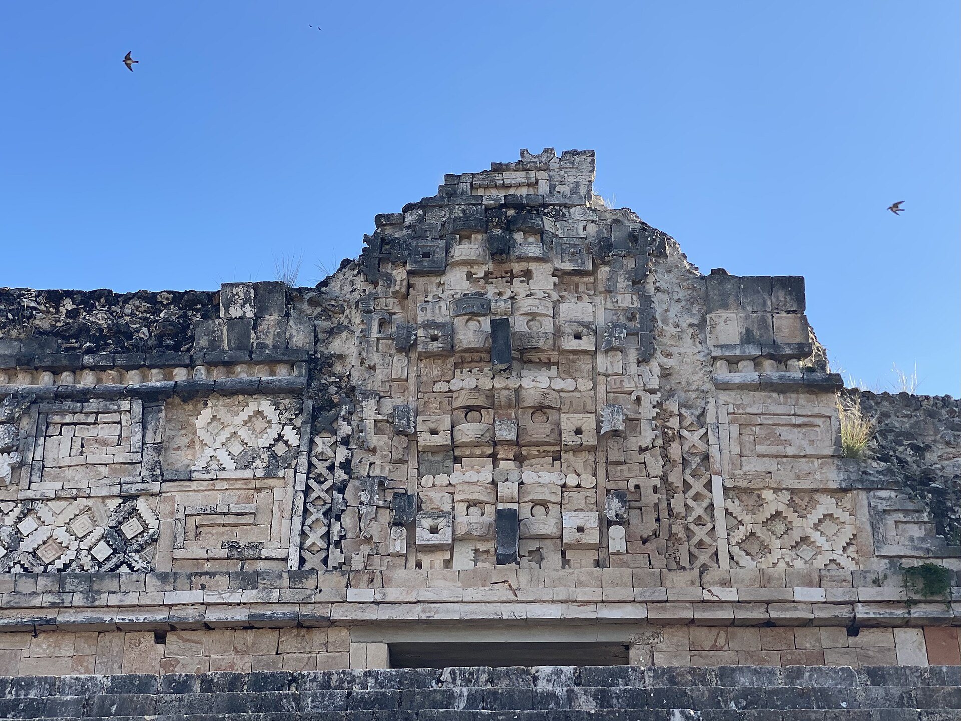
The eastern and western buildings are raised above the court and each contains fourteen rooms arranged in two parallel rows. Their façades use lattice panels, stepped meanders, cascades of Chaac masks, double-headed serpents, owl-like faces, rosettes, and projecting sculptural elements. The western building has seven entrances and the most elaborate surviving façade in the quadrangle. Its decoration includes a feathered throne or canopy, intertwined feathered serpents, Chaac masks, thatched houses, human and animal figures, and a serpent whose open mouth frames a human face. Much of the rear façade is destroyed and has not been reconstructed.
The northern building stands on the highest platform and is reached by a stairway approximately 30 meters wide. It contains 26 rooms and thirteen exterior entrances. Its construction involved several phases, beginning with an earlier building, followed by the addition of side rooms and a new outer façade. The decoration includes tall cascades of Chaac masks, traditional houses with double-headed serpent roofs, intertwined jaguars, latticework, chimez motifs, a bound captive, and an owl-like figure. Projecting stone platforms may once have supported sculpted heads. A circular opening in one façade may have held a human skull, although that interpretation is uncertain.
Eastern annexes
Two long annex buildings east of the Nunnery Quadrangle contain unusually long rooms with large-span vaults. Their vaults span approximately 4.1 and 4.35 meters, the latter possibly the largest room span recorded in the Maya area. The southern annex uses massive blocks extending through the full thickness of its walls rather than the more usual rubble core and veneer construction. Traces of red wall paint survive inside, along with a horizontal band of large black hieroglyphic signs on a light background. These features suggest an early Proto-Puuc or early Puuc date.
Great Pyramid and western central group
Great Pyramid
The Great Pyramid is Uxmal’s largest pyramid by volume. Its approximately square base measures about 80 meters on each side and originally supported a summit building reached by a broad northern stairway. The summit structure had five rear rooms and three front rooms. Oversized Chaac-mask entrances led to the central rear rooms, while the side rooms on the other three sides were single rooms. The northern façade carried three rows of stepped meanders separated by intertwined serpents and decorated with parrot reliefs.
In a later phase, the pyramid was raised to the level of the summit building’s roof. This work covered all four façades and filled the rooms. A larger building was apparently planned on the new surface but was never completed. Exploratory excavations began in 1941. The northern façade and great stairway were exposed and reconstructed around 1969, while an earlier Early Classic façade discovered on the north side in 2009 was reburied for structural reasons.
Pigeon House complex
The Pigeon House complex is the westernmost central group and probably belongs to an early phase of Uxmal’s construction. It consists of four successive courts in front of the South Pyramid and has undergone several alterations. Extensive reconstruction of its northern section began after 2000.
The Pigeon House itself has two parallel rows of rooms and a central vaulted passage. Its distinctive two-register roof comb has rectangular openings below and triangular gabled sectors above. The openings reduced wind resistance. Projecting stone supports once held figures or stucco ornaments, none of which survive.
South Pyramid
The South Pyramid rises on a terrace south of the Pigeon House. It had a long stairway and a narrow summit temple with three front rooms and a smaller rear room, a plan associated with the Chenes region. Only two vaulted rooms survive, and the complex has not been fully excavated.
Peripheral courts and later structures
Cemetery Group
The Cemetery Group is a typical Uxmal court complex. Its buildings stood on high platforms, while a pyramid on one side supported a single-room summit building. The partly preserved western building had three entrances facing the court, a broad entrance platform, and a rare southern entrance. Its wooden lintels were later replaced by concrete, and its façade belongs to the early Puuc tradition.
Low platforms in the group carry crossed bones, skulls, shields, and human figures. Their imagery may commemorate conflicts involving Uxmal’s rulers. Several platforms also carried hieroglyphic bands, although their dates cannot be securely interpreted.
Round Pyramid
Excavated in the 1990s, the Round Pyramid consists of a stepped circular platform approximately 18 meters in diameter and 2.5 meters high. It supported a circular building with a northern entrance, a low outer wall, and a roof and wall structure that were probably partly perishable. The building was destroyed by fire, after which valuable offerings were placed in its debris.
The Round Pyramid was built very late in Uxmal’s history and is associated with the C-shaped buildings. One such structure was attached directly to it.
House of the Old Woman complex
The House of the Old Woman complex lies approximately 80 meters southeast of the Governor’s Palace platform. Its main pyramid has not been fully excavated or reconstructed, and portions of its summit building appear never to have been completed. The House of the Old Woman stands halfway up the pyramid’s northwestern slope on a smaller and earlier pyramid. It is an early Puuc building with two rooms, western entrances, wooden lintels, a partly preserved roof comb, and projecting supports for stucco figures that are now lost. Its northern half has collapsed.
Building 14N2 immediately north of the Old Woman pyramid is largely destroyed. It had three rooms, a second storey with one room, and a western stairway crossing the ground-floor façade. The wooden lintel above its central entrance remains in place.
Phallus Temple
The Phallus Temple lies approximately 450 meters south of the Governor’s Palace on the southern edge of a large stepped platform. Its upper cornice contains phallus-shaped waterspouts with channels that drained rainwater from the roof. The building probably had five north-facing rooms and an additional rear room. Only part of the rear wall survives, and the structure has not been consolidated.
Chimez Temple
The Chimez Temple lies approximately 400 meters south-southwest of the Governor’s Palace beyond the central enclosure. It is a ten-room building arranged around a massive stone core, with a principal northern façade, a portico at roof level, and a vaulted passage beneath its stairway.
The temple retains a functioning Chicozapote-wood door lintel. Its façade includes latticework, stepped meanders, vertical rows of lozenges, chimez or toothed-stone motifs, low columns, and a partly preserved upper storey with a roof comb. It has not been excavated or consolidated.
Northern Group
The Northern Group lies approximately 200 meters north-northwest of the Nunnery Quadrangle on higher ground. More than a dozen mostly ruined buildings surround at least three courts. Their plans and masonry indicate that the group belongs among the oldest surviving parts of Uxmal, but it has not been excavated or consolidated.
Roads, inscriptions, and archaeological interpretation
A sacbe, a raised and surfaced Maya road, connected Uxmal with Kabah through Nohpat. Its precise starting point was probably a smaller eastern ruin group rather than the city center. The relationship between this road and Uxmal’s political territory remains unresolved.
A stela platform west of the Nunnery Quadrangle contains approximately half a dozen or more heavily eroded stelae and other monuments with calendar references dating approximately from AD 810 to 928. Their short non-calendar texts are generally unreadable. Painted vault stones retain partial calendrical dates, while many stelae and other monuments preserve eroded or incomplete calendar signs. The site’s pseudo-hieroglyphs imitate writing without conveying readable texts.
Interpretations of Uxmal’s political territory, its relationship with Chichen Itza, the duration of their overlap, and the meaning of the sacbe remain unsettled. Possible evidence for conflict includes the enclosure around the central area, imagery in the Cemetery Group, and the destruction or deliberate overturning of some monuments. The restored center therefore represents only one stage in a much longer and incompletely understood history. Beneath its reconstructed buildings and forested surroundings survive the architectural layers of an urban center that developed through successive Puuc traditions, water-management practices, political changes, and later reuse.