Kabah: A Maya Archaeological City in the Puuc Region of Yucatán
Site at a Glance
- Rating
- 4.8
- Popularity
- Medium
- Country
- Mexico
- Primary era
- Classical
- External website
- Open
- Eras represented
- Classical
- Civilizations
- Maya
- Site type
- City
On this page20 sections
History
Kabah is a Maya archaeological city in the Puuc region of western Yucatán, Mexico, whose visible architecture was built mainly between the 7th and 11th centuries CE in the Late and Terminal Classic periods. It was regarded as the second-largest or second-most important ruin complex in the Puuc region after Uxmal. The area had already been inhabited by the middle of the 3rd century BCE, while the city’s principal buildings belong to its later development.
Early settlement and the Classic-period city
Kabah’s early occupation began centuries before the surviving monumental buildings were constructed. Most of the architecture visible today belongs to the period when Puuc cities developed elaborate stone façades, formal courts, palaces, and temples. The site’s buildings reflect the Puuc architectural tradition of northern Yucatán, known for carefully cut stone veneer, geometric mosaic decoration, columns, and complex façades. Some structures also incorporate features associated with the Chenes tradition, including projecting architectural elements and rounded corners.
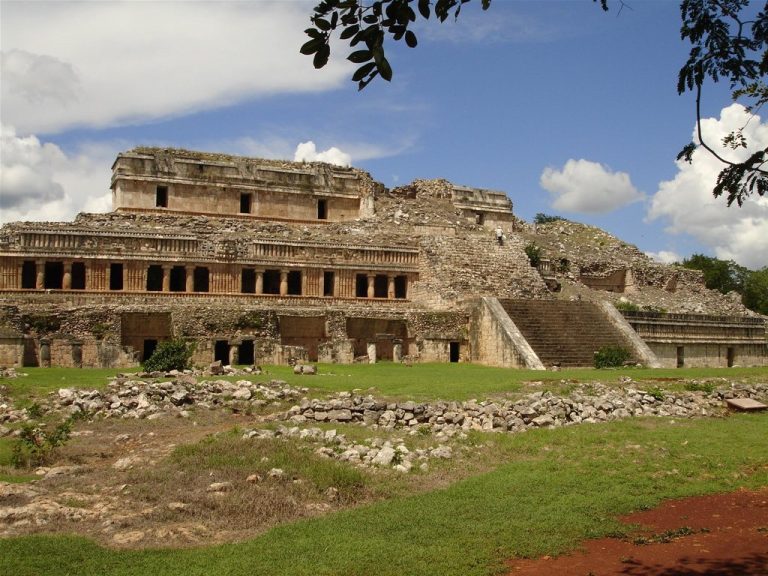
The city occupied an area extending approximately 1.5 kilometres from east to west and 1 kilometre from north to south. Its buildings were arranged in several architectural groups, generally around rectangular courts. Palaces, low stone buildings, altars, and stepped pyramid temples formed a settlement whose principal groups extended across both sides of the modern Federal Highway 261.
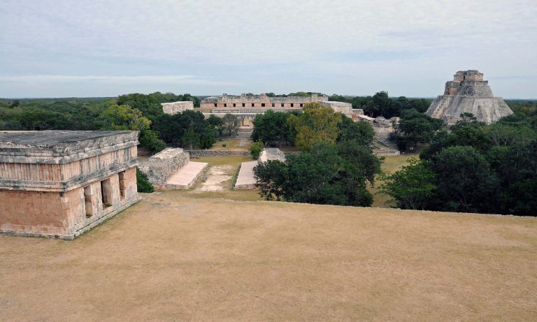
The eastern Palace Group was probably the most important part of Kabah and remains its largest and best-preserved architectural group. Its principal orientation was westward, toward the central part of the city and the groups on the western ridge. The western area contained the Great Pyramid, Kabah’s only identified pyramid, together with additional temple and palace complexes. Much of that sector remains uncleared, preserving evidence of an extensive but incompletely investigated urban landscape.
Water, religion, and political expression
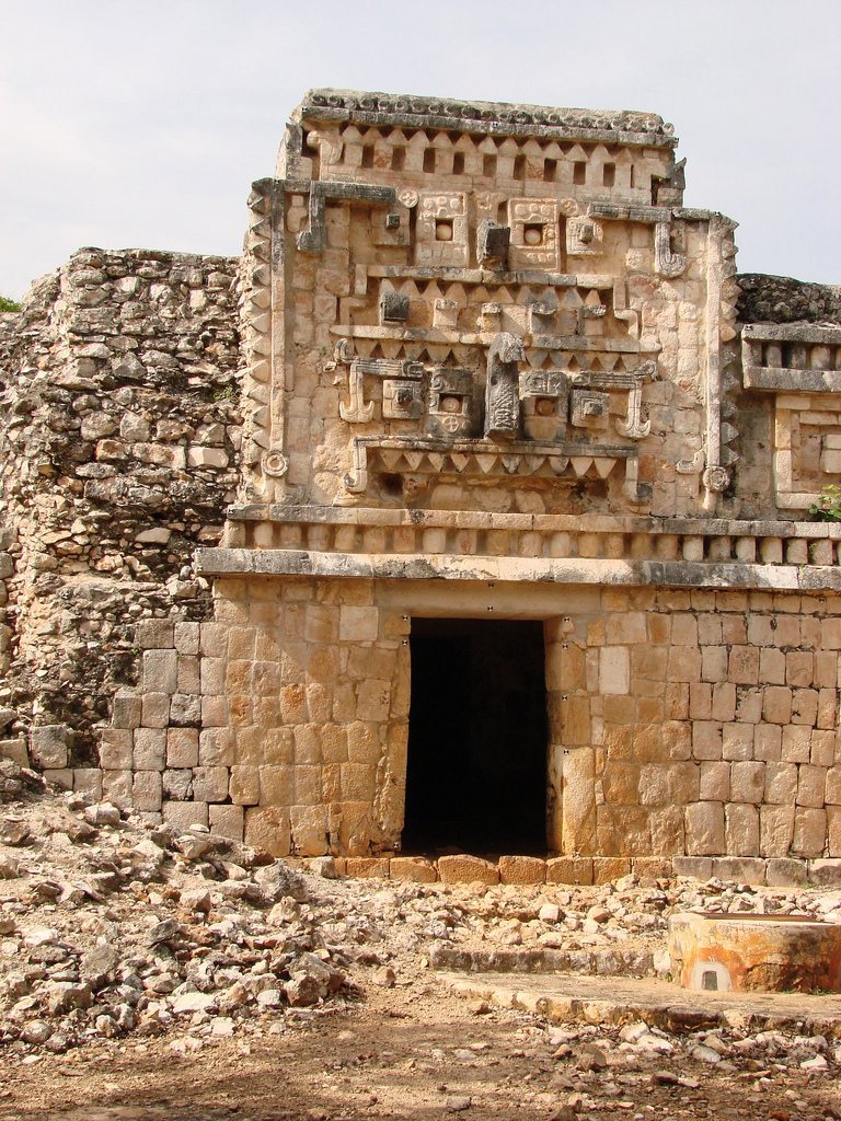
Kabah’s architecture placed unusual emphasis on Chaac, the Maya rain deity associated with rainfall and agricultural fertility. The region around the site has few natural water sources such as cenotes, so dependable rainfall was especially important to farming communities. Chaac masks, recognizable by their prominent projecting noses or trunks, were therefore a repeated feature of Kabah’s monumental decoration. Copal incense was found in some of the stone noses of these masks, linking the architectural imagery with ritual activity.
Inscriptions provide several dates within the city’s later history. The eastern relief panels of Codz Poop carry the date 859, while the unfinished upper temple of Manos Rojas bears the date 876. A sculpted doorjamb from Structure 2C6 was used to propose a date of 879, probably close to the city’s apex. Another inscription dated 987 is regarded as among the latest examples carved in the Classic Maya style.
Many sculpted panels, lintels, and doorjambs were removed from Kabah and transferred to museums elsewhere. Their imagery mainly depicts rulers and scenes of warfare. Other sculptural pieces, designated M1 to M7, may represent people, deities, or rulers. One piece, apparently resembling a clenched hand, has been associated with a proposed meaning of the name Kabah.
The road to Uxmal
Kabah was connected with Uxmal by an approximately 18-kilometre-long raised road called a sacbé, a paved Maya route linking settlements and ceremonial areas. The road was about 5 metres wide and passed through the large, incompletely investigated site of Nohpat and the smaller site of Xhaxché. At Kabah, it began beside the unreconstructed Great Pyramid. It formerly continued toward the Governor’s Palace at Uxmal, although its exact endpoint has not been located.
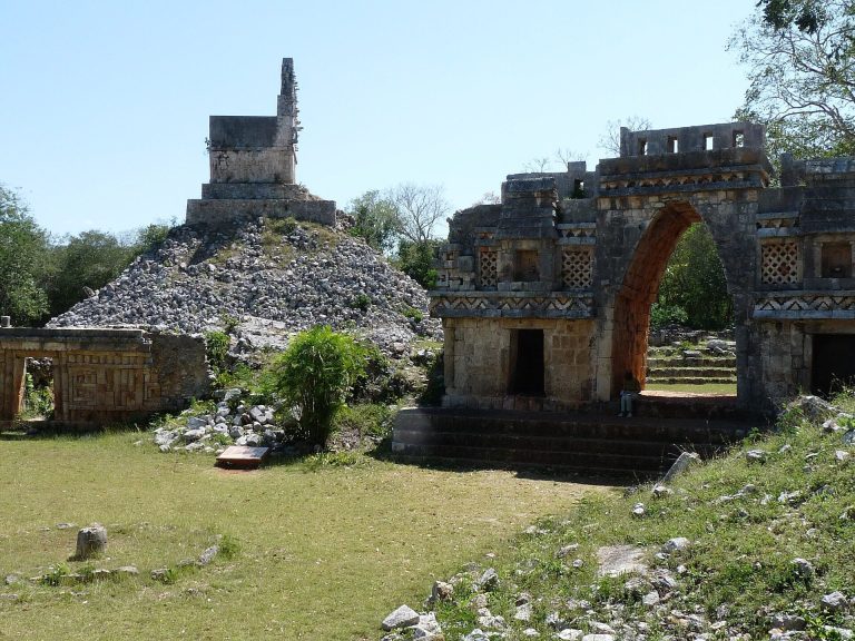
Monumental arches marked the road at both ends. The arch beside the Great Pyramid has been reconstructed and marks the road’s entrance into Kabah. Near Uxmal, only parallel lines of stones survive in places. The small-stone and mortar filling has disappeared from sections of the route, while other stretches are concealed beneath accumulated soil.
Abandonment and modern investigation
Kabah had been abandoned before the Spanish arrived in Mesoamerica. Its pre-Columbian name is preserved in the Book of Chilam Balam of Chumayel, although the meaning remains uncertain. “Strong hand” has been proposed as one interpretation, while another proposed translation is “royal snake in the hand.”
John Lloyd Stephens was the first modern visitor to describe Kabah. His account, prepared with Frederick Catherwood, was published in 1843. Teobert Maler followed in 1887 and produced descriptions, plans, and photographs. The most extensive early documentation was undertaken by H. E. D. Pollock between 1936 and 1940.
Archaeological work beginning around 1960 concentrated largely on consolidating individual buildings. Later investigations directed by Ramón Carrasco Vargas included work at the rear of Codz Poop and at Manos Rojas. Structures 1A3 to 1A6 were excavated in 2004, and their walls were reconstructed to cornice level. A wider programme of clearing, restoration, and excavation included other buildings, although some remain overgrown or inaccessible. Research in the 1950s also examined house types, terraces, ceremonial groups, and architectural groups associated with chultuns, underground storage or water-collection features.
Kabah became a Yucatán state park in 1993. In 1996 it was incorporated with Uxmal, Sayil, and Labna into the UNESCO World Heritage property officially known as the Pre-Hispanic Town of Uxmal. The site’s division by Federal Highway 261 leaves the eastern complex as the principal restored and publicly accessible area, while many western and more distant structures remain only partly cleared or inaccessible.
Remains
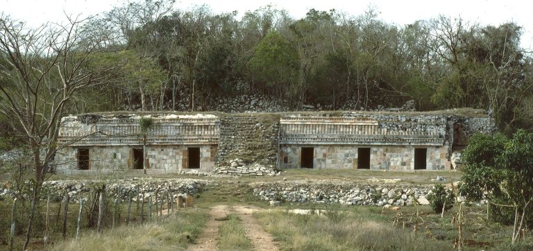
Kabah’s surviving remains form a dispersed urban landscape of courts, palaces, temples, low stone buildings, terraces, altars, and raised roads. Most structures use Puuc construction, with carefully fitted stone veneer and geometric mosaic decoration, while selected buildings show Chenes-related forms. The eastern Palace Group contains the most extensively restored architecture, whereas the western ridge and outlying groups retain buildings that are unfinished, partly excavated, or concealed by vegetation.
The eastern Palace Group
Codz Poop
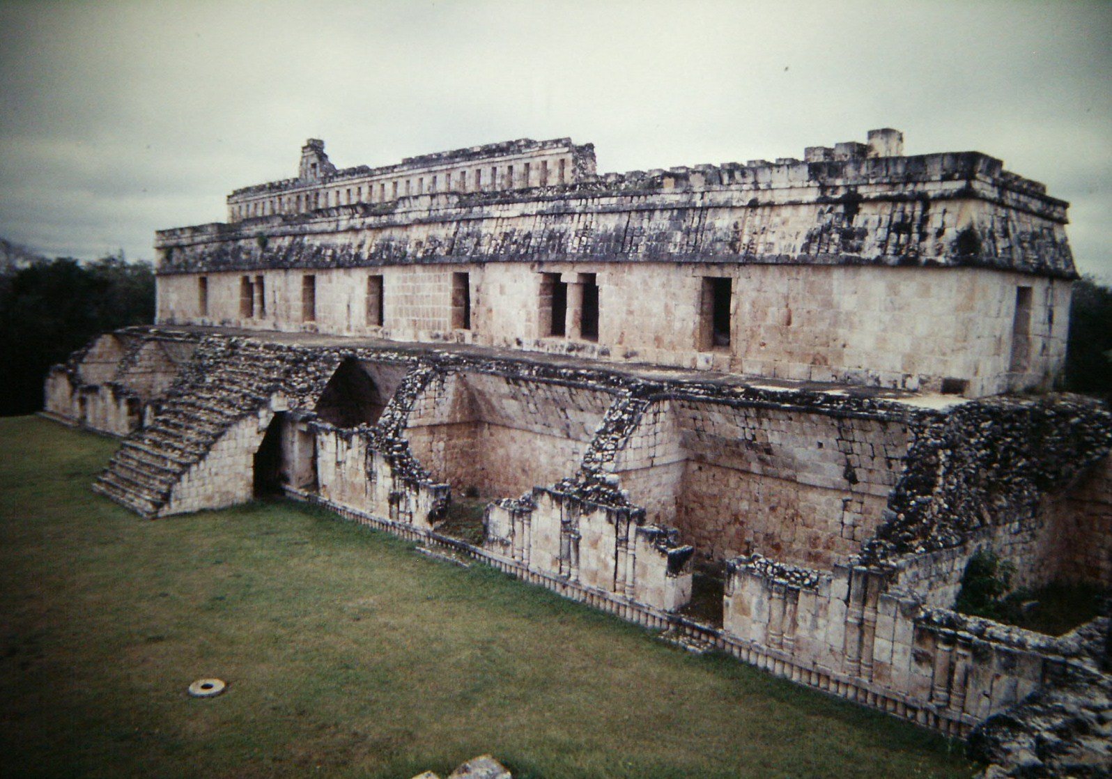
Codz Poop, also called Structure 2C6 or the Palace of the Masks, dominates the eastern group. The building is approximately 45 metres long and stands on a high platform that compensates for the rising ground. Its west-facing entrance was approached from a forecourt nearly 40 metres wide, although the central staircase has not been reconstructed. The forecourt contains low constructions and an altar platform whose outer face carries two superimposed rows of hieroglyphs.
The platform is approximately 7 metres wider than the building. Around a rubble-filled central core, rooms occupy all four sides. The west front and the two ends have both outer and rear rows of rooms, while the east side has a single row. Together with two nearly destroyed cross-rooms, the building contained 26 rooms. No second storey was built above the central core. Instead, a two-level openwork roof comb ran parallel to the principal façade.
The west façade is covered with repeated masks of Chaac. A continuous sequence occupies the approximately 1.4-metre-high outer face of the platform, while the other sides display horizontal bands of meanders and interlaced designs. The principal façade had continuous cascades of three masks in both its lower and upper wall zones. Including the platform base, it probably originally carried at least 210 masks, and part of the façade has been consolidated.
The rear rooms stand about 80 centimetres higher than the outer rooms. In the central west room, a monumental mask rather than a staircase bridged the difference in floor level, with its projecting trunk serving as the route upward. The east façade has a markedly different design. Its lower wall contains diagonal bands arranged in panels, interrupted by vertical rows of triangular and cross-shaped stones. Above them are rosettes, diagonal saw-tooth stones, and a smooth band.
Life-sized, fully three-dimensional stone figures occupy the upper east façade. Their expressionless faces are covered with ornamental scarification, making them rare examples of three-dimensional human stone figures in Maya ruins. Two relief panels beside the central east entrance show Maya warriors with Toltec-style features in two registers. Partly legible writing in a narrow central band includes the date 859.
Segunda Casa
Segunda Casa, or Structure 2C2, stands on the eastern side of a court at the same level as Codz Poop. A separate staircase approaches the court from the west. The ground floor consists of a single row of rooms around a rectangular rubble-filled core. Its east and west sides mirror one another, each with six broad rooms, while the north and south ends each contain two rooms.
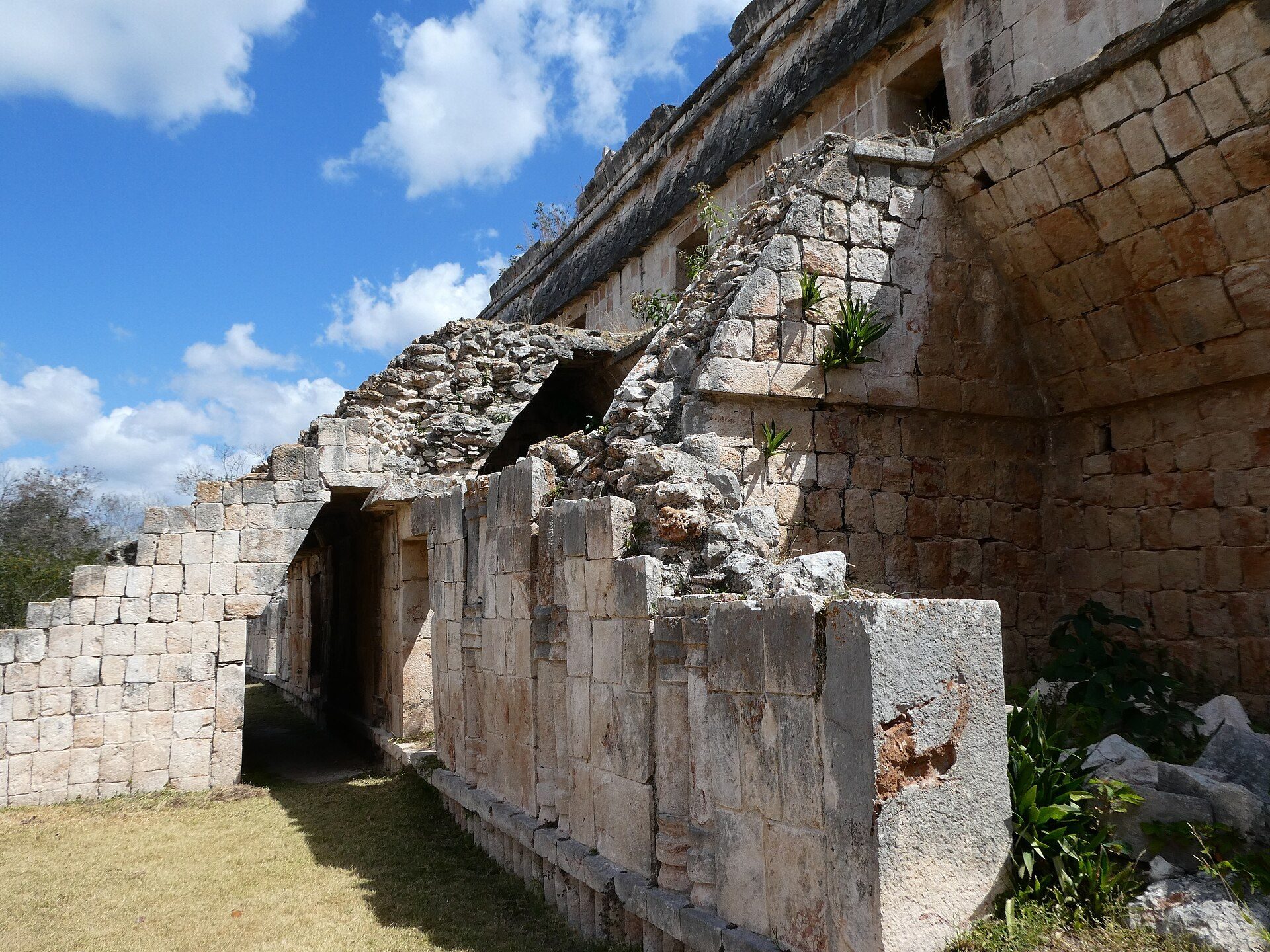
Projecting stairways over the two principal façades lead to the upper level. There, two corresponding rows of seven rooms open east and west, with a cross-room closing each end. The entrances supported by columns show minor differences in their positions. A two-level roof comb extends along the full length of the building above the wall dividing the upper room rows. Its lower façade has a continuous line of small columns between smooth bands, while the smooth wall surfaces are interrupted by three pairs of triple-offset columns. Much of the middle frieze and upper wall has not survived.
Teocalli and Structure 2C1
Teocalli, or Structure 2C3, is an almost square building arranged around a large rubble core. Its front faces north toward the court, and each side contains five rooms. Three entrances on the front and one at the rear have especially formal column arrangements. Plain lower and upper wall surfaces are separated by a simple frieze of two smooth bands, while stone projections in the upper wall probably supported stucco decoration.
The building’s simple base and three plain upper frieze rows place it in an early phase of Puuc architecture combining features of Puuc Types I and II. A second storey was planned from the beginning around the rubble core, with flying stairways on the north and east sides. The platform is substantially larger than the building, but severe ruin has left the plan as the clearest surviving evidence. The strongly symmetrical arrangement included opposed rows of rooms on the north and south sides and two adjoining cross-rooms at each end. Only wall starts remain for the inner rooms, and the presumed roof comb has not survived.
Structure 2C1 stands opposite Teocalli on the north side of the court. It is irregular, consisting of a five-room row with two additional groups behind it. Wall joints reveal several construction phases. The earliest part was a small three-room building with a central south entrance framed by two columns. One room opened from the rear, reversing the building’s general orientation. Later additions created a small court, another three-room building, and an irregular three-room rear extension. One unusually thick wall remains unexplained. The structure has undecorated wall surfaces, a simple base, and a plain middle band associated with Puuc Types I or II.
Structures 2C4, 1C1, and 2C7
Structure 2C4 adjoins Teocalli immediately to the northwest and has been reconstructed to the roofline. It contains three rooms, including a front room facing the court through an entrance formed by two masonry piers. Its thick walls could have supported a Maya corbel vault, formed by stone courses projecting inward until they meet above a room, although the approximately 3-metre room width approaches the limit of such a span. The building may therefore have carried a wooden roof. Five rooms extend northward along the edge of the high platform beside the staircase.
An unnamed building below the eastern platform consists of two mirror-image rows of three small rooms, with a cross-room at each end. About 200 metres east of Segunda Casa, Structure 1C1 forms a simple north-south row of five rooms. Its façade probably had smooth lower walls interrupted between the doors by groups of three massive triple-offset columns. The rear façade preserves a strong example of the Puuc column style, with a continuous row of tall triple-offset columns above an undecorated lower wall. Its three frieze bands consist mainly of low columns between smooth bands.
Structure 2C7 stands approximately 150 metres south-southwest of Structure 1C1. Its lower frieze contains very tall columns between bands, while pairs of tall offset columns decorate the smooth wall surfaces. Recessed columns form the corners in both the frieze and wall zones. The stonework is exceptionally well cut, but the building was never completed. Vault stones are absent from the rubble, and its southernmost room was never begun. The planned five-room arrangement placed a rear room only behind the central room, a pattern associated with the Chenes region.
The western and northwestern groups
The Great Pyramid and the sacbé arch
The western area contains the Great Pyramid, the only pyramid identified at Kabah. It has not been excavated, and the buildings around it remain largely uncleared. A court with a central altar lies to its south. Beside the pyramid stands the reconstructed monumental arch that marked the beginning of the raised road to Uxmal. The western group is otherwise largely inaccessible and includes additional temple and palace complexes, especially along a ridge west of the city centre.
Manos Rojas
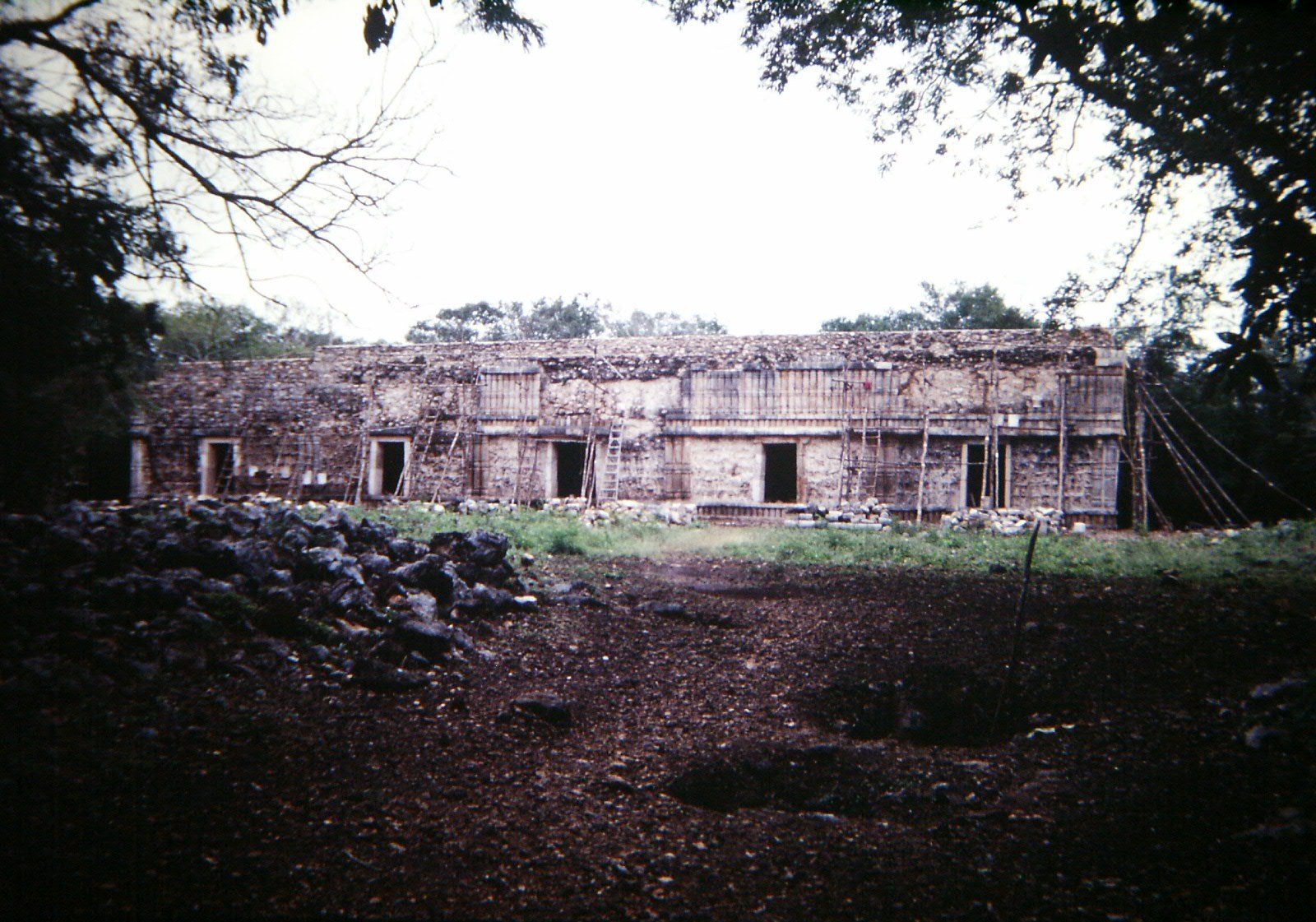
Manos Rojas, or Structure 1A1, is a partly reconstructed two-storey building that remained unfinished in antiquity. It is arranged around a rectangular rubble core, with rooms on all four sides. One room has a rear wall covered with ochre-coloured hand impressions, giving the building its name. On the east façade, a further rear row of rooms stands behind the front rooms.
Broad flying stairways rise from the east and west sides to the second-storey level. Their vaulted passages leave corridors parallel to the façades and provide access to two rooms beneath the stairways. These arrangements indicate that small upper structures were planned on both sides, although only the eastern one was built. It is a small temple with two rooms in succession and a richly decorated façade approaching the Chenes style. Stone slabs intended for its entrance carry the date 876, probably marking the abandonment of construction.
Structures 1A3 to 1A6
The group formed by Structures 1A3 to 1A6 represents an early settlement core on flatter ground east of Manos Rojas. It surrounds a small irregular court and was excavated in 2004. Structure 1A3, north of the court, has three rooms in a rear row and probably had a full-length front room with a columned façade, although excavation did not find columns.
Structure 1A6, south of the court, consists of two parallel rows of three rooms opening north and south. Its nearly complete southwest room displays early Puuc masonry without decoration, characteristic of early Puuc Subtype I. Centrally placed on the west side of the court, Structure 1A4 rises several steps above the surrounding level. It has two parallel north-south rows of rooms, with rear rooms entered through front rooms with two-column entrances.
A rubble core separates the rows of Structure 1A4 and supports a second-storey double room with entrances from east and west. Flying stairways once led to it from both sides, but they had been blocked in antiquity, probably for structural reasons. South of Structure 1A4, Structure 1A5 is the smallest building in the group. It contains three rooms in a single row and has an early Puuc Subtype IIb feature, a simple projecting frieze above a central entrance supported by columns.
Edificio de las Grecas
Edificio de las Grecas, or Structure 1A2, stands about 100 metres south of Manos Rojas on the same rise. It occupies the highest of several stepped terraces and faces east toward the centre of Kabah. Three structurally independent but physically connected building bodies make up the complex.
The first body has two parallel north-south rows of seven rooms, with most rooms opening toward their respective sides. It was built in two phases. The first extended from the central room northward and comprised two sets of four rooms. Southern rooms were added later, although the extension appears to have been planned from the beginning to complete the symmetry of the façade.
The central room projects slightly and has rounded corners in a Chenes manner. The southern extension is less precisely built and includes a northeastern corner column that also suggests Chenes influence. Most of the façade veneer has fallen, but a large surviving section of the west upper wall rests on a three-part middle cornice. It contains an angular meander and a diagonal row of decorative stones, features that give the building its name and place it within the late Puuc mosaic style. Four rooms were attached obliquely behind the building to the west, connecting it with a high but apparently unfinished platform.
The southwestern group
Structure 2A1
The southwestern group centres on two-storey Structure 2A1, which stands on a ridge facing an approximately rectangular court to the east. Two mirror-image buildings occupy the north and south sides of the court. Structure 2A1 has rooms on all four sides of a rectangular rubble core. Its eastern row of seven rooms projects beyond the sides of the main rectangular body and represents the oldest part. The rectangular section was added later, followed by an unusually large second storey that formed a third construction phase.
The upper body contains ten rooms around a relatively narrow rubble core, with an additional rear room on both the south and east sides. Flying stairways crossed the west and east façades to reach the second storey. Their vaulted passages left corridors along the façades and provided access to the rooms beneath them.
The east façade remains well preserved through the passage beneath the eastern stairway. It has strongly projecting cornice slabs, spool-shaped column elements, and a row of interlaced bands. At the southeast corner, a well-preserved section combines a smooth lower wall with the same spool-shaped and interlaced elements. The upper wall is filled with diagonal bands interrupted by pairs of triple-offset columns, while a cascade of Chaac masks forms the actual corner.
The court buildings
The two mirror-image buildings on the southwestern terrace each had three front rooms and a long rear room divided at both ends into small chambers. Remains of stucco reliefs survive on these buildings. Other groups outside the central core include Structures 1B2, 1B3, 1C1 to 1C3, and 3B1. The Northwest Group includes Structures 1A1 and 1A2 on a hilltop ridge at the western edge of the site. It overlooks the city to the east and faces the principal pyramid temple, Structure 1B2. The West Group includes Structures 1A7 and 1A8 and the court of Structures 2A1 to 2A3.
Sculpture and material preservation
Chaac masks occur on several buildings, while repeated stone-mosaic elements appear at a scale and frequency distinctive within Maya art. The sculptural remains designated M1 to M7 consist of pieces of former statues that may depict people, deities, or rulers. M1 appears to resemble a clenched hand and has been connected with one proposed interpretation of the name Kabah.
The stone buildings are also affected by microbial biofilms. Phototrophic organisms such as Xenococcus occur especially on interior walls, while stone-degrading bacteria including Gloeocapsa and Synechocystis have also been recorded. These organisms form part of the present condition of Kabah’s surviving architectural surfaces.