Unterböbingen Roman Fort and Settlement: A Raetian Frontier Garrison
Site at a Glance
- Country
- Germany
- Primary era
- Classical
- Eras represented
- Classical
- Civilizations
- Roman
- Site type
- Military
- Remains
- Fort
On this page17 sections
History
Frontier garrison
Unterböbingen Roman Fort and Settlement was a Roman military base and associated civilian community at Böbingen an der Rems, Germany. Roman forces established the fort to secure the Raetian Limes, the Roman frontier in the province of Raetia, after the frontier advanced into the Rems valley. The garrison occupied the site from sometime between AD 150 and 160 until no later than AD 266. Regional tree-ring dates place frontier works in the mid-160s, indicating that the fort had been built several years before that advance. It was administered from Aalen.
The fort’s size suggests a regular auxiliary cohort, a unit with a nominal strength of about 500 soldiers. It may have consisted entirely of infantry or included cavalry as well. The unit’s identity is unknown. Hans Ulrich Nuber proposed the Cohors VI Lusitanorum, but this identification remains unproven. Another possibility is that the garrison came from the fort at Urspring, which was abandoned after Rome moved the frontier into the Rems valley.
Garrison and civilian community
Soldiers at Unterböbingen could monitor about 20 frontier towers along a stretch of roughly 15 kilometres, from Herlikofen in the west to Kolbenberg in the east. A civilian settlement grew around the fort, housing people alongside the garrison.
Destruction and archaeological investigation
Burning around the headquarters and granary has been interpreted as evidence that the fort met a violent end. Its occupation had ceased by AD 266 at the latest.
The field name Bürgle preserved local knowledge of an old fortification. Eduard von Kallée, a retired chief of staff in the Württemberg army, excavated there in 1885 and 1886 and identified a Roman fort. Major Heinrich Steimle investigated the site in 1892 for the Imperial Limes Commission, a German body created to study the Roman frontier. Quarrying from 1930 to 1935 removed the fort’s front section, including a large hall associated with its headquarters, for road-building gravel.
Dieter Planck led extensive excavations of the remaining fort in 1973, before building development spread across the site. Work in 1975 examined parts of the civilian settlement and a probable roadside lodging station before archaeological evidence there was lost. Investigations resumed in 1978, and the temple area was examined again in 1981. The fort and associated remains form part of the Upper German-Raetian Limes, a UNESCO World Heritage property since 2005. They are also protected under Baden-Württemberg’s heritage law.
Remains
The fort stood on a raised spur above the south bank of the Rems, at about 409 metres above sea level. The ground rises to roughly 446 metres southeast of the site and drops westward towards the Klotzbach valley, where the stream joins the Rems. The river flows from east to west here. The frontier line ran along heights across the river and could be seen from the fort in places; its wall descended steeply into the valley west of the site, turned northeast, and climbed again.
Fort enclosure
Built of stone on a natural rock shelf, the fort was aligned approximately south to north and enclosed about two hectares. Its rounded-corner rectangular plan measured 148 by 135 metres, with the northern side facing the frontier. The enclosing walls were 1.2 metres thick. At least three ditches, each about eight metres wide and cut into bedrock, surrounded the fort.
Four gates, each flanked by a pair of towers, pierced the walls. The east and west gates each had two passages, while the southern rear gate had a single passage. The southern passage at the west gate was later blocked. Only the eastern tower of the northern gate survives; it measured 4.475 metres wide. Ground-level entrances into the identifiable towers were two metres wide. Trapezoidal towers occupied the corners, and rectangular intermediate towers stood against the east and west walls in the fort’s rear section. Herringbone-pattern masonry was identified in the southeast corner tower and eastern intermediate tower. Foundations along the walls may have supported artillery towers, including a square structure beside the northwest tower.
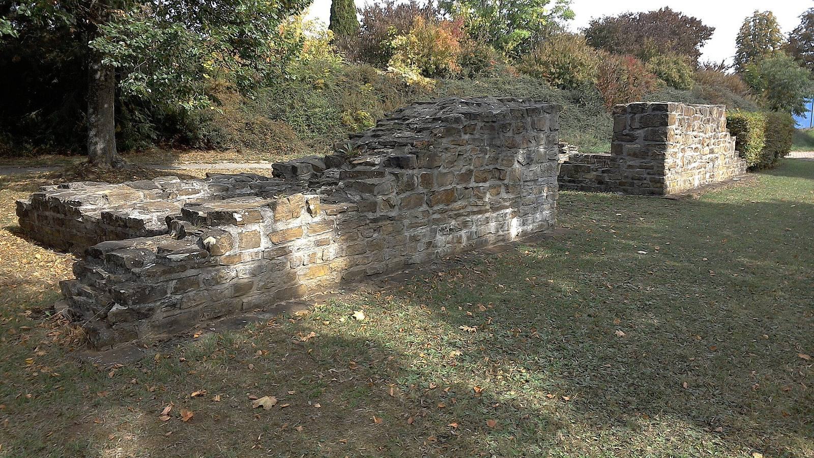
Most of the fort has been built over or destroyed. Surviving portions include the southeast gate, the southeast corner, and sections of the east wall with an intermediate tower.
Buildings within the fort
Central hall and headquarters
A multipurpose hall measuring 57.4 by 16 metres stood where the camp’s two main roads crossed and extended across one of them. Behind it, the headquarters building had rooms arranged around a rectangular courtyard with a colonnade. At least three heated rooms at the rear flanked the central shrine for the unit’s standards. The shrine projected beyond the back wall in a semicircular form.
Granary and commander’s residence
The granary stood west of the headquarters building, alongside its long wall. Its floors rested on stone piers. To the east was the commander’s residence, built partly of timber. Its heated rooms were made of stone. Several rooms on substantial foundations may have formed a bath: two were heated, while an eastern room with a projecting end was interpreted as a cold bath. Stone robbing has made parts of the remains difficult to interpret.
Other camp structures
A stone building in the front part of the fort was once identified as a barrack, although its purpose is uncertain. Remains of burned timber buildings lay beneath it. In the rear section, a drainage channel cut into the bedrock ran beside the road following the inside of the fort’s perimeter. It emptied into the innermost ditch south of the southeast corner tower and contained small finds.
Civilian settlement
Roadside buildings
The civilian settlement extended south, southeast, and east of the fort. About 80 metres east of the fort, south of the ancient road to Aalen, excavations uncovered four mainly long, rectangular buildings that may have formed a lodging station for travellers. Almost every room had underfloor heating and glass windows. Long courtyard walls separated the buildings, and one house contained an oven. The foundations suggest that the upper walls were timber-framed. Finds included many glass vessels and reused bricks stamped with the name of the First Raetian Cohort, a unit based at Schirenhof.
Temple building
About 100 metres southeast of the fort’s southeast corner, post trenches and pits probably belonged to an early settlement phase. A rectangular building measuring 13 by 9.4 metres stood above them. Its eastern rear wall had a central rectangular projection measuring 4.8 by 2 metres. The main entrance faced west, where a timber porch was supported by four posts. Stone robbing left only the lowest foundation layers. A heated annex against the south wall measured 4.4 by 5 metres; in a later phase it was extended eastward to 7 by 5 metres and continued to be heated from the east.
The building is interpreted as a temple, based on comparisons with similar remains in the Roman provinces of Germany and Britain. Finds place it in the second half of the second century AD. Objects recovered there included small glass bottles with thread wound around them, a silver spoon, weapons, and a bronze plate retaining the foot of a statuette. A stone head from a female sculpture was found just outside the building during levelling work in 1981.
Bath and archaeological finds
Military bath
The military bath stood north of the fort on a high terrace at the edge of the Rems valley. A well-preserved bronze yoke fitting was found among its rubble. The bath was also used by people from the civilian settlement.
Diploma and military objects
Finds from the fort include brooches, coins, a silver spoon, a gilded letter from an inscription, military belt fittings with openwork decoration, and pieces of horse harness. A bronze thumb from an oversized statue in armour probably belonged to a representation of an emperor.
A bronze military discharge document fragment, measuring 41 by 34 millimetres, came from the fort’s northeastern front section, 28 metres behind the north wall. It is assigned to the first half of the second century AD, although its date is not secure. The text names a man whose name may have been Strobilus and refers to a check against a bronze tablet displayed in Rome behind the Temple of the Deified Augustus, near the Temple of Minerva. Strobilus may have received the document after AD 134, following 25 years of service. The fragment does not identify the fort’s garrison.
Statuettes and burials
A bronze statuette of the war god Mars, 19.4 centimetres high and dated to the second or third century AD, was found about 110 metres southeast of the southern gate in 1962, together with iron objects. An 11.8-centimetre bronze statuette of Jupiter, Rome’s chief god, was found in Rems gravel 11 kilometres downstream in 1926. It may have come from the fort or its civilian settlement, but its origin is uncertain.
Several cremation burials may have been uncovered during building work west of the fort, on the eastern slope of the Schlierbach.