Ulsan Castle: A Japanese Defensive Stronghold in Korea
Site at a Glance
- Country
- South Korea
- Primary era
- Early Modern
- Eras represented
- Early Modern
- Civilizations
- Toyotomi regime
- Site type
- Military
- Remains
- Castle
On this page14 sections
History
Ulsan Castle is a Japanese-built fortress in South Korea, erected in 1597 during the Imjin War, Japan’s invasions of Korea from 1592 to 1598. It stood on the site of an earlier fortress from Silla, an ancient Korean kingdom, and became a frontline base where two major battles were fought.
Construction during the Imjin War
After Japanese forces were blocked in Chungcheong and withdrew toward the southern coast, they began building the castle. Work probably started in October or November 1597. Kato Kiyomasa, a Japanese military commander serving ruler Toyotomi Hideyoshi, is credited with designing it; Ota Kazuyoshi supervised construction. Regional lords from western Japan, including Mori Hidemoto and Asano Yoshinaga, took part with some of Kato’s troops. Builders also reused stone and other materials from parts of Byeongyeong Fortress and Ulsan town fortress.
Kato transferred his garrison from Seosaengpo Waeseong to Ulsan on December 4, 1597, making the new castle a Japanese defensive base on the front line. In late December, a Joseon-Ming allied army besieged it. Joseon was Korea’s ruling dynasty, and Ming China had joined the conflict as its ally. The force of nearly 60,000 was commanded by Yang Hao, a Ming general.
Sieges and withdrawal
The Japanese garrison initially had little stored food. During the siege, defenders ate horses and drank urine. After about ten days, relief forces led by Mori Hidemoto and Kuroda Nagamasa reached the castle, and the allied army was defeated. The defenders then strengthened the fortifications with three lines of walls.
The castle withstood another allied attack in September 1598. Following Hideyoshi’s death, Japanese forces began withdrawing from Korea. They set fire to Ulsan Castle on November 18, 1598, ending its use as a Japanese stronghold. The siege had exposed how blockades could cut off food and water and cause severe losses. These problems influenced Kato’s later planning of Kumamoto Castle, which included about 120 wells and mats made with edible taro stems to help sustain defenders during a siege.
Later uses and changing names
After the Japanese withdrawal, Joseon naval forces used the site as a base for a time. From 1624, it also housed a shipbuilding yard that produced warships for about 30 years.
Joseon and Ming forces called the fortress Dosan Castle, after the mountain on which it stood; it was also known as Rice-Steamer Castle. The name Hakseong, meaning Crane Castle, became established in the late Joseon period, and the surrounding area was also called Hakseong-ri. A Joseon gazetteer begun under King Jeongjo and published under King Gojong records the name Sinhakseong. A separate fortress from the earlier Goryeo dynasty is now considered a more likely origin for the Hakseong name. During Japanese colonial rule, the site was formally called Ulsan Hakseong. In 1997 it was named Ulsan Waeseong, using the Korean term for a Japanese-style castle built in Korea during the invasions.
Modern changes and protection
In 1913, local notable Kim Hongjo established a park on nearby land, planting black pines, cherry trees and plum trees. He donated it to Ulsan Township in 1928. The site had been designated a historic site during the colonial period. On January 21, 1963, South Korea designated it Historic Site No. 9 under the name Ulsan Hakseong. It was removed from that list in 1997 as colonial-era designations were reassessed, then classified on October 30 as Ulsan Metropolitan City Cultural Heritage Material No. 7, a local category for protected historic properties.
Remains
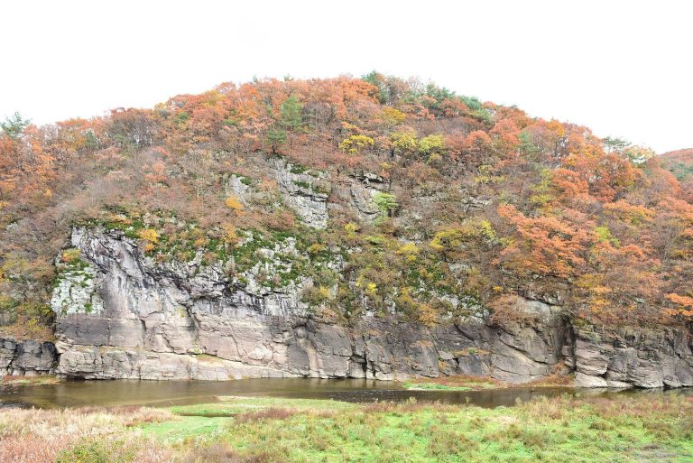
The castle occupied an isolated hill rising about 50 metres above a plain. Three enclosures were set at different heights around its summit, with stone walls following the slopes and earthworks and wooden defenses protecting the other sides. When the castle was built, the Taehwa River estuary reached its southern foot, where boats could berth at high tide. A stone marker associated with the landing place remains. Sediment later shifted the estuary eastward, and reclamation turned the former channel below the castle into housing.
Hilltop enclosures and defenses
The three enclosures
The principal enclosure, or Honmaru, stood at about 45 metres elevation and measured roughly 100 metres east to west by 60 metres north to south. The second enclosure, the Ninomaru, lay to its north at about 35 metres and measured about 100 by 40 metres. Northwest of the principal enclosure, the third, or Sannomaru, stood at about 25 metres and measured about 40 metres east to west by 100 metres north to south. The castle keep had a linked, compound arrangement, and a keep platform is identified among the remains.
Stone enclosure walls
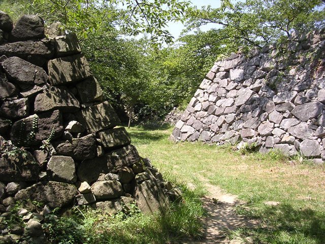
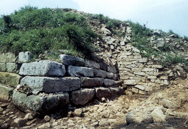
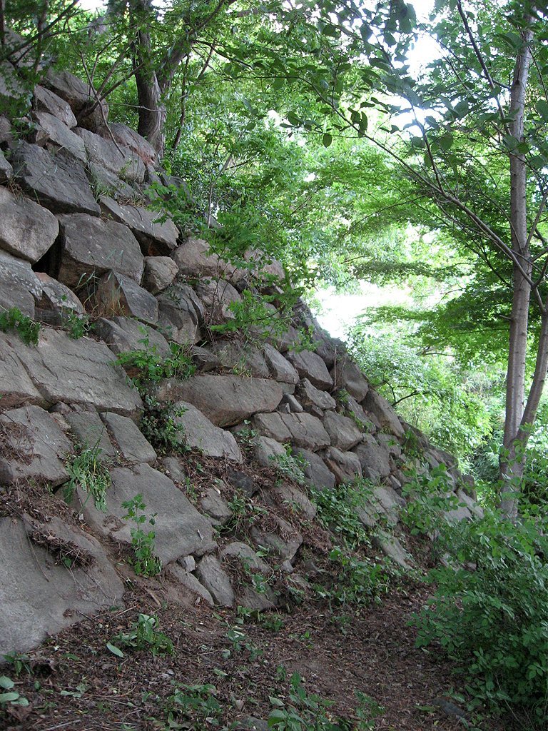
Three stone walls encircled the enclosures for a combined length of about 1.3 kilometres, rising between 10 and 15 metres. The Asano family construction inventory lists 12 large and small towers, about 632 metres of walling and roughly 2.6 kilometres of outer-enclosure walling. Builders set large stones along the outer face and filled the core with rough rubble. The face sloped outward, with small stones wedged between larger cut blocks. Near the face, rows of core stones ran along the rising walls and were stacked in steps, a method intended to help the core hold together if the outer surface collapsed. The construction combined Japanese and Korean fortification methods.
A 1985 investigation identified a stone wall climbing the slope and joining the second enclosure. It also recorded three curved and two inward-curving sections of enclosure wall, along with features interpreted as possible gate sites.
Earthworks and wooden defenses
Earthworks and wooden palisades guarded the three sides other than the south. The palisades stood above earthen barriers, with firearms positioned along the defensive line. The castle also had 12 watchtowers, gates and moats.
Walls beyond the hilltop
Eastern earthen wall
East of the castle, an earthen wall extended about 500 metres across level ground toward Dongcheon, passing near present-day Ulsan Jungang Girls’ High School. Its base was about eight metres wide and narrowed upward. Builders raised it quickly with earth taken from nearby fields and homes. Post holes indicate that a wooden palisade stood along it at intervals of about 1.5 metres. Housing development has made the wall’s former scale and character difficult to discern.
Southwestern stone wall
A separate wall section lies on level ground about four metres above sea level, southwest of and apart from the hilltop enclosure. Its outer face slopes at about 50 degrees. Small rubble and gravel about the size of chestnuts were packed behind the outer stones for roughly two metres, while the inner side was built up with compacted earth. Rows of stones within the fill indicate that the wall was constructed in stages.
Present condition
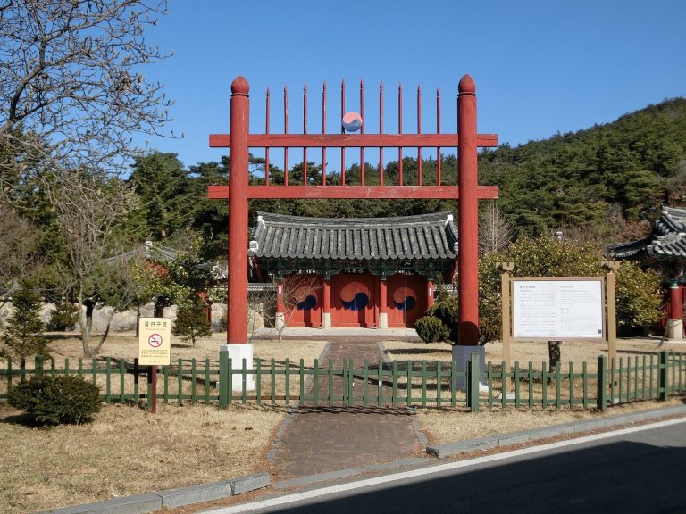
Hakseong Park now occupies the former castle grounds. Park development and urban expansion have damaged the northwestern wall and much of the second and third enclosures. The wall of the principal enclosure and traces beside the river remain visible. The park also displays the Ulsan Taehwaji Twelve Zodiac Sarira Pagoda, a Buddhist reliquary structure associated with sacred relics.