Tunnels of Claudius: A Roman Hydraulic Project in Italy


Site at a Glance
- Rating
- 3.7
- Popularity
- Low
- Country
- Italy
- Primary era
- Classical
- Eras represented
- Classical, Modern
- Civilizations
- Italian, Kingdom of the Two Sicilies, Roman
- Site type
- Infrastructure
- Remains
- Tunnel
On this page14 sections
History
The Tunnels of Claudius are a Roman hydraulic project in Italy, extending through Mount Salviano between Avezzano and Capistrello in the Marsica region of Abruzzo. Begun under Emperor Claudius in AD 41, the works formed part of a Roman effort to regulate Lake Fucino and control its unstable water level. The project protected lakeside settlements from flooding and marshes, while making exposed land more suitable for cultivation.
Planning the Fucine drainage system
The Marsi had appealed to Rome because Lake Fucino repeatedly changed level. Its only natural swallow-hole, at Petogna near Luco dei Marsi, often became blocked. During summer, the retreating water left marshy ground around settlements and contributed to severe sanitary problems, including malaria. Julius Caesar had also considered a road across the Apennines linking the Tiber with the Adriatic, but his death prevented that plan from beginning.
An easier drainage scheme would have taken the lake through Cesolino Hill into the Salto, then onward through the Velino, Nera, and Tiber toward Rome. This route was rejected because the volume of water was thought to threaten the capital with flooding. The more difficult alternative carried the water through Mount Salviano to the Liri River, and this became the basis of the Claudian project.
The Claudian works
Claudius resumed construction in AD 41, provided substantial public funding, and placed the work in the hands of a Roman company. About 30,000 people took part, including enslaved workers, masons, carpenters, and smiths. Working largely by hand, they excavated an underground route through the mountain. The system was completed in AD 52 after eleven years and was regarded in antiquity as one of the greatest hydraulic enterprises.
Construction relied on inclined service tunnels, descending galleries, and many wells. These openings multiplied the points from which the main tunnel could be excavated, while also providing ventilation, routes for removing spoil and water, and access for workers and equipment. Landslides in weak, sandy sections of the mountain created serious difficulties. Problems also affected the dam or lock between the Roman storage basins and the emissary entrance near the Fucine Inlet.
After the works were completed, Claudius marked the occasion with a naumachia, a staged naval battle, on Lake Fucino. Agrippina the Younger, his wife, and the young Nero were present. Suetonius connects the spectacle with the phrase “Ave, Caesar, morituri te salutant,” and describes opposing Rhodian and Sicilian fleets. The emissary initially proved too shallow, so its outlet was dammed and the tunnel was excavated farther before the system was put into operation.
Roman operation and decline
The project regulated Lake Fucino rather than draining it completely. It reduced the lake basin by approximately 6,000 to 8,000 hectares and removed much of the danger from flooding. Agriculture and the economies of Alba Fucens, Lucus Angitiae, and Marruvium subsequently flourished, while the surrounding mountain districts became places of retreat.
Clearance and maintenance were probably carried out under Trajan, who ruled from AD 98 to 117, and certainly under Hadrian, whose reign lasted from AD 117 to 138. The system later fell into neglect, became blocked, may have been reopened under Hadrian, and was blocked again before AD 235. After the fall of the Roman Empire and the barbarian invasions, regular maintenance ceased. The channels eventually filled, probably also as a result of major earthquakes between the second half of the fourth century and AD 508, and the lake returned to its earlier levels.
Restoration and reclamation
Several later rulers attempted to revive the Roman drainage system. Frederick II of Hohenstaufen tried to restore the emissary in the thirteenth century. Ferdinand IV, king of Naples, pursued another attempt between 1787 and 1789, with planning involving Niccolò Carletti, Ferdinando Ruberti, and the architect Ignazio Stile. These efforts failed because of limited funds and the complexity of the undertaking.
From 1826, Luigi Giura and Carlo Afan de Rivera made further attempts to restore part of the emissary’s function. King Francis I of the Two Sicilies assigned Afan de Rivera a new plan. Alessandro Torlonia resumed the work in 1854 with the Swiss engineer Franz Mayor de Montricher. Construction was completed in 1870 under Henry Samuel Bermont and Alexandre Brisse, assisted by Léon De Rotrou. Progressive drainage began in 1873, and reclamation was completed between 1875 and 1876.
The nineteenth-century project substantially rebuilt and enlarged the Roman emissary, tunnels, and inlet works. Lake Fucino was officially declared drained on 1 October 1878, after which many former fishermen became farmers. The reclaimed basin developed into a fertile plain of more than 14,000 cultivated hectares, producing cereals, potatoes, vegetables, and sugar beet. The sugar beet was processed at the Avezzano sugar refinery.
During the first half of the twentieth century, the Torlonia family built a second emissary as a backup for the main tunnel during extraordinary maintenance. Its outlet at Canistro lay near Torlonia hydroelectric infrastructure in the Roveto Valley, which supplied power to the Avezzano paper mill and sugar refinery.
The tunnels were declared a monument worthy of preservation by the Italian Ministry of Public Education in 1902 and were included among Italy’s national monuments. The Archaeological Park of Claudius was established in June 1977 between the tunnel entrances and the Fucine Inlet to protect and enhance the hydraulic complex. The site was included in the FAI “Places of the Heart” initiative in 2016.
Remains
Emissary and inlet system
The complex is organized around a long underground emissary, six inclined service tunnels, and numerous vertical wells. The emissary begins at the Fucine Inlet south of Avezzano, crosses Mount Salviano, and discharges into the Liri beneath Capistrello. It extends for more than 6 kilometres, has a cross-section varying from 5 to 10 square metres, an average flow of approximately 9.09 cubic metres per second, a total fall of 8.44 metres, and an average gradient of 1.50 metres per kilometre.
At Borgo Incile, the emissary meets a collector canal that gathers water from other channels of the plain, including the Giovenco and smaller mountain streams. The collector runs toward the Bacinetto, a lower reservoir created by Alessandro Torlonia to store water for use during extraordinary maintenance. The modern inlet connects the collector with the underground emissary through storage basins and a lock or sluice bridge, allowing the discharge into the Mount Salviano tunnel to be regulated.
The Torlonia emissary follows much of the Roman route. The earlier Roman section can be observed near the Fucine Inlet and near the outlet at Pisciacotta beneath Capistrello. Some underground stretches retain Roman masonry in opus reticulatum, a technique using small diamond-set blocks in a net-like pattern. The nineteenth-century enlargement altered or destroyed some features above ground, while remains of temporary scaffolding were found in weak-rock sections during the renovation.
Fucine Inlet headworks
The Fucine Inlet combines Roman hydraulic infrastructure with the principal nineteenth-century headworks. Its monumental treatment includes a stone statue of the Immaculate Conception of the Blessed Virgin Mary, executed in 1876 by Carlo Nicola Carnevali, an architect employed by the Torlonia household. The complex contains two water-storage basins, one trapezoidal and one hexagonal, together with three gates.
Wells and excavation routes
The system is commonly described as having 32 wells, while a construction account records at least 40, including 29 on the western side and 11 on the eastern slope. The wells have square sections and range from 19 to 122 metres in depth. Well no. 22 reaches 122 metres, and the wells on the western side generally exceed 80 metres.
The wells and inclined tunnels supported excavation, ventilation, the removal of spoil and water, and the movement of workers and equipment. Beneath the deepest part of Mount Salviano, wells could not be sunk. Excavation there crossed loose rock and pebbles and required a change of alignment. Temporary supports were needed in other weak sections, and some of their remains survived into the Torlonia renovation.
Inclined service tunnels
Major Tunnel
The Major Tunnel lies on the eastern side of Mount Salviano near Colle degli Stabbi, formerly called Mount Terrentino. Its entrance has three large arches that merge after a short interior stretch. Farther inside, an oblique service passage called the bypass branches from the main route. The descending gallery was built with the fori pontai technique, using holes associated with temporary construction platforms or scaffolding.
Blacksmith Tunnel
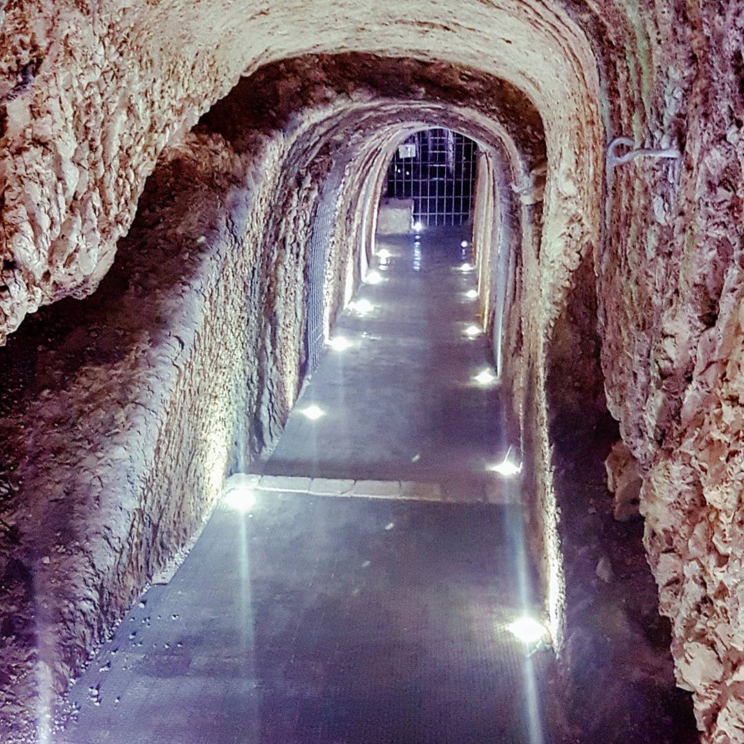
The Blacksmith Tunnel is also on the eastern side of the mountain and gives access to the tunnel-and-well system. Its first section has been paved and fitted with lighting, while a bypass links it with the Major Tunnel. Its name comes from the smiths who worked nearby during the construction of the Roman system.
Imperial Tunnel
The Imperial Tunnel lies slightly below the Blacksmith Tunnel, between wells 23 and 24. Its inner end intersects well no. 23.
Calderaro, Machine, and Oil-Lamp Tunnels
The Calderaro Tunnel is on the western slope of Mount Salviano, between wells 21 and 22. Farther south, in the Palentini fields beyond Valle Fredda, the Machine and Oil-Lamp Tunnels lie between wells 9 and 15. Together, these inclined routes formed the supporting excavation network through which the main emissary was driven.