Träleborg: A Prehistoric Hillfort near Falköping, Sweden
Site at a Glance
- Rating
- 4.3
- Popularity
- Very Low
- Country
- Sweden
- Primary era
- Stone Age
- External website
- Open
- Eras represented
- Stone Age
- Civilizations
- Unclassified
- Site type
- Military
- Remains
- Fort
On this page9 sections
History
Träleborg, also known as Mösseberg Hillfort, is a prehistoric defensive hillfort in Sweden near Falköping. Built during the prehistoric period, it occupies the northern tip of Mösseberg on the rocky elevation called Stångaberget. Radiocarbon analysis of scorched earth from its ramparts has produced a date of approximately 2800 BC, placing the proposed construction in the later Neolithic, the New Stone Age period when farming communities became established in northern Europe.
Strategic position and possible functions
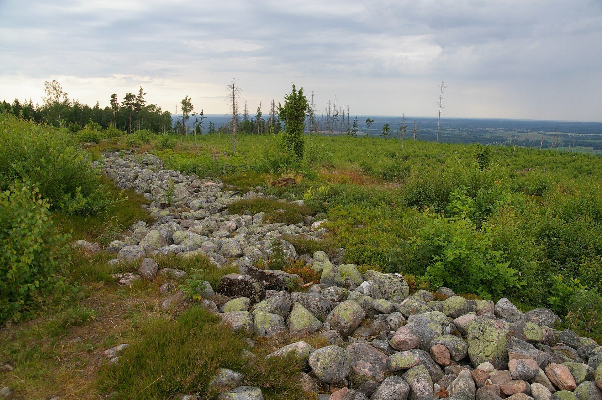
Träleborg stands above the route between Lake Hornborgasjön and Mösseberg. From this elevated position, people could observe travelers on the road and boat traffic on the lake. The view extended for about 50 kilometers in most directions, although Mösseberg blocked the view to the southeast. These advantages help explain the hillfort’s defensive character, but its exact purpose remains uncertain. Its large enclosed area would have been difficult to defend completely, and interpretations have included a refuge, a protected settlement, and a religious center.
Comparisons have also been made with fortified settlements associated with Slavic communities and with Stone Age fortified structures in northwestern Finland. The enclosed area could have accommodated about 300 farmsteads during a siege. Approximately 300 archers, positioned around two meters apart, would have been needed to defend the palisades. Experimental construction estimates suggest that the walls required about 2,500 person-days in theory, or about 5,000 person-days under practical conditions. A group of 100 people might therefore have completed the work in about two months, excluding the transport of stone, woodland clearance, and construction of the palisade.
Beacon system and later surveying
Träleborg formed part of a beacon-signaling system in which fire and smoke signals passed between local hundreds, the historical administrative and judicial districts of Scandinavia. A working beacon stood in the courtyard until the middle of the nineteenth century. The land-surveying authorities later used the site for a triangulation point, a surveyed reference point used to map an area through geometric measurements. The name Stångaberget comes from the pole on which the beacon was raised.
Dating and archaeological investigation
Einar Magnusson measured and mapped Träleborg in 1933 without excavating it. Students from Uppsala University’s Department of Archaeology, working with the Skaraborg County Museum, investigated three wall sections in 1985 and 1986. The ramparts contained earth and small stones covered by dumped gray stone. The earth had been burned and darkened by soot and charcoal, leading to the interpretation that the hill had been burned before the fortification was built and that the scorched earth was reused as wall fill.
Radiocarbon dating estimates age by measuring the decay of radioactive carbon in organic material. Analysis of the scorched earth produced a result of 4,880 plus or minus 350 years before present, corresponding to approximately 2800 BC. The early date was initially viewed skeptically because the surrounding region has produced Migration Period gold, including the Ålleberg Collar and the Timboholm Treasure. The Migration Period belongs to the first millennium AD and is therefore much later than the proposed Neolithic date for Träleborg.
A competing interpretation held that the scorched earth came from slash-and-burn agriculture about 3,500 years earlier and later became mixed into the wall material during construction. Later dates from other prehistoric hillforts and earthworks made an early date for Träleborg more plausible. Stone Age settlements around the southern end of Lake Hornborgasjön and the many Stone Age burial chambers in Falbygden, the agricultural district around Falköping, are consistent with the possibility that early farmers built the fortification.
Later names and traditions
Träleborg has also been called Skansen, Förskansninga, King Albrecht’s Redoubt, Margaret’s Redoubt, and Skansarögga. The two names connected with King Albrecht and Queen Margaret derive from a local story that Queen Margaret imprisoned Albrecht of Mecklenburg at Träleborg after his defeat at the Battle of Åsle. Albrecht was a fourteenth-century king of Sweden, while Margaret was the ruler who united Denmark, Norway, and Sweden under the Kalmar Union. The story is regarded as a legend rather than reliable history, since Albrecht was imprisoned at Bohus Fortress.
A 2.3-kilogram cannonball found within the hillfort has an uncertain connection with the site. It may have been a lost peasant object. Danish forces raided Västergötland several times during the sixteenth and seventeenth centuries, including during the Nordic Seven Years’ War, a conflict between Denmark-Norway and Sweden from 1563 to 1570.
Changes to the surrounding landscape
Until about 150 years ago, Stångaberget and Mösseberg consisted mainly of heath and marshland with scattered trees and shrubs. Livestock grazed on the slopes. Large areas of Mösseberg, including the hillfort courtyard and its surroundings, were planted with spruce in the late nineteenth century. The trees became too tall for Träleborg to serve as a viewpoint after the 1930s. Most of the woodland within and around the hillfort was felled after storm damage in the late 1990s, restoring the long-distance views associated with its elevated position.
Remains
Träleborg occupies the high northern tip of Mösseberg above Lake Hornborgasjön. The lake lies about five kilometers to the north and 170 meters below the hillfort. The enclosure has a circumference of approximately 1,150 meters and covers about 20 hectares, or 200,000 square meters. Its fortifications follow the mountain’s contours, while the steep western slope and cliff provide natural protection. The site overlooks the route between the lake and Mösseberg, and the surviving earthworks preserve the relationship between the elevated enclosure, its approaches, and the surrounding landscape.
Stone ramparts and palisades
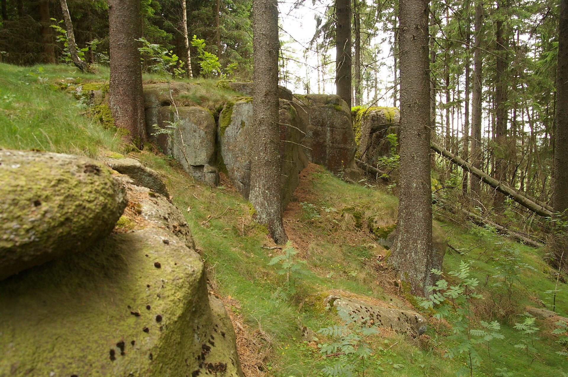
About 770 meters of stone ramparts enclose the hillfort on three sides. They range from 1 to 16 meters in width and from approximately 0.2 to 2 meters in height. Dry-laid gray stone, sand, and earth form the walls, whose total volume is estimated at about 5,000 cubic meters. Much of the stone was brought from the foot of the mountain rather than collected within the enclosure. Postholes in the ramparts indicate that a wooden palisade was set into the walls, giving the name Träleborg a likely connection with an old word meaning “fence” or “trellis.”
Four rampart sections, together measuring about 420 meters, were built as double walls along relatively level ground. The gap between the walls varies from 5 to 18 meters and may have served as a controlled passage for movement into and out of the fortification. The gates were offset from one another, so an attacker moving through the entrance would have exposed unprotected parts of the body. Along the western side, an approximately 80-meter-deep slope ends in a cliff at the crest and provides the principal natural defense.
Courtyard and water sources
The courtyard extends across approximately 20 hectares. Four hollows collected rainwater and snowmelt. One lies beside the western cliff, while three are positioned near the eastern double wall, where traces of a ditch also survive. Cesarbäcken flows about 400 meters east of the hillfort and could have supplied water when the gates were open.
The rampart investigations revealed earth darkened by soot and charcoal beneath layers of small stones and gray stone. This material preserves evidence used in the debate over the fortification’s age and construction. The stones also show where posts once stood, linking the surviving earthworks with the palisade that probably crowned them.