Tarout Castle: A Historic Fortress on Tarout Island, Saudi Arabia


Site at a Glance
- Rating
- 4.4
- Popularity
- Medium
- Country
- Saudi Arabia
- Primary era
- Medieval
- Eras represented
- Bronze Age, Medieval
- Civilizations
- Dilmun
- Site type
- Military
- Remains
- Castle
On this page25 sections
History
Tarout Castle is an archaeological fortress on Tarout Island in Saudi Arabia, standing on Tarout Hill near the center of the island. The castle is generally associated with the Uyunid period, a medieval dynasty that ruled much of eastern Arabia from approximately 1076 to 1238, although its builder and original purpose remain uncertain. The hill itself preserves a much older history, with settlement beginning during the Ubaid period in the fifth millennium BC and continuing into the Dilmun period.
Prehistoric and Dilmun settlement
Tarout Hill is estimated to be about 5,000 years old. Excavations indicate that its earliest identified remains belong to the second Ubaid period, approximately 4300 to 4000 BC. Occupation continued into the third millennium BC, when Tarout formed part of the wider world of Dilmun, an ancient Gulf civilization centered in eastern Arabia and Bahrain. The archaeological sequence associated with the mound extends broadly from about 4300 to 500 BC.
The mound’s early layers contain evidence of connections with Mesopotamia. Large vessels from the lower deposits resemble Jemdet Nasr pottery, dated approximately 3100 to 2900 BC, while orange-yellow pottery associated with the Early Dynastic period, approximately 2900 to 2350 BC, was found beneath the castle foundations. Surveys and excavations have also identified several forms of third-millennium Dilmun pottery, including cylindrical, bell-shaped, and ribbed jars, deep bowls, curved-sided plates, and cups.
Medieval origins and Portuguese occupation
The castle is commonly believed to have originated during the Uyunid period, possibly in 1076. Other interpretations place its construction in the Portuguese period, between 1515 and 1521, while some local historians connect it with the Qarmatian period. The structure was built over an earlier building interpreted as a temple dedicated to Inanna, Ishtar, or Astarte. Inanna was a major Mesopotamian goddess associated with fertility, love, sexuality, and political power. The island’s name is traditionally linked with this group of related divine identities, although the precise reason for the name remains uncertain.
Portuguese forces occupied the Qatif region and used Tarout Castle as a defensive position. It formed part of their effort to control commercial routes in the Gulf and support their stronghold at Hormuz. On 29 March 1544, corresponding to 1 Jumada I 951 AH, Portuguese forces restored the castle. Their occupation lasted for a limited period before they abandoned their Gulf fortifications and withdrew from the region. Portuguese power in the Gulf continued until 1650, but it declined after Turkish attacks on Portuguese positions in Qatif and elsewhere in 1551 and 1552, and after Shah Abbas expelled the Portuguese from Bahrain in 1602.
Defense and local administration
Tarout Castle served several military and administrative purposes. It protected Deira, accommodated soldiers, stored supplies and ammunition, and provided an office or headquarters for a governor. Fires acted as warning signals, with smoke visible during the day and flames at night. This system connected Tarout with nearby settlements and fortifications, while also helping observers monitor ships passing through the surrounding waters.
The castle became involved in the conflict between Saudi forces and Banu Khalid in 1791. After the Khalidi commander Abdullah bin Suleiman al-Mahshuri was defeated at al-Jarudiyah, he withdrew to Tarout Castle. Saudi forces led by Fahd bin Afisan and Ibrahim bin Afisan besieged the fortress with a combined force of 3,000 men. The siege continued for twenty days and included artillery bombardment. The attack damaged the eastern half of the castle and parts of the northern wall, after which Saudi forces took control of the castle and the wider Qatif region.
Political struggles continued to affect Tarout during the nineteenth century. After the death of Imam Turki bin Abdullah Al Saud in 1834, Sheikh Abdullah bin Ahmed Al Khalifa seized Tarout and Darien. Later, a leader known as Mushrif, associated with the Amir tribe, took refuge in the castle after a failed revolt against Saudi authority. A Saudi attempt to storm the fortress failed, and the Emir of Bahrain responded with a naval blockade of Qatif and Uqair.
Ottoman administration and later conservation
From 1871 to 1912, during the late Ottoman period, Tarout belonged administratively to the Qatif district in the Najd Brigade, which was attached to the province of Basra. The castle was in poor condition and held a Turkish force of ten men. Their duties probably included guarding the site, maintaining artillery, managing the Ottoman flag, and controlling the village gates.
Ottoman authorities ordered repairs in 1872 under the governor Ahmed Medhat Pasha, a senior Ottoman administrative and military official. The northwestern tower collapsed sometime between 1872 and 1888, while the associated spring and bath facilities were neglected or filled. The southeastern tower later collapsed in approximately 1916 or 1917, reportedly because of rain.
Archaeological investigations by foreign researchers and expeditions, including the Danish expedition led by Geoffrey Bibby during the 1960s, examined the hill and castle area. Their work and later field surveys brought attention to the prehistoric settlement and recovered pottery, statues, and other material connected with Tarout’s early occupation. The Saudi Ministry of Antiquities restored the castle and some of its parts in 1984, but the work stopped before completion for reasons that remain unknown.
Later conservation efforts addressed the castle, the surrounding village fabric, and Ain al-Awda. Between 2007 and 2018, government and municipal bodies announced or undertook conservation, excavation, fencing, restoration, and rehabilitation initiatives. A 2011 intervention cleaned the spring, reinforced its deteriorated walls, and temporarily restored its water flow, although the spring later dried again. Continued neglect, erosion, rain, and structural cracking have threatened the surviving towers and walls, while the castle has remained closed to official visitors.
Religious and local traditions
Ain al-Awda and its associated bath formed part of Tarout’s social and religious life. The spring was traditionally regarded as sacred. Women used it for washing clothes and bathing, and men later used it as well. Its sulfurous water attracted residents, sailors, and divers from the eastern Arabian coast and the Gulf. Traditional practices included bridal bathing processions to Ain al-Awda and other springs.
Local traditions also describe islanders jumping from the northern tower into the spring when the water was deep, from a height of about 27 meters. Stories tell of a supernatural creature living in the spring and of a hidden passage leading to Darien. These traditions remain part of the site’s local historical memory.
Remains
The mound and castle plan
Tarout Castle occupies a raised mound formed from clay, earth, and large limestone fragments. Beneath the fortress are polished and regularly arranged stone foundations, probably belonging to one or more buildings from the third millennium BC. Stone foundations and other remains of the earlier building interpreted as a temple are visible particularly near the northern tower and the spring.
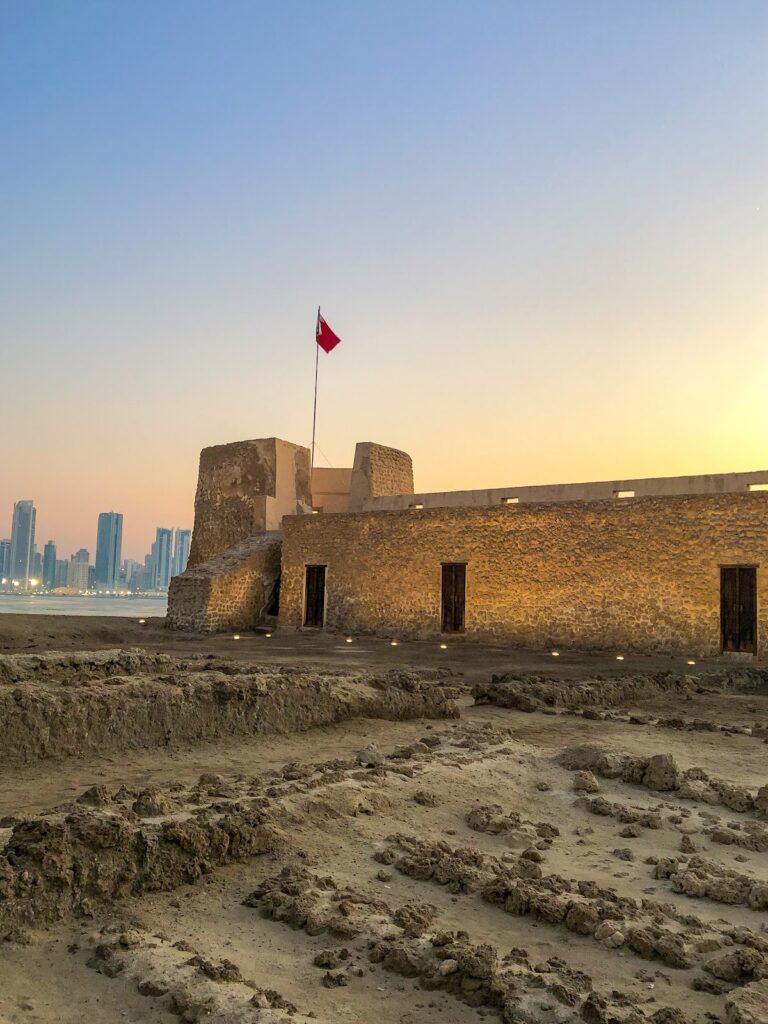
The castle’s internal plan is irregular and nearly oval, though broadly comparable to a rectangle. Its total area is no more than approximately 600 square meters. Projecting walls and towers give the plan an uneven outline that has been compared with the shape of a crab. A broad external wall surrounds the enclosure. Built from mud, plaster, limestone or bedding stones, and sticky unbaked mud mortar, the wall is approximately 1.5 to 2.5 meters thick and reaches about 9 meters in height. Iron rods embedded in the walls are also described as strengthening the structure.
Castle towers and entrance
Principal towers
The castle was described as having four principal conical towers arranged to follow the natural topography. High projecting elements and extended bridges or concealed passageways connected parts of the defenses during wartime. The northwestern and southwestern towers are the two principal towers consistently visible in old photographs.
Southeastern and northeastern towers
The southeastern tower was damaged by Saudi artillery during the 1791 siege. It remained partly standing until collapsing onto a nearby house in approximately 1916 or 1917, and part of it was restored in 1984. The northeastern tower overlooked the old Tarout market and stood beside Ain al-Awda. It was destroyed during the same period of conflict, and a large crack later appeared in the remaining structure near the spring. Parts of the tower tops and walls became unstable.
Entrance area
The entrance was probably near the northeastern tower. Old photographs show the remains of a three-step stone staircase in front of the tower’s ruins. The original form of the fourth tower is uncertain. It may have been square and may have contained the principal entrance.
Fortified village enclosure
Village walls and gates
The castle stood within a larger fortified village enclosure. The village wall formed an arched strip connected to houses, bathhouse facilities, and parts of the old market. It intersected another wall running from west to east, with a central entrance serving the village and castle. The enclosure wall was approximately 4 to 6 meters high and originally about 1 meter wide. It was later widened to approximately 1.5 meters, and its height increased by about 1 meter during the Turkish period.
The wall and its towers were incorporated into two-story houses rather than standing separately. The fortified village had two principal gates, Darwaza al-Ain, also called Darwaza al-Hammam, near the market, and Darwaza al-Sharqiya between Beit Umaybad and Beit Askariya. A smaller gate called Khadaa reportedly gave farmers access to their fields.
Outer enclosure towers
Four additional towers belonged to the village’s outer enclosure rather than to the castle itself. Known as the towers of Beit Qais, Ibn Adibis, Beit Abd al-Wahid, and al-Rifaa, they formed parts of two-story houses. Together with the castle’s four principal towers, they brought the reported total of towers in the castle and village defenses to eight.
Square and water channel
The principal northern entrance opened onto a large square outside the wall. A traditional water channel called al-Seeb ran from Ain al-Awda toward Sanabis along the edge of the square. The channel also functioned as a natural moat. Temporary bridges made from palm trunks allowed movement in peaceful periods and could be removed during conflict. An Ottoman flagpole stood in the square in front of the northwestern tower, behind the northern wall and near the principal entrance. Public announcements and official regulations may have been read nearby, although the exact arrangement of the entrance remains uncertain.
Courtyard well and underground spaces
A deep well lies at the center of the courtyard. It was interpreted as a reservoir for water and provisions during sieges, while another interpretation connects it with an underground basement containing storage rooms. The well or associated underground space was reportedly used as a prison during the Portuguese and Ottoman periods. It was also connected by a concealed passage toward the Rumaili area for escape during a siege. The arrangement of corner towers, a well, and underground storage has been compared with Portuguese fortifications in Oman and with the plan of Dibba Portuguese Castle.
Ain al-Awda and the historic bath
Ain al-Awda spring
Ain al-Awda, also called Ain al-Hammam, Ain al-Halqoum, Ain Tarout, or Ain al-Qalaa, is a sulfur spring near the base of the castle and below the surrounding walls. It is described as approximately 4,000 years old and carved into rock. The spring formerly produced hot water and steam in winter and lukewarm water in summer. Its water once supported swimming and diving, but the spring later dried up.
The spring had four described layers. An outer cavity defined its form, rocky projections lined the inner walls, and a narrow underground passage and water channel led toward agricultural land. A sedimentary bottom allowed groundwater to flow through the spring. The spring was enclosed on three sides, while the northern castle tower formed the fourth protective side.
Ain al-Awda supplied the island’s gardens and sent a tributary southward toward Darien. Its channel extended more than 1,500 meters to the sea, and residents of Darien reportedly walked about 1,000 meters to collect water. The supply ended after depletion attributed chiefly to oil extraction and also to excessive drilling of artesian wells.
Ain Tarout Bath
A branch of the spring supplied Ain Tarout Bath, also known as Hammam Tarout, Hammam al-Masjid, or Hammam al-Souq. Underground channels connected the sulfur bath with the spring, Hammam Pasha, ponds, and irrigation channels. The bath’s construction date is uncertain, with descriptions associating it with both the Uyunid and Portuguese periods. Ottoman pashas and Gulf sailors later used it.
The bath was built from large stones and carved boulders. One section was about 3 meters wide and approximately 25 meters long, while Hammam Pasha was reportedly about 75 meters long. Small fish lived in the spring and bath, and sailors believed they cleansed wounds, scars, ulcers, and fungal infections. They consequently called the fish “underwater doctors.” The bath attracted sailors and divers from Tarout, Qatif, Darien, al-Zour, Sanabis, Kuwait, Bahrain, and other Gulf areas. In 1991, the municipality filled and removed the bath and replaced it with modern swimming facilities.
Archaeological finds
Objects recovered from the mound and castle area include statues, copper and pottery vessels, traditional weapons, and an Indus Valley bowl. The bowl is held at the National Museum in Riyadh, while an ancient war cannon is displayed at the Dammam Regional Museum.
A pure-gold statue associated with the goddess Ishtarot was found in one of Tarout’s palm groves. Beneath the castle foundations, excavators found a 94-centimeter-high limestone statue of a standing unclothed man. His hands are crossed in a reverential posture, and three belt-like symbols encircle his waist. The statue resembles Sumerian sculpture and is dated to the Second or Third Early Dynastic period in the middle of the third millennium BC. Its proposed interpretation as a gift from Mesopotamia to a prominent Dilmun figure remains speculative.
Adjacent traditional buildings
Al-Kazim Mosque
A small single-room mosque known as Al-Kazim Mosque, Al-Qalaa Mosque, or Al-Ain Mosque stands beside the castle. The building includes a toilet and forms part of the traditional architecture surrounding the fortress.
Artisans’ market
The adjacent artisans’ market occupies approximately 112 square meters. Its rehabilitation incorporated old shops, wooden doors decorated with copper and traditional carvings, Tarout window designs, and roofs made with jandal timber, basjil, and woven mats. Structural beams connect the buildings, preserving elements of the historic fabric around the castle.
Traditional cafe
A traditional cafe established beside the castle in 2004 occupies no more than approximately 4 square meters. It uses palm fronds, palm trunks, simple traditional equipment, old lanterns, and related decorative elements. Its founders, Hassan Ali al-Saffar and Abdulaziz al-Khabbaz, intended it to provide a place where older residents could pass on local memories and historical knowledge.